Routes

Planner

Features

Updates

App

Login or Signup

Get the App

Login or Signup

Routes
Hikes
United States
New York
Greene County

Hunter-West Kill Wilderness

The best walks and hikes in Hunter-West Kill Wilderness

4.5

(70)

1,023

hikers

15

hikes

Hiking in Hunter-West Kill Wilderness offers access to a remote and mountainous expanse within the Catskill Forest Preserve, characterized by rugged terrain and numerous peaks. The area features a high-elevation east-west ridge, with elevations ranging from 1,000 feet to over 4,000 feet. This landscape includes prominent mountains like Hunter Mountain and West Kill Mountain, alongside diverse natural features such as waterfalls and streams. The wilderness provides varied hiking experiences across its extensive network of trails.

Best hiking trails in Hunter-West Kill Wilderness

  • The most popular hiking route is Hunter Mountain Loop – Catskill Park, an 8.1 miles (13.0 km) trail that takes 4 hours 16 minutes to complete. This moderate loop ascends Hunter Mountain, offering expansive views from its summit.
  • Another top favourite among local hikers is Diamond Notch Falls Hike – Catskill Park, a moderate 3.9 miles (6.3 km) path. This trail leads directly to the picturesque Diamond Notch Falls, set within an amphitheater-like natural area.
  • Local hikers also love the Diamond Notch Falls – Buck Ridge Lookout loop from Buck Ridge, a 6.2 miles (10.0 km) trail leading through varied forest and offering scenic viewpoints, often completed in about 3 hours 31 minutes.
  • Hiking in Hunter-West Kill Wilderness is defined by rugged mountain peaks, dense forests, and scenic waterfalls. The network offers options for different ability levels, from moderate climbs to challenging ascents.
  • The routes in Hunter-West Kill Wilderness are highly rated by the komoot community with an average score of 4.6 stars from over 60 reviews. More than 900 hikers have used komoot to explore Hunter-West Kill Wilderness's varied terrain.

Last updated: June 25, 2026

7

hikers

#1.

Devil's Path: West Kill to Hunter Mountain

16.9km

06:13

1,210m

550m

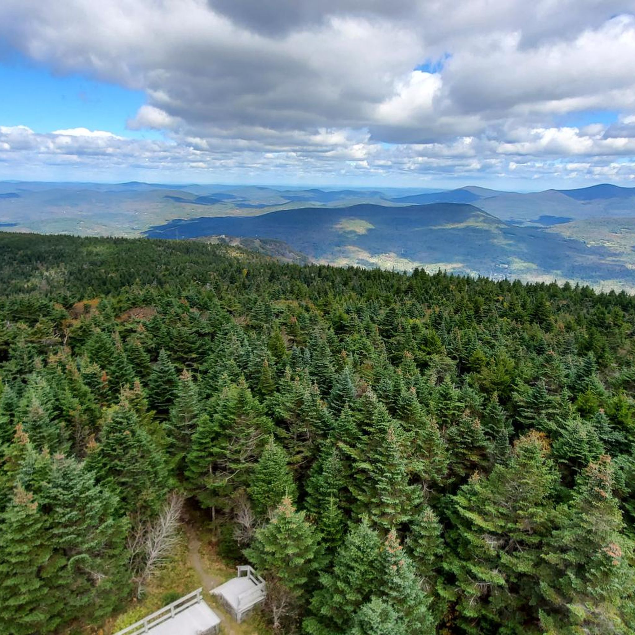
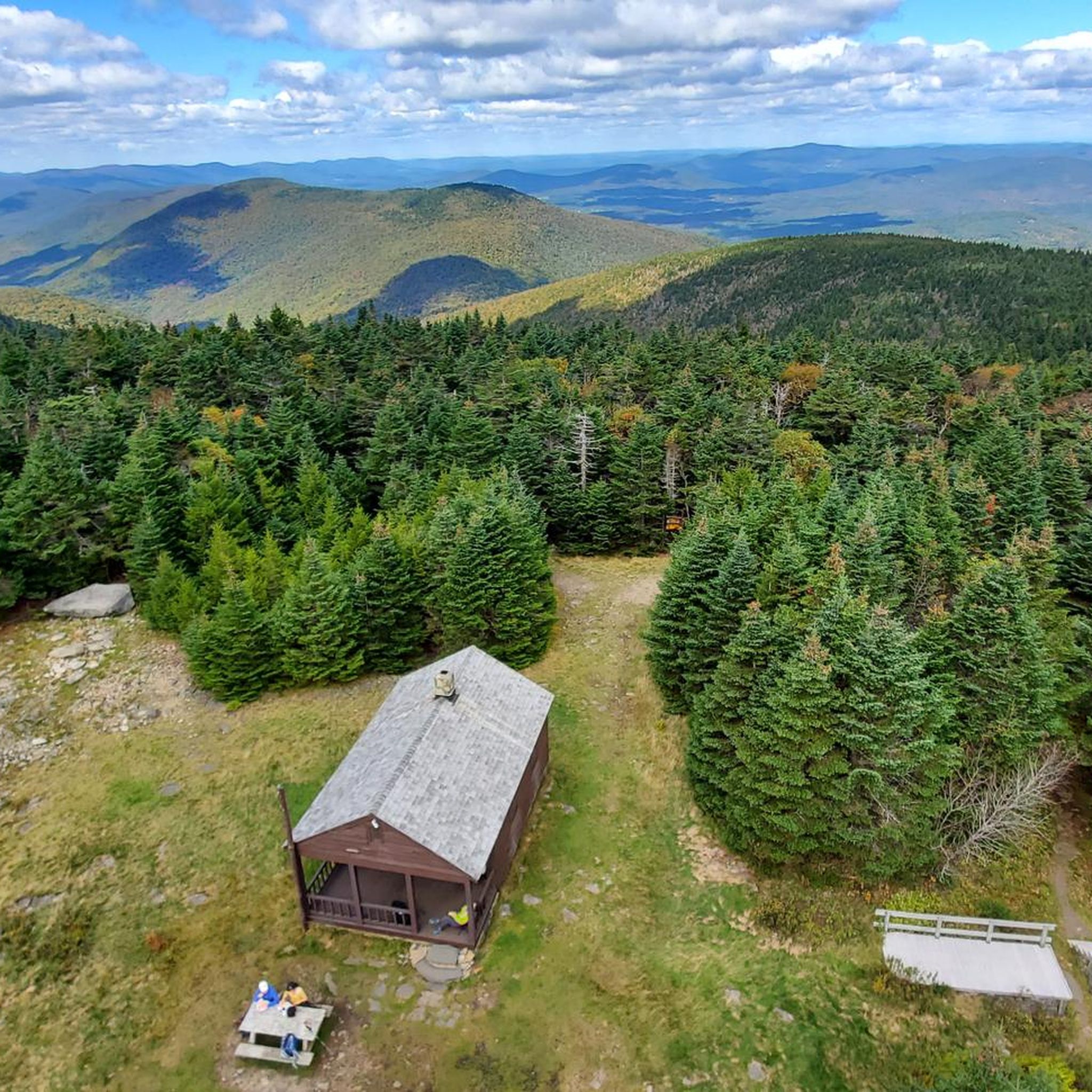
Embark on a challenging 10.5-mile (16.9 km) hike along the Devil's Path from West Kill to Hunter Mountain, a route that demands approximately 6 hours and 12 minutes to complete. You'll navigate through dense boreal forests and encounter impressive rock outcrops, gaining a significant 3967 feet (1209 metres) in elevation. The trail offers a rugged experience, leading you past the picturesque Diamond Notch Falls before culminating in panoramic views from Hunter Mountain Summit and its iconic Fire Tower.

Prepare for extremely demanding terrain on this difficult route, which often requires using your hands for scrambling over rocky sections and through rock chutes. While specific warnings for snow, road closures, or permits are not noted, be aware that the Devil's Acre Lean-To provides a potential overnight stop if you plan a multi-day trip. Always check local conditions before you head out, especially for a trail of this intensity.

This section of the Devil's Path is notable for traversing a high-elevation ridge within the expansive Hunter-West Kill Wilderness. It uniquely connects two prominent Catskill High Peaks, West Kill Mountain and Hunter Mountain, offering a true test of endurance for experienced hikers. The trail's relentless steep ascents and descents make it a standout challenge in the region.

Navigate with device

Send to Phone

Save

Hard

Embark on an easy hike up Hunter Mountain via the Spruceton Trail, a route known for its diverse scenery. You'll journey through dense forests that open up to expansive meadows, offering glimpses of the Catskill Mountains. This straightforward path covers 3.6 miles (5.9 km) with a minimal elevation gain of 34 feet (10 metres), making it accessible for many. The estimated duration for this pleasant walk is around 1 hour and 48 minutes. As you ascend, look forward to reaching the Hunter Mountain Summit and its iconic Fire Tower, which provides sweeping 360-degree views of the region.

The trailhead for this route is easily found at the Spruceton Road parking area in West Kill, New York. While the initial parts of the trail are wide and well-kept, be aware that it can narrow and become rockier as you climb higher. If you plan your visit during wet periods, expect muddy sections, and in winter, ice flows can make certain areas hazardous. Always ensure you have proper footwear for the conditions.

This trail offers a unique opportunity to experience the Hunter-West Kill Wilderness, transitioning between different natural environments. Keep an eye out for local wildlife, including deer and various bird species, as you make your way. The journey culminates at the historic Hunter Mountain Fire Tower, a significant landmark that provides an unparalleled vantage point over the surrounding landscape.

Easy
guide_signup
Let us show you the way with the komoot mobile app
With a free komoot account, you can easily find, customize, and navigate endless outdoor adventures.

Sign up for free

2

hikers

4.43km

01:28

180m

300m

Embark on an easy hike along the Diamond Notch Trail, a 2.8-mile (4.4 km) route that takes about 1 hour and 28 minutes to complete. You will gain 591 feet (180 metres) in elevation as you explore lush forests and follow the West Kill. The path offers views of numerous cascades and the stream itself, creating a serene atmosphere. Keep an eye out for the picturesque Diamond Notch Falls, a double waterfall that is a true highlight of the journey. This trail is perfect for a relaxing outdoor experience.

Before you head out, be aware that trail conditions can change, especially following snow or heavy rain, which might lead to rockier sections and stream crossings. Parking at the trailhead can be quite limited, particularly if you plan to visit on a weekend, so arriving early is a good idea to secure a spot. It's always wise to check local conditions before your trip to ensure a smooth and enjoyable hike. This easy route is generally accessible, making it a great option for many.

The Diamond Notch Trail is nestled within the Hunter-West Kill Wilderness of New York, offering a unique geological experience. Beyond the beautiful waterfalls, you can also discover the distinctive Diamond Notch, a natural "wind gap" where you can stand between West Kill Mountain and Southwest Hunter. This feature adds an interesting layer to the trail's natural environment, making it more than just a walk in the woods. The trail provides a wonderful opportunity to connect with the region's natural beauty.

Easy

Hike the moderate 4.1-mile Hunter and Leavitts Peak via Devil's Path, gaining 1586 feet with views and Diamond Notch Falls.

Moderate

1

hikers

1.38km

00:24

70m

0m

Embark on an easy hike along the Diamond Notch Trail, a short route that takes you through lush forests in the Hunter-West Kill Wilderness. You'll discover the beautiful Diamond Notch Falls, a double waterfall nestled in a natural basin, as the trail generally follows the West Kill. This pleasant hike covers 0.9 miles (1.4 km) with a gentle elevation gain of 216 feet (66 metres), making it perfect for a quick outdoor escape. Expect to spend about 24 minutes on this easy path, enjoying views of cascades and the unique 'wild, narrow cut' of the Diamond Notch itself. Some sections near the falls can be rocky, adding a bit of varied terrain to your journey.

Before you head out to the Diamond Notch Trail, it's wise to check local weather conditions, as snow or heavy rain can affect the path. The trail is easily accessible, with a clear starting point for your adventure, making it simple to begin your hike. Remember to wear sturdy shoes, especially near the waterfalls where conditions can be slippery. This short route is ideal for a quick visit when you have limited time but still want to experience the outdoors.

The Diamond Notch Trail offers a glimpse into the natural beauty of the Catskill Mountains. The path follows the West Kill, providing a chance to see the distinctive 'wild, narrow cut' of the Diamond Notch. This area is known for its serene forest settings and the captivating Diamond Notch Falls, which are a highlight of the region. It's a great way to connect with nature without committing to a long or strenuous journey.

Easy
Sign up for free to see 11 more hikes in Hunter-West Kill Wilderness.

Get access to more routes and recommendations from other explorers.

Sign up for free

Already have an account?

Our route recommendations are based on thousands of hikes, rides, and runs completed by other people on komoot.

Start today with a free account

Your next adventure awaits.

Login or Signup

Popular around Hunter-West Kill Wilderness

Running Trails in Hunter-West Kill Wilderness

Road Cycling Routes in Hunter-West Kill Wilderness

Cycling in Hunter-West Kill Wilderness

Tips from the Community

Andrus
September 5, 2024, View of Hunter Mountain

A short spur trail will lead you to this great viewpoint over the mountains. If you're hiking the Hunter Mountain Loop trail there's really no reason not to take the extra few minutes to hike out to the overlook.

0

1

Andrus
September 4, 2024, Diamond Notch Falls

Though the falls are relatively short, at only 15 feet, they are in a stunning location and make for great photos. Keep in mind that the falls may be easy to access the trail has plenty of rocks and can be slippery so proper footwear is essential. Also, this is a beautiful location all year round, but visiting during the fall color season is truly special.

1

0

Stunning panoramic viewpoint of endless green forest at the Blue Ridge lookout in the Catskills.

0

0

West Kill Summit offers breathtaking views, hiking trails, and a serene atmosphere in the Hunter-West Kill Wilderness. It's a nature lover's paradise, providing a perfect escape into the beauty of the Catskills.

0

0

Hunter Mountain is the second highest mountain in the Catskills. From the top of the fire tower, you have views of the surrounding mountains as well as of the Hudson Valley, Massachusetts, and Connecticut. Epic!

1

0

A stunning spot! The falls are a beautiful sight.

0

1

Frequently Asked Questions

Are there any easy hikes suitable for beginners in Hunter-West Kill Wilderness?

While many trails in Hunter-West Kill Wilderness are moderate to difficult, there is at least one easy route available. These trails typically feature gentler inclines and shorter distances, making them ideal for those new to hiking or looking for a less strenuous experience.

What are some challenging hiking trails in Hunter-West Kill Wilderness?

For experienced hikers seeking a challenge, the Hunter-West Kill Wilderness offers several demanding routes. The iconic Devil's Path traverses over eleven miles within the wilderness, known for its spectacular views and being one of the most challenging trails on the East Coast. Another strenuous option is the Becker Hollow Trail, which presents a climb of nearly 2,000 feet in two miles to the summit of Hunter Mountain.

Can I see waterfalls while hiking in Hunter-West Kill Wilderness?

Yes, the wilderness is home to the beautiful Diamond Notch Falls, a 25-foot waterfall nestled in an amphitheater-like setting. You can reach it via the moderate Diamond Notch Falls Hike – Catskill Park, a 3.9-mile path that leads directly to the falls.

Are there any loop trails available in Hunter-West Kill Wilderness?

Yes, several loop trails offer varied experiences. A popular option is the Hunter Mountain Loop – Catskill Park, an 8.1-mile route ascending Hunter Mountain. Another is the Diamond Notch Falls – Buck Ridge Lookout loop from Buck Ridge, which covers 6.2 miles through varied forest. For a shorter loop, consider the Rusk Mountain loop from Rusk Mountain.

What notable landmarks or viewpoints can I find on the trails?

The Hunter-West Kill Wilderness is rich with scenic points. You can find panoramic views from peaks like West Kill Mountain, which offers some of the best vistas in the Catskills. Other notable viewpoints include Buck Ridge Lookout and Geiger Point. The Hunter Mountain Fire Tower is also a key sight, offering an elevated perspective from the summit of Hunter Mountain.

Is Hunter-West Kill Wilderness suitable for family hiking?

While many trails are rugged, there are options that families can enjoy. The Diamond Notch Falls Hike – Catskill Park is a moderate, 3.9-mile trail that leads to a picturesque waterfall, making it a rewarding destination for families with some hiking experience.

What is the best time of year to hike in Hunter-West Kill Wilderness?

The Hunter-West Kill Wilderness offers beauty year-round, but the best time for hiking is typically spring through fall. Spring brings lush greenery and flowing waterfalls, while fall showcases vibrant foliage. Summer is popular, but be prepared for warmer temperatures and potential insects. Winter offers opportunities for snowshoeing and cross-country skiing, but requires appropriate gear and experience.

Are dogs allowed on the hiking trails in Hunter-West Kill Wilderness?

Generally, dogs are permitted on trails within the Catskill Forest Preserve, including the Hunter-West Kill Wilderness. It is always recommended to keep your dog on a leash and practice Leave No Trace principles, including packing out all waste, to ensure a pleasant experience for everyone and protect the wilderness.

What do other hikers enjoy most about hiking in Hunter-West Kill Wilderness?

The area is highly rated by the komoot community, with an average score of 4.6 stars from over 60 reviews. Hikers frequently praise the rugged mountain peaks, dense forests, and scenic waterfalls. The diverse network of trails, offering options from moderate climbs to challenging ascents, is also a highlight for many visitors.

Are there less crowded trails in Hunter-West Kill Wilderness?

While popular routes like parts of the Devil's Path can see more traffic, the extensive 19,250-acre wilderness area offers many opportunities for solitude. Exploring trails to lesser-known peaks like Rusk Mountain or North Dome, or venturing onto less-trafficked sections of longer trails, can provide a more secluded hiking experience.

Is parking available at the trailheads in Hunter-West Kill Wilderness?

Yes, designated parking areas are typically available at major trailheads throughout the Hunter-West Kill Wilderness. However, these can fill up quickly during peak season or on weekends, especially for popular routes. It's advisable to arrive early, particularly for trails leading to Hunter Mountain or Diamond Notch Falls, to secure a spot.

Most popular routes in Hunter-West Kill Wilderness

Easy hikes in Hunter-West Kill Wilderness

Store rating

Get inspired with the komoot mobile app

With a free komoot account, you can easily find, customize, and navigate endless outdoor adventures.

or

Join komoot Now

Store rating

Explore more

Browse the best Hikes in other regions.

Round TopPalenvilleIndian Head WildernessHunterCairoEast DurhamWindham-Blackhead Range WildernessTannersvilleSouth CairoVillage of AthensSleepy Hollow LakeHaines FallsWindhamMount Hayden State ForestCoxsackieAshland Pinnacle State ForestWest KillCementonBearpen Mountain State ForestNew BaltimorePrattsvilleJefferson HeightsLeedsCatskillMount Pisgah State Forest

Nearby adventure guides

Things to Do around Phoenicia

background

Get ready to conquer new peaks

Sign up for Free

Explore
RoutesRoute plannerFeaturesHikesMTB TrailsRoad cycling routesBikepackingSitemap
Download the app
Follow Us on Socials

© komoot GmbH

Privacy Policy