The best walks and hikes in Myra-Bellevue Provincial Park
4.6
(52)
850
hikers
13
hikes
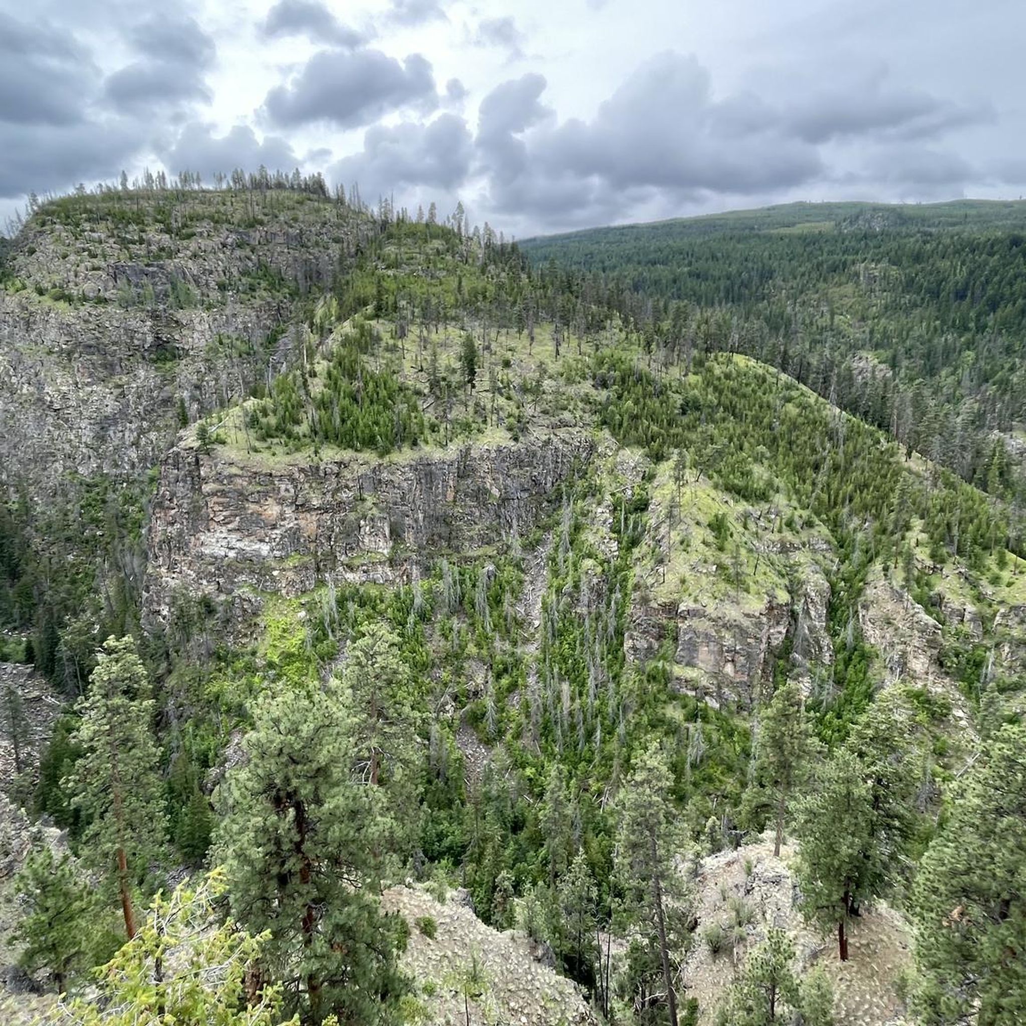
Hiking trails in Myra-Bellevue Provincial Park traverse a diverse landscape within the Okanagan Highlands, east of Kelowna, British Columbia. The park features the slopes of Little White Mountain, its sole peak at 7,123 feet (2,171 meters), offering sub-alpine meadows and panoramic views. Myra Canyon, carved by natural forces, is another prominent feature, alongside ecosystems ranging from dry ponderosa pine and Douglas fir forests to subalpine fir and Engelmann spruce. The area also includes unique tufa mineral deposits at Angel Springs.
…Last updated: October 19, 2026
4.7
(6)
70
hikers
23.9km
06:40
450m
450m
Hard hike. Very good fitness required. Easily-accessible paths. Suitable for all skill levels.
5
hikers
10.5km
03:39
560m
560m
Hike the moderate Little White Mountain via Okanagan Highland Trail for 360-degree views and sub-alpine meadows in Myra-Bellevue Provincial

2
hikers
4.57km
01:17
90m
90m
Easy hike. Great for any fitness level. Easily-accessible paths. Suitable for all skill levels.
4.7
(18)
188
hikers
6.71km
02:02
230m
230m
Moderate hike. Good fitness required. Easily-accessible paths. Suitable for all skill levels.
4.4
(5)
133
hikers
Easy hike. Great for any fitness level. Easily-accessible paths. Suitable for all skill levels.
Get access to more routes and recommendations from other explorers.
Already have an account?
Our route recommendations are based on thousands of hikes, rides, and runs completed by other people on komoot.
Start today with a free account
Your next adventure awaits.
Popular around Myra-Bellevue Provincial Park

Other adventures in Myra-Bellevue Provincial Park

Tips from the Community

Lower Bench runs parallel to its upper counterpart, closer to the valley floor. This wide, hard-packed doubletrack trail is loved by hikers, dog walkers, and mountain bikers looking for an easier, low-intensity cruise. It's also a return route to the main Stewart Road East parking lot. The trail is also known for more loose “kitty litter” gravel and springtime bloom of vibrant blankets of yellow Arrowleaf balsamroot wildflowers.
0
0
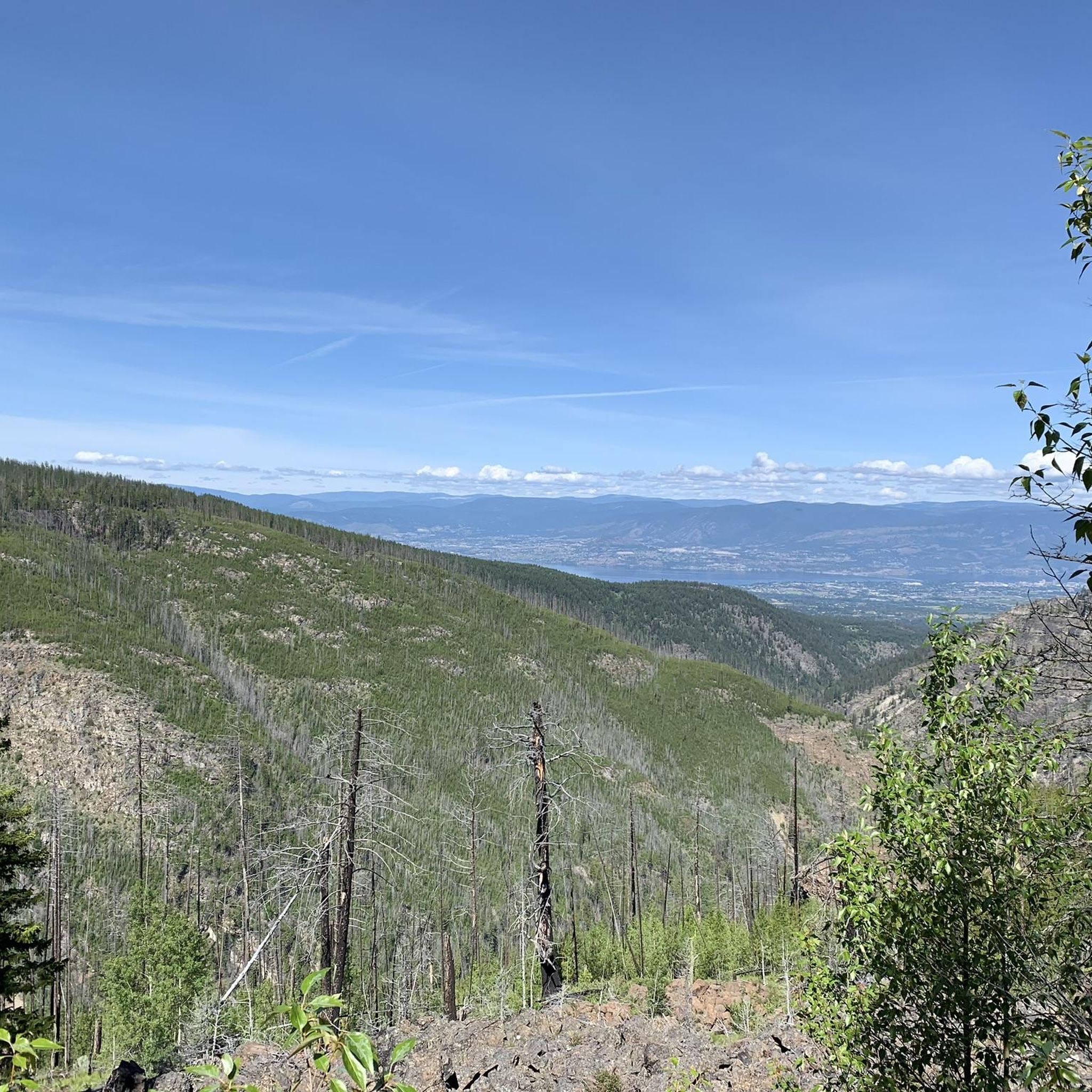
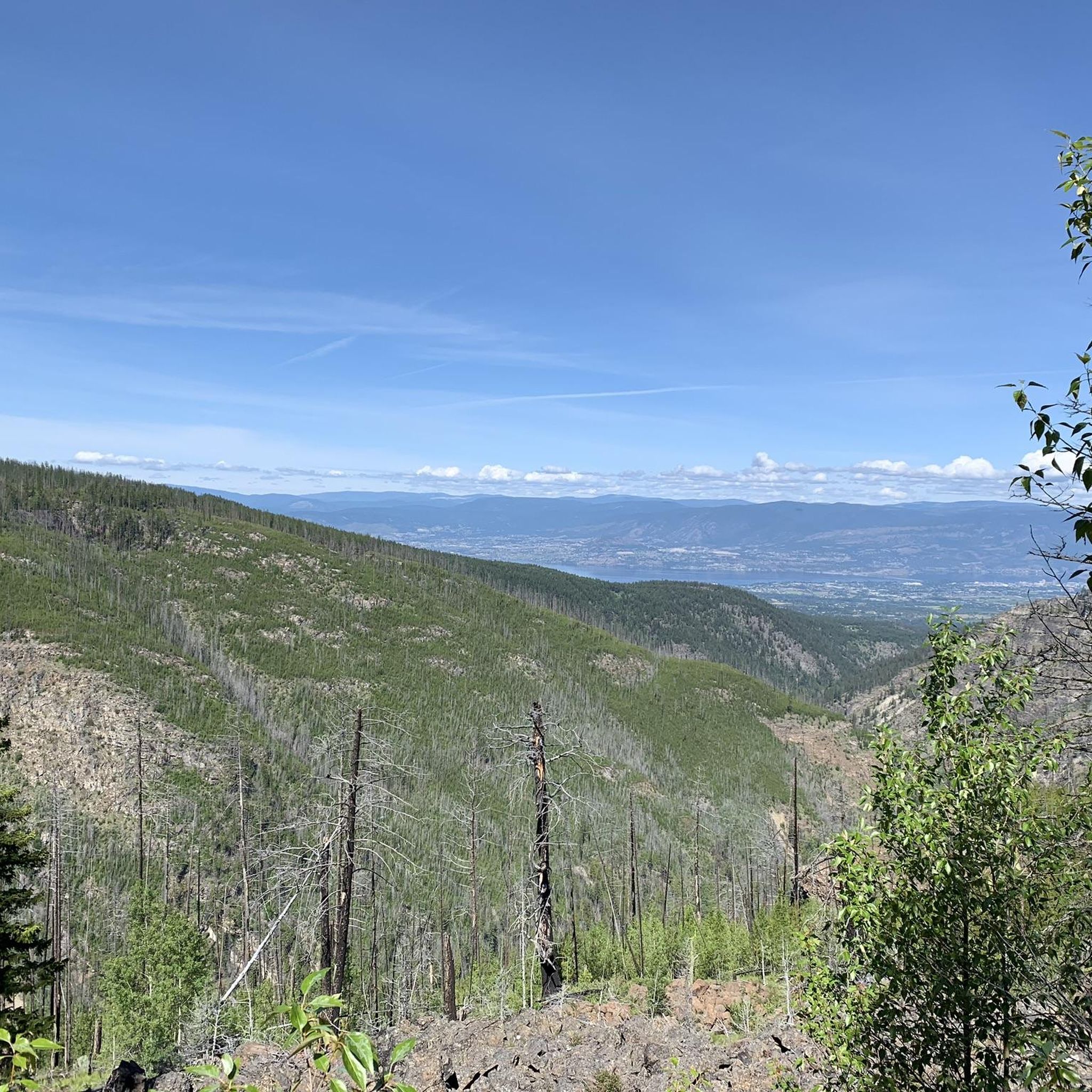
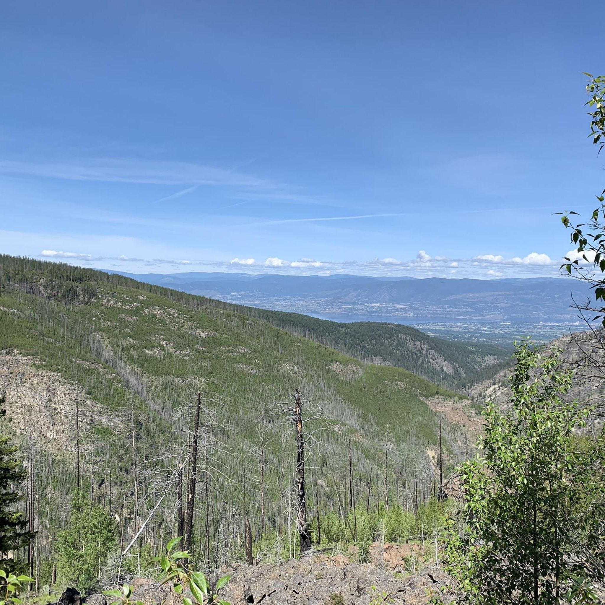
Upper Bench is a doubletrack trail that connects several of Myra-Bellevue Provincial Park's more technical downhill runs. It cuts through a resilient pocket of Douglas fir alongside the skeletal tree snags left behind by the historic 2003 Okanagan Mountain Park wildfire. Because of its exposure, travelling along Upper Bench treats hikers and bikers to unobstructed views of the valley below.
0
0
The Fairlane Trail is a blue singletrack trail that cuts horizontally across the mountain slopes. For mountain bikers, it's used as a downhill-only corridor with a mix of flowy sections and minor technical elements, loose dirt, and optional small rock drops. For hikers and trail runners, it is frequently combined with other trails to explore the open ponderosa pine forests with view points over Okanagan Lake and Kelowna valley.
0
0

Starting early is worth it. It was more than 5 degrees colder on the trail than in the valley. There is a trail guide that can be downloaded as a PDF.
0
0

Myra-Bellevue Provincial Park protects a diverse range of ecosystems east of Kelowna, spanning 7,677 hectares of rugged terrain. It’s best known for the dramatic granite summit of Little White Mountain and the historic Myra Canyon section of the Kettle Valley Railway, with its wooden trestles and tunnels. The park offers over 100 kilometres of multi-use trails for hiking and biking, and it is home to an abundance of wildlife, including mule deer, black bears, and mountain goats.
0
0
Little White Mountain rises to 2,171 metres in Myra-Bellevue Provincial Park, forming one of the highest points in the central Okanagan Highland. Its summit is an impressive granite dome with fantastic expansive views of Kelowna, Okanagan Lake, and distant ranges to the south and east. The mountain’s upper slopes are dotted with beautiful alpine wildflowers, exposed rock, and scattered trees. It is the perfect spot, with plenty of room to stay for a while and take in the vast scenery, appreciating its beauty.
0
0
The Okanagan Highland Trail is a fantastic route that climbs through high-country forest and exposed rock to reach Little White Mountain. Along the way, you'll pass beautiful wildflower meadows and scenic outcrops with views of Kelowna and Okanagan Lake. Beyond the summit, the trail continues to Crawford Lake, a quiet alpine basin set deep in the high country.
0
0

Original iron trestle over Pooley Creek, the iron survived the fires but the wood surface has been restored.
0
0
Frequently Asked Questions
How many hiking trails are available in Myra-Bellevue Provincial Park?
Myra-Bellevue Provincial Park offers a wide network of trails, with over 100 kilometers of multi-use paths. Our guide features 12 distinct hiking routes, catering to various skill levels from easy strolls to challenging ascents.
Are there any easy hiking trails suitable for beginners or families?
Yes, the park has several easy trails perfect for beginners or families. An excellent option is the Information pavilion – View of Myra Canyon loop from Myra Bellevue Protected Area, which is 5.6 km long and offers scenic views. The historic Kettle Valley Railway (KVR) Trail section within Myra Canyon is also relatively flat and suitable for all ages.
What unique natural features can I discover while hiking in the park?
Myra-Bellevue Provincial Park is home to several unique natural features. You can explore the dramatic escarpments and sub-alpine meadows of Little White Mountain, or the spectacular Myra Canyon. A particularly unique spot is Angel Springs, accessible via a roughly 7 km forested hike, which features fascinating tufa mineral deposits, natural pools, and small caves.
Can I bring my dog on the trails in Myra-Bellevue Provincial Park?
While the park is generally dog-friendly, it's important to keep your dog on a leash at all times to protect wildlife and ensure the safety of other visitors. Always check specific trail regulations before heading out, as some areas might have restrictions.
Are there any challenging hikes for experienced trekkers?
For experienced hikers seeking a challenge, trails leading to the summit of Little White Mountain, such as the Little White Mountain via Okanagan Highland Trail, offer strenuous ascents and rewarding panoramic views. Another difficult option is the Myra Canyon Tunnels – Steel Trestle #9 loop from Angel Springs, which covers 18.6 km with significant elevation changes.
What historical attractions can be found along the hiking routes?
The park is rich in history, primarily due to the historic Kettle Valley Railway (KVR) Trail. The 12 km section within Myra Canyon features 18 restored wooden trestles, two tunnels, and remnants of railway construction camps and 'rock ovens' used by Italian stonemasons. You can also find historical sites like Myra Station and Ruth Station, and an old forest service lookout built in 1914 on Little White Mountain.
What is the best time of year to hike in Myra-Bellevue Provincial Park?
The park is beautiful year-round, but the best time for hiking is typically spring through fall. The autumn months are particularly scenic, with vibrant fall foliage. During winter, some trails may be covered in snow, requiring appropriate gear and caution.
Are there any loop trails available for hikers?
Yes, Myra-Bellevue Provincial Park offers several loop trails. A popular choice is the View of Myra Canyon – Information pavilion loop from Myra Bellevue Protected Area, which provides excellent views of the canyon. Another option is the Hiking loop from Cattleguard Junction, an easy 5.9 km route.
Where can I park when visiting Myra-Bellevue Provincial Park?
The park offers various access points with parking facilities. A primary access point for the Kettle Valley Railway Trail is near Myra Station, which is also listed as a highlight: Myra Station - Kettle Valley Trailhead. It's advisable to check specific trailhead information for parking availability before your visit.
What do other hikers enjoy most about Myra-Bellevue Provincial Park?
The komoot community highly rates Myra-Bellevue Provincial Park, with an average score of 4.3 stars from over 30 reviews. Hikers frequently praise the spectacular views of Myra Canyon, the historical significance of the Kettle Valley Railway trestles, and the diverse landscapes ranging from forests to sub-alpine meadows. The variety of trails catering to different fitness levels is also a common highlight.
Are there any trails that offer distant views of Okanagan Lake?
Yes, the Myra Bellevue Trail, a multi-use loop trail within the park, is known for providing distant views of Okanagan Lake, offering a different perspective of the region's stunning scenery.
What kind of wildlife can I expect to see in Myra-Bellevue Provincial Park?
Myra-Bellevue Provincial Park is home to a variety of wildlife due to its diverse ecosystems. Visitors often have opportunities for wildlife observation and birdwatching, especially in the varied forests and sub-alpine meadows. Keep an eye out for local bird species and other forest inhabitants.
Most popular routes in Myra-Bellevue Provincial Park
Most popular attractions in Myra-Bellevue Provincial Park

Get inspired with the komoot mobile app


Explore more
Browse the best Hikes in other regions.
