The best road cycling routes in Claireville Conservation Area
2.0
(1)
22
riders
4
rides
Road cycling routes in Claireville Conservation Area offer diverse terrain within 540 hectares of natural and forested land. The area features pine forests, meadows, grasslands, and wetlands, alongside creeks, ravines, rolling hills, and flat plains. The West Branch of the Humber River flows through the conservation area, connecting to the paved Humber River Trail, which provides extensive road cycling opportunities. This network of trails and connecting paths caters to various skill levels, with mostly paved surfaces suitable for road bikes.
…Last updated: October 21, 2026
2.0
(1)
4
riders
79.3km
03:12
310m
310m
Moderate road ride. Good fitness required. Some segments of this route may be unpaved and difficult to ride.
3
riders
91.8km
03:45
350m
350m
Moderate road ride. Good fitness required. Some segments of this route may be unpaved and difficult to ride.

3
riders
Moderate road ride. Good fitness required. Some segments of this route may be unpaved and difficult to ride.
6
riders
Moderate road ride. Good fitness required. Some segments of this route may be unpaved and difficult to ride.
6
riders
52.6km
02:04
180m
180m
Moderate road ride. Good fitness required. Some segments of this route may be unpaved and difficult to ride.
Our route recommendations are based on thousands of hikes, rides, and runs completed by other people on komoot.
Start today with a free account
Your next adventure awaits.
Popular around Claireville Conservation Area


Tips from the Community

Parking for this section of the Oak Ridges Trail is available along the shoulder of 16th Sideroad where it meets Weston Road. There isn't a formal trailhead parking lot, but there's plenty of space on both sides of the road close to the trail entrance. Depending on the time of day and which side you choose, the mature trees along the roadside can provide a welcome patch of shade.
0
0
Following a railway corridor first built in 1877, the Caledon Trailway winds through rolling farmland, woodlots, wetlands, and small rural communities across the Caledon countryside. This section between Caledon East and Palgrave is part of both The Great Trail and the Greenbelt Route, with a wide crushed-limestone surface that makes for easy walking. Along the way, you'll pass open views of the Oak Ridges Moraine, quiet forests, beaver ponds, and reminders of the region's railway heritage.
0
0

The East Humber River flows through farms and parks in northern Toronto before joining the main branch of the Humber River in Woodbridge. There's a good trails system along its banks that allow hikers to visit various parks and nature preserves with ease.
0
0

The Humberwood Bird Flyway is a quiet, lightly trafficked loop near the upper Humber River, known more for its birdlife than its trail infrastructure. Though the path is unmarked and overgrown in places, it winds through a mix of wetlands and wooded edges where you might spot mallards, cardinals, red-winged blackbirds, and other seasonal migrants. It’s best visited in early spring or fall for birdwatching, and while it’s not a polished trail, it's a peaceful detour for anyone exploring the Humber River corridor.
0
0

If you`re biking there: better watch out! Cause of all the construction there are a lot of traffic lights, stopngos, cars, loose gravel and mud on the street. But if you enjoy sneaking through traffic, go for it!
0
0

Little detour from the Humber River trail will help you learn about birds in Toronto area and their migration and winter life. Nicely done info panels along the way, explain many unknowns that we were guessing. Enjoy and respect
0
0
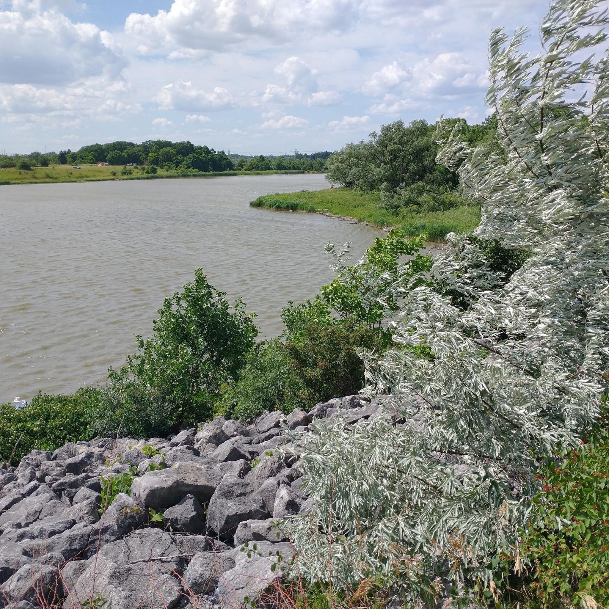
As a result of the dam on the Humber River, this peaceful place was created. It's on the northwest end of the West Humber recreation trail. Camping and RV parking is available. Pick your hobby and spend the day in this oasis in the middle of the city. Fishing is also available.
2
0
While enjoying West Humber river recreation trail, hiking or biking, close to the Claireville lake, you will come accoss this educational area about migrating birds of the Ontario. You will definetly learn some new and interesting facts.
0
0
Frequently Asked Questions
How many road cycling routes are available in Claireville Conservation Area?
Claireville Conservation Area offers a selection of 7 road cycling routes, catering to various preferences. These routes range from easy to moderate difficulty, providing options for different skill levels.
What kind of landscapes can I expect to see while road cycling in Claireville Conservation Area?
While road cycling in Claireville Conservation Area, you'll experience diverse landscapes including pine forests, meadows, grasslands, and wetlands. The routes often follow creeks and ravines, with sections featuring rolling hills and flat plains. A significant part of the experience involves the West Branch of the Humber River and its connection to the paved Humber River Trail, offering scenic views along the water.
Are there paved routes suitable for road bikes?
Yes, Claireville Conservation Area is well-suited for road bikes, particularly through its connection to the Humber River Trail. This multi-use path is mostly paved and flat, extending over 20 kilometers from the lakefront north to the Claireville Dam, providing excellent, uninterrupted paved surfaces for road cyclists. Within the conservation area itself, connecting paths are also generally paved.
What are the typical difficulty levels for road cycling routes here?
The road cycling routes in Claireville Conservation Area are predominantly easy to moderate. For instance, the Napa Valley Pond loop from Woodbridge is an easy route, while popular options like the Roadbike loop from Zenway Boulevard / New Enterprise Way and the Roadbike loop from The Soccer Centre are moderate, offering varied terrain without extreme challenges.
Are there any notable landmarks or points of interest along the road cycling routes?
While cycling, you might encounter the heritage-protected Wiley Bridge, built in 1924, offering picturesque views of the creek. The area is also rich in wildlife, providing opportunities for birdwatching and spotting deer, coyotes, and various bird species. The Humber River Trail itself is a historical route winding through parks and green spaces.
Is there parking available for road cyclists?
Yes, parking is available at various access points to Claireville Conservation Area. Specific parking details can often be found on individual route descriptions or by checking the conservation area's official website for designated parking lots suitable for accessing the cycling trails.
How can I access Claireville Conservation Area by public transport for road cycling?
Claireville Conservation Area is accessible by public transport, particularly through services like the TTC (Toronto Transit Commission) and other regional transit providers that serve the surrounding GTA cities of Brampton, Mississauga, Toronto, and Vaughan. Cyclists should check specific bus routes and schedules that stop near the conservation area's entrances or along the Humber River Trail for convenient access.
Are the road cycling routes suitable for families or beginners?
Yes, many of the road cycling routes, especially those connected to the paved and mostly flat Humber River Trail, are suitable for families and beginners. The conservation area offers options like the easy-rated Napa Valley Pond loop from Woodbridge, making it accessible for all fitness levels.
What do other road cyclists say about their experience in Claireville Conservation Area?
The road cycling experience in Claireville Conservation Area is highly regarded by the komoot community, with an average rating of 5.0 stars. Cyclists often praise the diverse terrain, the peaceful natural settings, and the excellent connectivity to the paved Humber River Trail, which allows for longer, uninterrupted rides.
Can I combine road cycling with other activities in the area?
Absolutely. Beyond road cycling, Claireville Conservation Area offers numerous other activities. You can enjoy hiking on various trails, horseback riding at the Claireville Ranch, or wildlife viewing. The Etobicoke Field Studies Centre also provides nature-based educational programs, and the Indian Line Campground offers camping facilities.
What is the best time of year for road cycling in Claireville Conservation Area?
Spring, summer, and fall generally offer the best conditions for road cycling in Claireville Conservation Area. These seasons provide pleasant weather, vibrant natural scenery, and optimal trail conditions. It's always advisable to check local weather forecasts before heading out, especially during shoulder seasons when conditions can change.
Are there any circular road cycling routes in the area?
Yes, many of the road cycling routes in Claireville Conservation Area are designed as loops, allowing you to start and end at the same point. Examples include the Albion Hills – Gulley Hill loop from The Gore Rd n/of Countryside Dr and the Roadbike loop from Odlum Valley, which offer varied distances and scenery.
Most popular routes in Claireville Conservation Area

Get inspired with the komoot mobile app


Explore more
Browse the best Road cycling routes in other regions.
