The best walks and hikes in Oasi Valtrigona
4.6
(2328)
14,900
hikers
296
hikes
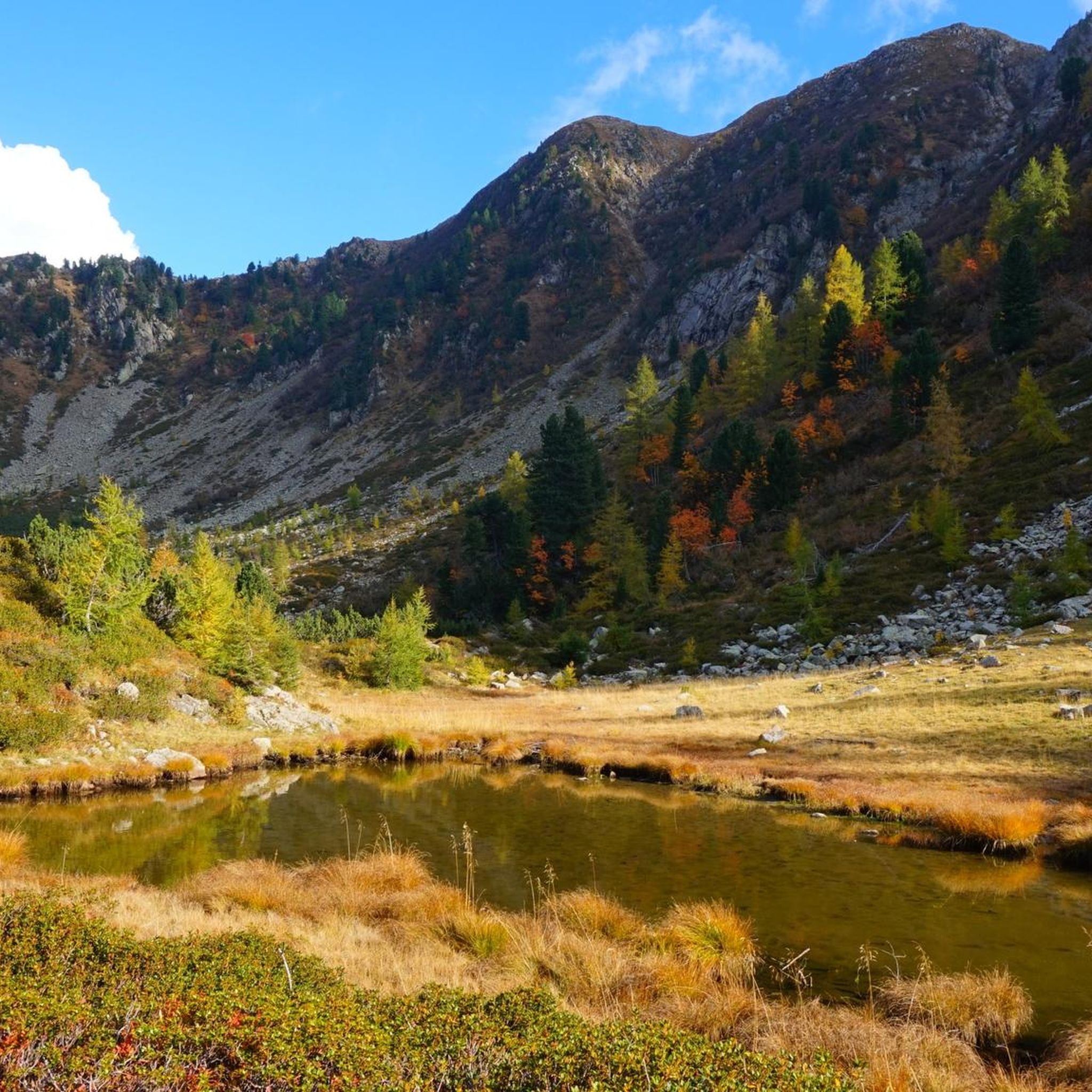
Hiking in Oasi Valtrigona offers access to a pristine alpine environment within the Lagorai mountain range in Trentino. This area is characterized by high-mountain landscapes, with altitudes ranging from 1,600 to 2,200 meters. The terrain includes silent larch and Cembran pine forests, dense conifer woodlands, expansive mountain meadows, and dramatic porphyritic rock formations. The valley itself is U-shaped, a testament to its glacial past, and features a glacial lake.
Best hiking trails in Oasi Valtrigona
- The most popular hiking route…
Last updated: July 9, 2026
4.2
(6)
31
hikers
9.74km
04:45
750m
750m
Moderate hike. Good fitness required. Mostly accessible paths. Sure-footedness required.
14.3km
07:24
1,360m
1,360m
Hard hike. Very good fitness required. Mostly accessible paths. Sure-footedness required.

Sign up for free
5.0
(7)
41
hikers
15.2km
07:06
1,080m
1,080m
Hard hike. Very good fitness required. Sure-footedness, sturdy shoes and alpine experience required.
4.1
(7)
42
hikers
18.3km
06:05
780m
780m
Hard hike. Very good fitness required. Mostly accessible paths. Sure-footedness required.
4.4
(5)
19
hikers
12.2km
04:21
570m
570m
Moderate hike. Good fitness required. Mostly accessible paths. Sure-footedness required.
Get access to more routes and recommendations from other explorers.
Sign up for free
Already have an account?
Our route recommendations are based on thousands of hikes, rides, and runs completed by other people on komoot.
Start today with a free account
Your next adventure awaits.
Login or Signup
Tips from the Community

Easily accessible refuge, nestled in a basin with a semicircle of rare beauty mountains
0
0
The trail leading to the d'Ezze pass, Erdemolo lake and the Delio Paci trail, the latter suitable for experienced hikers
0
0

Fast circular route, beautiful view of the Dardemolo lake and the Sasso Rotto peak
0
0

Beautiful mountain refuge nestled among all the peaks, classic style, with breathtaking views of the surrounding peaks. I recommend a visit if you are in the area 😍🤩
0
0

The Zoliera pass is located at over 2,200 meters above sea level and offers a splendid panorama of the valley. Here, there are still several traces of the First World War and a cross in memory of the Tyrolean Standschützen (company of riflemen). During the Great War, in fact, these areas were occupied by Austro-Hungarian soldiers, who controlled the Calamento and Campelle valleys from these positions.
1
0
Beautiful refuge set in an amphitheater of peaks of rare beauty
1
0

Nice and smooth descent to Rifugio Sette Selle! The smell of food will ease and speed up your descent :)
0
0
Very nice and cozy hut! Very good food, water and toilets are available. You are required to take your rubbish with you :)
1
0
Frequently Asked Questions
What kind of terrain can I expect when hiking in Oasi Valtrigona?
Oasi Valtrigona offers a diverse high-mountain landscape, with altitudes ranging from 1,600 to 2,200 meters. You'll encounter silent larch and Cembran pine forests, dense conifer woodlands, expansive mountain meadows, and dramatic porphyritic rock formations. The valley itself is U-shaped, a testament to its glacial past, and even features a glacial lake.
Are there any easy hiking trails suitable for beginners in Oasi Valtrigona?
Yes, Oasi Valtrigona has several options for less experienced hikers. There are 10 easy routes available. For a moderate option that's still accessible, consider the WWF Valtrigona Oasis loop from Salvadori, which is about 4.5 km long and takes under 2 hours.
What are the best times of year to hike in Oasi Valtrigona?
The Nature Trail (Sentiero Natura), a key attraction, is generally accessible from June to October. This period offers the best conditions to experience the high-mountain environment, diverse flora, and wildlife. Outside of these months, conditions can be challenging due to snow and ice.
What kind of wildlife might I see in Oasi Valtrigona?
As the only WWF wildlife sanctuary in the Alps, Oasi Valtrigona is rich in biodiversity. You might spot chamois, fox, ermine, deer, roe deer, marmot, alpine hare, and squirrels. Birdwatchers can look for capercaillie, ptarmigan, golden eagle, and various owls and woodpeckers. Occasionally, the alpine brown bear is also present.
Are there any family-friendly hiking options in Oasi Valtrigona?
The Sentiero natura dell'Oasi di Valtrigona Nature Trail is an excellent choice for families. It functions as an open-air nature museum with informational boards, making it engaging for all ages. This moderate trail is approximately 9.7 km long and typically takes around 4 hours 45 minutes.
Are dogs allowed on the hiking trails in Oasi Valtrigona?
While Oasi Valtrigona is a wildlife sanctuary, dogs are generally permitted on trails if kept on a leash. This is crucial to protect the delicate ecosystem and prevent disturbance to the abundant wildlife. Always ensure your dog is under control and follow local regulations.
Are there any circular hiking routes in Oasi Valtrigona?
Yes, there are several circular routes available. A challenging option is the WWF Valtrigona Oasis – Sette Selle Refuge loop from Oasi Valtrigona, which is 16.1 km long. For a shorter, moderate loop, consider the WWF Valtrigona Oasis loop from Salvadori.
What are the notable natural features or landmarks to look out for?
Beyond the diverse forests and meadows, keep an eye out for the U-shaped glacial valley and its glacial lake. The dramatic porphyritic rock formations are also a distinctive feature. The Nature Trail itself guides you past numbered landmarks and informational boards, highlighting key aspects of the oasis.
How many hiking routes are available in Oasi Valtrigona?
There are over 280 hiking routes available in Oasi Valtrigona, catering to various skill levels. This includes 10 easy routes, 158 moderate routes, and 119 difficult routes, offering plenty of options for exploration.
What do other hikers say about Oasi Valtrigona?
The area is highly rated by the komoot community, with an average score of 4.6 stars from over 2,100 reviews. Hikers often praise the pristine alpine environment, the rich wildlife, and the well-maintained nature trails that offer a unique experience in the Lagorai mountain range.
Are there any particularly challenging hikes in the area?
For experienced hikers seeking a challenge, routes like the Val Ziolèra Trail offer a demanding experience. This difficult path is 14.3 km long with significant elevation gain, ascending through varied alpine terrain and providing extensive views of the high-mountain peaks.
Is there a visitor center or facilities in Oasi Valtrigona?
Yes, the WWF Oasis Visitor Centre is located in refurbished alpine huts. The Nature Trail leads to this center, which provides more information about the sanctuary. Some old alpine dairies also continue traditional livestock breeding and cheese-making, adding a cultural element to your visit.
Most popular routes in Oasi Valtrigona

Get inspired with the komoot mobile app


Explore more
Browse the best Hikes in other regions.
