The best road cycling routes in Riserva Naturale Statale Marsiliana
4.7
(405)
11,525
riders
141
rides
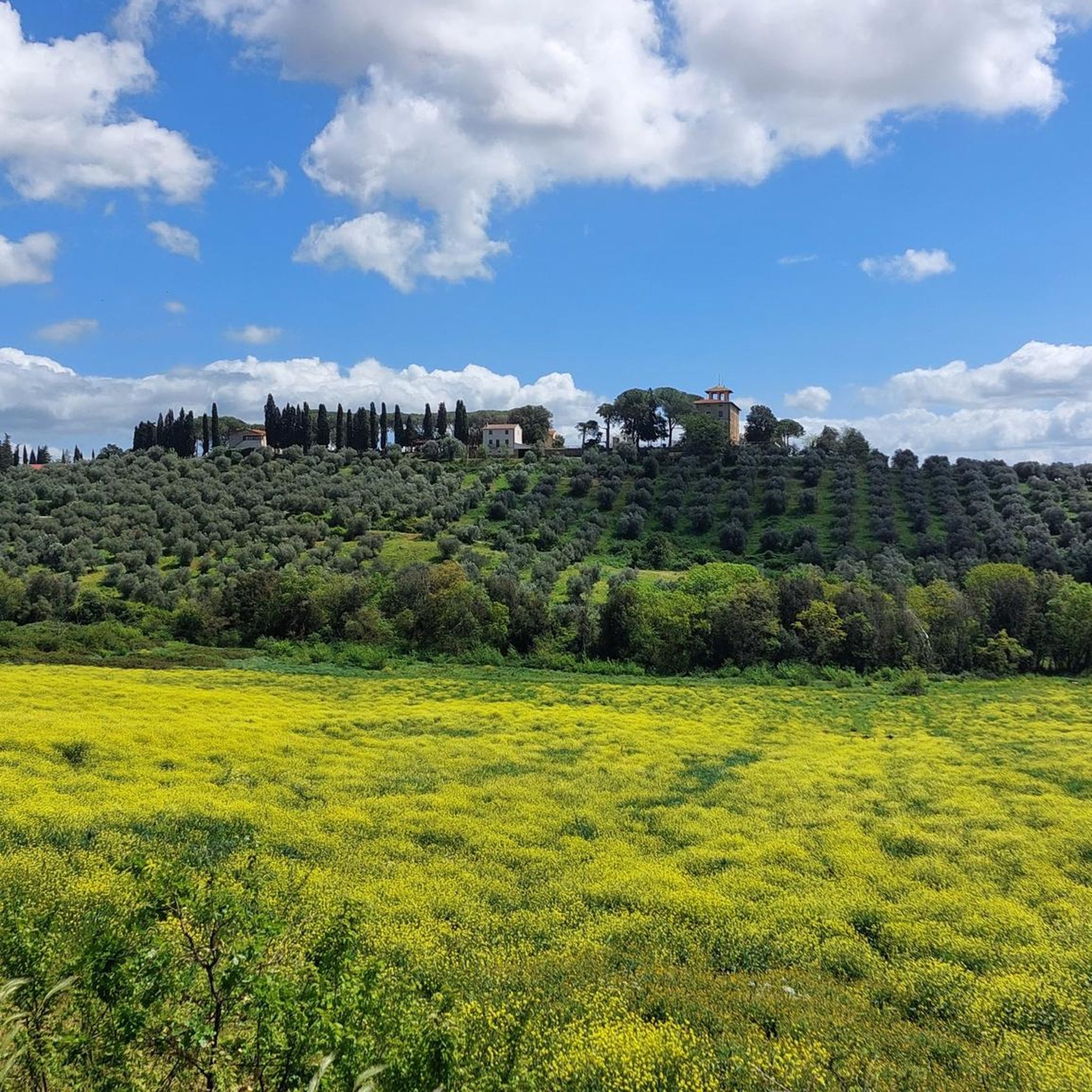
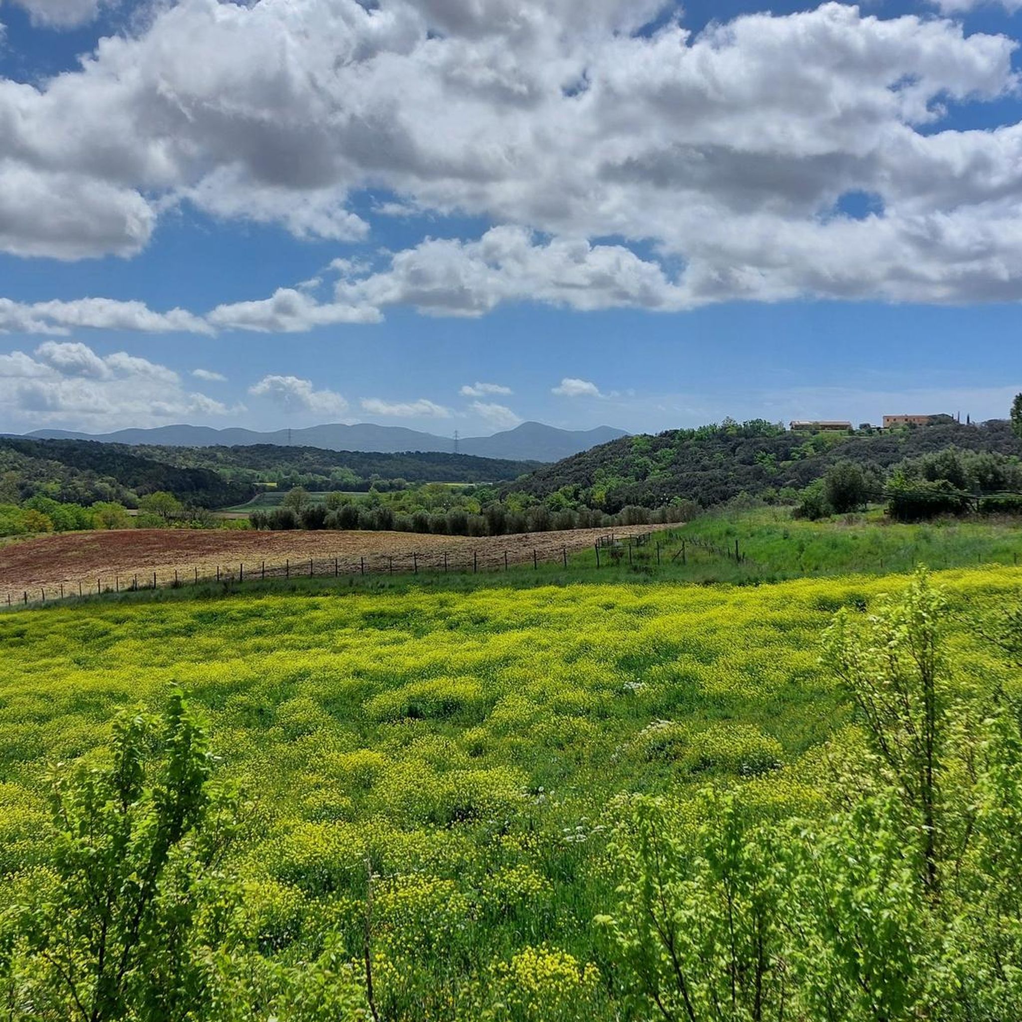
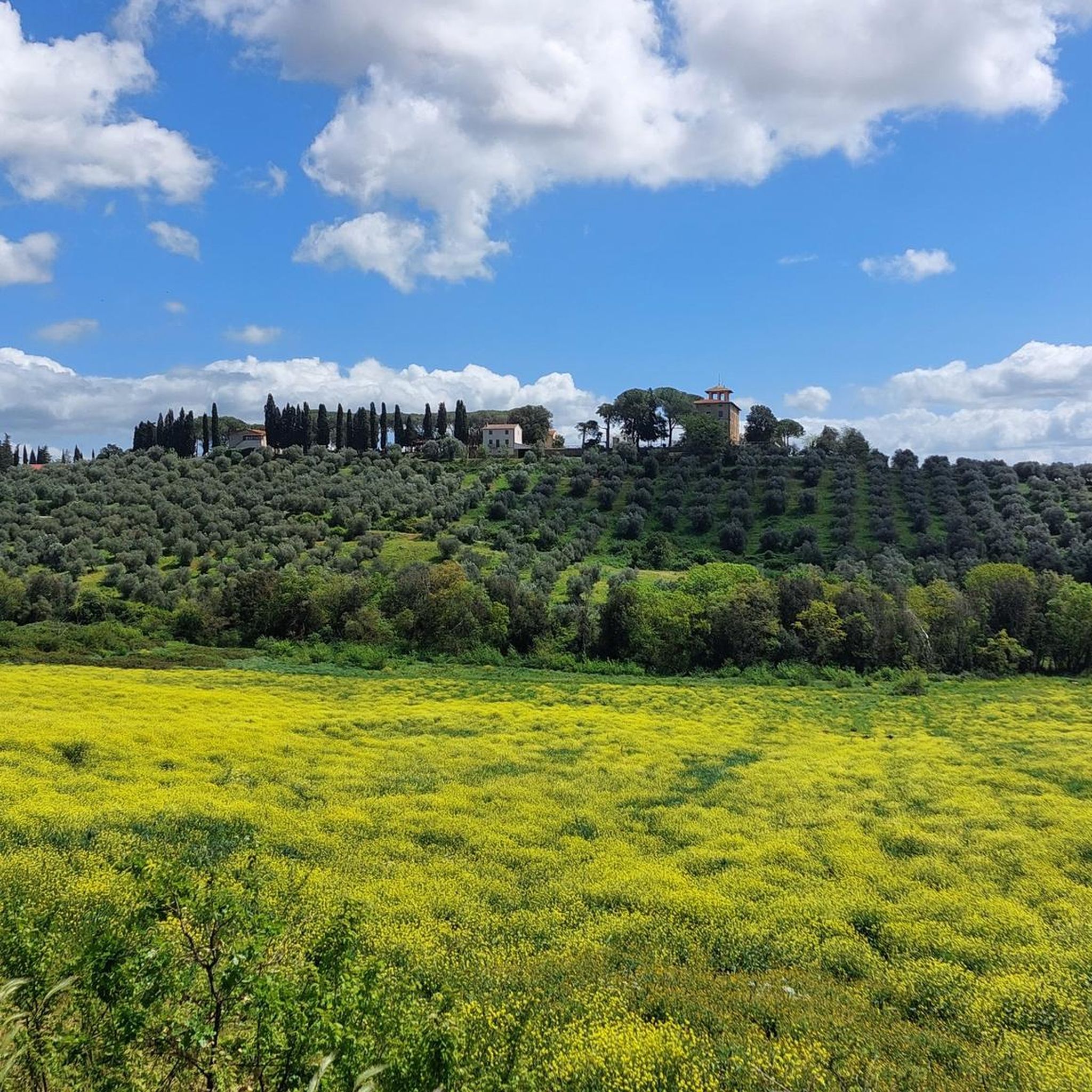
Road cycling in Riserva Naturale Statale Marsiliana features a landscape of rolling hills, generally ranging from 120 to 180 meters above sea level. The terrain includes dense forests, Mediterranean scrub, open pastures, and cultivated olive groves, providing a dynamic environment for road cyclists. Roads within the reserve are predominantly paved and well-maintained, offering smooth riding surfaces. The region is committed to preserving biodiversity, including the indigenous Maremmano horses.
Best road cycling routes in Riserva Naturale Statale Marsiliana
- The most popular road cycling route is Lago dell'Accesa – View of Massa Marittima loop from Valpiana, a 34.5 miles (55.5 km) trail that takes 2 hours 40 minutes to complete. This moderate route offers views of Massa Marittima and the surrounding landscape.
- Another top favourite among local road cyclists is Lake Accesa – Lago dell'Accesa loop from Valpiana, a moderate 20.5 miles (33.0 km) path. This route features a significant elevation gain of 2,031 feet (619 meters) and passes by Lake Accesa.
- Local road cyclists also love the View of Prata – Lago dell'Accesa loop from Scarlino, a 45.9 miles (73.8 km) trail leading through varied terrain with a substantial elevation gain of 3,104 feet (946 meters), often completed in about 3 hours 33 minutes.
- Road cycling in Riserva Naturale Statale Marsiliana is defined by rolling hills, dense forests, and open pastures. The network offers options for different ability levels, from moderate loops to more challenging routes with significant elevation.
- The routes in Riserva Naturale Statale Marsiliana are highly rated by the komoot community with an average score of 4.4 stars from more than 400 reviews. More than 10,000 road cyclists have used komoot to explore Riserva Naturale Statale Marsiliana's varied terrain.
Last updated: July 8, 2026
4.9
(10)
212
riders
51.3km
02:32
780m
780m
Moderate road ride. Good fitness required. Mostly well-paved surfaces and easy to ride.
4.0
(11)
265
riders
33.0km
01:45
620m
620m
Moderate road ride. Good fitness required. Mostly well-paved surfaces and easy to ride.

Sign up for free
4.2
(9)
103
riders
28.5km
01:28
480m
480m
Moderate road ride. Good fitness required. Mostly well-paved surfaces and easy to ride.
4.3
(4)
137
riders
47.3km
02:24
520m
520m
Moderate road ride. Good fitness required. Mostly well-paved surfaces and easy to ride.
4.6
(19)
519
riders
73.9km
03:30
950m
950m
Hard road ride. Very good fitness required. Mostly well-paved surfaces and easy to ride.
Get access to more routes and recommendations from other explorers.
Sign up for free
Already have an account?
Our route recommendations are based on thousands of hikes, rides, and runs completed by other people on komoot.
Start today with a free account
Your next adventure awaits.
Login or Signup
Tips from the Community

The medieval village of Prata (part of Massa Marittima) is located at an altitude of 620 meters. From its dominant position on the Colline Metallifere, it offers a 360-degree panorama ranging from the summit of Monte Amiata to the Gulf of Follonica, even offering views of the Island of Elba and, on the clearest days, Corsica.
0
0
The Montioni Interprovincial Park (also known as Montioni Natural Park) is a protected natural area of approximately 7,000 hectares located straddling the provinces of Livorno and Grosseto. The park is famous for its dense Mediterranean scrub dominated by holm oak woods and houses important historical and mining evidence within it, particularly related to the Napoleonic period and the extraction of alum.
0
0
The Archaeological Museum is housed in the ancient Palazzo del Podestà (1225), which overlooks the Piazza del Duomo of Massa Marittima. The collection is organized into sections, ordered chronologically from the lower paleolithic to the etruscan age; the main piece of the prehistoric collection is the eneolithic statue-stele of Vado all’Arancio, the only find of its type in Maremma; the etruscan finds come mainly from excavations carried out at the village of Lago dell’Accesa, they are mainly kitchenware, loom weights, fishing weights and bricks; also present are the funerary trousseaux found in the necropolises, especially pottery (figulina clay and bucchero), bronze fibulae, iron pot stands, iron and bronze weapons. On the ground floor, an educational section is set up with a life-size reconstruction of typical caves: a paleolithic and an eneolithic one. Guided tours and educational activities, organization of cultural events and film screenings are available.
1
0
The Palazzo Comunale of Massa Marittima, located in Piazza Garibaldi, is an imposing 13th-14th century travertine building, the hub of medieval Tuscan power. The complex, characterized by three floors of mullioned windows and 19th-century battlements, combines the 14th-century Torre del Bargello (formerly Biserno) with the Sienese Gothic central body. The facade features the Medici coat of arms and a 15th-century bas-relief. Travertine structure composed of several blocks, with the Torre del Bargello (13th century) and the Gothic central body (14th century). It features the Medici coat of arms (1555), a bas-relief by Urbano da Cortona (15th century), and commemorative plaques of Giuseppe Garibaldi. It houses the Cappella dei Priori (frescoed in 1525, now the Mayor's office) and Igor Mitoraj's sculpture "Icarus" in the atrium.
0
0
Cronoscalata. In 2018, the Kapannenberg time trial took place. There were 53 athletes registered on September 29th, organized by Velo Club Massa Marittima, in collaboration with Uisp ciclismo of Grosseto. The 5-kilometer time trial route started from the former miners' village in Capanne and ended near the Massa Marittima Penitentiary. The best time was set by Fabio Cini of Cicli Copparo with 10’21" 67.
0
0
Massa Marittima is visible from many parts of the plain, because it is built in a dominant position, precisely to see what was happening on the plain
2
0

A truly stunning place both for its nature and landscape and for mountain bike lovers, with many trails for all abilities.
1
0
The Accesa area is also extremely significant from an archaeological perspective. Near the lake, in the Macchia del Monte area, numerous excavations were carried out as early as the 1930s, and resumed in the 1980s, bringing to light numerous remains of four Etruscan villages dating from the 9th to the 6th century BC. The buildings of the various settlements, of which only the foundations are visible, are gathered in scattered groups within a rather large area. Given their location, it is hypothesized that these villages were linked to mining, especially copper from the Fenice Capanne and Serrabottini mines. It is also thought that these mining villages were mining outposts that were subordinate to the large center of Vetulonia, to which they supplied raw materials. In addition to the complexes intended for housing and mining, many tombs of various types (pit, pit, circle, and chamber) were also discovered.
1
0
Frequently Asked Questions
How many road cycling routes are available in Riserva Naturale Statale Marsiliana?
There are over 130 road cycling routes available in Riserva Naturale Statale Marsiliana, offering a wide range of options for different skill levels and preferences.
What kind of terrain can I expect when road cycling in Riserva Naturale Statale Marsiliana?
The region is characterized by rolling hills, with elevations typically ranging from 120 to 180 meters above sea level. You'll cycle through diverse landscapes including dense forests, Mediterranean scrub, open pastures, and cultivated olive groves, providing a dynamic and scenic experience.
Are there challenging road cycling routes for experienced riders?
Yes, Riserva Naturale Statale Marsiliana offers challenging routes. For instance, the View of Prata – Lago dell'Accesa loop from Scarlino is a difficult 73.8 km trail with a substantial elevation gain of 946 meters, perfect for experienced cyclists seeking a strenuous journey.
Are there easier road cycling routes suitable for beginners or families?
While many routes involve some elevation, there are easier options. The region offers 20 routes classified as easy. For example, the "Mulino del 1314 – Strada della Marsiliana loop from Riserva Naturale Statale Marsiliana" is a 16.4 km ride with 120m of elevation gain, suitable for a more relaxed pace.
What natural features or landmarks can I see along the road cycling routes?
Many routes offer picturesque views and pass by notable landmarks. You might encounter historical sites like the Montioni Ruins and the ancient Alum Quarries, or natural beauty such as Lake Accesa. The Lago dell'Accesa – View of Massa Marittima loop from Valpiana offers views of Massa Marittima and the surrounding landscape, while the Montioni Village is another point of interest.
What is the quality of the road surfaces for cycling?
The roads within and around Riserva Naturale Statale Marsiliana are generally well-maintained and mostly paved, providing a smooth riding experience. The 'Scenic Road to Massa Marittima' is particularly noted for its solid surface and tranquil passage through a sparsely populated, hilly landscape.
Are there any circular road cycling routes?
Yes, many of the routes in Riserva Naturale Statale Marsiliana are designed as loops. Examples include the Lake Accesa – Lago dell'Accesa loop from Valpiana and the Lago dell'Accesa – View of Massa Marittima loop from Valpiana, allowing you to start and finish at the same point.
What do other road cyclists enjoy most about the routes here?
The area is highly rated by the komoot community, with an average score of 4.4 stars from over 400 reviews. Cyclists often praise the varied terrain, the well-maintained paved roads, and the opportunity to combine scenic beauty with cultural and historical insights, all within a tranquil environment.
Can I find routes that pass by vineyards or other agricultural areas?
Yes, the region's landscape includes cultivated olive groves and vineyards. Some routes offer views of the vineyards of Montebamboli, providing a picturesque backdrop to your ride and a glimpse into the local agricultural heritage.
Are there any specific attractions related to local produce or culture?
Yes, you can explore the Monteregio di Massa Marittima Wine Route, which offers a cultural experience related to the region's wine production, often accessible or visible from various cycling paths.
What is the best time of year for road cycling in Riserva Naturale Statale Marsiliana?
While specific seasonal data isn't provided, the Mediterranean climate generally makes spring and autumn ideal for cycling, offering pleasant temperatures and lush landscapes. Summer can be warm, but early mornings or late afternoons might still be enjoyable. Winters are typically mild.
Most popular routes in Riserva Naturale Statale Marsiliana
Most popular attractions in Riserva Naturale Statale Marsiliana

Get inspired with the komoot mobile app


Explore more
Browse the best Road cycling routes in other regions.
