The best MTB trails in Réserve Naturelle Des Étangs De Mépieu
4.3
(176)
908
riders
89
rides
Mountain biking in Réserve Naturelle Des Étangs De Mépieu's wider region offers diverse terrain, though the core natural reserve itself is protected and prohibits mountain biking. The landscape is characterized by a mosaic of wetlands, ponds, and dry grasslands, alongside streams connected to the Rhône River. The broader Isle Crémieu area provides varied cycling routes.
Best mountain bike trails in Réserve Naturelle Des Étangs De Mépieu
- The most popular mountain bike trail is Blue Valley – Forest and stream loop from Arandon-Passins, a 74.7 miles (120.2 km) trail that takes 7 hours 18 minutes to complete. This difficult route features significant elevation gain through varied landscapes.
- Another top favourite among local mountain bikers is Quirieu Medieval Town loop from Bouvesse-Quirieu, a moderate 21.7 miles (34.9 km) path. This route offers a blend of historical sights and natural scenery, typically completed in about 2 hours 49 minutes.
- Local mountain bikers also love the Groslée Bridge – Château de Brangues loop from Arandon, a 21.8 miles (35.1 km) trail leading through river valleys and past historical landmarks, often completed in about 2 hours 38 minutes.
- Mountain biking in Réserve Naturelle Des Étangs De Mépieu's surrounding area is defined by a mix of wetlands, forests, and rolling hills. The network offers options for easy, moderate, and difficult routes, catering to different ability levels.
- The routes in Réserve Naturelle Des Étangs De Mépieu are highly rated by the komoot community with an average score of 4.4 stars from over 140 reviews. More than 780 mountain bikers have used komoot to explore Réserve Naturelle Des Étangs De Mépieu's varied terrain.
Last updated: October 14, 2026
3.5
(2)
8
riders
34.1km
02:45
410m
410m
Moderate mountain bike ride. Good fitness required. Suitable for all skill levels.
4.7
(11)
45
riders
33.1km
01:50
150m
150m
Easy mountain bike ride. Great for any fitness level. Suitable for all skill levels.

21
riders
121km
07:25
600m
600m
Hard mountain bike ride. Very good fitness required. Advanced riding skills necessary.
3
riders
26.5km
02:40
700m
700m
Moderate mountain bike ride. Good fitness required. Suitable for all skill levels.
2.0
(1)
7
riders
Moderate mountain bike ride. Good fitness required. Suitable for all skill levels.
Get access to more routes and recommendations from other explorers.
Already have an account?
Our route recommendations are based on thousands of hikes, rides, and runs completed by other people on komoot.
Start today with a free account
Your next adventure awaits.
Popular around Réserve Naturelle Des Étangs De Mépieu


Tips from the Community

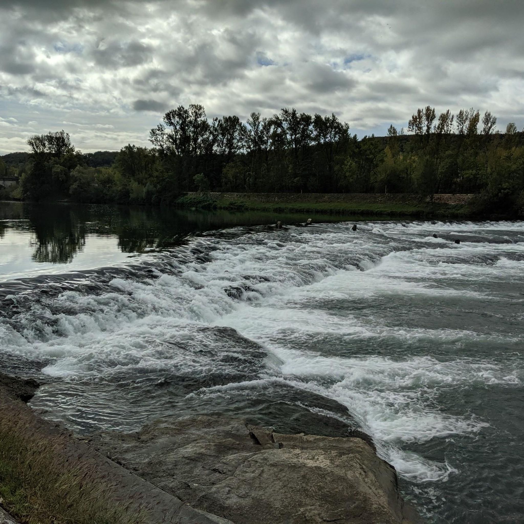
The Sault-Brénaz dam (also called Villebois dam or Sault-Brénaz facility) is an important hydroelectric infrastructure located on the Rhône River. It is situated on the border between the departments of Ain and Isère, mainly near the communes of Sault-Brénaz and Villebois. Commissioned in 1986, this structure was the last major facility built by the Compagnie Nationale du Rhône (CNR) on the upper Rhône.
0
0

Leisure base opposite Bas Bugey. A pleasant stop, but strangely located between 2 nuclear power plants...
0
0

Great camping, cheap but great and new facility's. It's near a white water course which can be entertaining to see people paddle on
0
0

A big surprise was the reference to the grave of this poet and philosopher. His grave is located in a corner of the park of the Château de Brangues and is open to the public.
0
0

It is at the bottom of the park, at the end of a small path that winds through the undergrowth, that the poet's grave is located. In accordance with his wishes, Paul Claudel was buried in Brangues, alongside one of his grandsons, Charles-Henri Paris, who died in 1938 at the age of two. It is in this land of Brangues, next to this child and a tall poplar, that the patriarch rests. His wife, Reine Sainte-Marie-Perrin, was buried next to him in 1973. (Access to the tomb is free and signposted for visitors) The epitaph. “Here lie the remains and the semen of Paul Claudel” This inscription is inspired by the epistle of Saint Paul to the Corinthians: “this seed which we put in the ground in the fall, seems to die during the winter, but germinates and comes back to life in the spring”. This is a message of hope. Already in 1892 Paul Claudel addressed this theme: “Below reason, below consciousness, below sense, Below instinct and every lit part of ourselves, Behold, completely lost in a revolt like that of the Conception, We feel that we can no longer defend this within ourselves, Which is like the germinal nucleus, the intimate grain, the seed of our own name! » (Paul Claudel – The Young Girl Violaine) Source: ABVL
2
0

great trail with a view of the waterfall
0
0

Leisure center with marina, entertainment, boat rental and a swimming pool (you are not actually allowed to swim in the Rhone, despite the sunbathing area right next to it)
0
0
Frequently Asked Questions
Can I mountain bike directly within the Réserve Naturelle Des Étangs De Mépieu?
No, mountain biking is strictly prohibited within the Réserve Naturelle Régionale des Étangs de Mépieu itself to protect its delicate ecosystems and diverse wildlife. However, the wider Isle Crémieu area, where the reserve is located, offers numerous mountain biking opportunities on trails outside the reserve's boundaries.
How many mountain bike trails are available in the wider Réserve Naturelle Des Étangs De Mépieu area?
There are over 90 mountain bike trails available in the region surrounding the Réserve Naturelle Des Étangs De Mépieu, catering to various skill levels. These routes explore the diverse landscapes of the Isle Crémieu area.
What kind of difficulty levels can I expect for mountain biking near Réserve Naturelle Des Étangs De Mépieu?
The trails in the surrounding area offer a good mix of difficulty levels. You'll find approximately 27 easy routes, 49 moderate routes, and 16 difficult routes, ensuring options for beginners to experienced riders.
Are there family-friendly mountain bike trails near Réserve Naturelle Des Étangs De Mépieu?
Yes, there are easy mountain bike trails suitable for families in the region. For example, the White-water stop – Blue Valley loop from Briord is an easy 33.1 km route that offers a pleasant ride without significant elevation challenges.
What natural features or landmarks can I see while mountain biking in the region?
While mountain biking is not permitted inside the reserve, trails in the surrounding Isle Crémieu area often provide views of the region's natural beauty. You might encounter river valleys, forests, and rolling hills. The reserve itself is known for its ponds, peat bogs, and dry grasslands, and the Promontoire de Potet offers panoramic views over the Grand Etang.
Are there any circular mountain bike routes available?
Yes, many of the mountain bike routes in the area are loops. For instance, the Quirieu Medieval Town loop from Bouvesse-Quirieu and the Groslée Bridge – Château de Brangues loop from Arandon are popular circular routes that allow you to start and end in the same location.
When is the best time of year to go mountain biking in the Réserve Naturelle Des Étangs De Mépieu region?
The region is generally pleasant for mountain biking during spring, summer, and autumn. Spring offers lush greenery and comfortable temperatures, while autumn provides beautiful foliage. Summer can be warm, so early morning or late afternoon rides are often preferred. Always check local weather conditions before heading out.
Can I bring my dog on mountain bike trails in this area?
While the Réserve Naturelle Des Étangs de Mépieu has specific rules for dogs (often requiring them to be on a leash or restricting access in certain areas), for mountain biking trails outside the reserve, it generally depends on local regulations and the specific trail. It's always best to check for signage at trailheads or local tourism information for the most accurate and up-to-date rules regarding dogs on trails.
Is there parking or public transport access for mountain biking trails near the reserve?
Parking is typically available at the starting points of many routes in the towns and villages surrounding the reserve, such as Arandon-Passins, Bouvesse-Quirieu, or Briord. Public transport options directly to specific trailheads might be limited, so planning your journey by car is often the most convenient way to access these mountain biking routes.
What do other mountain bikers say about the trails in the Réserve Naturelle Des Étangs De Mépieu region?
The mountain biking routes in the surrounding area are highly rated by the komoot community, with an average score of 4.4 stars from over 140 reviews. More than 780 mountain bikers have used komoot to explore the varied terrain, often praising the diverse landscapes and the blend of natural and historical sights.
Are there challenging mountain bike trails for experienced riders?
Yes, experienced riders will find challenging options. The Blue Valley – Forest and stream loop from Arandon-Passins is a difficult 120.2 km trail with significant elevation gain, offering a substantial challenge for advanced mountain bikers.
Can I combine mountain biking with exploring historical sites in the region?
Absolutely. The region offers routes that blend natural scenery with historical interest. The Quirieu Medieval Town loop from Bouvesse-Quirieu is a moderate 34.9 km route that allows you to explore historical sights while enjoying your ride.
Are there mountain bike routes that pass by water features or rivers?
Yes, several routes in the area incorporate water features. The Groslée Bridge – Château de Brangues loop from Arandon leads through river valleys, and the wider region is characterized by its connection to the Rhône River via streams like the Chogne and Save.
Most popular routes in Réserve Naturelle Des Étangs De Mépieu

Get inspired with the komoot mobile app


Explore more
Browse the best MTB trails in other regions.
