The best walks and hikes in Spirkenwälder Saminatal
4.6
(5728)
32,631
hikers
691
hikes
Hiking trails in Spirkenwälder Saminatal traverse a diverse landscape within the Rätikon mountain range, characterized by unique hook pine forests (Spirkenwälder) and the wild Saminatal valley. Elevations in the region range from approximately 830 meters to 2,200 meters above sea level, featuring prominent peaks like Galinakopf and Hohe Köpfe. The area includes calcareous alpine habitats, alpine pastures such as Amerlugalpe and Sarojaalpe, and the Samina creek.
Best hiking trails in Spirkenwälder Saminatal
- The most popular hiking route is View of…
Last updated: July 1, 2026
4.6
(39)
297
hikers
6.25km
03:18
650m
650m
Moderate hike. Good fitness required. Mostly accessible paths. Sure-footedness required.
4.4
(7)
88
hikers
6.08km
03:05
540m
540m
Hard hike. Good fitness required. Sure-footedness, sturdy shoes and alpine experience required.

Sign up for free
5.0
(1)
37
hikers
4.42km
02:52
500m
500m
Hard hike. Good fitness required. Sure-footedness, sturdy shoes and alpine experience required.
4.8
(10)
23
hikers
Moderate hike. Good fitness required. Mostly accessible paths. Sure-footedness required.
5.0
(1)
27
hikers
2.57km
01:18
270m
270m
Moderate hike. Great for any fitness level. Mostly accessible paths. Sure-footedness required.
Get access to more routes and recommendations from other explorers.
Sign up for free
Already have an account?
Our route recommendations are based on thousands of hikes, rides, and runs completed by other people on komoot.
Start today with a free account
Your next adventure awaits.
Login or Signup
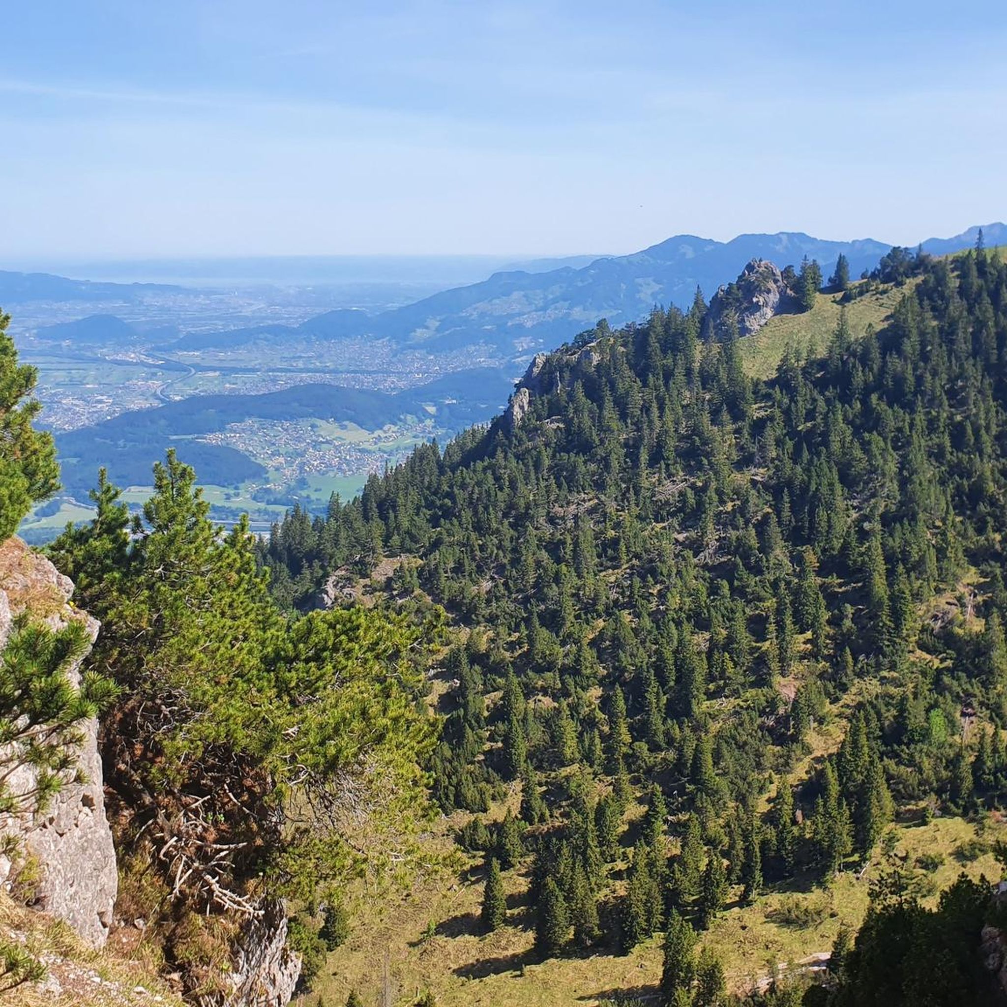
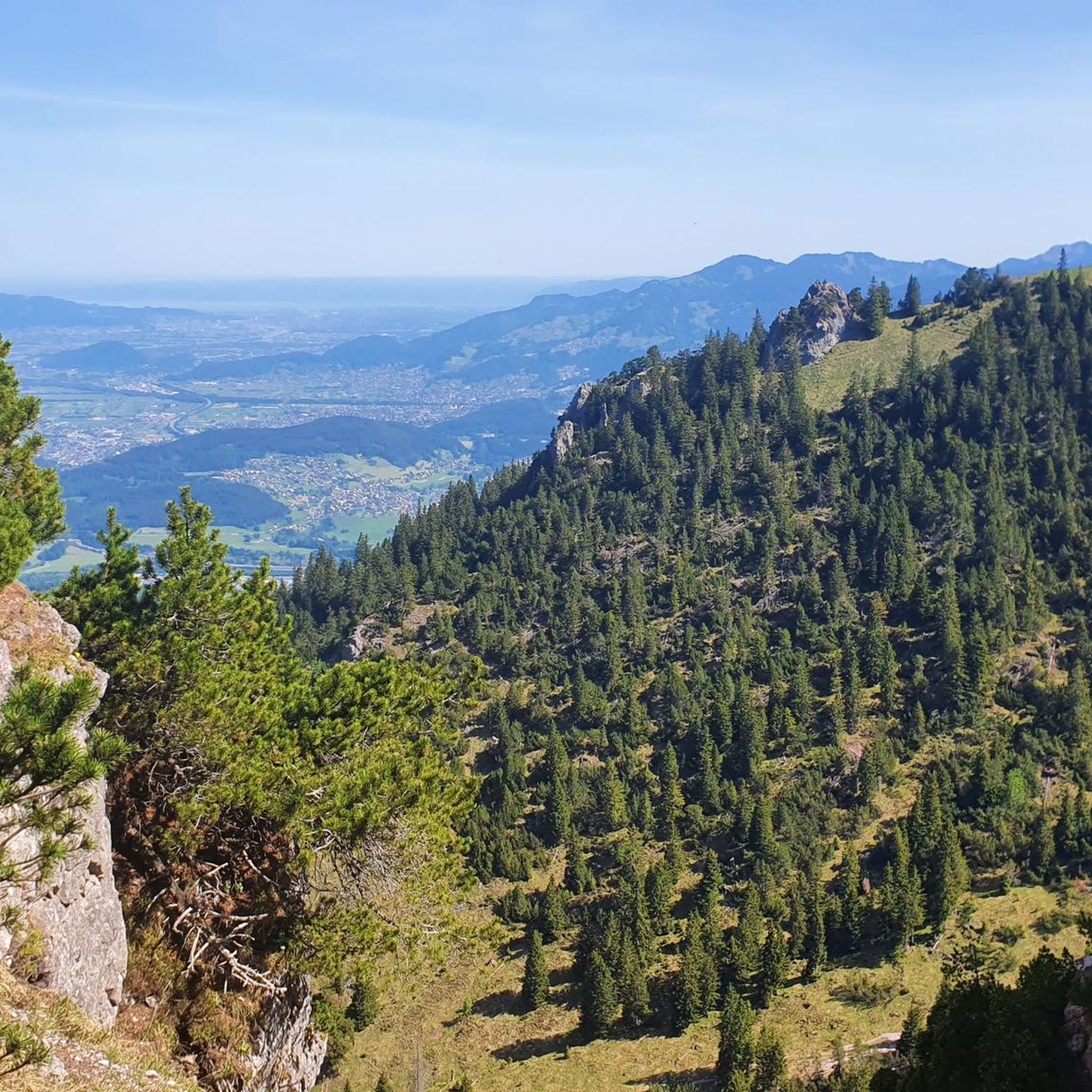
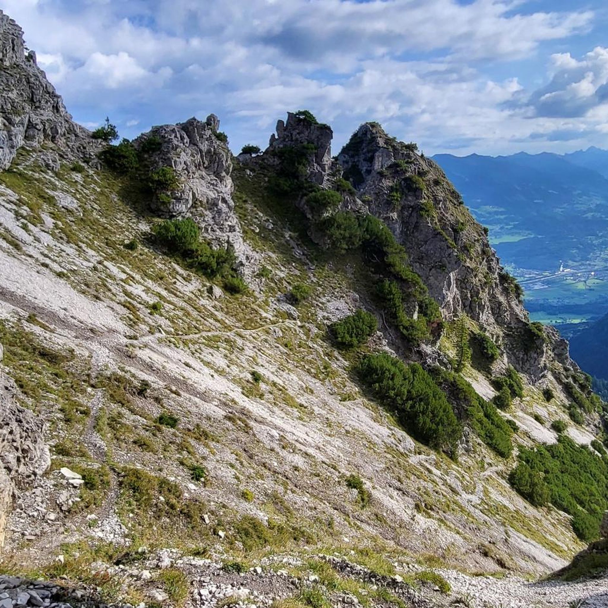
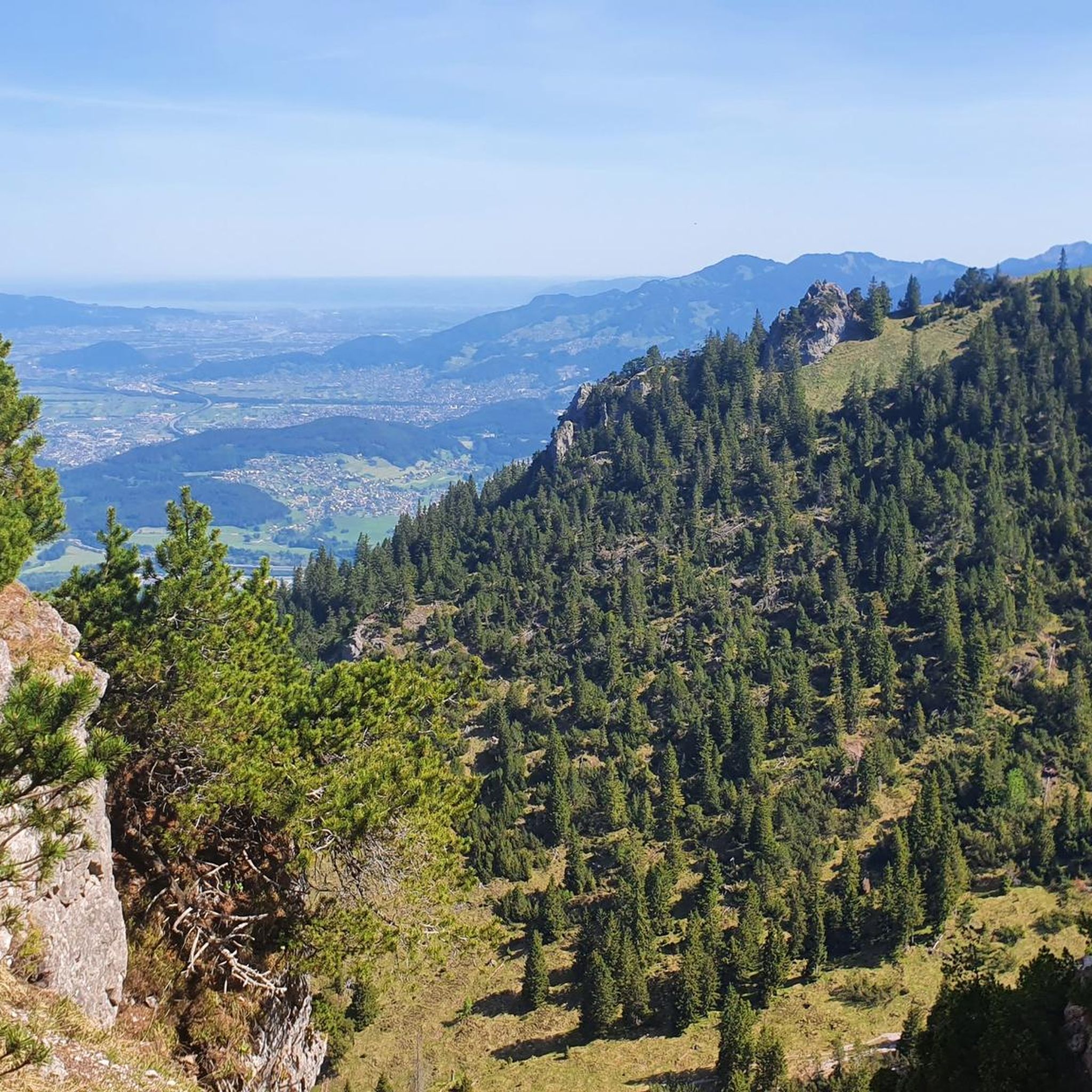

Tips from the Community

pretty here, very pretty
3
1
pretty here, very pretty
3
0

Good hiking boots are a must. Special equipment isn't absolutely necessary, but you should bring enough time and a head for heights.
0
0

you should not be afraid of heights
0
0

Info with dogs 🐾 Anyone who can safely carry their dog on their shoulders can climb this route. It looks spectacular at first, but for experienced mountain dogs, it's not an insurmountable obstacle. We climbed with climbing harnesses and safety harnesses, and webbing slings in case we need to be secured in between.
2
0
very pretty here, very pretty
3
0

There is a wooden cross with a bench on the Alpe where you can take a nice break. Enjoy the wide view!
1
0
Frequently Asked Questions
How many hiking trails are available in Spirkenwälder Saminatal?
Spirkenwälder Saminatal offers a vast network of over 700 hiking trails. This includes a wide range of options, with approximately 350 easy routes, nearly 300 moderate paths, and around 70 challenging trails for experienced hikers.
What makes the Spirkenwälder Saminatal region unique for hiking?
The region is renowned for its distinctive hook pine forests (Spirkenwälder), which thrive in extreme conditions and are a designated Natura 2000 site. Hikers will also experience the dramatic alpine backdrop of the Rätikon mountain range, the wild and romantic Saminatal valley with the Samina creek, and picturesque alpine pastures like Amerlugalpe and Sarojaalpe.
What kind of natural landmarks or viewpoints can I expect to see on the trails?
Hikers can enjoy breathtaking vistas from prominent peaks such as Galinakopf (2,198 m), Hohe Köpfe (2,066 m), and Zigerbergkopf (2,042 m). The striking "Drei Schwestern" (Three Sisters) mountains are a significant landmark, offering challenging objectives and impressive views. You can find specific viewpoints like the Galinakopf Summit or the Summit Cross Hohe Köpfe.
Are there any family-friendly hiking options in Spirkenwälder Saminatal?
Yes, the area provides numerous easy strolls suitable for families. With over 340 easy routes available, you can find paths that are less strenuous and allow for a relaxed experience amidst nature. These trails often traverse the light-filled hook pine forests or follow the Samina creek.
Can I bring my dog on the hiking trails in Spirkenwälder Saminatal?
Generally, dogs are welcome on the hiking trails in Spirkenwälder Saminatal. However, as it is a protected area and home to rare wild animals, it's crucial to keep dogs on a leash to prevent disturbance to wildlife and ensure their safety, especially near alpine pastures or sensitive habitats.
Are there any circular hiking routes in the region?
Yes, many routes in Spirkenwälder Saminatal are designed as circular walks. For example, the challenging Three Sisters Peaks – Climbing Sections with Ladders loop from Saroja offers a demanding circular experience. Another option is the moderate View of the Drei Schwestern – Bench With a View of Gurtis loop from Amerlügen.
What is the best time of year to go hiking in Spirkenwälder Saminatal?
The best time for hiking in Spirkenwälder Saminatal is typically from late spring to early autumn (May to October). During these months, the weather is generally favorable, and the trails are clear of snow. Some paths, especially in forested areas, can be wet, so good footwear is always recommended.
Are there places to rest or get refreshments along the trails?
Yes, hikers can find convenient rest and refreshment points. Huts like the Feldkircher Hütte are available along some trails, offering a place to take a break and enjoy the surroundings.
What kind of wildlife can I observe in Spirkenwälder Saminatal?
As a protected Natura 2000 site, Spirkenwälder Saminatal provides excellent opportunities for observing rare wild animals. Visitors are encouraged to use binoculars and maintain quiet to minimize disturbance and increase their chances of spotting local fauna.
What are the typical elevation changes on hikes in this region?
The elevation in Spirkenwälder Saminatal ranges from approximately 830 meters to 2,200 meters above sea level. Hikes can involve significant ascents and descents; for instance, the difficult View of the Drei Schwestern – Summit Cross Hohe Köpfe loop from Bazora includes over 950 meters of elevation gain.
What do other hikers say about the trails in Spirkenwälder Saminatal?
The routes in Spirkenwälder Saminatal are highly rated by the komoot community, with an average score of 4.6 stars from over 5,300 reviews. Hikers often praise the diverse landscapes, from the unique hook pine forests to the dramatic Rätikon mountains, and the well-maintained paths.
Are there any particularly challenging routes for experienced hikers?
Yes, for experienced trekkers, there are challenging alpine routes, particularly those leading to the "Drei Schwestern" mountains. The Three Sisters Peaks – Descent from the Drei Schwestern loop from Saroja is a difficult path involving a significant descent from these peaks, and some routes feature climbing sections with ladders, requiring appropriate equipment.
Most popular routes in Spirkenwälder Saminatal
Most popular attractions in Spirkenwälder Saminatal

Get inspired with the komoot mobile app


Explore more
Browse the best Hikes in other regions.
