The best walks and hikes in Hoher Ifen
4.6
(81054)
364,655
hikers
1,301
hikes
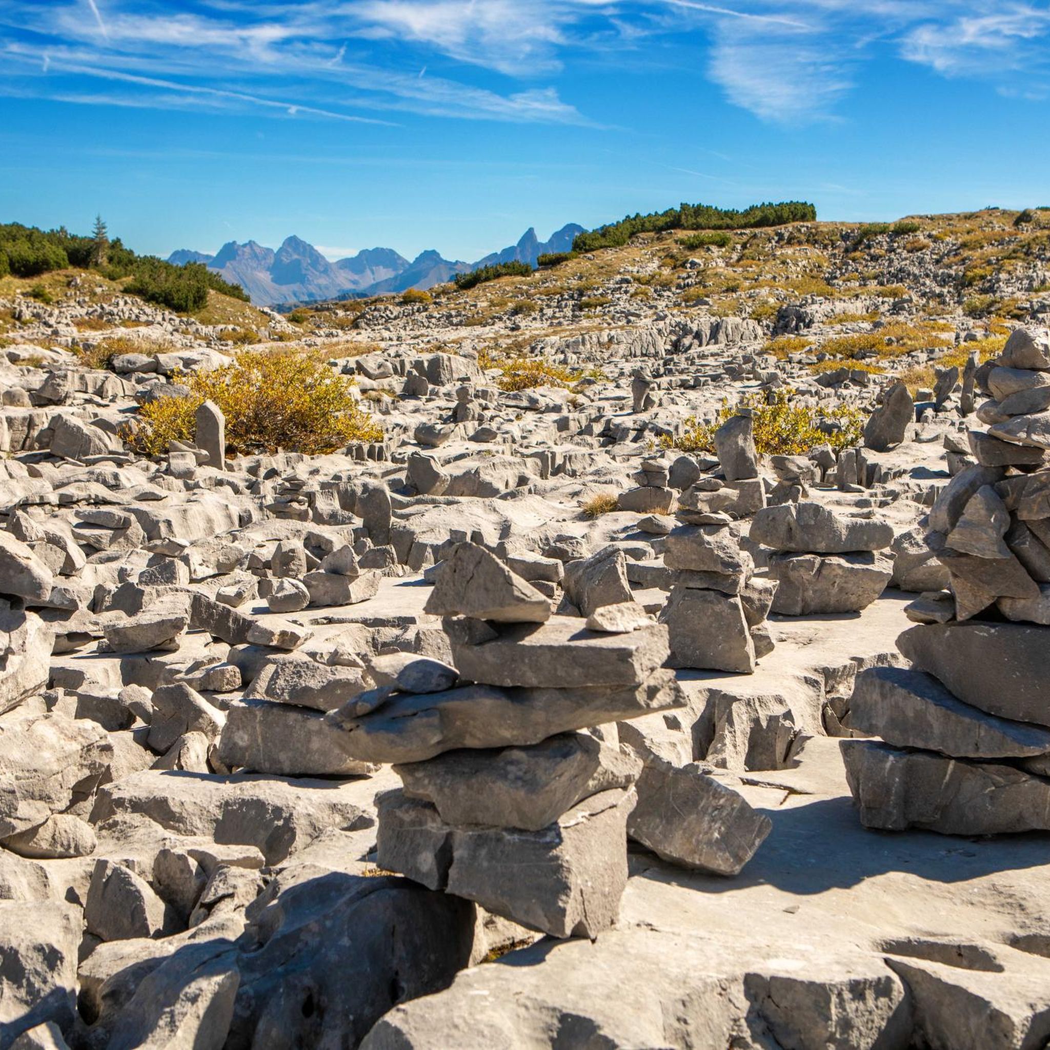
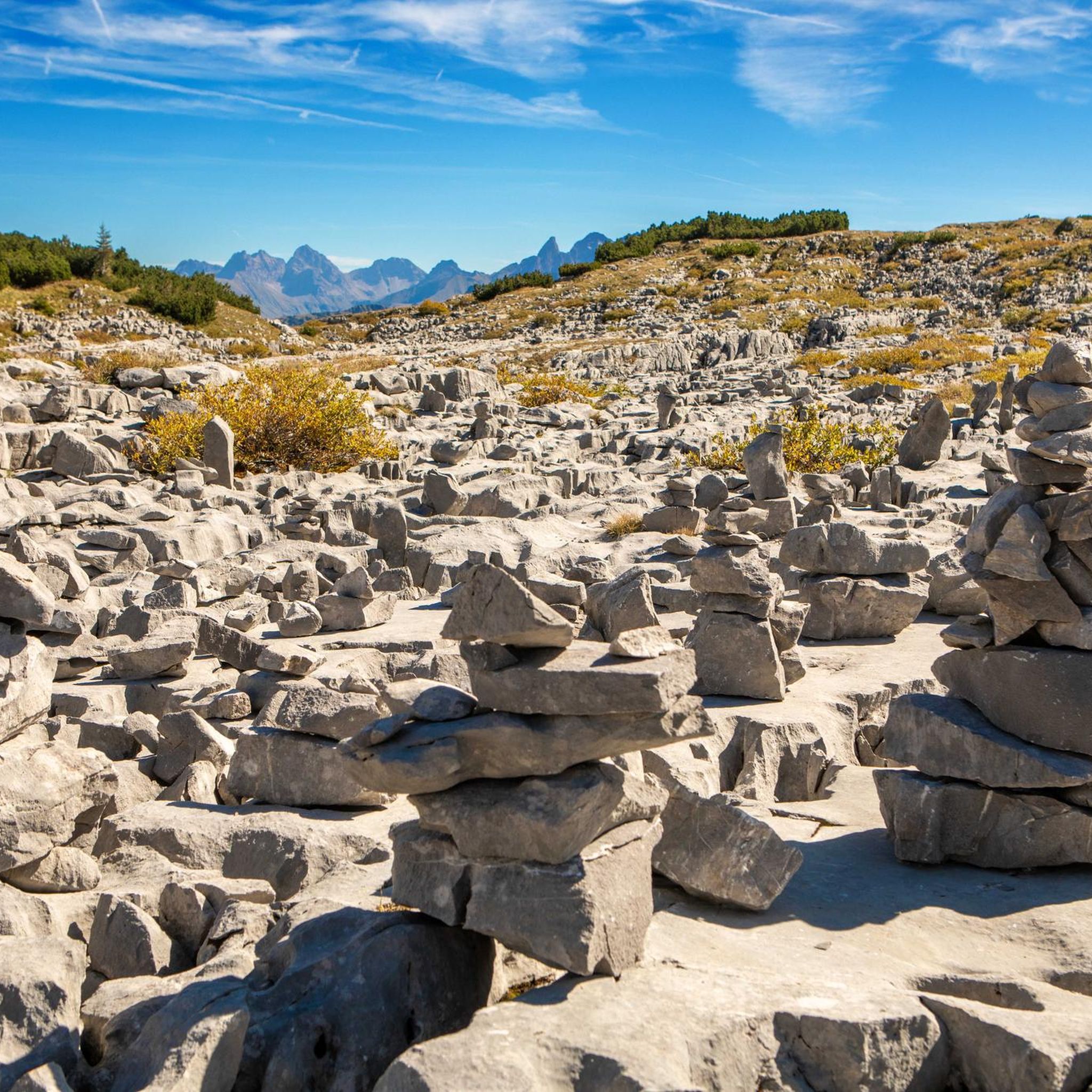
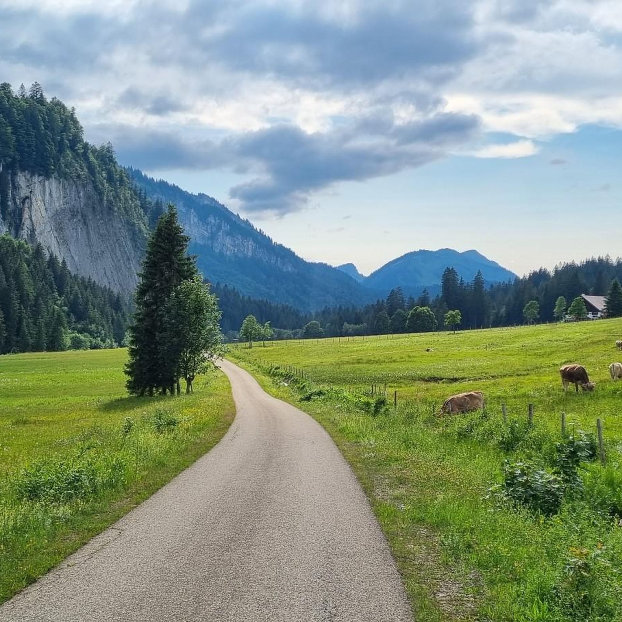
Hiking in Hoher Ifen offers a diverse landscape characterized by its distinctive limestone formations, known as the Gottesacker plateau, and surrounding alpine meadows. The region features a mix of challenging ascents to prominent peaks and gentler trails through valleys and forests. Elevation changes are significant on many routes, providing varied terrain for hikers.
Best hiking trails in Hoher Ifen
- The most popular hiking route is Besler Loop – Besler Ridge loop from Rohrmoos, a 6.9 miles (11.1 km) trail that takes 4 hours 32 minutes to complete. This route offers panoramic views from the Besler Ridge.
- Another top favourite among local hikers is Below the Gottesacker Cliffs – Waterfall in the Schwarzwassertal loop from Riezlern, a difficult 9.0 miles (14.6 km) path. This trail navigates through rugged terrain with notable elevation gain, passing a waterfall.
- Local hikers also love the Besler Ridge – Besler summit loop from Rohrmoos, a 8.7 miles (14.1 km) trail leading through alpine meadows and offering summit views, often completed in about 5 hours 17 minutes.
- Hiking in Hoher Ifen is defined by its unique karst landscapes, high alpine pastures, and dense forest sections. The network offers options for various ability levels, from easy valley walks to challenging mountain ascents.
- The routes in Hoher Ifen are highly rated by the komoot community with an average score of 4.6 stars from over 77,000 reviews. More than 350,000 hikers have used komoot to explore Hoher Ifen's varied terrain.
Last updated: July 1, 2026
4.9
(58)
308
hikers
11.0km
04:29
640m
640m
Moderate hike. Good fitness required. Mostly accessible paths. Sure-footedness required.
4.8
(56)
249
hikers
Hard hike. Very good fitness required. Mostly accessible paths. Sure-footedness required.

Sign up for free
4.2
(10)
66
hikers
14.1km
05:17
690m
690m
Hard hike. Very good fitness required. Sure-footedness, sturdy shoes and alpine experience required.
4.8
(21)
109
hikers
6.80km
01:49
80m
80m
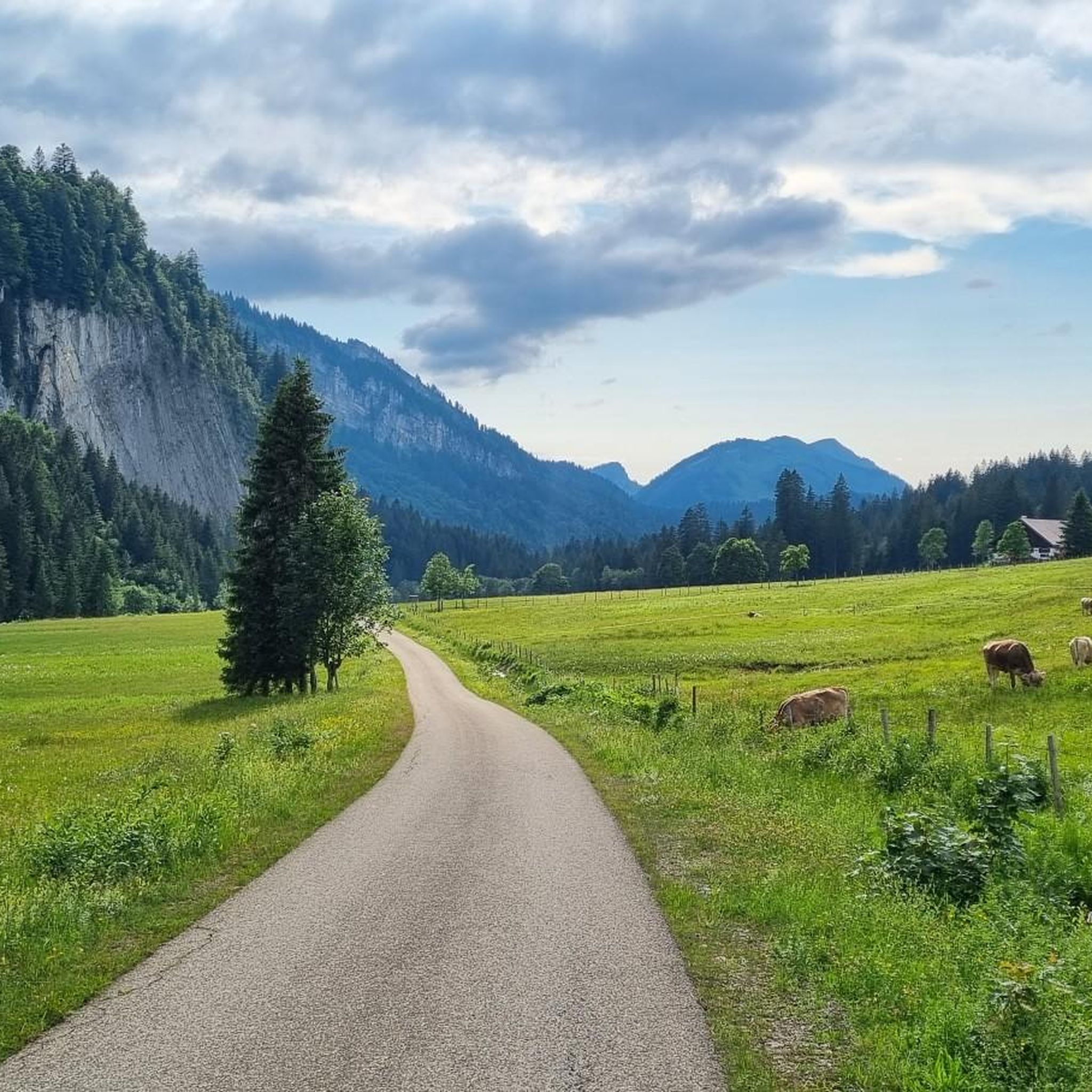
Easy hike. Great for any fitness level. Easily-accessible paths. Suitable for all skill levels.
4.9
(14)
66
hikers
12.5km
05:43
900m
900m
Hard hike. Very good fitness required. Mostly accessible paths. Sure-footedness required.
Get access to more routes and recommendations from other explorers.
Sign up for free
Already have an account?
Our route recommendations are based on thousands of hikes, rides, and runs completed by other people on komoot.
Start today with a free account
Your next adventure awaits.
Login or Signup

Tips from the Community

Very nice round and starting to the left is definitely worth it. The ascent is then not quite as steep and more in the forest. The descent requires sure-footedness, but is easily manageable with good equipment.
0
0

A very beautiful area with clearings and small woods.
3
0
Beautiful natural waterfall with a steep rock face. However, there was no water in winter, just some ice.
4
0

Waterfall near the natural stone bridge
1
0

Located at 1,279 meters, the Alpe Dinjörgen is a beautiful and peaceful spot for a snack. The homemade products taste wonderful! 👍
7
0
The St. Anne Chapel in Rohrmoos was built in 1568 by Count Jakob von Waldburg and his wife. Since 1500, Rohrmoos and the entire valley have belonged to the counts, later princes, of Waldburg. The chapel is still completely original, and the beautiful murals date from the year of its construction. In addition to the Last Judgment (above the entrance door, difficult to see), you can see figures of apostles and saints, stories of Saint Anne, and a winged altar. Above it is the large coat of arms of the Waldburg family.
9
0
The 1,967 m high Gottesackerscharte ridge is a small pass between the Torkopfscharte ridge and the Gottesacker plateau. While taking a break, you can enjoy a beautiful view over the impressive Gottesacker plateau and the Hoher Ifen mountain. A boundary stone marks one of the points of the perfectly straight boundary lines on the Gottesacker plateau.
6
0
The Mahdtalalpe is located at 1,497 m and is not open for business, so there are no refreshment stops.
6
0
Frequently Asked Questions
How many hiking trails are available in Hoher Ifen?
Hoher Ifen offers a vast network of over 1200 hiking trails. This includes a diverse range of routes, from easy valley walks to challenging mountain ascents, catering to various preferences and fitness levels.
Are there hiking options for all skill levels in Hoher Ifen?
Yes, Hoher Ifen provides trails for every skill level. You'll find over 530 easy routes perfect for beginners or leisurely strolls, more than 560 moderate trails for those seeking a bit more challenge, and nearly 200 difficult paths for experienced hikers looking for demanding ascents and rugged terrain.
What do other hikers enjoy most about hiking in Hoher Ifen?
The komoot community highly rates Hoher Ifen, with an average score of 4.6 stars from over 77,000 reviews. Hikers frequently praise the region's unique karst landscapes, especially the distinctive Gottesacker plateau, as well as the stunning alpine meadows and panoramic views from peaks like the Besler Ridge.
Are there any family-friendly hiking trails in Hoher Ifen?
Yes, Hoher Ifen has several family-friendly options. For an easier walk suitable for families, consider the View of the Allgäu Mountains – Rohrmoos Valley loop from Rohrmoos, which is an easy 6.8 km trail with minimal elevation gain, offering pleasant views without being too strenuous.
Are there any circular hiking routes in Hoher Ifen?
Hoher Ifen is home to many excellent circular routes. A popular choice is the Besler Loop – Besler Ridge loop from Rohrmoos, which is a moderate 11.1 km trail offering panoramic views. Another option is the more challenging Besler Ridge – Besler summit loop from Rohrmoos, an 8.7-mile (14.1 km) trail with rewarding summit views.
Can I find trails with waterfalls in Hoher Ifen?
Yes, you can experience trails featuring waterfalls in Hoher Ifen. A notable route is the difficult Below the Gottesacker Cliffs – Waterfall in the Schwarzwassertal loop from Riezlern, a 14.6 km path that navigates rugged terrain and passes a beautiful waterfall.
What are some interesting landmarks or attractions to see along the trails?
Hoher Ifen offers several natural landmarks and points of interest. You can explore various mountain passes such as the Hörnlepass Border Crossing or the Rohrmoos Saddle (1,120 m). For those seeking summit experiences, the Summit Cross of Hoher Ifen and Hahnenköpfle Summit are prominent features.
What is the best time of year to hike in Hoher Ifen?
The best time for hiking in Hoher Ifen is typically from late spring (May/June) through early autumn (September/October). During these months, the weather is generally milder, trails are clear of snow, and the alpine meadows are vibrant. Always check local weather forecasts before heading out, especially for higher elevations.
Are there any specific considerations for winter hiking in Hoher Ifen?
Winter hiking in Hoher Ifen requires careful preparation due to snow and ice. Many trails become impassable or require specialized equipment like snowshoes or crampons. Lower elevation paths might be accessible, but it's crucial to check current conditions, avalanche warnings, and trail closures before planning a winter hike.
Where can I find parking or trailheads for hikes in Hoher Ifen?
Many popular trailheads in Hoher Ifen, such as those for routes starting from Rohrmoos or Riezlern, offer designated parking areas. Specific parking information is often available on individual route descriptions on komoot, or through local tourism offices. It's advisable to arrive early during peak season to secure a spot.
Are dogs allowed on the hiking trails in Hoher Ifen?
Generally, dogs are welcome on most hiking trails in Hoher Ifen, but it's important to keep them on a leash, especially in areas with livestock or wildlife. Always carry water for your dog and be prepared to clean up after them. Some protected areas or specific routes might have restrictions, so check local signage.
Are there any cafes or pubs near the hiking trails for refreshments?
Yes, the Hoher Ifen region, particularly around villages like Riezlern and Rohrmoos, has various mountain huts (Alpenhütten) and guesthouses that offer refreshments and meals. These are often strategically located along or near popular hiking routes, providing a welcome break for hikers. Check their opening times, especially outside of peak season.
What should I wear for hiking in Hoher Ifen?
Given the varied terrain and potential for rapid weather changes in Hoher Ifen, layering is key. Wear moisture-wicking base layers, insulating mid-layers, and a waterproof/windproof outer shell. Sturdy hiking boots with good ankle support are essential. Always pack sun protection, a hat, gloves, and plenty of water, even on shorter hikes.
Most popular routes in Hoher Ifen
Most popular attractions in Hoher Ifen

Get inspired with the komoot mobile app


Explore more
Browse the best Hikes in other regions.
