The best walks and hikes in Endmoränenlandschaft Ringenwalde
4.5
(1529)
5,563
hikers
283
hikes
Hiking in Endmoränenlandschaft Ringenwalde offers diverse trails through a terminal moraine landscape within the Schorfheide-Chorin Biosphere Reserve. This region is characterized by its hilly and varied terrain, shaped by ancient glaciers. Hikers will find numerous lakes, dense forests, and rolling hills, providing a range of natural features to explore. The area is known for its well-preserved natural environment, making it suitable for various outdoor activities.
Best hiking trails in Endmoränenlandschaft Ringenwalde
- The most popular hiking route is Düstersee West Shore…
Last updated: June 29, 2026
4.8
(33)
97
hikers
7.45km
01:56
40m
40m
Easy hike. Great for any fitness level. Easily-accessible paths. Suitable for all skill levels.
4.3
(3)
14
hikers
Easy hike. Great for any fitness level. Easily-accessible paths. Suitable for all skill levels.

Sign up for free
4.6
(10)
28
hikers
13.1km
03:22
70m
70m
Moderate hike. Good fitness required. Easily-accessible paths. Suitable for all skill levels.
4.0
(6)
14
hikers
10.8km
02:48
70m
70m
Moderate hike. Good fitness required. Easily-accessible paths. Suitable for all skill levels.
5.0
(1)
7
hikers
Hard hike. Very good fitness required. Easily-accessible paths. Suitable for all skill levels.
Get access to more routes and recommendations from other explorers.
Sign up for free
Already have an account?
Our route recommendations are based on thousands of hikes, rides, and runs completed by other people on komoot.
Start today with a free account
Your next adventure awaits.
Login or Signup

Tips from the Community


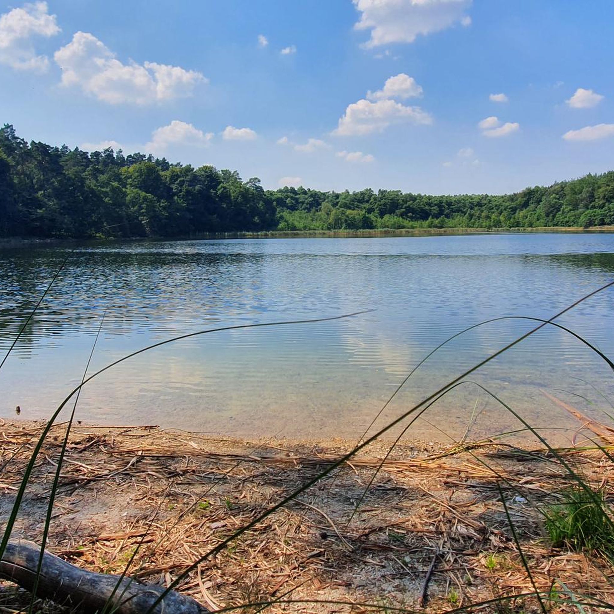
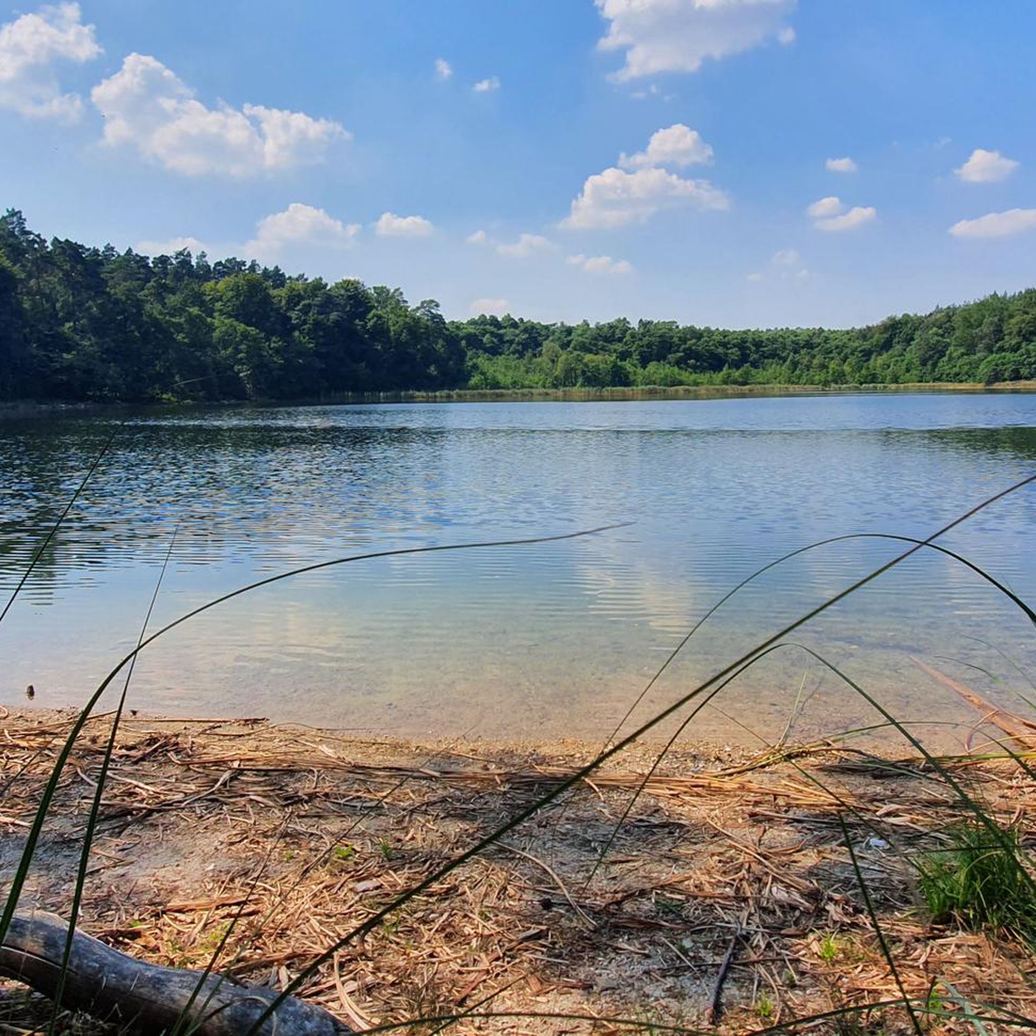
The bench is still stable (extra thick version), but currently in April 2026 it is unusable due to scattered branches! You would have to clear them away first. Just 5 m further, you can sit more comfortably on the edge of the terrain on the side path.
0
0

Unfortunately didn't read it properly. Too bad.
0
0

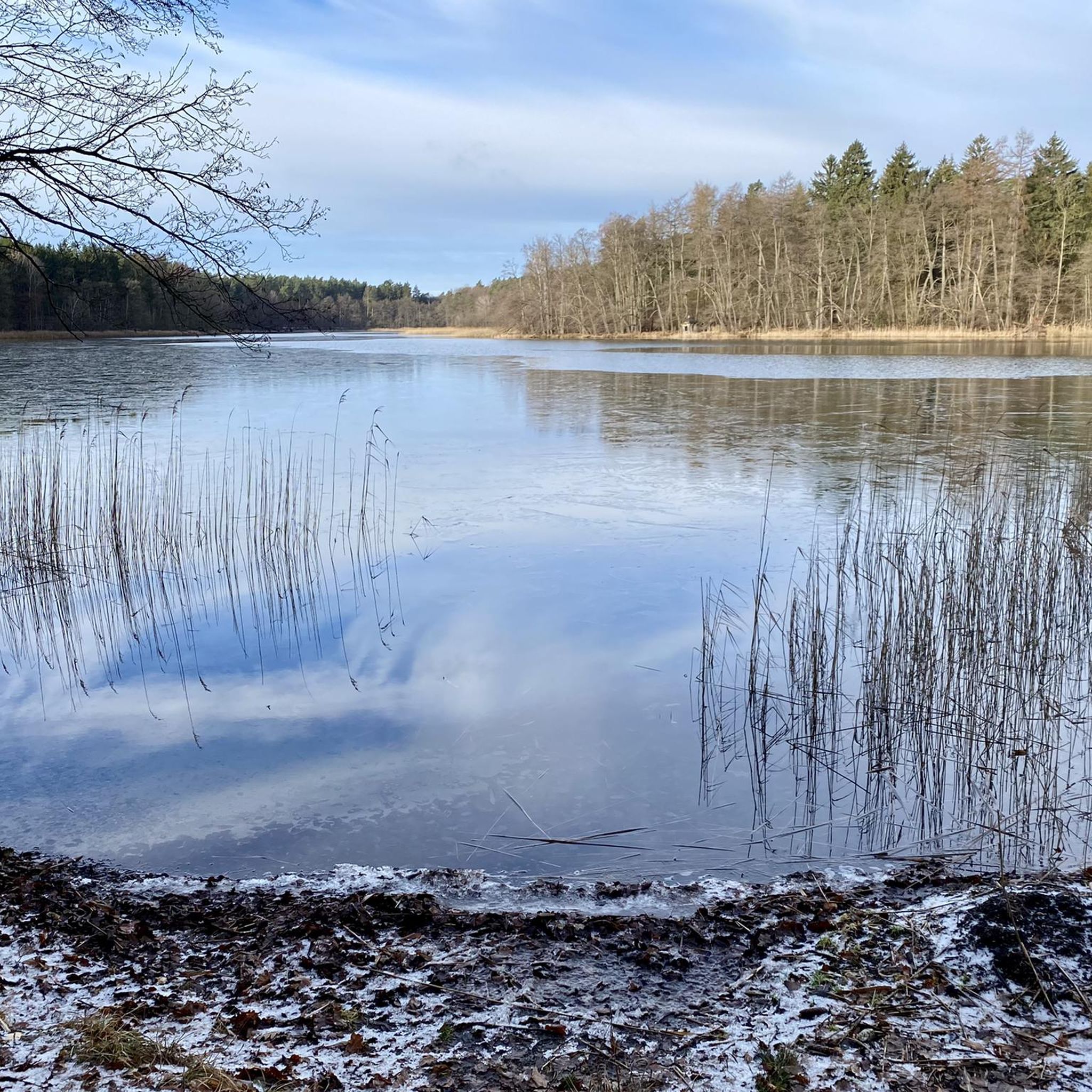
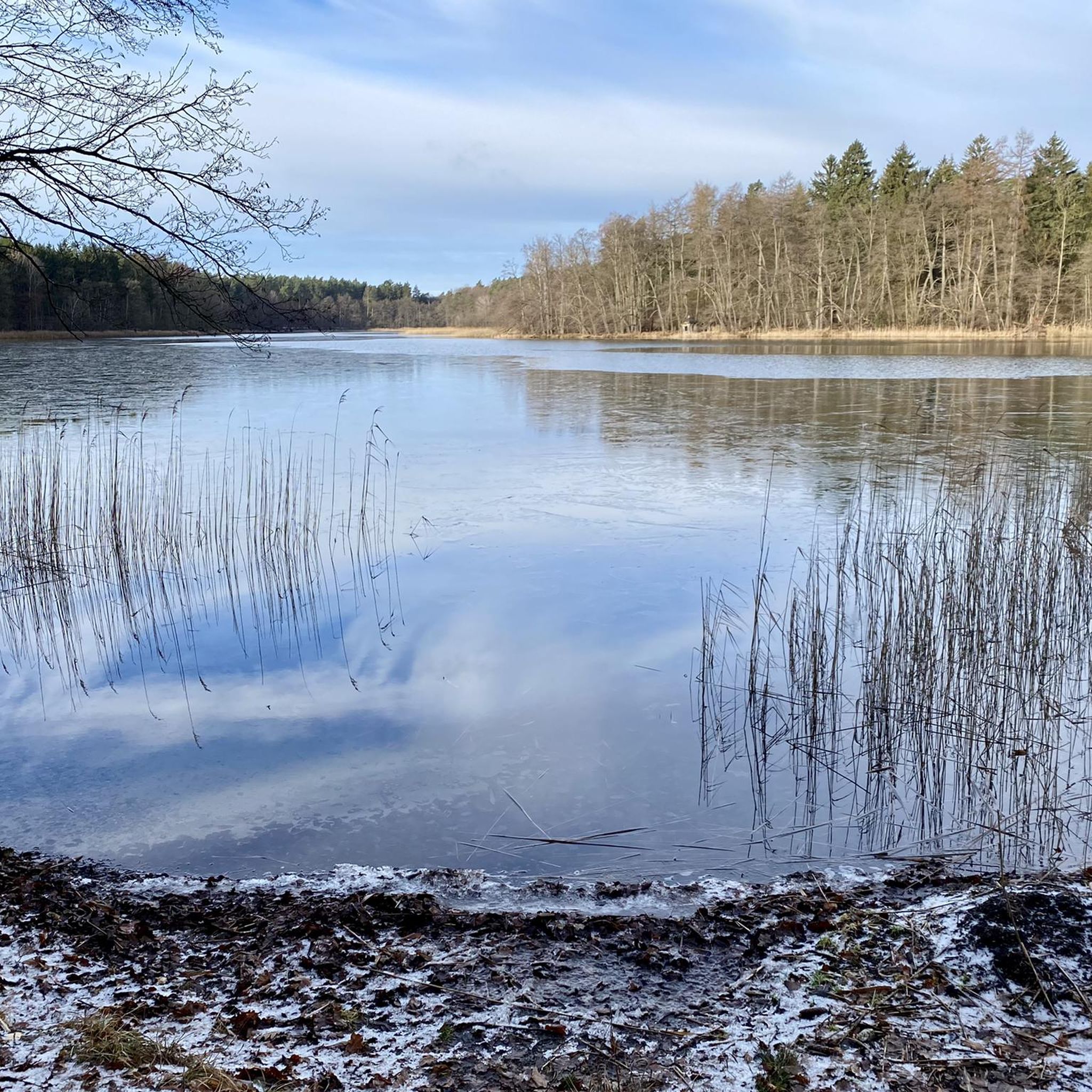
Swimming is prohibited here due to nature conservation. The lake is home to rare and protected species.
0
0
This natural jewel should be enjoyed quietly and carefully, so don't camp on the bank for hours, for example. Walking or cycling slowly, taking a short break, maybe even going into the water quickly at the recognizable spots (please be quiet), these are the best ways to have a respectable and memorable experience here!
1
0
The Lübelowsee is a natural lake, extremely idyllic and somewhat difficult to reach. Location: In the middle of the Uckermark forest and in the biosphere reserve. - You can enjoy silence and we have to be very grateful for such opportunities. In some places it's quite easy to get to see something. If you search tirelessly and have good scouting skills, you may even discover an opportunity to swim!
0
0
Frequently Asked Questions
How many hiking trails are available in Endmoränenlandschaft Ringenwalde?
There are nearly 300 hiking routes in Endmoränenlandschaft Ringenwalde, catering to various fitness levels. You'll find a wide selection of easy, moderate, and challenging trails to explore the region's diverse landscapes.
What types of terrain can I expect on hikes in Endmoränenlandschaft Ringenwalde?
The region is characterized by its 'terminal moraine landscape,' meaning you'll encounter a hilly and varied terrain shaped by ancient glaciers. Expect rolling hills, dense forests, and numerous lakes. Paths are generally accessible, offering a mix of natural woodlands and scenic lakeside trails.
Are there easy hiking trails suitable for families or beginners?
Yes, Endmoränenlandschaft Ringenwalde offers over 120 easy routes perfect for families and beginners. These trails allow you to enjoy the natural beauty without strenuous climbs. An example is the Düstersee West Shore – Gutshof Alt-Temmen loop from Krinertseen, which is an easy 4.6-mile trail through serene forest paths.
What natural features or landmarks can I see along the hiking trails?
Hikers can discover numerous lakes, such as Stabs Lake, known for its quiet forest setting, and Libbesickesee swimming spot. The landscape also features expansive forests and rolling hills, offering scenic viewpoints. The region is part of the Schorfheide-Chorin Biosphere Reserve, highlighting its rich biodiversity.
Are there any circular hiking routes in the area?
Yes, many trails in Endmoränenlandschaft Ringenwalde are circular, allowing you to start and end at the same point. For instance, the Großer Krinertsee – Gutshof Alt-Temmen loop from Krinertseen is a popular moderate 6.8-mile circular path that explores woodlands and the lake shore.
Is Endmoränenlandschaft Ringenwalde suitable for dog-friendly hikes?
The natural environment of Endmoränenlandschaft Ringenwalde is generally welcoming for dogs. As a protected area, it's important to keep dogs on a leash to protect local wildlife, which includes many bird species, beavers, and otters. Always check local signage for specific rules.
What is the best time of year to go hiking in Endmoränenlandschaft Ringenwalde?
The region is beautiful year-round, but spring and autumn offer particularly pleasant hiking conditions with mild temperatures and vibrant natural colors. Summer is also popular, especially around the lakes, while winter provides a serene, quiet experience, though some paths might be less accessible depending on snow conditions.
Are there any challenging or longer routes for experienced hikers?
Yes, for experienced hikers, there are 22 difficult routes available. One example is the Bench at Libbesickesee – Libbesickesee swimming spot loop from Endmoränenlandschaft Ringenwalde, a challenging 17-mile route that offers an extensive exploration of the landscape.
What do other hikers enjoy most about Endmoränenlandschaft Ringenwalde?
The area is highly rated by the komoot community, with an average score of 4.6 stars from over 1,400 reviews. Hikers often praise the quiet woodlands, the picturesque lakes, and the varied terrain that makes each route unique. The well-preserved natural environment and diverse wildlife are also frequently highlighted.
Is public transport available to reach hiking trails in Endmoränenlandschaft Ringenwalde?
While the region is primarily accessed by car, there are bus connections to villages like Ringenwalde, often from larger towns like Angermünde. It's advisable to check local bus schedules in advance, as services might be less frequent, especially on weekends or public holidays.
Are there parking facilities available for hikers?
Yes, parking is generally available near popular trailheads and villages within the Endmoränenlandschaft Ringenwalde. Specific parking information can often be found on individual route descriptions or local tourist information boards.
Are permits required for hiking in Endmoränenlandschaft Ringenwalde?
No, hiking permits are generally not required for exploring the trails in Endmoränenlandschaft Ringenwalde. As a nature reserve within a biosphere reserve, visitors are encouraged to respect the natural environment by staying on marked paths and not disturbing wildlife.
Most popular routes in Endmoränenlandschaft Ringenwalde
Most popular attractions in Endmoränenlandschaft Ringenwalde

Get inspired with the komoot mobile app


Explore more
Browse the best Hikes in other regions.
