The best walks and hikes in Näverkärrs Naturreservat
4.6
(986)
4,701
hikers
96
hikes
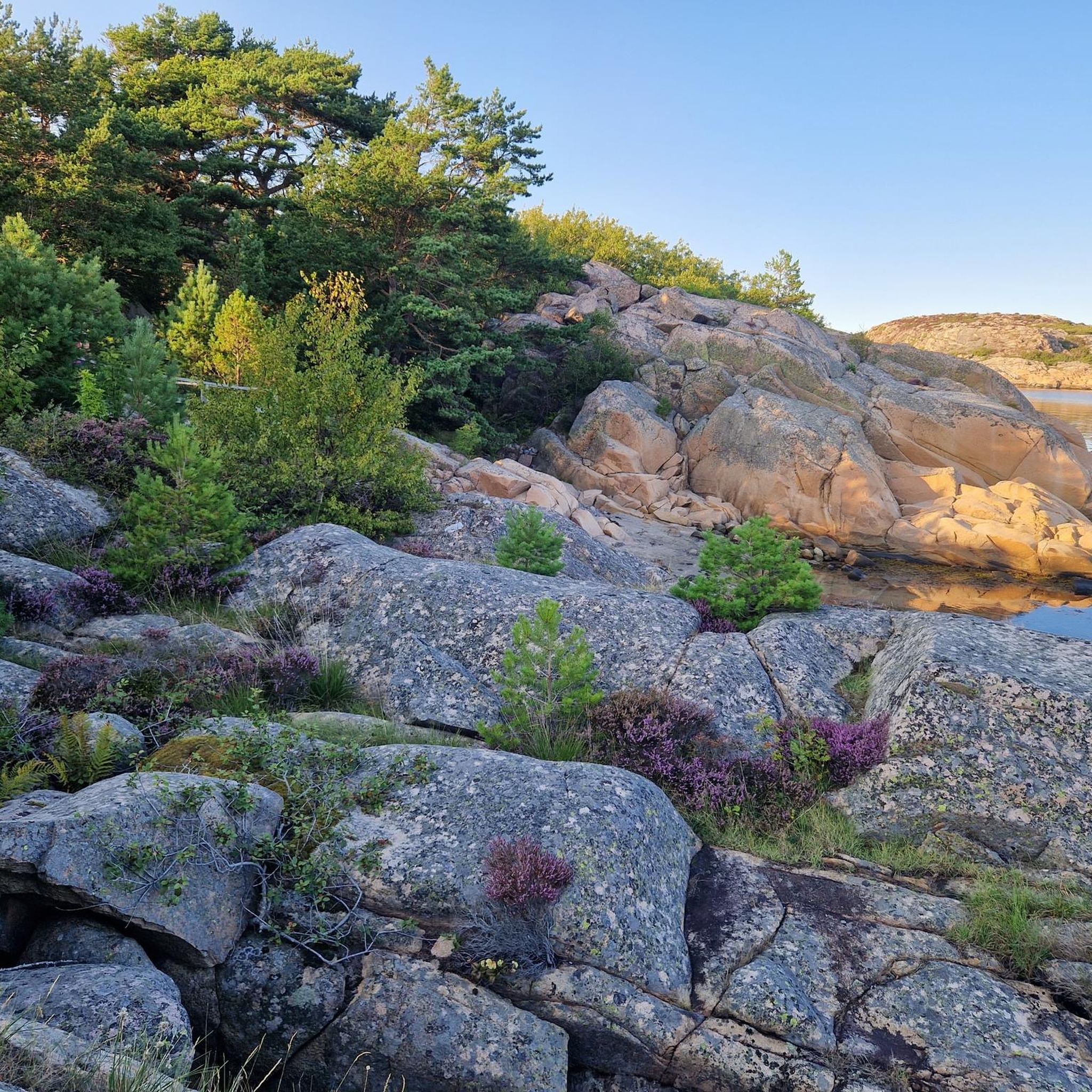
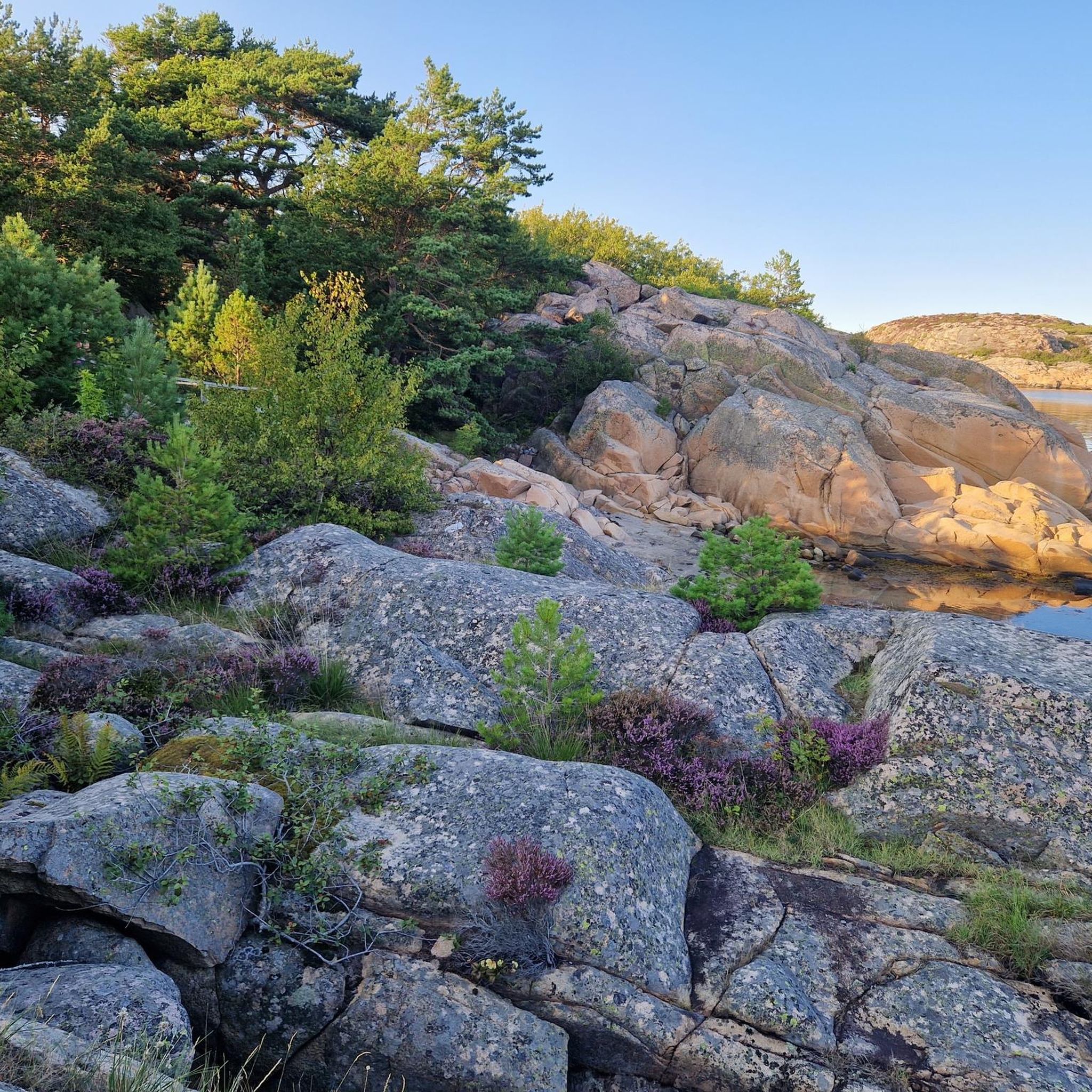
Hiking in Näverkärrs Naturreservat offers diverse landscapes, from ancient coastal broadleaf forests to granite cliffs and shell-rich sandy beaches. The reserve, located on the southwestern tip of Härnäset, features varied terrain including gravel roads, forest paths, and coastal trails. Hikers can explore environments with unique lichen flora and panoramic sea views. The area is characterized by its natural features and historical attractions, providing a range of outdoor experiences.
Best hiking trails in Näverkärrs Naturreservat
- The most popular hiking route is Näverkärr Loop Trail, a 2.9 miles (4.7 km) trail that takes 1 hour 23 minutes to complete. This difficult route leads through ancient forests and offers coastal views.
- Another top favourite among local hikers is Kuststigen loop - Näverkärr Nature Reserve, a difficult 2.9 miles (4.7 km) path. This trail is part of the longer Kuststigen network and features challenging terrain within the reserve.
- Local hikers also love the Karlsvik Bay beach loop from Näverkärrs naturreservat, a 1.6 miles (2.5 km) trail leading through shell-rich sandy beaches and coastal areas, often completed in about 40 minutes.
- Hiking in Näverkärrs Naturreservat is defined by ancient forests, granite landscapes, and coastal paths. The network offers options for different ability levels, from easy walks to more difficult hikes.
- The routes in Näverkärrs Naturreservat are highly rated by the komoot community with an average score of 4.6 stars from over 890 reviews. More than 4000 hikers have used komoot to explore Näverkärrs Naturreservat's varied terrain.
Last updated: July 7, 2026
4.9
(17)
58
hikers
4.67km
01:23
60m
60m
Hike the Näverkärr Loop Trail, a difficult 2.9-mile route through ancient forests and coastal views in Näverkärr Nature Reserve.
4.9
(17)
58
hikers
4.67km
01:23
60m
60m
Hard hike. Great for any fitness level. Sure-footedness, sturdy shoes and alpine experience required.

Sign up for free
5.0
(1)
4
hikers
2.54km
00:40
20m
20m
Easy hike. Great for any fitness level. Easily-accessible paths. Suitable for all skill levels.
5.0
(9)
41
hikers
Moderate hike. Good fitness required. Easily-accessible paths. Suitable for all skill levels.
4.8
(5)
26
hikers
Easy hike. Great for any fitness level. Easily-accessible paths. Suitable for all skill levels.
Get access to more routes and recommendations from other explorers.
Sign up for free
Already have an account?
Our route recommendations are based on thousands of hikes, rides, and runs completed by other people on komoot.
Start today with a free account
Your next adventure awaits.
Login or Signup
Tips from the Community

Tiny fishing station made up of small huts set over a turquoise sea. Take the time to admire the fishing boats, and scramble along the smooth rocks that surround the bay.
1
0
Beautiful little forest section as you walk between Karlsvik and Inre Sköllbergsvik.
0
0
A tiny pool sits just above the bay, making for a marvellous panorama of the granite landscape.
0
0
Breathtaking spot to stop for a break. The view along the granite cliffs stretches well beyond Karlsvik bay, and out to sea towards the numerous islands.
0
0
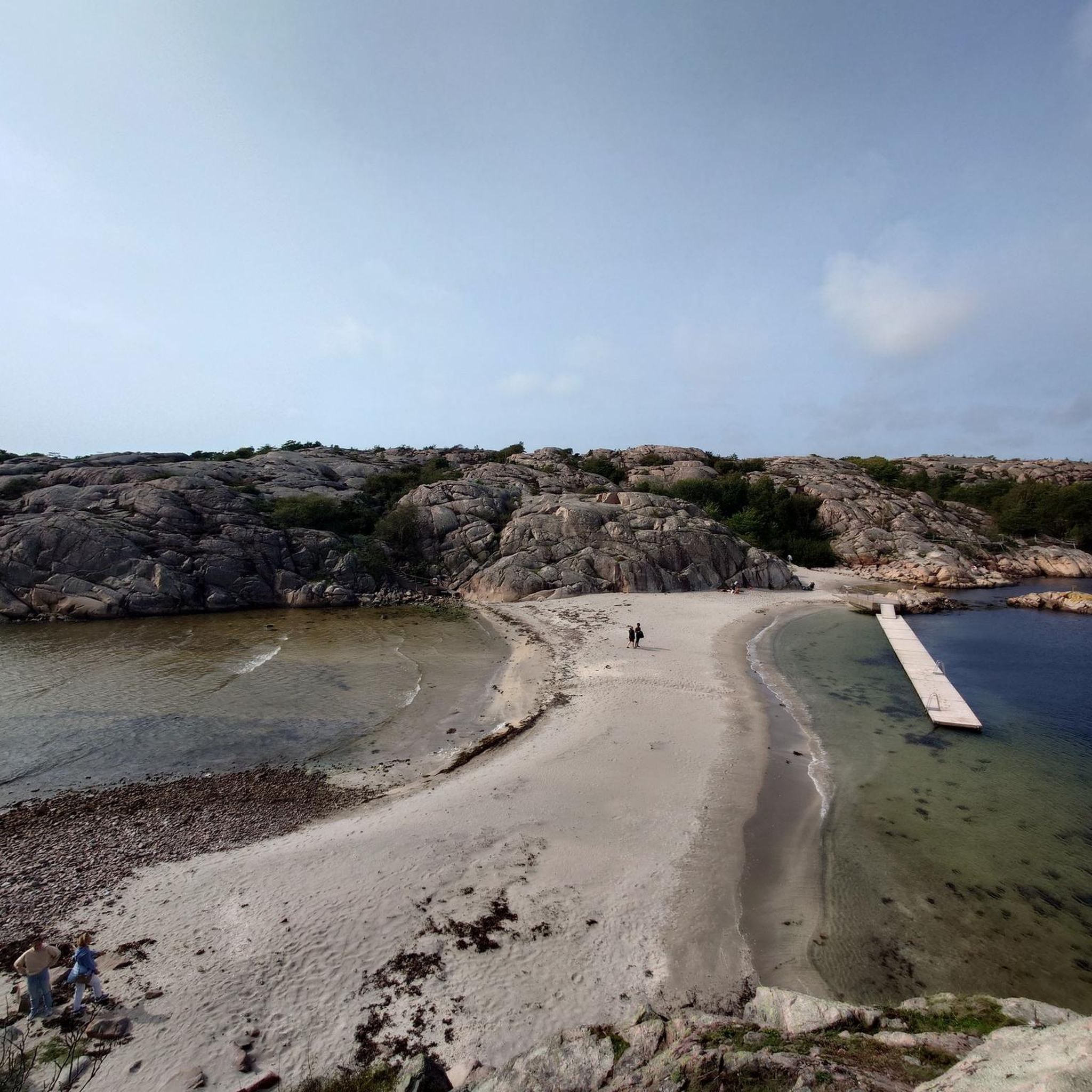
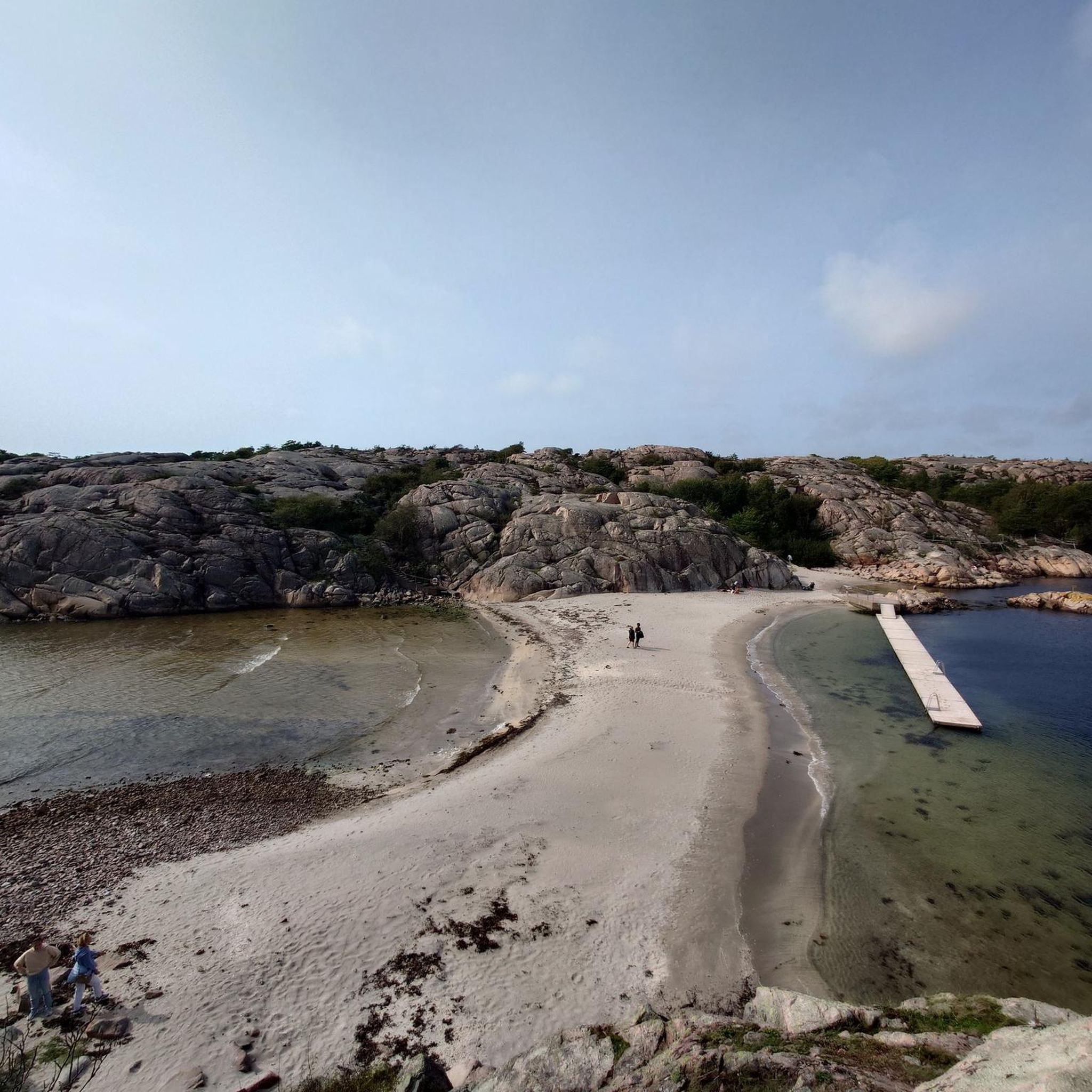
Beautiful sandy beach surrounded by granite cliffs. The bay is fairly narrow, and protected either side by long peninsulas, so the water is exceptionally calm for swimming. There are two barbecue areas just above the beach.
0
0

Very sweet the little fishing village!
0
0

The part of the Kärleksstigen by the dam is called the Brenner Pass. At the Brenner Pass on the Kärleksstigen at the Näckrosdammen, the inscription "Bränner Pass" was made when the road was built as emergency work during the Second World War - but was slightly misspelled... On the road towards the Brenner Pass and Fiskelægt there is an inscription "SES 1847" in the mountain on the left side made by Samuel Ericsson, son of Erik Nykter who lived in "Skogen" as a crofter in about 1820. He married "Beata i Bäcken" in 1847 and also took over the homestead the same year - and also carved this into the rock.
0
0
Originally "Pers lane" after the bay where the fisherman Per Andersson (1825-1907) used to land his catch. Per was born in the house Fiskelaget 29 (Tunnbinderestigen 3) and then built his own house (ca: 1857) by the path between the cemetery and Perlane where there is a house foundation today.
1
0
Frequently Asked Questions
What types of landscapes can I expect to see while hiking in Näverkärrs Naturreservat?
Näverkärrs Naturreservat offers a diverse range of landscapes. You'll encounter ancient coastal broadleaf forests, including the unique Storskogen with trees over 200 years old, stunning granite cliffs, and shell-rich sandy beaches like those at Karlsvik Bay. The trails also lead through alder marshes and offer panoramic views of the sea and surrounding islands.
Are there any easy hiking trails suitable for beginners or families in Näverkärrs Naturreservat?
Yes, there are several easy trails. For a pleasant, shorter walk, consider the Karlsvik Bay beach loop from Näverkärrs naturreservat, which is about 2.5 km and leads to a calm bay ideal for picnics. Another easy option is the Brennerpasset on Kärleksstigen – C.A. Kullgren Memorial Cross loop from Djupedal, which is around 6.8 km.
What are some notable natural features or viewpoints in the reserve?
The reserve is known for its ancient Storskogen forest, which boasts an incredibly rich lichen flora with over 300 identified species, indicating very clean air. You'll also find a tiny pool just above Karlsvik Bay that provides a marvelous panoramic view of the granite scenery stretching out to sea. The shell-rich sandy beaches themselves are a beautiful natural feature.
Can I bring my dog on the hiking trails in Näverkärrs Naturreservat?
Yes, dogs are generally welcome in Näverkärrs Naturreservat, but they must be kept on a leash to protect wildlife and other visitors. Please ensure you clean up after your pet.
Are there any circular hiking routes available in Näverkärrs Naturreservat?
Many of the trails in Näverkärrs Naturreservat are designed as loops. Examples include the challenging Näverkärr Loop Trail and the Kuststigen loop - Näverkärr Nature Reserve, both offering diverse scenery. For a moderate option, there's the Kvarnvik Fishing Huts – Malmön Fishing Harbor loop from Djupedal.
What is the best time of year to visit Näverkärrs Naturreservat for hiking?
The reserve is beautiful year-round, but spring and summer are particularly popular. In spring, a meadow on shell gravel near Karlsvik Bay is adorned with a rich bloom of cowslips. The warmer months are also ideal for enjoying the natural bathing spots and coastal views.
Are there any historical sites or attractions within Näverkärrs Naturreservat?
Yes, the reserve is home to the historic Näverkärr farm, which has origins dating back to the Viking Age. The current residential building likely dates from the early 1700s, offering a glimpse into the area's long history.
What do other hikers say about their experience in Näverkärrs Naturreservat?
The komoot community highly rates hiking in Näverkärrs Naturreservat, with an average score of 4.6 stars from nearly 900 reviews. Hikers often praise the varied terrain, from ancient forests to stunning coastal paths, and the well-marked trails that cater to different ability levels.
Are there facilities like picnic areas or barbecue spots in the reserve?
Yes, picnic areas with barbecue facilities are available, particularly at Karlsvik Bay. This makes it a great spot to relax and enjoy a meal amidst the beautiful coastal scenery after your hike.
How many hiking routes are available in Näverkärrs Naturreservat?
There are nearly 100 hiking routes available in Näverkärrs Naturreservat, offering a wide range of options for different fitness levels and preferences. This includes over 50 easy routes, more than 30 moderate routes, and a few challenging trails.
Is public transport available to Näverkärrs Naturreservat, or is parking provided?
While specific public transport details to the immediate reserve entrance are limited, parking is generally available for visitors. It's advisable to check local transport schedules if you plan to rely on public options to reach the general area.
Most popular routes in Näverkärrs Naturreservat

Get inspired with the komoot mobile app


Explore more
Browse the best Hikes in other regions.
