The best cycling routes in Armero
5.0
(2)
73
riders
4
rides
Touring cycling routes in Armero traverse a region shaped by volcanic activity, with the Nevado del Ruiz volcano located approximately 30 miles (48 km) away. The landscape features remnants of past events, alongside areas where vegetation has reclaimed the terrain. Routes in this area often involve varied elevations, characteristic of the Colombian Andes foothills.
Best touring cycling routes in Armero
- The most popular touring cycling route is Murillo loop from Armero, a 69.4 miles (111.7 km) trail that takes…
Last updated: July 15, 2026
18
riders
20.0km
01:36
590m
600m
Hard bike ride. Very good fitness required. Mostly paved surfaces. Suitable for all skill levels.
5.0
(2)
15
riders
29.4km
01:56
420m
420m
Moderate bike ride. Good fitness required. Mostly paved surfaces. Suitable for all skill levels.

Sign up for free
16
riders
48.0km
03:54
1,490m
1,490m
Hard bike ride. Very good fitness required. Mostly paved surfaces. Suitable for all skill levels.
6
riders
112km
08:48
3,190m
3,190m
Hard bike ride. Very good fitness required. Mostly paved surfaces. Suitable for all skill levels.
8
riders
Hard bike ride. Very good fitness required. Mostly paved surfaces. Suitable for all skill levels.
Our route recommendations are based on thousands of hikes, rides, and runs completed by other people on komoot.
Start today with a free account
Your next adventure awaits.
Login or Signup
Popular around Armero

Tips from the Community

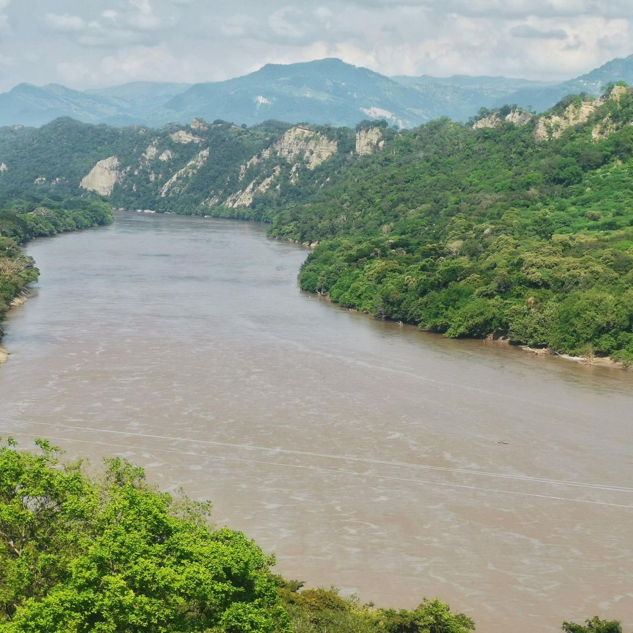
beautiful view of the majestic Magdalena River
0
0


Frequently Asked Questions
How many touring cycling routes are available in Armero?
There are a few touring cycling routes available in the Armero region, with komoot featuring 4 distinct options. These routes primarily traverse the varied terrain characteristic of the Colombian Andes foothills.
Are there any easy touring cycling routes in Armero suitable for beginners?
While most routes in Armero are rated as difficult due to significant elevation changes, there is one moderate option: Mirador La chagra loop from Mariquita. This 18.3-mile (29.4 km) path offers varied terrain but is less demanding than the other available routes.
What kind of terrain can I expect on touring cycling routes in Armero?
Touring cycling routes in Armero are defined by volcanic-influenced terrain and varied elevations, typical of the Colombian Andes foothills. You can expect challenging climbs and descents, with landscapes shaped by past volcanic activity and areas where nature has reclaimed the land.
Are there any circular touring cycling routes in the Armero region?
Yes, all the touring cycling routes featured in the Armero region are circular. Examples include the challenging Murillo loop from Armero and the moderate Mirador La chagra loop from Mariquita.
What are some of the longer touring cycling routes in Armero?
For a longer touring cycling experience, consider the Murillo loop from Armero, which spans 69.4 miles (111.7 km) and involves significant elevation gain. Another substantial option is the Rocky Outcrops, New Honda Bridge – Bonka Store Bike Holder loop from Mariquita, covering 40.0 miles (64.5 km).
What is the best time of year for touring cycling in Armero?
Given Armero's location in the Colombian Andes foothills, weather can be variable. Generally, the dry seasons are more favorable for cycling, but it's always advisable to check local weather forecasts before planning your trip, especially considering the region's volcanic context.
What should I consider packing for a touring cycling trip in Armero?
Due to the varied elevations and potential for changing weather in the Andes foothills, it's wise to pack layers, rain gear, and sufficient water and snacks. Given the challenging nature of many routes, a well-maintained touring bike and repair kit are also essential.
Are there any family-friendly touring cycling options in Armero?
The touring cycling routes in Armero are predominantly rated as difficult, with one moderate option. This suggests that most routes may not be ideal for young children or families seeking very easy, flat rides. The Mirador La chagra loop from Mariquita is the most accessible option, but still requires a moderate fitness level.
What are the main points of interest or scenic viewpoints along the cycling routes?
While the routes themselves offer views of the volcanic-influenced landscape and the Colombian Andes, Armero itself is a poignant memorial site. The area's 'attractions' are primarily historical and commemorative, focusing on the 1985 tragedy. These include memorial sites, the Camposanto, and the Omayra Sánchez Memorial. For more historical context, you can visit the Centro de Interpretación de la Memoria y la Tragedia de Armero.
Is public transport available to access the cycling routes in Armero?
Information regarding specific public transport links directly to the starting points of cycling routes in Armero is limited. Given the region's nature, it's advisable to research local bus services to nearby towns like Mariquita or Líbano, from which some routes originate, and plan accordingly for bike transport.
Are there parking facilities near the starting points of Armero's cycling routes?
Specific parking facilities directly at the start of each touring cycling route are not detailed. If driving, it's recommended to look for parking in the nearest towns associated with the route starting points, such as Mariquita or Líbano, and then cycle to the trailhead.
What do other cyclists say about touring cycling in Armero?
The touring cycling routes in Armero are highly rated by the komoot community, with an average score of 5.0 stars from the available reviews. Cyclists appreciate the challenging terrain and the unique landscapes shaped by the region's volcanic history.
Are there any routes that explore the unique historical landscape of Armero?
While the cycling routes traverse the broader region, the town of Armero itself is a memorial site. Cycling directly through the ruins might not be the primary focus of these routes, which are more about the regional terrain. However, the Murillo loop from Armero starts from the vicinity, allowing for exploration of the historical context before or after your ride. For a deeper understanding of the historical landscape, consider visiting the memorial sites on foot.
Most popular routes in Armero

Get inspired with the komoot mobile app


Explore more
Browse the best Cycling routes in other regions.
