The best road cycling routes in Armero
4.7
(10)
478
riders
6
rides
Road cycling routes in Armero traverse a region characterized by significant elevation changes, from tropical lowlands to high-altitude Andean landscapes. The terrain includes agricultural areas and river valleys, with routes often leading towards the slopes of Nevado del Ruiz. Cyclists encounter varied ecosystems, including paramo and forests, requiring good fitness due to sustained ascents. The area offers challenging road cycling experiences through diverse natural features.
Best road cycling routes in Armero
- The most popular road cycling route is Alto de…
Last updated: July 15, 2026
208
riders
161km
10:30
4,940m
4,940m
Hard road ride. Very good fitness required. Some segments of this route may be unpaved and difficult to ride.
62
riders
81.2km
04:08
1,340m
1,340m
Hard road ride. Very good fitness required. Mostly well-paved surfaces and easy to ride.

Sign up for free
3.0
(1)
49
riders
117km
07:13
3,210m
3,210m
Hard road ride. Very good fitness required. Some segments of this route may be unpaved and difficult to ride.
5.0
(4)
51
riders
37.6km
02:00
720m
720m
Moderate road ride. Good fitness required. Mostly well-paved surfaces and easy to ride.
5.0
(1)
37
riders
Hard road ride. Very good fitness required. Mostly well-paved surfaces and easy to ride.
Our route recommendations are based on thousands of hikes, rides, and runs completed by other people on komoot.
Start today with a free account
Your next adventure awaits.
Login or Signup
Popular around Armero

Tips from the Community

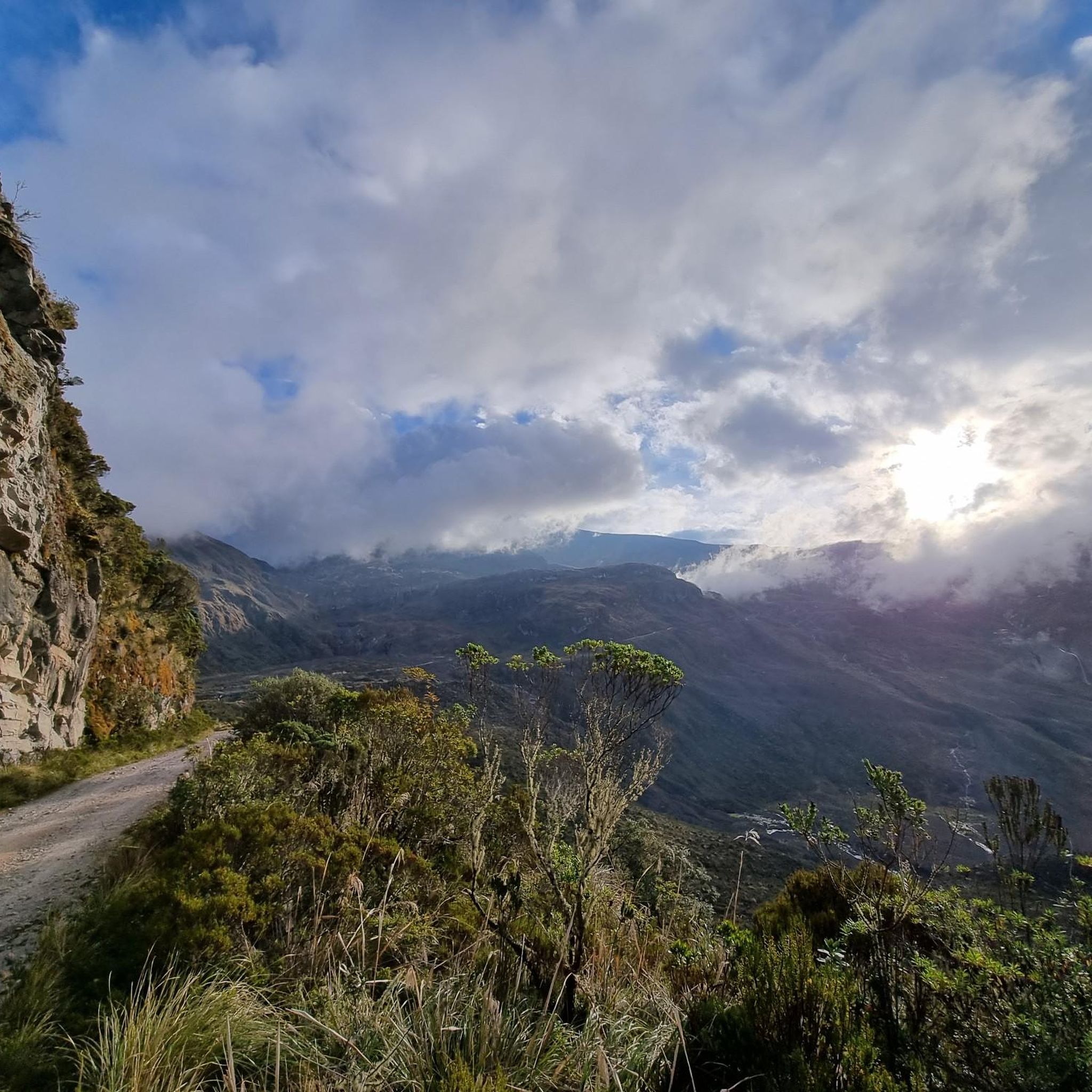
Excellent route to climb Murillo to the snow-capped mountains. Take into account excellent preparation and logistics. You will find the best landscapes in Colombia, climbing this great mountain range bordering the great Nevado del Ruiz volcano, where you will reach a height of 4,140 meters above sea level, reaching a maximum of 4,160 meters at the top of the tubes.
0
0
To reach this point, you must have trained sufficiently, or the altitude can take its toll. Always have excellent equipment, because no matter where we come from, little by little, we'll need clothing to maintain our body heat. Not to mention excellent hydration and nutrition before, during, and after to help us recover.
0
0

This is the site of the Armero Tragedy. A village destroyed by the 1985 eruption of volcán Nevado del Ruiz. Lots of ruins and buildings still visible and partially buried.
0
0

Good shelter, waterproof, hydration and adequate nutrition
0
0
Excellent route, demanding route, worth doing. Good preparation. Of the two routes, Mariquita-Letras and Lebanon-nevado-Letras, without hesitation I prefer the route through the snowy mountain, more demanding, but more rewarding, spectacular, the most beautiful route in Colombia.
0
0

The goal of many amateur cyclists, more because of how media it is, than because of its hardness. It is easily done in 6 hours, with a good accompaniment that provides water and adequate food on a scheduled basis. Save energy for the last 20 km (from Delgaditas), the steepest and highest masl. Ideal in the summer months, to see the Nevado del Ruiz, in an epic landscape.
3
1

Train three judicious months, go up regulated, feed on cyclist gels, but they don't like a little salt, remember to regulate yourself, don't push from Mariquita to Fresno, remember that they have Cerro Bravos left where they find S at 27%, and good hydration
0
0
Frequently Asked Questions
How many road cycling routes are available in the Armero region?
There are 6 road cycling routes available in the Armero region, offering a range of challenging experiences through diverse landscapes.
What is the typical terrain and difficulty for road cycling in Armero?
Road cycling in the Armero region is characterized by significant elevation changes, from tropical lowlands to high-altitude Andean landscapes. Most routes are considered difficult, involving sustained ascents and requiring very good fitness. You'll encounter varied ecosystems, including paramo and forests, making for a challenging yet rewarding experience.
What kind of natural features and landscapes can I expect to see while cycling near Armero?
The region offers stunning natural diversity. Cyclists can experience high-altitude paramo ecosystems, forests of frailejones, sulfurous rivers, and pristine lagoons, especially on routes that ascend towards the Nevado del Ruiz and Los Nevados National Natural Park. You might also encounter views of the Magdalena River valley and agricultural landscapes.
Are there any historical or cultural landmarks to explore along the routes?
Yes, the region holds significant historical importance. The former town of Armero itself is a poignant memorial site, offering a unique and somber historical experience. Routes like the Ruins of Armero – Junction to Líbano and Murillo loop from Armero lead directly through this historic area. Additionally, the charming town of Murillo, with its traditional architecture, is situated at an altitude of 3,000 meters and offers impressive landscapes of the Nevado del Ruiz.
What is the best time of year for road cycling in Armero?
Due to the varied terrain and significant altitude changes, temperatures can vary greatly. While specific 'best' seasons aren't defined, the broader Colombian Andes allow for cycling from glaciated snowlines down to tropical lowlands. It's advisable to check local weather conditions for the specific altitudes you plan to cycle, as conditions can change rapidly.
Are there any circular road cycling routes available in Armero?
Yes, several routes in the Armero region are circular. For instance, the Alto de Letras – Alto de Letras loop from Mariquita and the Magdalena loop from Mariquita are popular circular options, allowing you to start and finish in the same location.
What do other road cyclists enjoy most about road cycling in Armero?
The area is highly rated by the komoot community, with an average score of 4.7 stars from around 10 reviews. Cyclists often praise the challenging nature of the routes, the stunning Andean landscapes, and the unique experience of cycling through diverse ecosystems and historical sites.
Are there any moderate difficulty road cycling routes for those not seeking extreme challenges?
While most routes in the Armero region are classified as difficult, there is at least one moderate option available. The Time trial loop from Mariquita offers a less strenuous ride compared to the more demanding high-altitude routes.
Is it possible to find accommodation or places to eat for cyclists in the Armero region?
While Armero itself is primarily a memorial site, the surrounding towns like Mariquita and Murillo are more likely to offer accommodation, cafes, and restaurants suitable for cyclists. Murillo, in particular, is a charming town at 3,000 meters, perfect for relaxing and enjoying nature.
What should I know about parking and public transport for road cycling in Armero?
Information on specific parking facilities for cyclists in Armero Guayabal is limited. For routes starting from nearby towns like Mariquita, you would typically find parking options within the town. Public transport with bikes might be challenging due to the rural and mountainous nature of the region; it's best to inquire locally or arrange private transport if needed.
Are permits required for cycling in Los Nevados National Natural Park, which is near Armero?
Routes traversing the slopes of Nevado del Ruiz often pass through Los Nevados National Natural Park. It is highly recommended to check with local authorities or park management regarding any required permits or entry fees for cycling within the National Natural Park, especially for high-altitude sections.
Are the road cycling routes in Armero suitable for families or dog-friendly?
Given that most road cycling routes in Armero are classified as difficult with significant elevation gain and challenging terrain, they are generally not considered suitable for casual family rides or dog-friendly cycling. These routes typically require a good level of fitness and experience.
Most popular routes in Armero

Get inspired with the komoot mobile app


Explore more
Browse the best Road cycling routes in other regions.
