The best MTB trails in Baraya
4.8
(8)
163
riders
8
rides
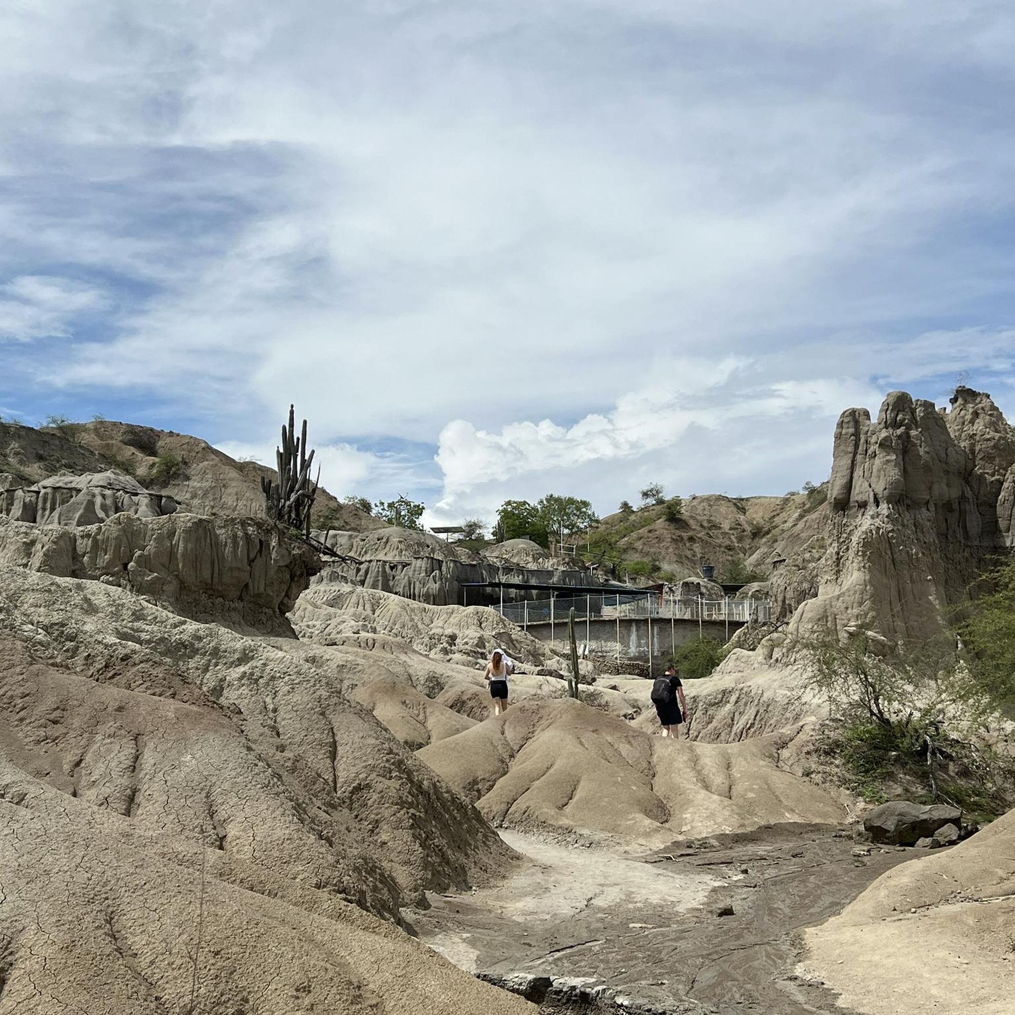
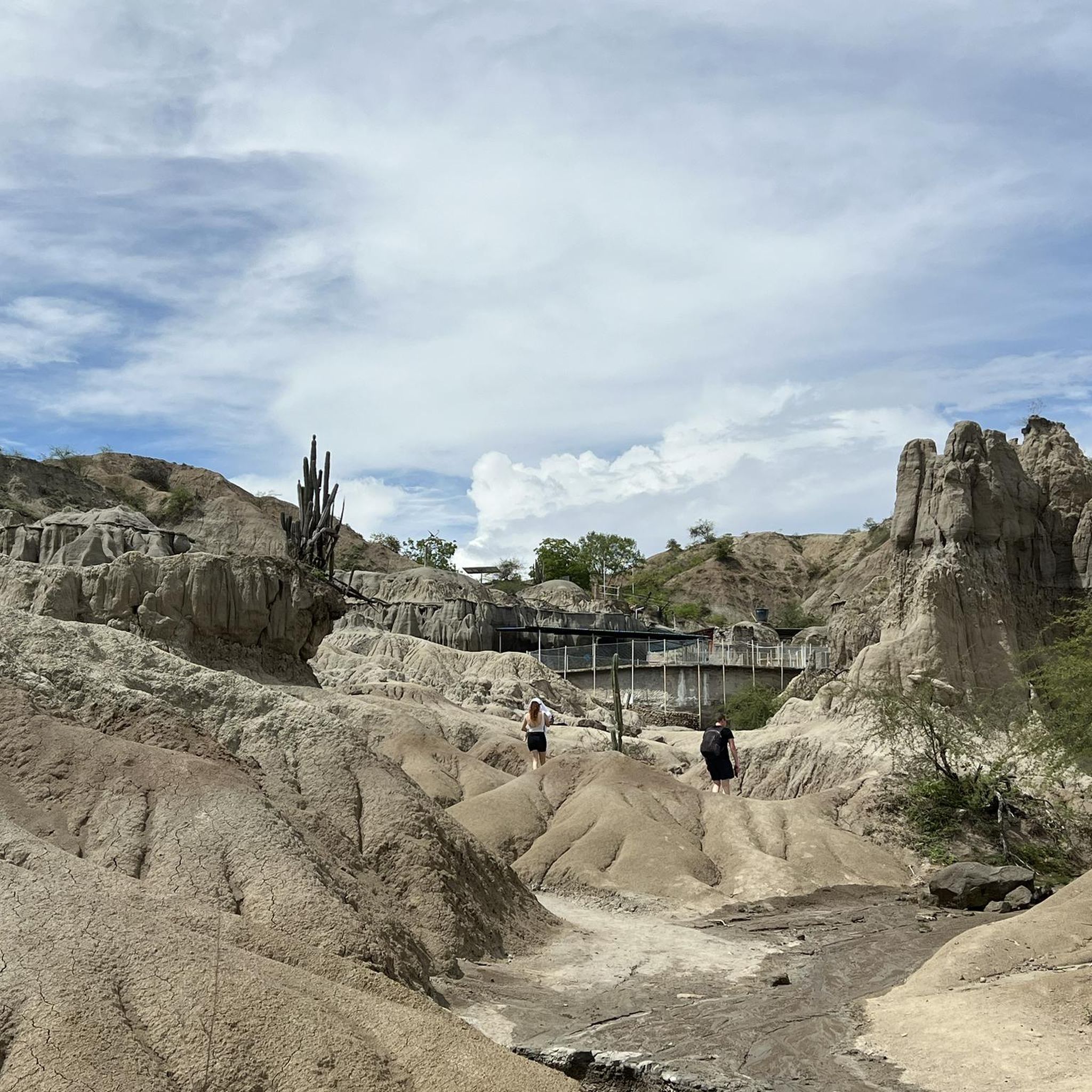
Mountain bike trails in Baraya are primarily characterized by routes traversing the Tatacoa Desert, offering a unique arid landscape for cycling. The region features varied terrain, including dirt roads and paths that connect local towns like Villavieja. Elevations along these routes indicate a mix of flat sections and gradual climbs, suitable for mountain biking exploration.
Best mountain bike trails in Baraya
- The most popular mountain bike trail is Villavieja loop from Villavieja, a 36.7 miles (59.1 km) trail that…
Last updated: July 13, 2026
44
riders
60.2km
04:35
600m
600m
Moderate mountain bike ride. Good fitness required. Advanced riding skills necessary.
5.0
(3)
22
riders
45.4km
03:17
440m
440m
Moderate mountain bike ride. Good fitness required. Suitable for all skill levels.

Sign up for free
5.0
(2)
22
riders
45.2km
03:16
450m
450m
Moderate mountain bike ride. Good fitness required. Suitable for all skill levels.
5.0
(1)
20
riders
72.4km
05:32
540m
540m
Hard mountain bike ride. Very good fitness required. Suitable for all skill levels.
4
riders
23.2km
01:41
210m
210m
Easy mountain bike ride. Great for any fitness level. Suitable for all skill levels.
Get access to more routes and recommendations from other explorers.
Sign up for free
Already have an account?
Our route recommendations are based on thousands of hikes, rides, and runs completed by other people on komoot.
Start today with a free account
Your next adventure awaits.
Login or Signup
Popular around Baraya
Tips from the Community

This crossing is not advisable; it costs five times what the boat from Natagaima costs (5000 COP instead of 1000)...it's better to use the car ferry a few kilometers before reaching Villavieja; it's cheaper.
0
0

A really nice section of an unpaved road into the Tatacoa desert via Villaviejo. This section follows and old railway line using the old infrastructure. The tunnels are dark and the road inside is quite lumpy. They’re both very short and full of bats that you can hear squeaking above you. After here the route is a bit more hilly and there are some rough and sandy sections but I managed with fully loaded touring bike on 35mm tyres.
2
0

Dirtroad which is not in the best condition but doable with touring setup. Views are nice especially last part.
0
0

This village on the Rio Magdalena is the starting point for tours into the Tatacoa Desert. In addition to hotels and restaurants, tours can be booked here or bikes can be rented to experience the beauty of the nearby desert.
0
0
After the dusty bike ride from Villavieja past the red Tatacoa to the gray, the pool and kiosk invite you to take a refreshing dip and rest. It feels like an oasis in the desert.
0
0
The Tatacoa Desert (Spanish: Desierto de la Tatacoa) is an approximately 330 km² desert in Colombia. It is located in the northern part of the Departamento del Huila in the valley of the Río Magdalena in the municipality of Villavieja, about 40 km north of the department capital Neiva and only about 3° north of the equator. The average temperature is over 28 °C. The Tatacoa Desert owes its existence to the special geographic location between the two mountain ranges of the Central and Eastern Cordillera in a dry basin at the foot of the Eastern Cordillera. As a result, it lies in the double rain shadow and usually remains low in precipitation even in the rainy season. Due to the high average temperature, the amount of precipitation of around 1000 mm per year is not sufficient to compensate for evaporation. The name Tatacoa comes from a species of snake originally native to the desert but now extinct. Source: https://de.wikipedia.org/wiki/Tatacoa-W%C3%BCste
2
0
Incredible to discover such a refreshing swimming pool in the middle of the unreal hot desert. Vendors sell cool drinks, snacks, and ice cream.
0
0
Frequently Asked Questions
What kind of terrain can I expect on mountain bike trails in Baraya?
Mountain bike trails in Baraya primarily traverse the unique arid landscape of the Tatacoa Desert. You can expect varied terrain, including dirt roads and paths that connect local towns like Villavieja. The routes feature a mix of flat sections and gradual climbs.
How many mountain bike trails are available in Baraya?
There are 8 mountain bike routes documented in Baraya, offering a range of experiences for different skill levels.
Are there mountain bike trails suitable for beginners in Baraya?
Yes, Baraya offers 2 easy mountain bike routes. These are great options for those new to mountain biking or looking for a more relaxed ride.
Are there challenging mountain bike routes for experienced riders in Baraya?
Absolutely. For experienced riders seeking a challenge, Baraya has 2 difficult mountain bike routes. One notable difficult route is the Villavieja – Dirt Road to Tatacoa Desert loop from Villavieja, which covers 72.4 km.
What do other mountain bikers enjoy most about Baraya's trails?
The mountain bike routes in Baraya are highly rated by the komoot community, with an average score of 4.75 stars from 8 reviews. Riders often praise the unique desert landscapes and the comprehensive tours that connect local towns.
Are there any circular mountain bike routes in Baraya?
Yes, many of the routes in Baraya are circular. For example, the Villavieja loop from Villavieja is a popular moderate circular route covering 59.1 km.
What are some notable landmarks or attractions I can see while mountain biking in Baraya?
While mountain biking in Baraya, you'll primarily be exploring the unique Tatacoa Desert. The routes often pass through or near the town of Villavieja, and you might encounter viewpoints offering expansive views of the desert, such as the View of Tatacoa Desert.
Is there a mountain bike route that specifically explores the Tatacoa Desert?
Yes, the Villavieja – Tatacoa Desert loop from Villavieja is a moderate 44.3 km route that guides riders directly through the distinctive landscapes of the Tatacoa Desert.
What is the longest mountain bike route available in Baraya?
The longest mountain bike route in Baraya is the Villavieja – Dirt Road to Tatacoa Desert loop from Villavieja, spanning 72.4 km and typically taking over 5 hours to complete.
Are there any routes that involve a ferry crossing?
Yes, the Ferry to Aipe – Villavieja loop from Villavieja is a moderate 31.2 km route that incorporates a ferry crossing, offering a unique element to your ride.
What is the typical duration for mountain bike routes in Baraya?
Route durations vary depending on distance and difficulty. For example, moderate routes like the Villavieja – Tatacoa Desert loop from Villavieja can take around 3 hours 13 minutes, while longer, more difficult routes can extend to over 5 hours.
Most popular routes in Baraya
Most popular attractions in Baraya

Get inspired with the komoot mobile app


Explore more
Browse the best MTB trails in other regions.
