The best walks and hikes in Baraya
4.7
(26)
212
hikers
9
hikes
Hiking in Baraya offers routes through a distinctive desert landscape. The region is characterized by arid terrain, eroded cliffs, and unique geological formations. Trails traverse both red and gray desert areas, providing opportunities to explore its dry riverbeds and open expanses. The elevation changes are generally mild, making many routes accessible for various fitness levels.
Best hiking trails in Baraya
- The most popular hiking route is Tatacoa Desert – Red Desert of Tatacoa loop from Casa de campo los cactus…
Last updated: July 13, 2026
5.0
(5)
38
hikers
Easy hike. Great for any fitness level. Easily-accessible paths. Suitable for all skill levels.
4.3
(3)
44
hikers
Moderate hike. Good fitness required. Easily-accessible paths. Suitable for all skill levels.

Sign up for free
5.0
(2)
20
hikers
Moderate hike. Good fitness required. Easily-accessible paths. Suitable for all skill levels.
4.0
(2)
29
hikers
Easy hike. Great for any fitness level. Easily-accessible paths. Suitable for all skill levels.
5.0
(4)
22
hikers
15.6km
04:12
190m
190m
Moderate hike. Good fitness required. Easily-accessible paths. Suitable for all skill levels.
Get access to more routes and recommendations from other explorers.
Sign up for free
Already have an account?
Our route recommendations are based on thousands of hikes, rides, and runs completed by other people on komoot.
Start today with a free account
Your next adventure awaits.
Login or Signup
Popular around Baraya
Tips from the Community

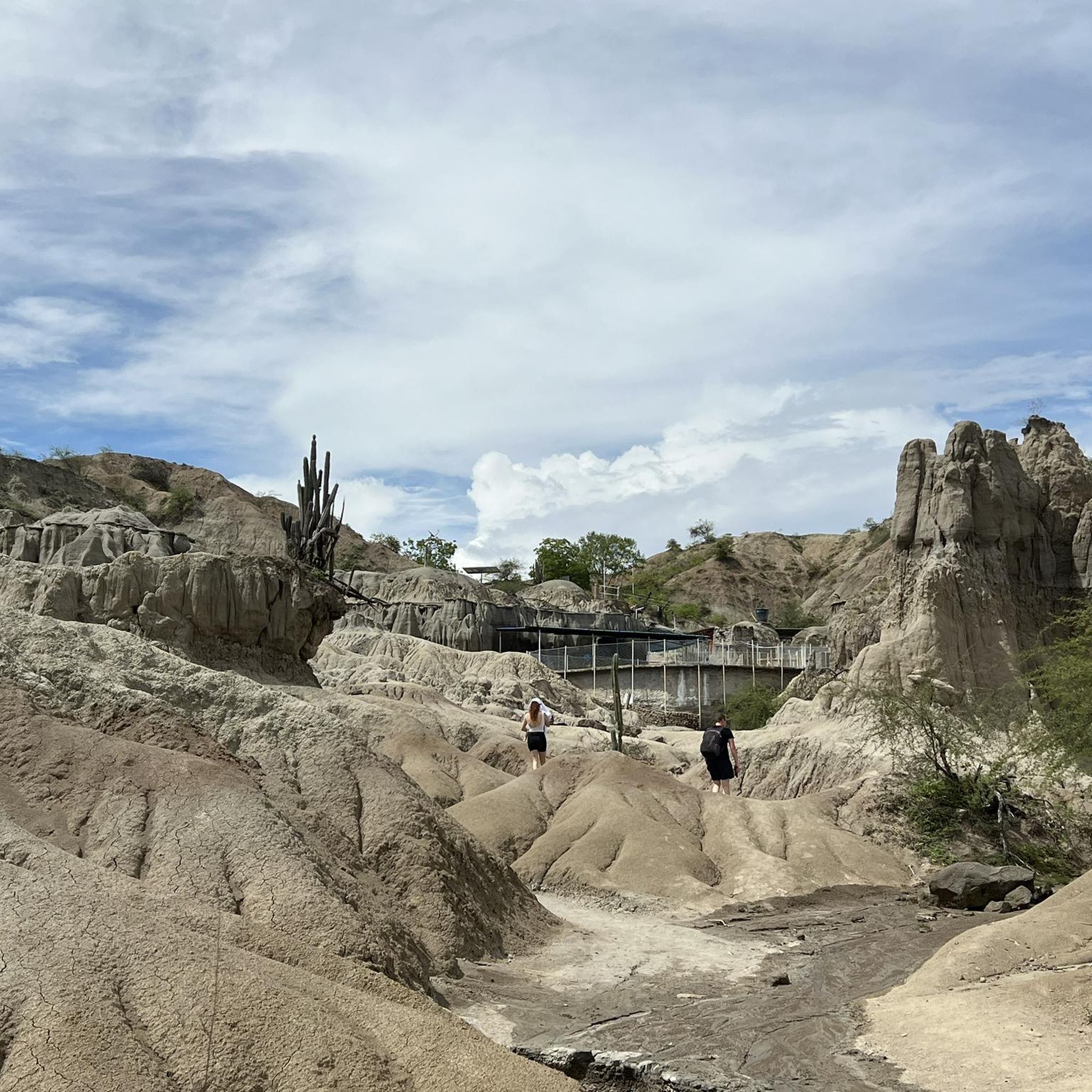
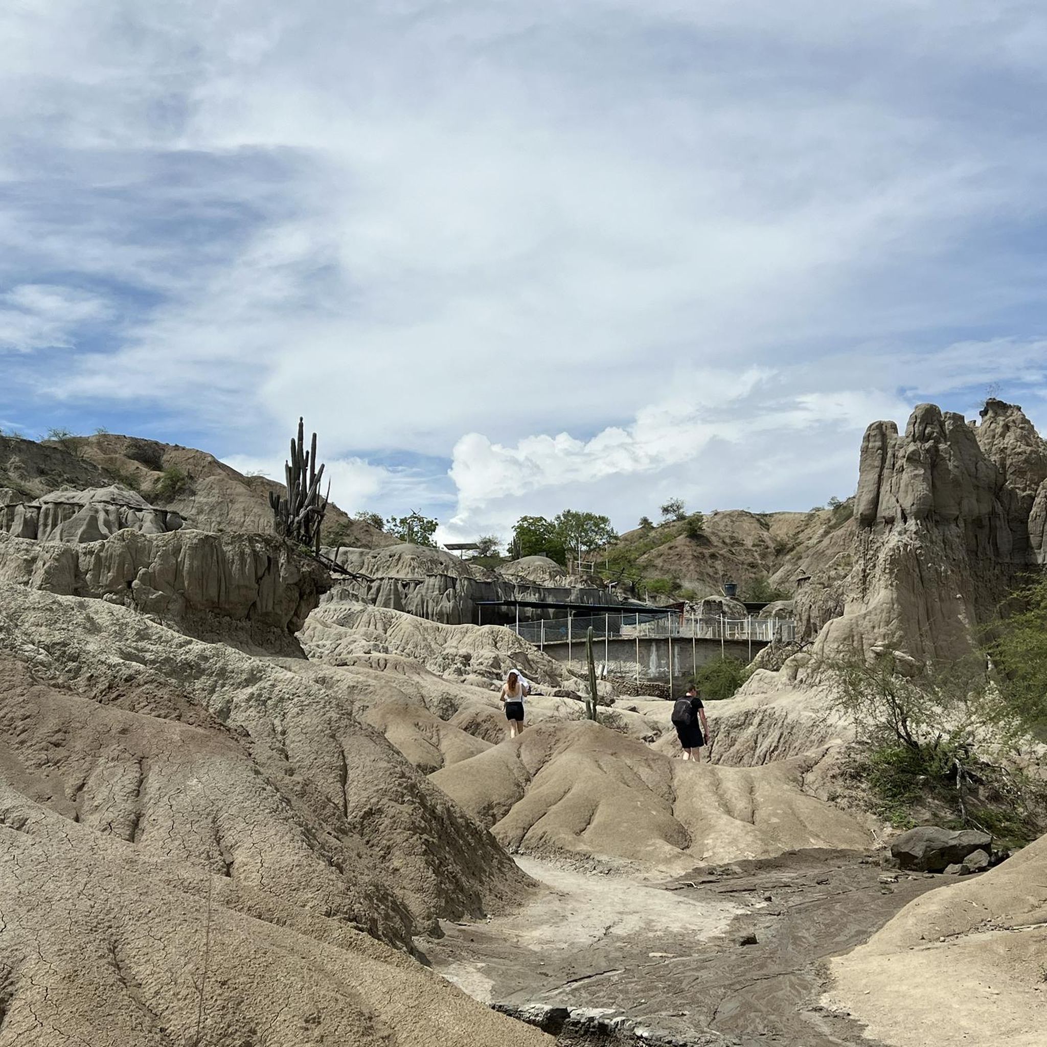
After the dusty bike ride from Villavieja past the red Tatacoa to the gray, the pool and kiosk invite you to take a refreshing dip and rest. It feels like an oasis in the desert.
0
0
The Tatacoa Desert (Spanish: Desierto de la Tatacoa) is an approximately 330 km² desert in Colombia. It is located in the northern part of the Departamento del Huila in the valley of the Río Magdalena in the municipality of Villavieja, about 40 km north of the department capital Neiva and only about 3° north of the equator. The average temperature is over 28 °C. The Tatacoa Desert owes its existence to the special geographic location between the two mountain ranges of the Central and Eastern Cordillera in a dry basin at the foot of the Eastern Cordillera. As a result, it lies in the double rain shadow and usually remains low in precipitation even in the rainy season. Due to the high average temperature, the amount of precipitation of around 1000 mm per year is not sufficient to compensate for evaporation. The name Tatacoa comes from a species of snake originally native to the desert but now extinct. Source: https://de.wikipedia.org/wiki/Tatacoa-W%C3%BCste
2
0
Incredible to discover such a refreshing swimming pool in the middle of the unreal hot desert. Vendors sell cool drinks, snacks, and ice cream.
0
0

The Tatacoa Desert is a unique landscape and is an extraordinary experience in Colombia.
2
0
Frequently Asked Questions
How many hiking trails are available in Baraya?
Baraya offers a selection of 9 hiking routes, catering to various preferences. These include 5 easy trails, 3 moderate excursions, and 1 challenging route, all exploring the unique desert landscape.
Are there easy hiking trails suitable for beginners or families in Baraya?
Yes, Baraya has 5 easy hiking trails perfect for beginners or families. A great option is the Tatacoa Desert Eroded Cliffs – Los Hoyos – The Gray Tatacoa loop from Los Hoyos - Desierto Gris, a short 1.3 km (0.8 miles) route that takes about 22 minutes to complete, offering a glimpse into the gray desert formations.
What are some longer distance hiking options in Baraya?
For those seeking a longer adventure, consider the Los Hoyos – The Gray Tatacoa – Tatacoa Desert Eroded Cliffs loop from Desert Tatacoa. This moderate 16.7 km (10.4 miles) trail takes approximately 4 hours 23 minutes, guiding you through the gray desert and past impressive eroded cliffs. Another substantial option is the Tatacoa Desert – Red Desert of Tatacoa loop from Villavieja, a 15.6 km (9.7 miles) moderate route.
Are there any challenging hikes in Baraya?
While most trails are easy to moderate, Baraya does offer one challenging route for experienced hikers. These trails typically feature more significant elevation changes or longer distances, providing a more strenuous experience within the desert terrain.
What kind of landscapes can I expect to see while hiking in Baraya?
Hiking in Baraya immerses you in a distinctive desert landscape. You'll encounter arid terrain, dramatic eroded cliffs, and unique geological formations. Trails traverse both vibrant red and subtle gray desert areas, offering opportunities to explore dry riverbeds and vast open expanses.
What do other hikers say about the trails in Baraya?
The hiking trails in Baraya are highly regarded by the komoot community, boasting an average rating of 4.7 stars from over 20 reviews. Hikers frequently praise the unique desert scenery, the striking red and gray desert formations, and the opportunity to explore a truly distinctive natural environment.
Are there any circular walks available in Baraya?
Yes, many of the trails in Baraya are designed as circular routes, allowing you to start and end at the same point. For example, the popular Tatacoa Desert – Red Desert of Tatacoa loop from Casa de campo los cactus is an easy 7.4 km (4.6 miles) circular trail that explores the vibrant red desert formations.
What attractions or points of interest can I see along the hiking trails in Baraya?
While hiking in Baraya, you'll be surrounded by the natural wonder of the Tatacoa Desert itself, with its unique geological formations. You can also visit the nearby town of Villavieja, often a starting point for desert explorations, or enjoy a refreshing stop at Los Hoyos Pool. Don't miss the chance to find a scenic View of Tatacoa Desert for panoramic vistas.
What is the best time of year to go hiking in Baraya?
Given Baraya's desert climate, the best time to hike is typically during the cooler, drier months. Avoiding the peak heat of summer and potential rainy seasons will ensure a more comfortable and enjoyable experience on the trails.
What essential gear should I bring for hiking in Baraya?
When hiking in Baraya's desert environment, it's crucial to bring plenty of water, sun protection (hat, sunscreen, sunglasses), and appropriate footwear for sandy and rocky terrain. Lightweight, breathable clothing is also recommended. Always check weather forecasts before heading out.
Are there any specific trails that showcase the red desert formations?
Absolutely. The Tatacoa Desert – Red Desert of Tatacoa loop from Casa de campo los cactus is an excellent choice, specifically designed to explore the vibrant red desert formations. Another great option is the Red Desert of Tatacoa – Tatacoa Desert loop from Desierto de la Tatacoa, which also leads through this distinctive landscape.
Are the trails in Baraya generally well-marked?
While specific marking details vary by trail, the routes in Baraya are generally well-defined, traversing the open desert landscape. It's always advisable to use a navigation tool like komoot to follow the planned routes, especially in areas with less distinct paths.
Most popular routes in Baraya
Most popular attractions in Baraya

Get inspired with the komoot mobile app


Explore more
Browse the best Hikes in other regions.
