The best cycling routes in Cachipay
4.8
(9)
133
riders
8
rides
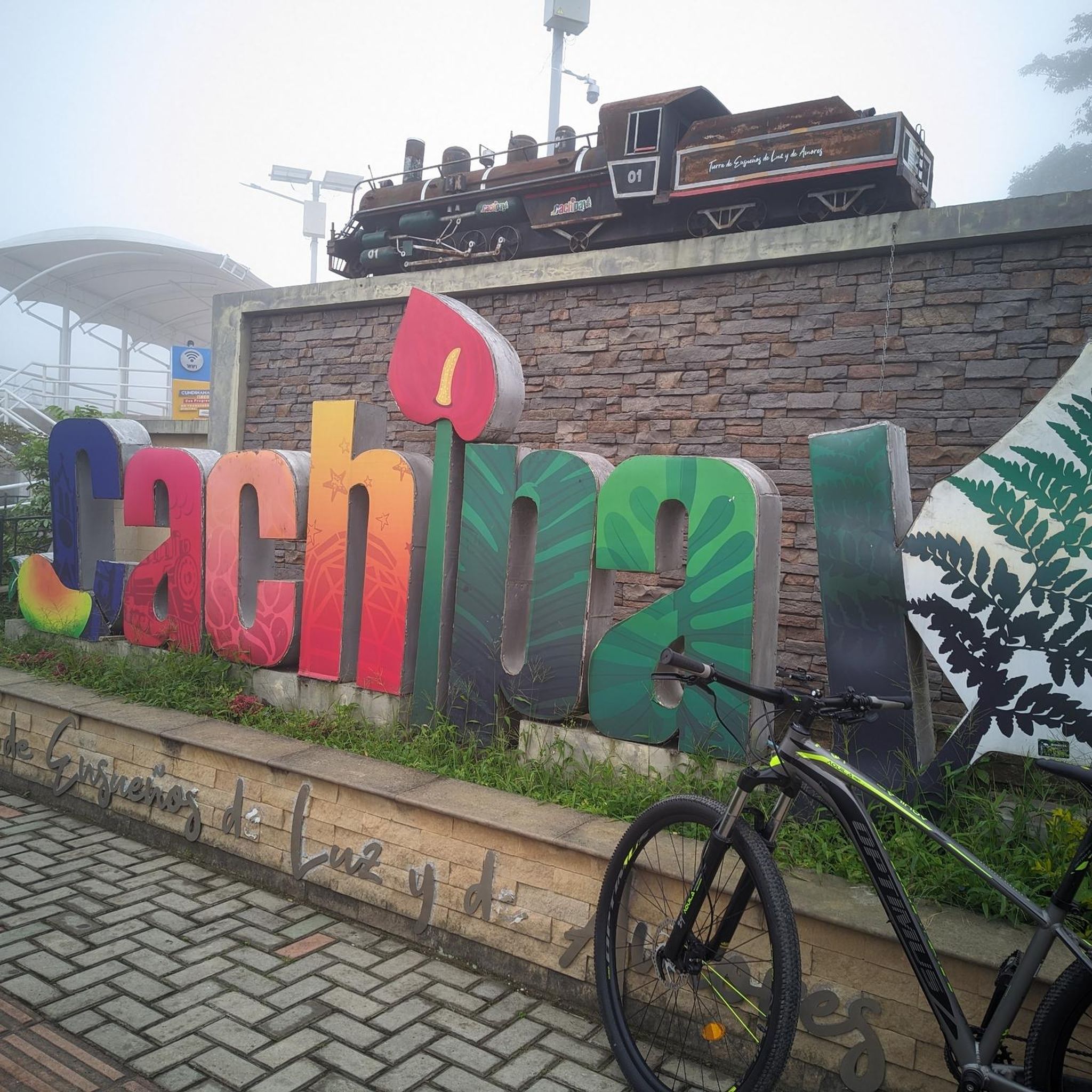
Touring cycling routes in Cachipay traverse a landscape characterized by Andean forests and extensive agricultural lands, including fruit, coffee, and flower farms. The region features varied topography, offering a mix of ascents, descents, and flatter sections suitable for different cycling abilities. Well-preserved old stone paths wind through large estates, contributing to the unique cycling experience. The area also includes hills and natural water features, providing diverse scenery for touring cyclists.
Best touring cycling routes in Cachipay
- The most popular touring…
Last updated: July 11, 2026
4.3
(3)
17
riders
61.8km
05:14
1,360m
1,360m
Hard bike ride. Very good fitness required. Mostly paved surfaces. Suitable for all skill levels.
31
riders
87.3km
06:29
1,930m
1,930m
Hard bike ride. Very good fitness required. Mostly paved surfaces. Suitable for all skill levels.

Sign up for free
25
riders
45.8km
03:22
1,030m
1,030m
Hard bike ride. Very good fitness required. Mostly paved surfaces. Suitable for all skill levels.
12
riders
121km
08:58
2,830m
2,830m
Hard bike ride. Very good fitness required. Mostly paved surfaces. Suitable for all skill levels.
5.0
(3)
14
riders
33.1km
02:16
410m
410m
Moderate bike ride. Good fitness required. Mostly paved surfaces. Suitable for all skill levels.
Get access to more routes and recommendations from other explorers.
Sign up for free
Already have an account?
Our route recommendations are based on thousands of hikes, rides, and runs completed by other people on komoot.
Start today with a free account
Your next adventure awaits.
Login or Signup


Tips from the Community


A safe place to train!!!
0
0

In this hotel restaurant you will find good food, good portions, good service and affordable prices.
0
0

here begins the uncovered ascent that can take it to the scale
1
0


Highest point on the road between Facatativá and La Vega. It is the border between the municipalities of Facatativá and La Vega
1
0

Good training, also for a walk, in La Vega start with a good roscón resobo, and take to eat at the top. Safe route, good berm, many fellow cyclists of all levels, so as not to feel alone.
0
0
Frequently Asked Questions
How many touring cycling routes are available in Cachipay?
Cachipay offers a selection of 8 touring cycling routes, catering to various skill levels. These routes traverse diverse landscapes, including Andean forests and agricultural lands.
What is the best time of year for touring cycling in Cachipay?
Cachipay generally enjoys a favorable temperate climate, making it suitable for touring cycling year-round. However, for the most comfortable experience, consider the drier seasons. Always check local weather forecasts before heading out.
Are there any easy touring cycling routes for beginners or families?
While many routes in Cachipay feature significant climbs, there are options that are more manageable. For a moderate experience, consider the Vereda Mancilla – Alto de Padilla loop from Estación 1 - Facatativá, which is 18.6 miles (29.9 km) long with moderate climbs and varied rural scenery. This route could be a good starting point for those looking for less challenging terrain.
What kind of terrain can I expect on Cachipay's touring cycling routes?
The routes around Cachipay offer a varied topography, including a mix of ascents, descents, and flatter sections. You'll cycle through Andean forests, extensive fruit, coffee, and flower farms, and even along well-preserved old stone paths winding through large estates. Some routes, like the Apulo Station – Pueblo gravel out of Bogota loop from La Mesa, feature challenging gravel sections.
Are there any notable natural features or viewpoints along the cycling routes?
Yes, Cachipay's routes offer scenic views and natural attractions. You can expect panoramic vistas from higher elevations, such as the climb towards Alto del Moán, which provides spectacular views of several municipalities. The region also features natural water features and tranquil spots like Laguna Escondida, known for its ancient trees.
What do other touring cyclists enjoy most about cycling in Cachipay?
The komoot community highly rates the touring cycling experience in Cachipay, with an average score of 4.9 stars from over 25 reviews. Cyclists frequently praise the diverse landscapes, the mix of challenging and scenic routes, and the opportunity to experience rural Colombian life amidst Andean forests and agricultural lands.
Are there circular touring cycling routes available in Cachipay?
Yes, many of the touring cycling routes in Cachipay are designed as loops, allowing you to start and finish at the same point. Examples include the Vereda Mancilla – Alto de Padilla loop from Estación 1 - Facatativá and the Apulo Station loop from Mirador de San Jerónimo, which leads through diverse terrain with a viewpoint.
Can I find places to eat or stay near the cycling routes in Cachipay?
Cachipay and its surrounding areas offer amenities for visitors. You'll find local fruit markets in town, and there are hotels and spas with pools available for relaxation after a day of cycling. These options provide convenient places to refuel and rest.
What are some of the more challenging touring cycling routes in Cachipay?
For experienced touring cyclists seeking a challenge, routes like the Alto de la Tribuna – Alto del Vino Rest Stop loop from Estación 1 - Facatativá offer significant elevation gain over its 74.5 miles (119.9 km) distance. Another demanding option is the San Antonio Station – San Joaquín Station loop from La Mesa, which covers 24.5 miles (39.4 km) with substantial climbs.
Is public transport available to reach Cachipay for cycling?
Cachipay is approximately 50 km from Bogotá, and public transport options are available to reach the municipality. From Bogotá, you can typically find bus services that connect to towns in the Tequendama Province, including Cachipay, making it accessible for cyclists without private vehicles.
Are there specific parking facilities for cyclists at the trailheads?
While specific dedicated parking facilities at every trailhead may vary, Cachipay is a small town with less population density, making it generally easier to find parking compared to larger cities. Many routes start from or pass through towns where parking might be available in central areas or near local establishments.
Are dogs allowed on the touring cycling routes in Cachipay?
The touring cycling routes in Cachipay often pass through rural and natural areas. While there are no explicit restrictions mentioned, it's always advisable to keep dogs on a leash, especially when passing through agricultural lands or near livestock. Be mindful of local regulations and other trail users.
Most popular routes in Cachipay

Get inspired with the komoot mobile app


Explore more
Browse the best Cycling routes in other regions.
