The best walks and hikes around South Harris
4.5
(69)
534
hikers
12
hikes
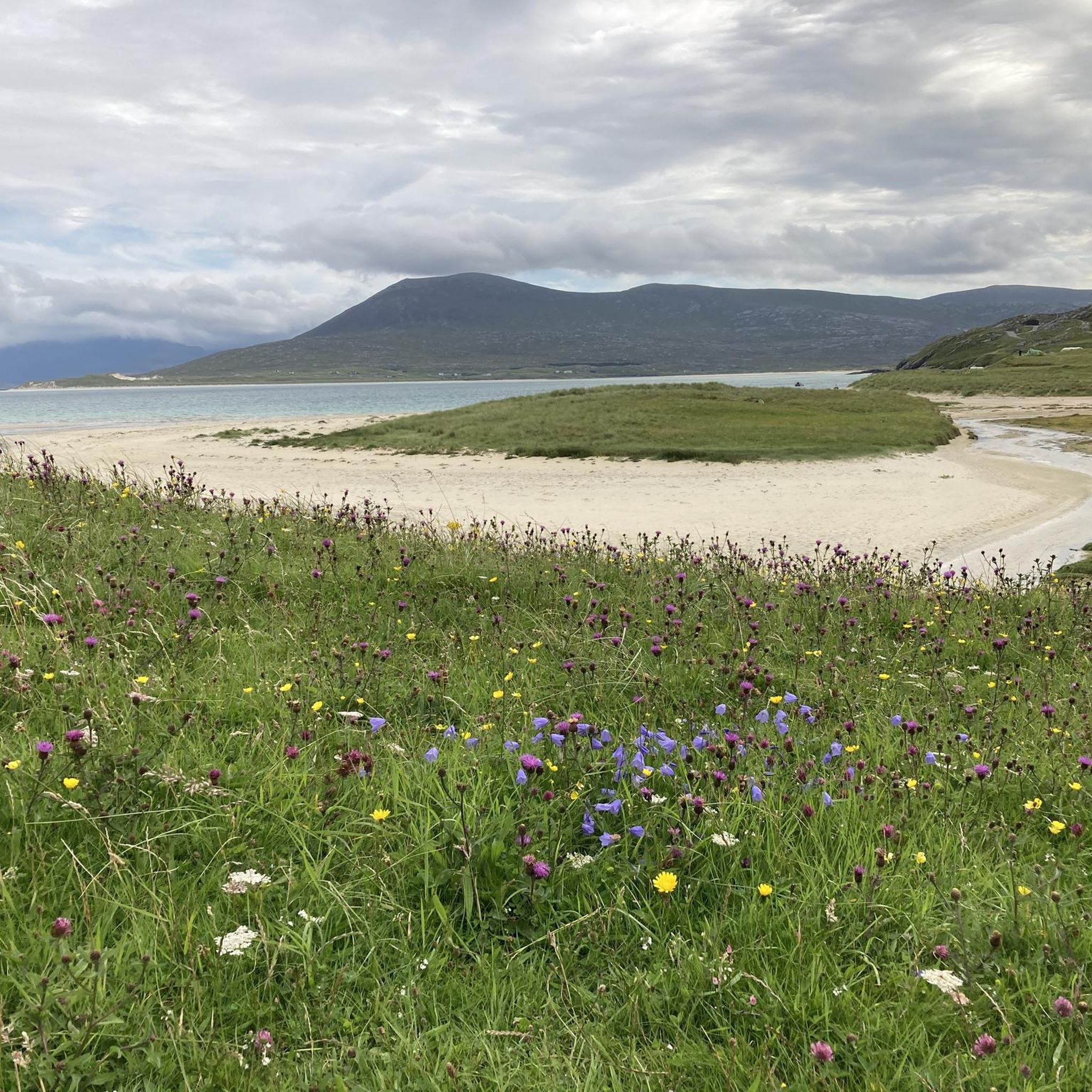
Hikes around South Harris explore a landscape of contrasts in Scotland's Outer Hebrides. The region is defined by a rugged, rocky eastern coast with numerous small bays, while the western coast features expansive white sand beaches and turquoise waters. Inland, the terrain consists of moorland, freshwater lochs, and rolling hills, offering a variety of walking experiences.
Best hiking trails around South Harris
- The most popular hiking route is the The Coffin Road – Seilebost Beach loop from Seilebost, a 11.5 mile (18.6 km) trail that takes around 5 hours to complete. This historic path crosses the island, combining coastal sections with inland moorland.
- Another top favourite among local hiking enthusiasts is the Toe Head & Ceapabhal loop from Northton — Harris, Outer Hebrides, a moderate 9.2 mile (14.8 km) path. The route includes an ascent of the Ceapabhal hill, which provides wide views over the Sound of Harris.
- Local hiking enthusiasts also love the Lickisto & Luskintyre loop — Isle of Harris, a 9.9 mile (15.9 km) trail leading through varied terrain, often completed in about 4 hours 20 minutes.
- Hiking around South Harris is defined by coastal paths along sandy beaches, historic coffin roads, and ascents of small, rocky hills. The network of trails provides options for different fitness levels, from short, easy walks to more demanding day hikes.
- The routes in South Harris are highly rated by the komoot community with an average score of 4.5 stars from more than 50 reviews. More than 450 hikers have used komoot to explore South Harris's varied terrain.
Last updated: October 16, 2026
4.0
(7)
63
hikers
15.9km
04:20
240m
240m
Embark on the Lickisto & Luskintyre loop for a hike that reveals the dramatic contrasts of South Harris. You will traverse the rugged, rocky eastern coast, known as the "Golden Road," where you can enjoy views across the head of Ob Lickisto. The trail then leads you to the iconic Luskentyre Beach, famous for its pristine white sands, turquoise waters, and rolling dunes. Connecting these coastal extremes, you will cross varied inland terrain of moorland and freshwater lochs. This moderate hike covers 9.9 miles (15.9 km) with an elevation gain of 789 feet (241 metres), typically taking around 4 hours and 20 minutes to complete.
To prepare for this adventure, remember that the Lickisto & Luskintyre loop is considered a moderate hike. It requires good fitness and sure-footedness due to its varied terrain. Be ready for uneven paths and some ascents and descents as you move between the different landscapes. Always check local conditions before you set out to ensure a safe and enjoyable experience on the Isle of Harris.
This loop is notable for showcasing the incredibly diverse landscapes of the Isle of Harris within a single route. You will experience the craggy, ancient rock formations of the east and the soft, shell-sand beaches of the west. Luskentyre Beach itself is consistently ranked among the most beautiful beaches, and this trail provides access to its stunning vistas. The varied habitats also offer opportunities for wildlife spotting, including seals, otters, and various eagles.
4.5
(4)
14
hikers
14.8km
03:43
420m
420m
Start your hike on the Toe Head & Ceapabhal loop from Northton, a moderate 9.2-mile (14.8 km) route that takes about 3 hours and 42 minutes to complete. You will gain 1387 feet (423 metres) in elevation, offering diverse terrain and incredible views. The trail begins with a beautiful coastal stroll along pristine white sand bays, where you can enjoy views of deserted beaches and a mostly rocky shore. As you continue, you will pass three cream-colored sand beaches before reaching a small headland with a ruined medieval chapel. The path then leads to a steep but relatively short ascent to the summit of Ceapabhal, where you can expect panoramic 360-degree views. From the top, you might spot North Harris, the western beaches, the Uists, and even St. Kilda on a clear day. The machair, a fertile low-lying grassland, is also a prominent feature, often flowering in summer. Keep an eye out for wildlife like lapwings, oystercatchers, skylarks, and even golden and sea eagles. This trail is consistently described as one of the best viewpoints in the Outer Hebrides.
This trail is considered moderate, requiring good fitness, but it is generally suitable for all skill levels. While the initial coastal paths can be intermittent and sandy, the hill itself starts pathless before a track emerges as you ascend. The best route up Ceapabhal isn't always obvious, and you might encounter knee-deep heather in some sections. Be prepared for potentially very windy conditions at the exposed summit. The total distance is approximately 9.2 miles (14.8 km) with an ascent of around 1387 feet (423 metres), and it should take you about 3 hours and 42 minutes.
The isolated position of Ceapabhal makes it an exceptional viewpoint in the Outer Hebrides, combining glorious coastal scenery with a satisfying hill climb. Historically, the area around Toe Head also holds significant archaeological interest, with evidence of prehistoric settlement mounds, buildings, defense structures, graves, and cup marks dating back to Mesolithic, Neolithic, Beaker, Bronze Age, and Iron Age periods. Near the trailhead, you will find Croft 36, a charming honesty shop selling pies and treats, which is a unique local touch. Many consider this hike to be a life-affirming experience due to the stunning variety of views and the feeling of being on top of such a beautiful location.

5.0
(4)
26
hikers
11.7km
03:16
220m
220m
Moderate hike. Good fitness required. Easily-accessible paths. Suitable for all skill levels.
3.0
(2)
14
hikers
3.01km
00:47
30m
20m
Easy hike. Great for any fitness level. Easily-accessible paths. Suitable for all skill levels.
5.0
(1)
8
hikers
18.8km
05:04
250m
250m
Hard hike. Very good fitness required. Easily-accessible paths. Suitable for all skill levels.
Get access to more routes and recommendations from other explorers.
Already have an account?
Our route recommendations are based on thousands of hikes, rides, and runs completed by other people on komoot.
Start today with a free account
Your next adventure awaits.
Other adventures around South Harris

Tips from the Community


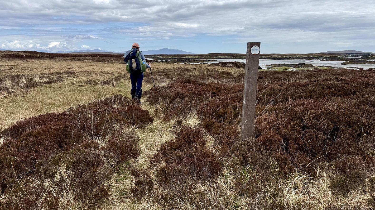
During the 19th century, many of Harris’ inhabitants were forcibly moved from their homes on the west coast to make way for sheep farming. This historic coffin road was used by the locals in the east to take their dead to burial sites in the west. The route is used by the Hebridean Way long-distance trail.
0
0

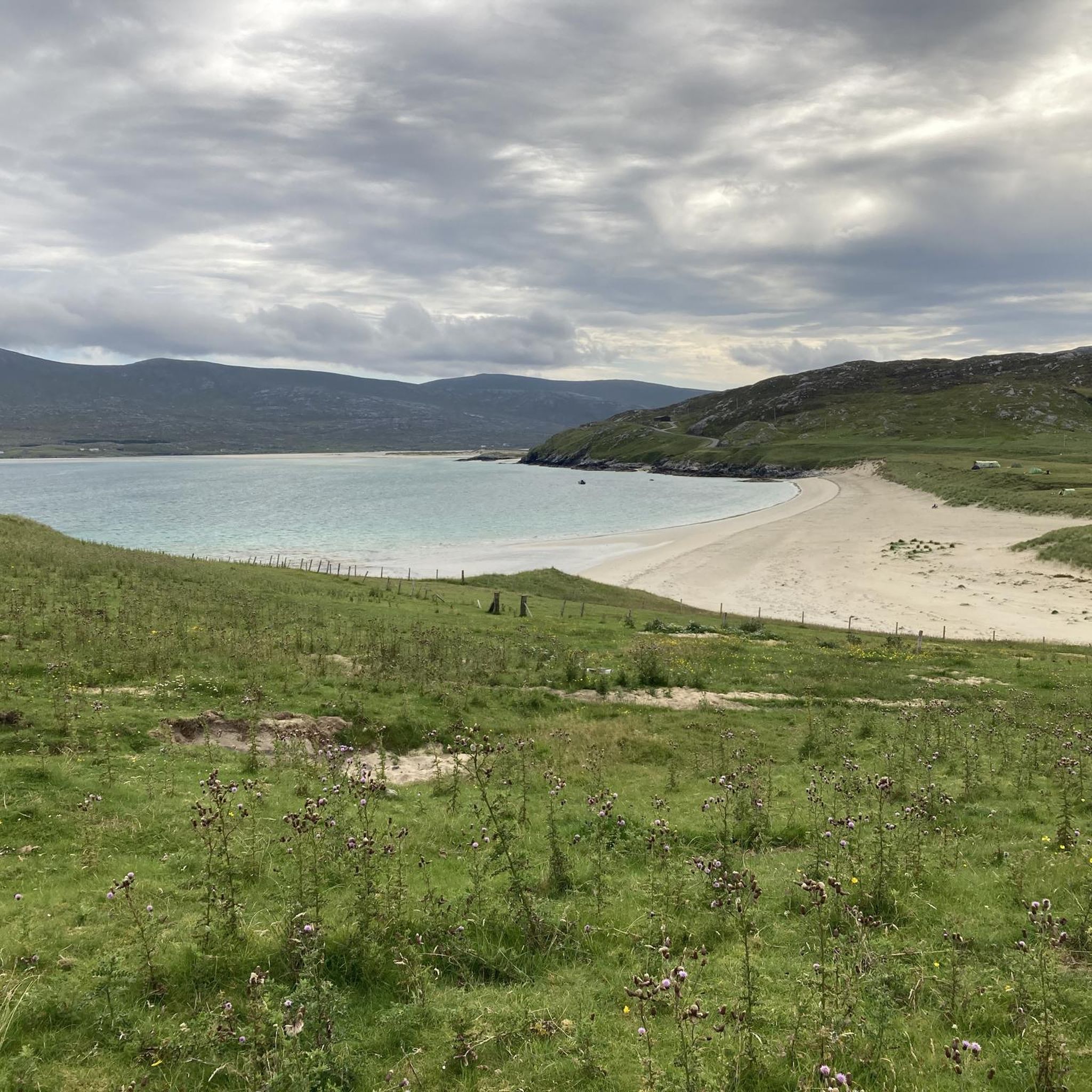
Beaches almost like in the Caribbean, only a little colder
0
0

St. Clement's Church is hailed as "the grandest medieval building in the Western Isles." The church was founded by Alasdair 'Crotach' MacLeod of Dunvegan and Harris, the 8th chief of Clan MacLeod. He died in 1547, and his remarkable tomb can be seen inside the church.
1
1


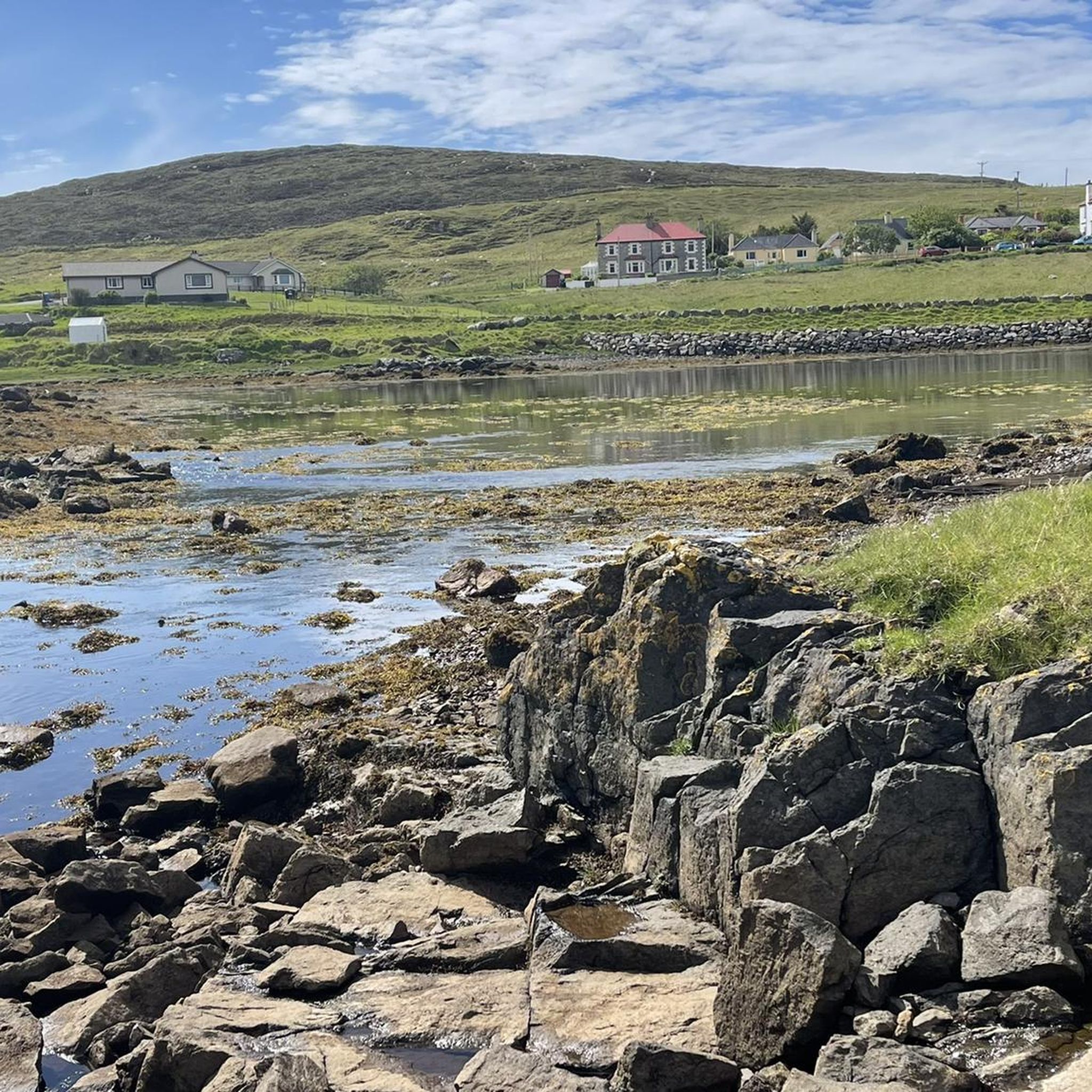
Enjoy the peace of the Isle of Harris' rolling hills and hidden lochs as you make your way through this serene landscape.
1
0

Lots of tourist's come here so usually a good few people here in the summer
0
0
need to turn here at sign post or carry one to main road. I would say clockwise is a bit easier.
0
1
Frequently Asked Questions
Are there any easy, family-friendly walks in South Harris?
Yes, South Harris has options suitable for families. For a short and accessible walk, consider the Loch Thorsagearraidh – St Clement's Church, Rodel loop from Rodel. It's a relatively flat route that combines lochside scenery with a visit to the historic St Clement's Church. Many of the western beaches, like Luskentyre or Horgabost, also offer gentle walking on firm sand, which can be great for all ages.
Can you recommend a good circular hike?
A great circular route that showcases the varied landscape is the Lickisto & Luskintyre loop — Isle of Harris. This moderate trail takes you from the rugged, loch-dotted terrain of the east coast over to the stunning white sands of the west coast at Luskintyre, providing a fantastic overview of the island's contrasting scenery.
What are the coastal walks like in South Harris?
The coastal walks are a highlight of the region. The west coast is famous for its vast, white-sand beaches and turquoise waters, offering spectacular walks along places like Luskentyre and Scarista. The east coast, known as 'The Bays', provides a more rugged experience with a rocky, indented coastline and paths that weave between small crofting communities.
I'm looking for a challenging hill walk. What do you suggest?
For a more demanding day out with rewarding views, the The Coffin Road – Seilebost Beach loop from Seilebost is a difficult-rated hike. This historic route crosses the island's interior, involving significant distance and ascent through wild moorland before rewarding you with views over the spectacular Seilebost Beach.
What kind of wildlife might I see while hiking?
South Harris is a haven for wildlife. While walking, keep an eye on the sky for golden eagles and other birds of prey. On the moors, you might spot red deer. Along the coast, seals are a common sight, often hauled out on rocks, and if you're patient and lucky, you might even see otters, dolphins, or whales.
Are there any hikes with particularly good viewpoints?
For panoramic views, the ascent of Ceapabhal is highly recommended. The Toe Head & Ceapabhal loop from Northton includes this climb, which offers breathtaking vistas over the Sound of Harris and its many small islands. The Luskintyre Beach Lookout is another spot that provides incredible 360-degree views for a relatively short climb.
What do other hikers think of the trails in South Harris?
The trails around South Harris are highly regarded by the komoot community, earning an average rating of 4.5 stars. Hikers frequently praise the stunning coastal scenery, the unique contrast between the rugged east and sandy west coasts, and the feeling of wild, open space.
Can I bring my dog on hikes in South Harris?
Yes, dogs are generally welcome on trails in Scotland under the Outdoor Access Code. However, it is crucial to keep them under close control, especially during lambing season (typically April-June) and near wildlife. Be prepared to put your dog on a lead when livestock are present or when walking near coastal areas with ground-nesting birds.
What is the terrain like for hiking?
The terrain is incredibly varied. Expect everything from soft, sandy beaches and firm machair (coastal grassland) on the west coast to rocky, boggy, and sometimes pathless moorland in the interior and on the east coast. Trails can be well-defined, like the historic Coffin Road, or require careful navigation. Waterproof hiking boots with good grip are essential.
How do I get to the trailheads? Is public transport an option?
Most trailheads are best accessed by car, as parking is usually available in small lay-bys or designated car parks near the start of the routes. A limited bus service runs along the main roads, which can be used to access some walks, but services can be infrequent. It's best to check the local bus timetables in advance if you plan to rely on public transport.
What should I pack for a day hike in South Harris?
The weather can change very quickly. Always carry waterproof and windproof jackets and trousers, even if the day starts sunny. Sturdy, waterproof hiking boots are a must. Also pack extra layers, a map and compass (as phone signal can be unreliable), plenty of water, and snacks. In summer, midge repellent is also highly recommended.
Most popular attractions around South Harris

Get inspired with the komoot mobile app


Explore more
Browse the best Hikes in other regions.
