The best mountain hikes around Campsie
9
hikers
3
hikes
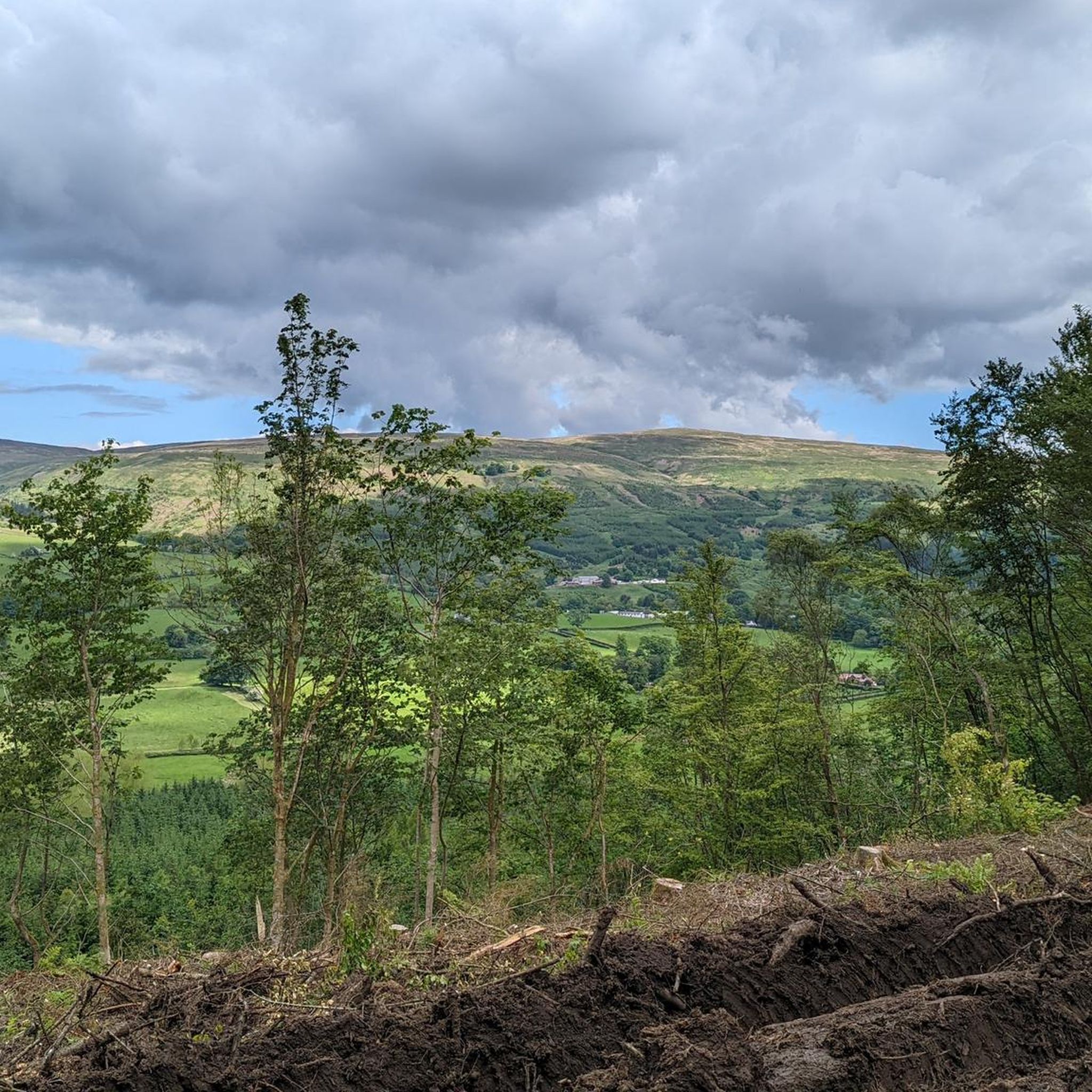
Mountaineering around Campsie offers a network of routes across the Campsie Fells, a range of hills characterized by rounded, grassy slopes and occasional rocky outcrops. The region provides varied terrain, from lower paths through woodlands to higher elevations offering panoramic views of the surrounding lowlands. These routes navigate through a landscape shaped by ancient geological processes, providing a distinct experience for mountaineers. The area's natural features make it suitable for exploring on foot, with trails that traverse open moorland and ascend to prominent viewpoints.
Best mountaineering routes around Campsie
- The most popular mountaineering route is Auchineden Hill Trig Point – The Whangie Rock Formation loop from Queen's View, an easy 2.9 miles (4.7 km) trail that takes 1 hour 27 minutes to complete, featuring the distinctive Whangie Rock Formation.
- Another top favourite among local mountaineers is Crichton's Cairn – View of Glasgow from Crow Road loop from Lennoxtown, a moderate 7.0 miles (11.3 km) path. This route offers ascents to Crichton's Cairn with expansive views towards Glasgow.
- Local mountaineers also love the View of Glasgow from Crow Road – Crichton's Cairn loop from Muckle Alicompen, a 5.8 miles (9.4 km) trail leading through open hillsides to viewpoints overlooking Glasgow, often completed in about 3 hours 1 minute.
- Mountaineering around Campsie is defined by rolling hills, panoramic views, and varied terrain including grassy slopes and rocky sections. The network offers options for different ability levels, from easy walks to more challenging ascents.
- The guide includes highly-rated routes that showcase the best of the region's landscape. More than 9 mountaineers have used komoot to explore Campsie's varied terrain.
Last updated: June 24, 2026
6
hikers
Easy mountaineering route. Great for any fitness level. Easily-accessible paths. Suitable for all skill levels.
2
hikers
11.3km
03:40
450m
450m
Moderate mountaineering route. Good fitness required. Easily-accessible paths. Suitable for all skill levels.

Sign up for free
1
hikers
Moderate mountaineering route. Good fitness required. Easily-accessible paths. Suitable for all skill levels.
Our route recommendations are based on thousands of hikes, rides, and runs completed by other people on komoot.
Start today with a free account
Your next adventure awaits.
Login or Signup
Popular around Campsie


Tips from the Community

Great wee walk and easy for first timers.
0
0


Great view from the northern slopes of Auchineden Hill out over Loch Lomond to the Highlands beyond.
0
0

Treacherous road surface and lots of traffic on the Weekends. But the view is definitely worth it - especially if approaching from the South
0
0

There must be some sort of metal below ground as my two compasses were off!
0
0

An easy walk to the top of this hill which offers great views north towards Loch Lomond and the mountains, and south towards Glasgow. Combine it with the Whangie for a really interesting short walk
0
0
The Whangie is an amazing natural rock formation with far ranging views towards both Loch Lomond and Glasgow. You can walk right through the rock chasm and explore all the cool rock formation up close, meaning its a great place to explore for kids, or a sort walk with lots of interest for adults
1
0

The mural was created by Scottish artist Rogue Oner (aka Bobby McNamara), based on a photograph by Graham Watson. celebrating the achievements of Robert Miller now Philippa York
0
0
Frequently Asked Questions
What types of mountaineering routes can I find in the Campsie Fells?
The Campsie Fells offer a variety of mountaineering routes, ranging from easy walks to more challenging ascents. You'll find paths traversing open moorland, grassy slopes, and occasional rocky sections, all providing panoramic views of the surrounding lowlands.
Are there any easy mountaineering routes suitable for beginners in Campsie?
Yes, there is at least one easy mountaineering route. For a relatively gentle introduction, consider the Auchineden Hill Trig Point – The Whangie Rock Formation loop from Queen's View. This 2.9-mile (4.7 km) trail takes about 1 hour 27 minutes and features the distinctive Whangie Rock Formation.
What are some moderate mountaineering routes in the Campsie Fells?
For those seeking a moderate challenge, the Campsie Fells offer routes like the Crichton's Cairn – View of Glasgow from Crow Road loop from Lennoxtown. This 7.0-mile (11.3 km) path includes ascents to Crichton's Cairn, providing expansive views towards Glasgow.
Are there any circular mountaineering routes in Campsie?
Yes, many of the routes in Campsie are designed as circular loops. For example, the View of Glasgow from Crow Road – Crichton's Cairn loop from Muckle Alicompen is a 5.8-mile (9.4 km) circular trail that leads through open hillsides to viewpoints overlooking Glasgow.
What interesting landmarks or natural features can I see along the mountaineering routes?
The Campsie Fells are rich in natural beauty and historical interest. Along the routes, you might encounter features like The Whangie Rock Formation, a unique geological site. Other notable points of interest in the wider area include Devil's Pulpit (Finnich Glen) and various summits offering panoramic views such as Auchineden Hill Trig Point.
Is the Campsie Fells area suitable for family-friendly mountaineering?
The Campsie Fells can be suitable for families, especially on the easier, shorter routes. It's important to choose trails appropriate for the fitness and experience level of all family members. The varied terrain means some paths are more accessible than others, so check route details for distance and elevation before heading out.
Are dogs allowed on the mountaineering trails in Campsie?
Generally, dogs are welcome on the trails in the Campsie Fells. However, it's crucial to keep them under close control, preferably on a lead, especially when passing through areas with livestock or ground-nesting birds. Always follow the Scottish Outdoor Access Code and clean up after your dog.
What is the best time of year for mountaineering in the Campsie Fells?
Spring, summer, and early autumn (April to October) generally offer the most favorable conditions for mountaineering in the Campsie Fells, with longer daylight hours and milder weather. However, weather in Scotland can be unpredictable, so always be prepared for changing conditions regardless of the season.
What are the winter mountaineering conditions like in Campsie?
Winter mountaineering in the Campsie Fells can be challenging. While not as high as some Scottish ranges, the Fells can experience snow, ice, strong winds, and reduced visibility. Proper winter gear, including ice axe and crampons, and experience in winter navigation are essential if attempting routes in snowy conditions.
Where can I find parking for mountaineering routes in the Campsie Fells?
Parking availability varies depending on the specific trailhead. Many routes start from small car parks or roadside lay-bys in villages or at scenic viewpoints around the Fells. It's advisable to check the starting point of your chosen route on komoot for specific parking information and to arrive early during peak times.
Is it possible to reach the Campsie Fells mountaineering routes by public transport?
While some villages around the Campsie Fells are served by local bus routes, direct public transport access to specific trailheads can be limited. Planning your journey in advance and checking bus schedules is recommended. You may need to combine public transport with a short walk or taxi ride to reach your desired starting point.
Are there any cafes or places to eat near the Campsie Fells hiking trails?
You'll find cafes, pubs, and small shops in the villages surrounding the Campsie Fells, such as Lennoxtown, Fintry, and Killearn. These can be good spots to refuel before or after your mountaineering adventure. Always check opening times, especially outside of peak season.
Most popular routes around Campsie
Most popular attractions around Campsie

Get inspired with the komoot mobile app


Explore more
Browse the best Mountain Hikes & Routes in other regions.
