St. Louis/Red River Stream Bank Protection Area
St. Louis/Red River Stream Bank Protection Area
The best road cycling routes in St. Louis/Red River Stream Bank Protection Area
5.0
(2)
112
riders
5
rides
Road cycling in St. Louis/Red River Stream Bank Protection Area offers routes through a landscape characterized by riverbanks, dense forests, and undulating terrain in Douglas County. The region features a mix of natural areas and parklands, providing varied scenery for road cyclists. Elevation changes are generally gentle, with some routes including moderate climbs. This area provides opportunities for road cycling along the St. Louis River.
Best road cycling routes in St. Louis/Red River Stream Bank Protection Area
- The most popular…
Last updated: July 9, 2026
5.0
(2)
59
riders
Easy road ride. Great for any fitness level. Mostly well-paved surfaces and easy to ride.
8
riders
62.5km
02:41
250m
250m
Moderate road ride. Good fitness required. Mostly well-paved surfaces and easy to ride.

Sign up for free
13
riders
30.3km
01:16
180m
180m
Moderate road ride. Great for any fitness level. Some segments of this route may be unpaved and difficult to ride.
7
riders
27.3km
01:07
160m
160m
Easy road ride. Great for any fitness level. Mostly well-paved surfaces and easy to ride.
25
riders
Easy road ride. Great for any fitness level. Mostly well-paved surfaces and easy to ride.
Our route recommendations are based on thousands of hikes, rides, and runs completed by other people on komoot.
Start today with a free account
Your next adventure awaits.
Login or Signup
Popular around St. Louis/Red River Stream Bank Protection Area

North Country Trail – 4,800 Miles along the edge of northern U.S.
Hiking in St. Louis/Red River Stream Bank Protection Area
Cycling in St. Louis/Red River Stream Bank Protection Area
MTB Trails in St. Louis/Red River Stream Bank Protection Area

Running Trails in St. Louis/Red River Stream Bank Protection Area
Other adventures in St. Louis/Red River Stream Bank Protection Area

Tips from the Community


Leif Erikson Park is a small park just off the side of the Lakewalk path. You get great views of the water, and the park sometimes plays host to live music and theater events.
0
0

A paved multi-use that runs roughly eight miles long, most of it along the shore of Lake Superior.
0
0

This beautiful paved multi-use path takes you along the westernmost shore of the great lakes. You pass through Leif Erikson Park and the Duluth Rose Garden as Lake Superior unfolds next to you. This is a great short, scenic trail.
0
0

Bob Smith Memorial Bench is at a viewpoint overlooking the St. Louis River Estuary. From here, peer down into the land conservancy project protecting the St. Louis River and the headwaters in Minnesota's Northwoods. The water below flows into Lake Superior and forms a 12,000-acre freshwater estuary.
0
0
The Willard Munger State Trail, spanning between Hinckley and Duluth, offers trails for hiking, biking, in-line skating, snowmobiling, and horseback riding. This scenic trail passes through northern hardwood forests, pine stands, and bog-filled hills. It also follows a historic railroad route that saved lives during the Hinckley and Cloquet fires in the 19th century. Visitors have the opportunity here to spot a variety of wildlife, including whitetail deer, raccoons, foxes, porcupines, and occasionally bobcats or black bears.
0
0

There is a park right at the trailhead with a playground, picnic shelter, and plenty of picnic tables and benches along the stream.
1
0
Leif Erikson Park is a small park just off the side of the Lakewalk path. You get great views of the water, and the park sometimes plays host to live music and theater events.
0
0
Frequently Asked Questions
How many road cycling routes are available in St. Louis/Red River Stream Bank Protection Area?
There are 5 road cycling routes in the St. Louis/Red River Stream Bank Protection Area. These routes cater to various skill levels, offering both easy and moderate options.
What are the typical lengths of road cycling routes in this area?
The routes vary in length, with options ranging from approximately 12.5 miles (20.2 km) to 40.0 miles (64.4 km). For example, the Roadbike loop from Buffalo Valley Campground is about 12.5 miles, while the Lester Park Trailhead – Leif Erikson Park loop from Norton Park extends to 40.0 miles.
Are there easy road cycling routes suitable for beginners in St. Louis/Red River Stream Bank Protection Area?
Yes, there are 3 easy road cycling routes. A great option for beginners is the View of St. Louis River Gorge – Trail cut through the rock loop from Norton Park, which is 29.1 miles (46.9 km) and features gentle elevation changes.
Are there any challenging or advanced road cycling routes in the area?
The St. Louis/Red River Stream Bank Protection Area primarily offers easy and moderate road cycling routes. There are no routes currently classified as difficult, making it a great destination for those seeking enjoyable rides without extreme challenges.
What kind of scenery can I expect while road cycling here?
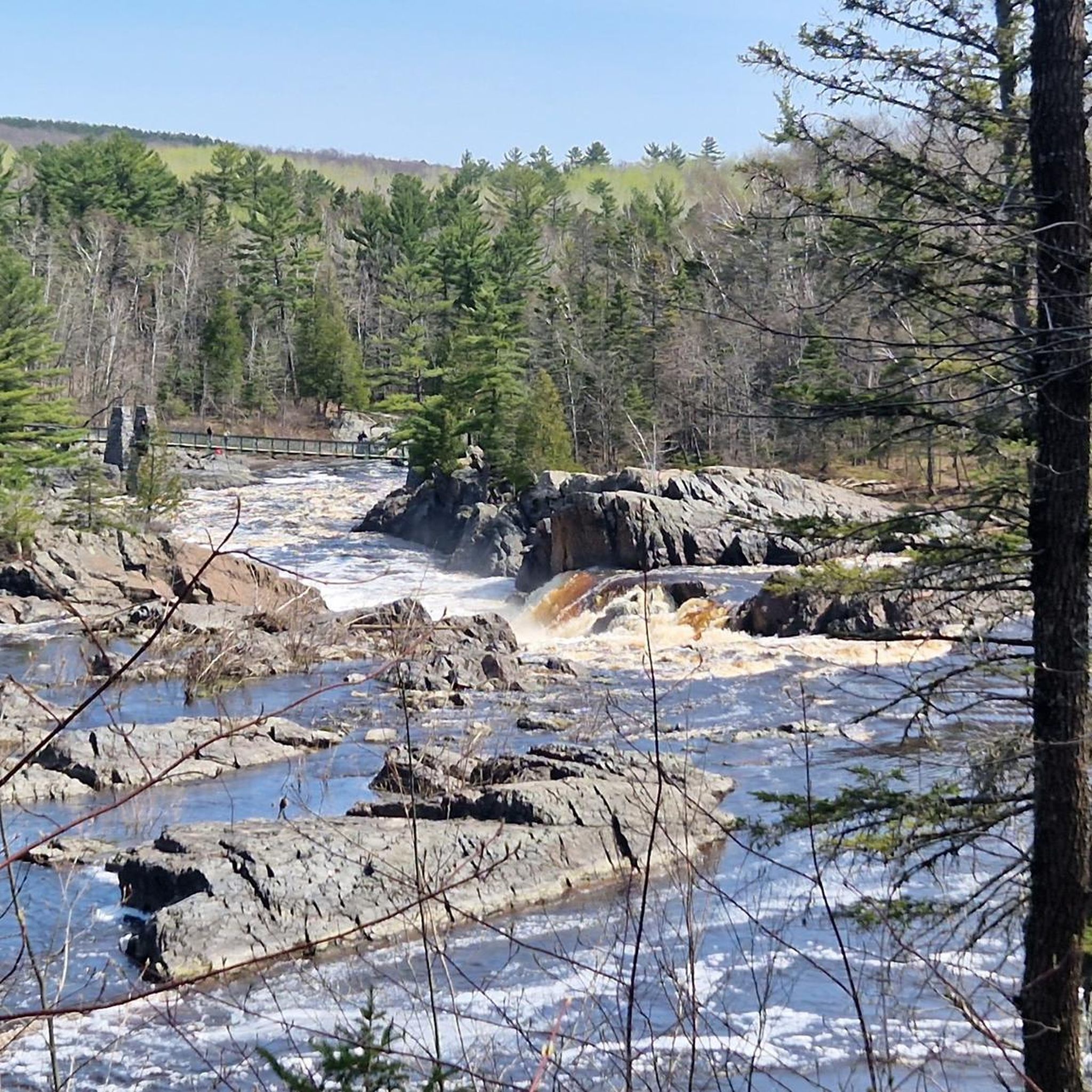
Road cycling in this region offers diverse scenery characterized by riverbanks, dense forests, and parklands. Routes often feature views of the St. Louis River Gorge and sections cut through rock, providing a mix of natural beauty and unique geological features.
Are there any loop road cycling trails available?
Yes, all the listed road cycling routes in the St. Louis/Red River Stream Bank Protection Area are loops. Examples include the View of St. Louis River Gorge – Trail cut through the rock loop from Norton Park and the Roadbike loop from Buffalo Valley Campground.
What do other road cyclists say about the routes in St. Louis/Red River Stream Bank Protection Area?
The routes in St. Louis/Red River Stream Bank Protection Area are highly rated by the komoot community, with an average score of 5.0 stars from 2 reviews. Over 100 road cyclists have used komoot to explore the varied terrain, often praising the scenic river views and well-maintained paths.
Are there any routes that offer notable viewpoints?
Yes, several routes provide scenic viewpoints. The View of St. Louis River Gorge – Trail cut through the rock loop from Norton Park is specifically highlighted for its views of the St. Louis River Gorge.
What are some of the most popular road cycling routes in this region?
Among the most popular routes are the View of St. Louis River Gorge – Trail cut through the rock loop from Norton Park, known for its river gorge views, and the Lester Park Trailhead – Leif Erikson Park loop from Norton Park, which winds through varied parklands.
Are the road cycling routes suitable for families?
With 3 easy-rated routes and generally gentle elevation changes, many of the road cycling paths in St. Louis/Red River Stream Bank Protection Area can be suitable for families. Routes like the Trail cut through the rock – Willard Munger State Trail loop from Jay Cooke State Park offer accessible options.
What is the typical elevation gain on these road cycling routes?
The elevation changes are generally gentle, with some routes including moderate climbs. For instance, the View of St. Louis River Gorge – Trail cut through the rock loop from Norton Park has an elevation gain of about 287 meters, while the Roadbike loop from Buffalo Valley Campground has around 110 meters of gain.
Most popular routes in St. Louis/Red River Stream Bank Protection Area

Get inspired with the komoot mobile app


Explore more
Browse the best Road cycling routes in other regions.
