The best road cycling routes in Bosch Di Rughel
4.9
(34)
887
riders
7
rides
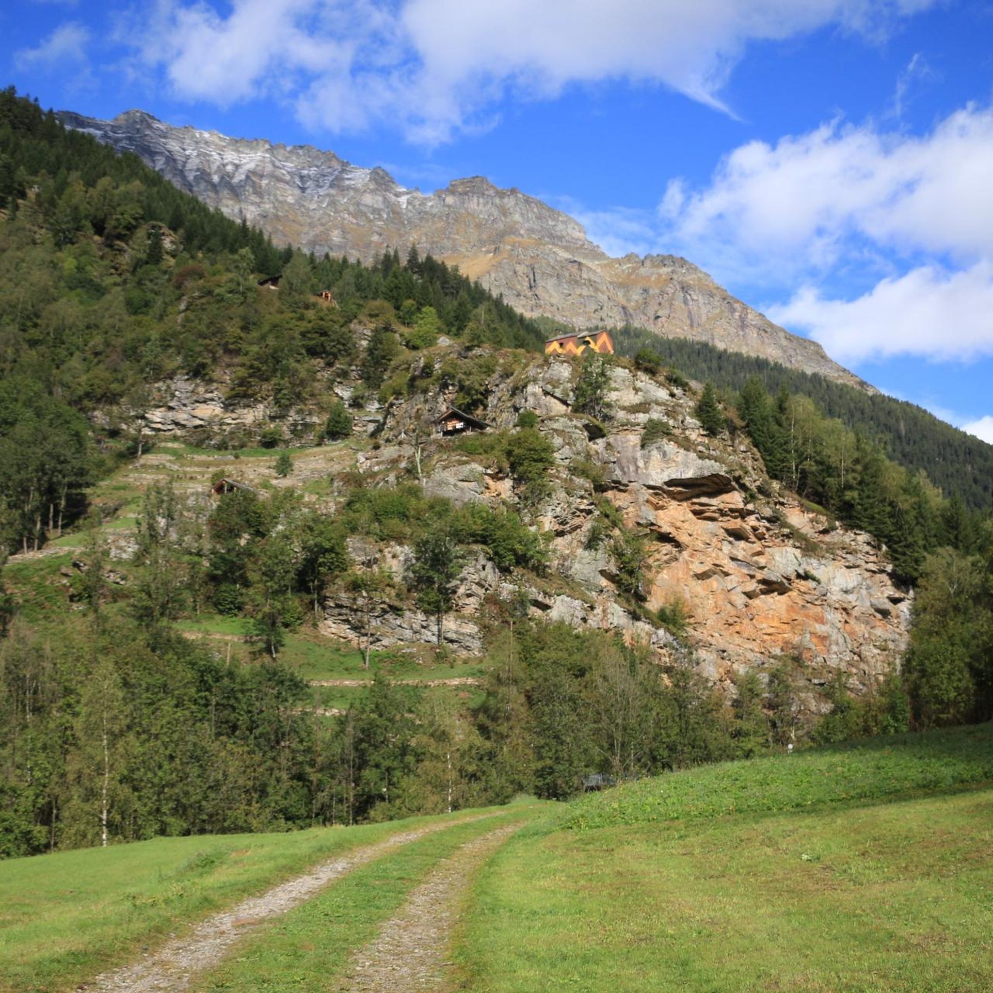
Road cycling routes in Bosch Di Rughel traverse a landscape characterized by river valleys, forested areas, and notable elevation changes. The region, situated in Moësa, offers varied terrain suitable for road cyclists seeking both challenging climbs and more moderate routes. Features include the Calancasca River and the area around Lostallo Village, providing diverse backdrops for cycling.
Best road cycling routes in Bosch Di Rughel
- The most popular road cycling route is Lostallo Village and Waterfall – Pian San Giacomo loop…
Last updated: July 11, 2026
4.7
(9)
42
riders
Moderate road ride. Good fitness required. Mostly well-paved surfaces and easy to ride.
5.0
(7)
73
riders
38.3km
02:45
670m
670m
Moderate road ride. Good fitness required. Mostly well-paved surfaces and easy to ride.

Sign up for free
5.0
(1)
109
riders
56.4km
03:20
1,340m
1,340m
Hard road ride. Very good fitness required. Mostly well-paved surfaces and easy to ride.
5.0
(3)
24
riders
27.7km
01:22
340m
340m
Moderate road ride. Good fitness required. Mostly well-paved surfaces and easy to ride.
13
riders
23.3km
01:23
570m
570m
Moderate road ride. Good fitness required. Mostly well-paved surfaces and easy to ride.
Get access to more routes and recommendations from other explorers.
Sign up for free
Already have an account?
Our route recommendations are based on thousands of hikes, rides, and runs completed by other people on komoot.
Start today with a free account
Your next adventure awaits.
Login or Signup
Popular around Bosch Di Rughel
Tips from the Community

The old track bed is now a very beautiful cycle path.
0
0
Beautiful nature and many views that cannot be seen from the pass road
0
0

Station, Grono - (1907-2013) History of the BM With the inauguration of the new San Bernardino motorway (1970), the small, narrow-gauge Mesolcina railway, with no direct connection to the nearby Gotthard railway, appeared obsolete. Starting in 1972—amidst lively protests from the Moesa population—passenger service was discontinued and replaced by P.T.T. buses. After the loss of three out of five electric locomotives due to serious accidents (1969) and the damage to the Soazza-Mesocco section in the 1978 flood, the length of the railway line was significantly reduced on the Castione-Cama stretch. The Rhaetian Railway (which had absorbed the BM between 1942 and 1943 during the severe economic crisis) decided to store its rolling stock in a disused factory in the Grono industrial area, which became a large depot and workshop for overhauling the bogies. This space will be the starting point for the redevelopment of what remains of the Bellinzona-Mesocco electric railway for tourism. In 1985, the Friends of the Mesolcinese Railway Association (AAFM) was founded, and in the summer of 1995 the first Sunday passenger service was inaugurated, a service that continued every summer for the next 18 years. In 2000, the Association transformed into the Tourist Railway Operations Company (SEFT) and recovered an original BM electric locomotive (purchased by the Gotthard Railway Club in 1980), built in Prague in 1909 before being sold to France. In 2003, the Rhaetian Railway also discontinued its freight service, and SEFT was granted another decade of passenger transport. On October 27, 2013, the last tourist run between Castione and Cama took place, definitively ending railway operations in Mesolcina. Since 2020, a Swiss electric locomotive with first and second class seats (1933) and a Belgian freight car (1889) used by the BM have been on public display in the Al Pascolet industrial area on the site of Fratelli Censi SA Tecnica Ferroviaria, not far from the former SEFT depot-workshop. Text / Source: visit-moesano.ch https://www.visit-moesano.ch/sites/moesano/files/2024-04/Storia%20BM.pdf
16
0
Stage 7: San Bernardino – Bellinzona An exhilarating descent through the Mesolcina Valley. Eagerly absorbing the mild southern climate. In Mesocco, cyclists enjoy the largest ruin in Switzerland and, at the end of the tour, in Bellinzona, the defiant towers and walls of the tre castelli. Refreshed, they follow the rushing Moësa River out of the lively resort town of San Bernardino. The 46-kilometer-long tributary of the Ticino rises at the San Bernardino Pass and gives its name to the Mesolcina Valley (Misox). Although Italian is spoken in the valley, as in the Poschiavo and Bregaglia valleys, it has always maintained close ties to Graubünden. In the smaller villages, where many of the houses are covered with stone slabs, time seems to have stood still. You hardly stop on your bike during the rapid descent towards the south. Surrounded by rocky cliffs, you roar along a well-maintained road with countless skid marks. The highway, which practically hangs from the mountain, seems a bit surreal. Later, a varied side road leads down to Mesocco. Magnificent views of the valley are revealed. Below the village, perched on a rocky outcrop, are the ruins of the Castello di Mesocco, the 11th-century ancestral castle of the Count of Misox. It is considered one of the most important in Graubünden and the largest in Switzerland. Roveredo is the main town in the lower Misox Valley. And what could be nicer here than a break in a cool grotto, enjoying a typical lunch menu and a glass of local wine? The village also boasts several beautiful 17th-century houses, such as the one designed by local architect and builder Enrico Zuccalli. A secluded stretch follows near Lumino, just after crossing the highway and the river. A forest path leads along the Moësa River over hill and dale. Passing an inviting forest garden grotto and some secluded swimming spots, you reach Arbedo-Castione. Here, the Moësa flows into the Ticino River. Text / Source: Schweizmobil.ch https://schweizmobil.ch/de/veloland/route-6/etappe-7
14
0

The lake can be bypassed with a mountain bike. Two gates can only be bypassed by stopping and pushing. :-(
1
0
Short flat stretch that allows you to regain some strength.
0
0
Torre di Santa Maria The medieval residential tower was built in the 13th/14th century by the Counts of Sax. Overlooking the valley floor of the Misox, it was part of a territorial control system. The pentagonal tower is inspired by architectural models from central France. Text / Source: Raetia Association, grisun & romanisch https://www.visit-moesano.ch/de/chiesa-parrocchiale-santa-maria-assunta
14
0
Chiesa San Rocco e San Sebastiano, Grono The church of San Rocco and San Sebastiano, decorated with colourful frescoes, is located in a small square in the centre of Grono. The church, originally dedicated to Saint Bernardine, was a modest chapel probably built at the beginning of the 16th century. In 1660 it was restored and enlarged and dedicated to Saint Bernardine of Siena and Saint Charles Borromeo. Later, in 1690, the sacristy was added and at the beginning of the 19th century the bell tower was built. The nave is characterised by a barrel vault, while the chancel has a cross vault decorated with beautiful baroque stuccoes dating from 1715. The main façade of the church is characterized by colorful frescoes depicting Our Lady of Milk and the patron saints of the church. In 1660 it was restored and enlarged and dedicated to Saint Bernardine of Siena and Saint Charles Borromeo. Later, in 1690, the sacristy was added and at the beginning of the 19th century the bell tower was built. The nave is characterized by a barrel vault, while in the choir there is a cross vault decorated with beautiful baroque stuccoes dating from 1715. The main façade of the church is characterized by colorful frescoes depicting Our Lady of Milk and the patron saints of the church. Text / Source: Raetia Association, grisun & romanisch https://www.visit-moesano.ch/de/chiesa-san-rocco-san-sebastiano
14
0
Frequently Asked Questions
What kind of terrain and elevation changes can I expect on road cycling routes in Bosch Di Rughel?
Road cycling in Bosch Di Rughel is characterized by diverse terrain, including river valleys, forested areas, and significant elevation changes. Routes often feature sustained climbs and descents, particularly along the Calancasca River valley and around Lostallo Village, offering a varied and engaging experience for cyclists.
How many road cycling routes are available in Bosch Di Rughel, and what are their difficulty levels?
Bosch Di Rughel offers 8 road cycling routes. These include 1 easy route, 4 moderate routes, and 3 difficult routes, providing options for various skill levels, from leisurely rides to challenging climbs.
Are there any easy or family-friendly road cycling routes in Bosch Di Rughel?
Yes, there is one easy road cycling route in Bosch Di Rughel. The Lostallo Village and Waterfall – San Martino Church, Soazza loop from Lostallo is a 16.1-mile (25.8 km) trail that is generally considered suitable for an easier ride, making it a good option for families or those seeking a less strenuous experience.
What are some of the more challenging road cycling routes in Bosch Di Rughel?
For experienced cyclists seeking a challenge, Bosch Di Rughel offers several difficult routes. The Lostallo Village and Waterfall – Pian San Giacomo loop from Cama is a 28.3-mile (45.5 km) route with significant elevation gain. Another demanding option is the Calancasca River – Sorte Landslide loop from Santa Maria in Calanca, which features sustained climbs and descents.
What natural features or landmarks can I see along the road cycling routes in Bosch Di Rughel?
Road cycling routes in Bosch Di Rughel often pass through scenic areas. You can expect to see the Calancasca River, the picturesque Lostallo Village, and potentially waterfalls. The routes also traverse forested areas and offer views of the surrounding mountainous terrain in the Moësa region.
Are there any circular road cycling routes in Bosch Di Rughel?
Yes, many of the road cycling routes in Bosch Di Rughel are designed as loops. Examples include the Lostallo Village and Waterfall – Pian San Giacomo loop from Cama, the Calancasca River – Sorte Landslide loop from Santa Maria in Calanca, and the Lostallo Village and Waterfall – San Martino Church, Soazza loop from Lostallo.
What do other road cyclists say about their experience in Bosch Di Rughel?
The road cycling routes in Bosch Di Rughel are highly rated by the komoot community, with an average score of 4.9 stars from over 40 reviews. Cyclists often praise the varied terrain, the scenic river valleys, and the challenging climbs that define the region's routes.
Is Bosch Di Rughel suitable for dog-friendly road cycling?
While road cycling itself is generally not ideal for dogs to run alongside, the routes in Bosch Di Rughel are primarily on paved roads. If you plan to bring a dog, consider if they can be safely transported in a trailer or basket, and always prioritize their safety and comfort, especially given the elevation changes and traffic on some sections.
Are there any specific parking areas or public transport options for accessing road cycling routes in Bosch Di Rughel?
The guide data does not specify dedicated parking areas or public transport links for each individual route. However, routes often start from villages like Cama, Santa Maria in Calanca, and Lostallo, where local parking or public transport connections might be available. It is advisable to check local information for these specific starting points.
What is the best time of year to go road cycling in Bosch Di Rughel?
Given the region's characteristics of river valleys and mountainous terrain, the best time for road cycling in Bosch Di Rughel is typically during the spring, summer, and early autumn months. During these periods, the weather is generally more favorable, and mountain passes are less likely to be affected by snow or ice, ensuring safer and more enjoyable riding conditions.
Are there any moderate difficulty road cycling routes in Bosch Di Rughel?
Yes, Bosch Di Rughel features 4 moderate road cycling routes. An example is the Lago di Buseno and Dam – Laura loop from Castaneda, which covers 23.8 miles (38.3 km) with a balanced amount of climbing and descending, offering a good challenge without being overly strenuous.
Can I find cafes or accommodation near the road cycling routes in Bosch Di Rughel?
While specific cafes or accommodation are not detailed in the route information, the road cycling routes often pass through or start from villages such as Cama, Lostallo, and Santa Maria in Calanca. These villages are likely to offer local amenities, including places to eat or stay. It's recommended to check local services in these areas for your specific needs.
Most popular routes in Bosch Di Rughel

Get inspired with the komoot mobile app


Explore more
Browse the best Road cycling routes in other regions.
