The best walks and hikes around Salvaterra Do Extremo
4.5
(6)
28
hikers
9
hikes
Hiking around Salvaterra Do Extremo, Portugal, offers trails through a landscape characterized by river valleys, rolling hills, and historical pathways. The region, situated near the Spanish border, features a mix of open terrain and areas with natural vegetation. Elevation gains are generally moderate, providing accessible hiking experiences.
Best hiking trails around Salvaterra Do Extremo
- The most popular hiking route is Peñafiel Castle Trail, a 5.6 miles (9.0 km) trail that takes 2 hours 20 minutes to complete. This moderate…
Last updated: October 11, 2026
3.0
(1)
6
hikers
9.00km
02:23
80m
80m
Moderate hike. Good fitness required. Easily-accessible paths. Suitable for all skill levels.
22.6km
06:15
390m
390m
Hard hike. Very good fitness required. Easily-accessible paths. Suitable for all skill levels.

Moderate hike. Good fitness required. Mostly accessible paths. Sure-footedness required.
8.14km
02:07
50m
60m
Moderate hike. Good fitness required. Easily-accessible paths. Suitable for all skill levels.
16.1km
04:21
210m
210m
Moderate hike. Good fitness required. Easily-accessible paths. Suitable for all skill levels.
Get access to more routes and recommendations from other explorers.
Already have an account?
Our route recommendations are based on thousands of hikes, rides, and runs completed by other people on komoot.
Start today with a free account
Your next adventure awaits.
Popular around Salvaterra Do Extremo

Tips from the Community

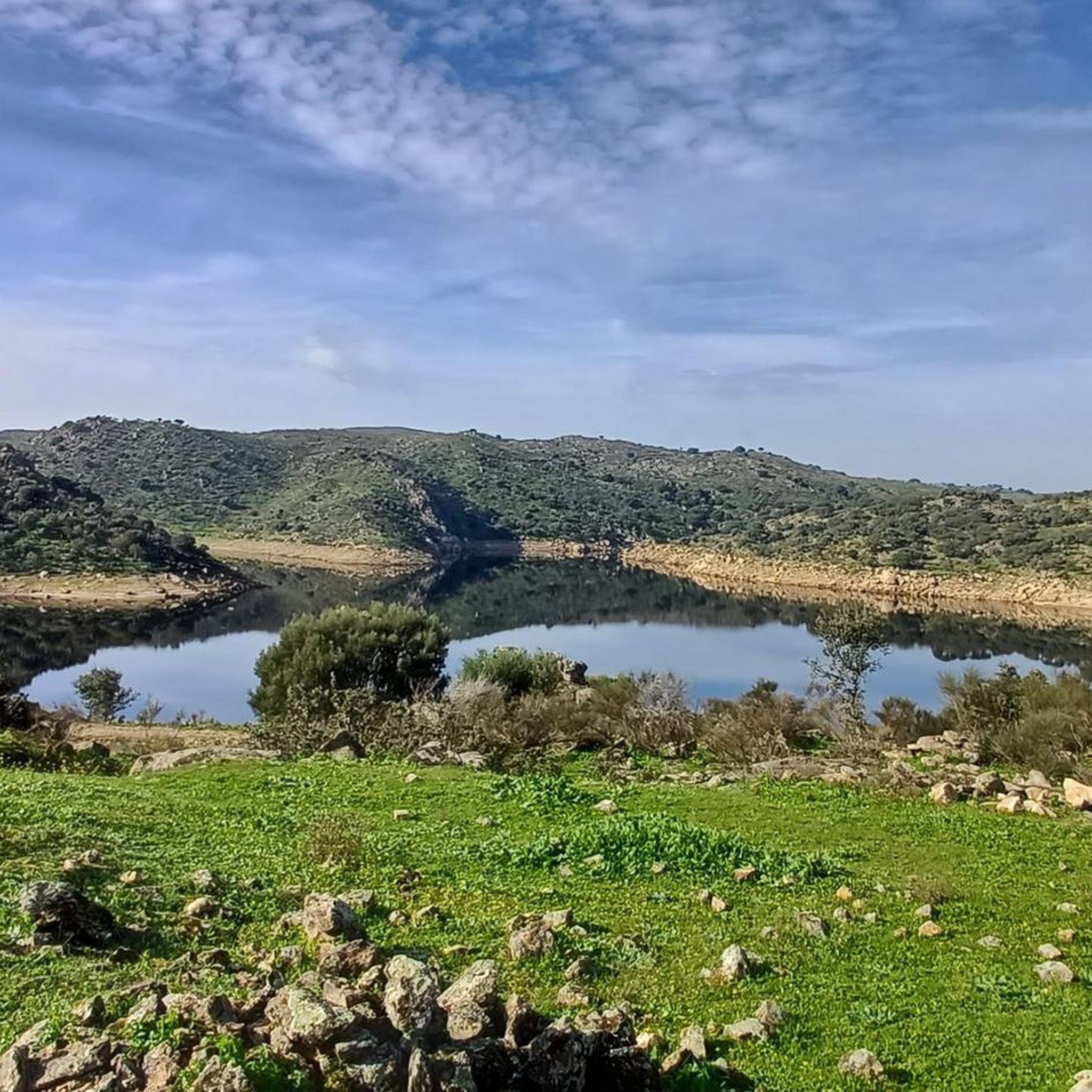
The Erjas River (also known as the Eljas River in Spain and the Erges River in Portugal) is a tributary of the Tagus River that serves as a natural border between Spain and Portugal for approximately 50 km.
6
0
Salvaterra do Extremo is a picturesque village in Portugal, known for its stunning views and natural surroundings.
8
0
The Mirador de la Caseta del Río Erjas, also known as the Eljas River in Portuguese, is a picturesque place that offers stunning views on the border between Spain and Portugal.
9
0
On the Spanish side, the bridge is located in the municipality of Alcántara in the province of Cáceres. It is reached via the regional highway EX-207 from the nearby town of Piedras Albas. On the Portuguese side, it connects with a local road to reach the town of Segura, from which this bridge takes its name. It was built in the Roman province of Lusitania to give continuity to the Roman road that connected Norba Caesarina (on the Via de la Plata) with the civitas Egitania (Idanha-a-Velha, Portugal) and with Bracara Augusta (Braga, Portugal), in order to save the Erjas river. This river marks the border line between Spain and Portugal, and the bridge serves as an international crossing between both countries.
9
0
The Cañada Real de Gata is a short-distance hiking route that offers great scenic value as it passes entirely through the surroundings of the Tajo Internacional Natural Park in Extremadura.
7
0
Peñafiel Castle, also known as Racha Rachel Castle, is an old fortification located in the municipality of Zarza la Mayor, in the province of Cáceres. The construction of the castle dates back to the 13th century. It was built on the remains of a fortress of Arab origin from the 9th century. King Alfonso IX conquered the fortress in 1212 and granted it to the Order of Alcántara, thus forming an important commandery.
11
0
The Pata de Buey Dolmen is a funerary structure that consists of a large chamber with an approximate diameter of 3 meters. The slate slabs that formed the chamber have remained mostly on the same side, especially in the areas adjacent to the corridor. In the northeast sector, there are also three small slabs.
8
0
Zarza la Mayor is a Spanish town and municipality, located in the province of Cáceres, in the autonomous community of Extremadura. It belongs to the judicial district of Cáceres and is the westernmost town in the community of Rivera de Fresnedosa. Furthermore, it is the only municipality in said community that has a border with Portugal, located four kilometers in a straight line from Salvaterra do Extremo.
10
0
Frequently Asked Questions
How many hiking trails are available in Salvaterra Do Extremo?
There are 9 hiking trails in the Salvaterra Do Extremo region. These include 2 easy routes, 6 moderate routes, and 1 difficult route, offering options for various skill levels.
Are there easy hiking trails suitable for beginners in Salvaterra Do Extremo?
Yes, Salvaterra Do Extremo offers 2 easy hiking routes. These trails are generally shorter with minimal elevation gain, making them suitable for beginners or those looking for a relaxed walk.
What kind of terrain can I expect on the hiking trails around Salvaterra Do Extremo?
The hiking trails in Salvaterra Do Extremo are characterized by river valleys, rolling hills, and historical pathways. You'll find a mix of open terrain and areas with natural vegetation, with generally moderate elevation gains.
Are there any circular hiking routes in Salvaterra Do Extremo?
Yes, there are circular routes available. For example, the Menhir del Cabezo from Piedras Albas — circular via Ruta de la Cañada Real de Gata is a moderate 5.8-mile (9.3 km) path that winds through historical pathways and natural landscapes.
What are some notable historical or natural landmarks I can see while hiking?
The region is rich in history and natural beauty. Along the trails, you might encounter landmarks such as the Segura International Bridge, the impressive Peñafiel Castle of Zarza la Mayor, or the ancient Peña Buraca (Canchal de los Ojos) and Medieval Tombs.
Are there any longer, more challenging hikes for experienced trekkers?
Yes, for experienced trekkers, there is a difficult route available. The Salvaterra do Extremo from Zarza la Mayor — circular by the Río Erjas is a challenging 14-mile (22.6 km) trail with significant elevation changes.
What do other hikers say about the trails in Salvaterra Do Extremo?
The trails in Salvaterra Do Extremo are highly rated by the komoot community, with an average score of 4.3 stars from over 4 reviews. Hikers often praise the varied terrain and the historical points of interest found along the routes.
Are there trails that follow traditional routes or pathways?
Yes, several trails in the region follow traditional routes. The Alcantara Livestock Trail, for instance, leads through historical livestock routes, offering a glimpse into the area's heritage.
Can I find trails that offer views of castles or other historical structures?
Absolutely. The Peñafiel Castle Trail is a moderate 5.6-mile (9.0 km) route specifically designed to feature historical points of interest, including the castle itself.
Are there any trails that explore the natural rock formations or unique geological features?
Yes, the Peña Buraca Trail from Piedras Albas is a moderate 10-mile (16.1 km) route that will lead you towards the fascinating Peña Buraca (Canchal de los Ojos), known for its distinctive rock formations.
What is the typical duration for a moderate hike in this region?
Moderate hikes in Salvaterra Do Extremo typically range from 2 to 3 hours. For example, the Peñafiel Castle Trail takes about 2 hours 20 minutes, while the Alcantara Livestock Trail is often completed in about 2 hours 5 minutes.
Most popular routes around Salvaterra Do Extremo
Most popular attractions around Salvaterra Do Extremo

Get inspired with the komoot mobile app


Explore more
Browse the best Hikes in other regions.
