The best running trails in Raggeds Wilderness
5.0
(1)
296
runners
39
runs
Jogging in Raggeds Wilderness offers routes through a landscape characterized by high ridges, pristine lakes, and extensive trail systems. The region features significant elevation changes, with many routes categorized as difficult, providing a challenging experience for runners. Trails often lead through varied terrain, including forested sections and open areas with expansive views.
Best jogging routes in Raggeds Wilderness
- The most popular jogging route is Beaver Lake & Lizard Lake via Crystal City Road trail run, a 5.1 miles (8.2 km) moderate trail that takes about 1 hour to complete, offering views of both Beaver Lake and Lizard Lake.
- Another top favourite among local runners is Scarp Ridge Loop Trail, a difficult 3.9 miles (6.3 km) path. This loop trail ascends Scarp Ridge, providing panoramic vistas of the surrounding wilderness.
- Local runners also love the Oh-Be-Joyful Trail 836, a 12.2 miles (19.6 km) trail leading through a scenic valley, often completed in about 2 hours 45 minutes.
- Jogging in Raggeds Wilderness is defined by high mountain ridges, clear alpine lakes, and extensive trail networks. The network offers options for different ability levels, from easy lakeside paths to challenging, long-distance routes.
- The routes in Raggeds Wilderness are highly rated by the komoot community with an average score of 5.0 stars. More than 170 runners have used komoot to explore Raggeds Wilderness's varied terrain.
Last updated: June 25, 2026
1
runners
8.25km
00:58
240m
240m
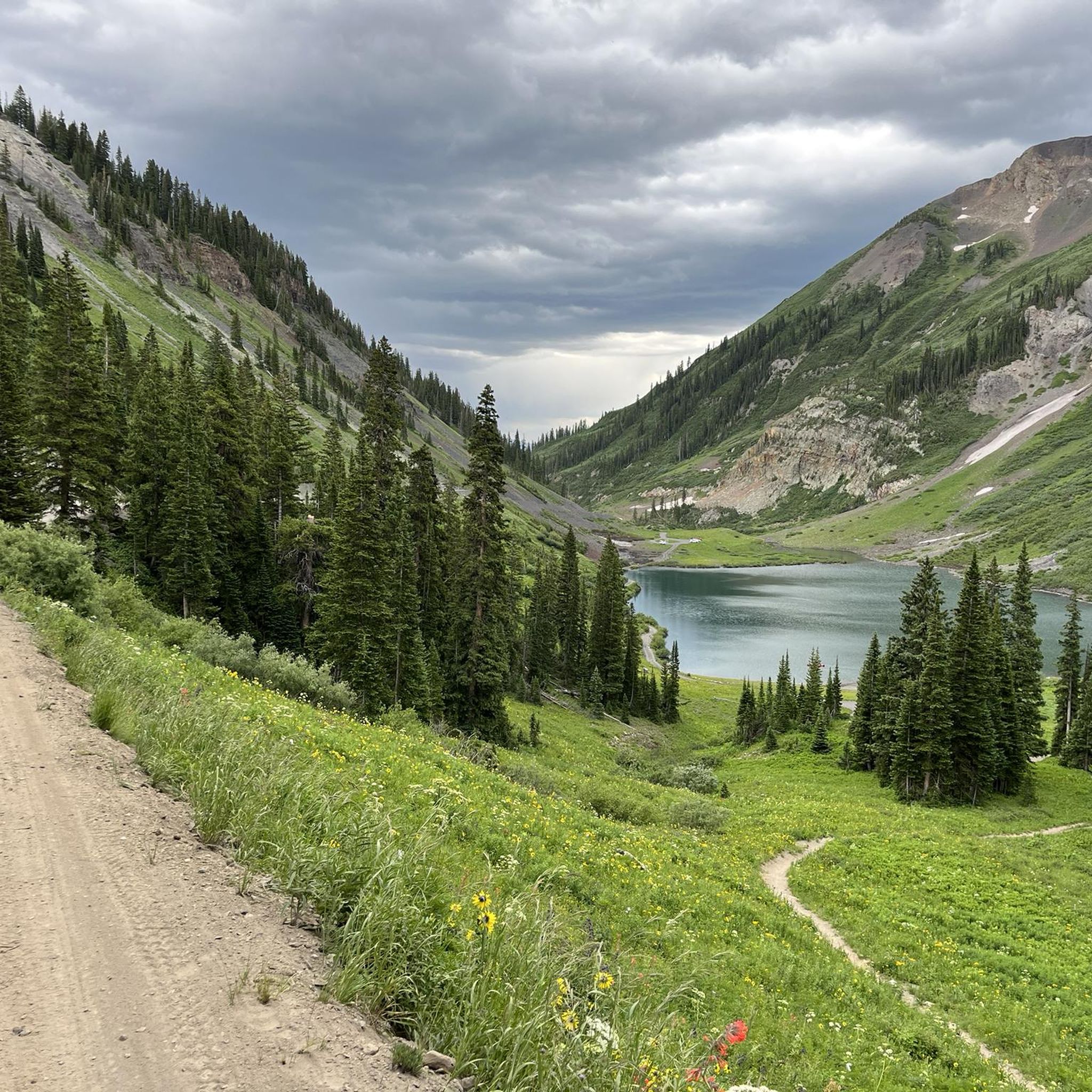
Jog this moderate 5.1-mile trail run to Beaver Lake and Lizard Lake via Crystal City Road, gaining 800 feet of elevation in White River Nati
4
runners
6.29km
01:45
400m
400m
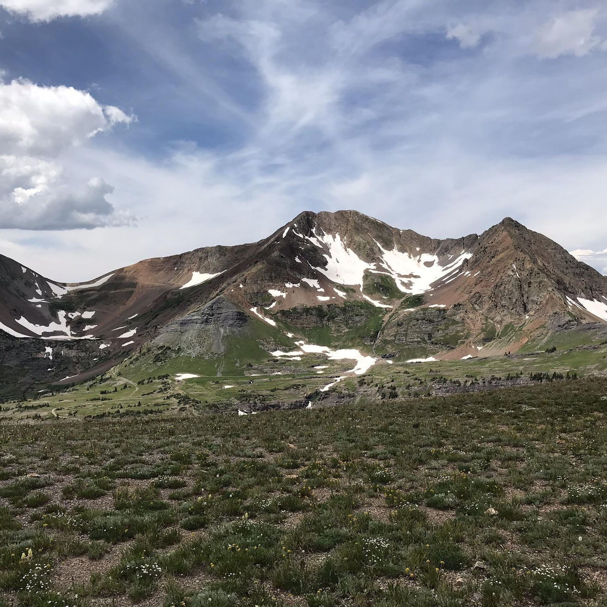
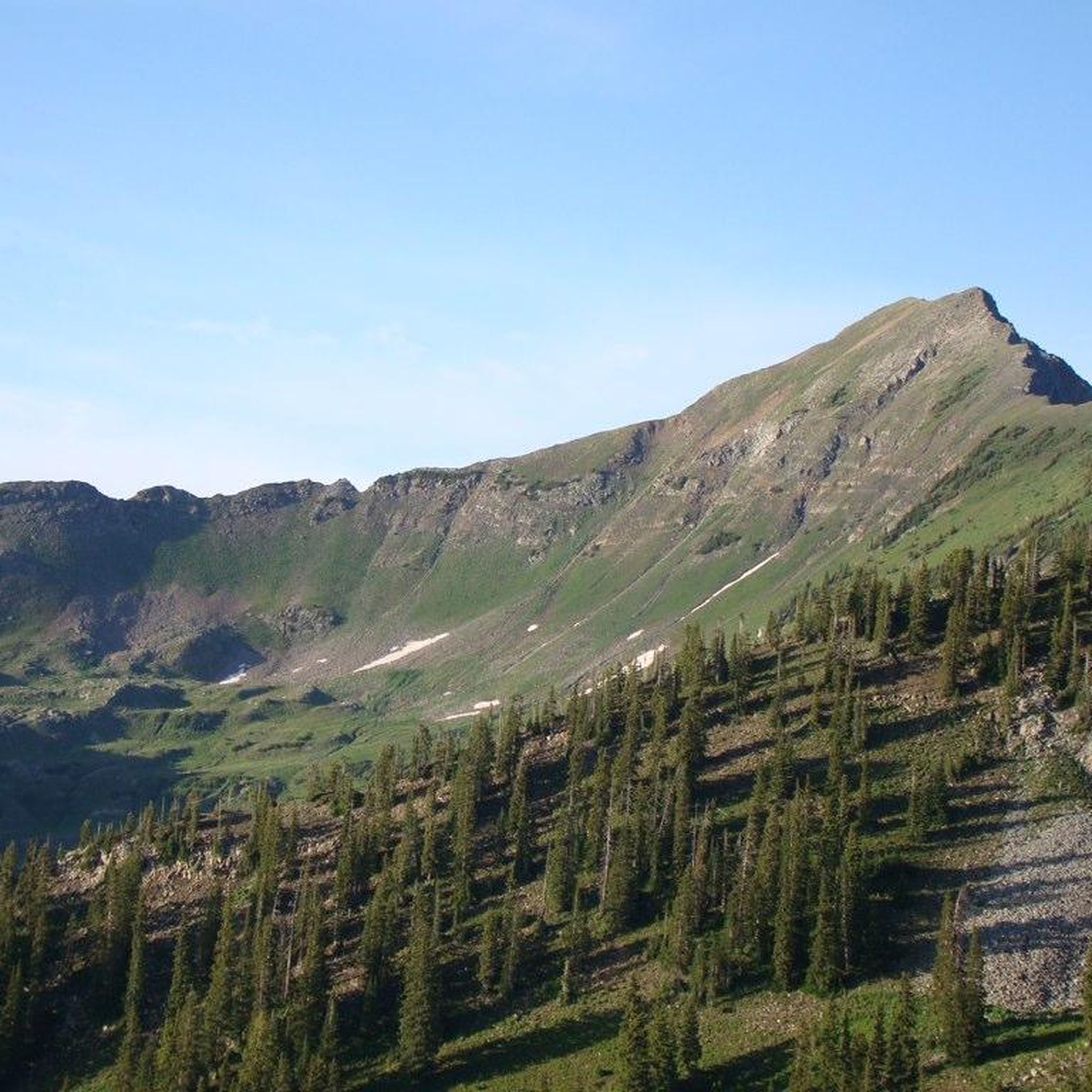
Prepare for a challenging jogging experience on the Scarp Ridge Loop Trail, a difficult route that covers 3.9 miles (6.3 km). You will ascend a significant 1327 feet (404 metres) in elevation, with an estimated duration of 1 hour and 44 minutes. This trail quickly becomes steep, rewarding your effort with spectacular 360-degree views from the ridgeline, where you can spot landmarks like Lake Irwin and the Anthracite Range. During summer, you will jog through hillsides often covered in vibrant wildflowers, adding to the continuous dramatic scenery.
When planning your visit, remember that this route involves high altitude and substantial elevation gain. It is wise to start your jog early in the day to avoid the common afternoon thunderstorms. The trail features primitive singletrack sections along the ridge, which are both steep and rocky, so be sure to wear supportive trail shoes. While no specific permits or fees are noted, prepare for a rigorous outing that demands good physical condition.
This loop offers a truly rewarding experience for those seeking a strenuous workout amidst stunning natural beauty. The continuous climbs and varied terrain make it a notable option in the Gunnison National Forest. You will find yourself immersed in an environment where every turn reveals a new vista, making the effort worthwhile. The views extend to distant peaks like Mt. Owen and Ruby Peak on clear days, highlighting the expansive wilderness of the area.

Sign up for free
19.6km
02:45
700m
700m
Jog the difficult Oh-Be-Joyful Trail 836 for 12.2 miles (19.6 km) through Gunnison National Forest, gaining 2296 feet (700 metres).
5
runners
19.7km
02:38
730m
720m
Prepare for a challenging jogging experience on the Lead King Basin Loop, a difficult route stretching 12.2 miles (19.7 km). As you navigate this trail, you will encounter diverse landscapes, from dense forests to expansive valleys and open mountain areas. The route offers panoramic views, especially between the four and seven-mile marks, providing a sense of the vast wilderness. You will also pass the iconic Crystal Mill, nestled beside a tumbling waterfall, a striking visual landmark. This demanding loop involves a significant elevation gain of 2380 feet (725 metres), typically taking around 2 hours and 38 minutes to complete.
When planning your visit to the Lead King Basin Loop, be mindful of the seasonal conditions, as they significantly impact trail accessibility. Snow can block parts of the route well into July and reappear as early as October. For the most reliable conditions, consider jogging this trail during August and September. If you choose to go earlier in the summer, be prepared for potential stream crossings and lingering patches of snow on the path.
The Lead King Basin Loop is situated within the expansive White River National Forest, an area renowned for its natural beauty and rugged terrain. This trail offers a unique opportunity to explore a region rich in mining history, with the Crystal Mill serving as a tangible link to the past. The diverse ecosystems you will traverse, from dense woodlands to high-alpine vistas, showcase the varied natural environment of this part of Colorado.
3.25km
00:24
20m
20m
Jog the easy 2.0-mile Lake Irwin Loop Trail in Gunnison National Forest, offering scenic lake and mountain views in just 23 minutes.
Get access to more routes and recommendations from other explorers.
Sign up for free
Already have an account?
Our route recommendations are based on thousands of hikes, rides, and runs completed by other people on komoot.
Start today with a free account
Your next adventure awaits.
Login or Signup
Popular around Raggeds Wilderness
Tips from the Community

The Crystal Mill located just outside of Marble is an old powerhouse that was constructed in the 1890s. It's right off the side of the forest road that you run on, so it's pretty much impossible to pass without catching your eye. There is a lot of history in this part of the mountains, and the remnants of these old mines and mills is a reminder of tougher times.
0
0
Beaver Lake is a large, popular lake in Marble, Colorado. You can swim and fish in the lake (it's cold, though), and you can follow the service road that passes by it and check out more of the natural and historical features along the Crystal City Road.
0
0
Beaver Lake is a large, popular lake in Marble, Colorado. You can swim and fish in the lake (it's cold, though), and you can follow the service road that passes by it and check out more of the natural and historical features along the Crystal City Road.
0
0
With camping, fishing, and restrooms available at this small alpine reservoir, Lake Irwin is a popular spot for outdoor enthusiasts to visit. You can hike up in the mountains on challenging singletrack trails and OHV roads, or you can hike on the flatter nature trail around the lake, itself. This is also the site of Marcellina Pass at 10,325 feet.
0
0
The Crystal Mill located just outside of Marble is an old powerhouse that was constructed in the 1890s. It's right off the side of the forest road that you hike (or drive) on, so it's pretty much impossible to pass without catching your eye. There is a lot of history in this part of the mountains, and the remnants of these old mines and mills is a reminder of tougher times.
0
0
Lizard Lake is a small lake in the mountains of Marble, Colorado. The lake is situated off the side of an old forest service road that leads to the historic Crystal Mill. The lake was named Lizard Lake even though it was the abundance of salamanders that gave the reservoir its name.
0
0
The Crystal Mill located just outside of Marble is an old powerhouse that was constructed in the 1890s. It's right off the side of the forest road that you run on, so it's pretty much impossible to pass without catching your eye. There is a lot of history in this part of the mountains, and the remnants of these old mines and mills is a reminder of tougher times.
0
0
Lizard Lake is a small lake in the mountains of Marble, Colorado. The lake is situated off the side of an old forest service road that leads to the historic Crystal Mill. The lake was named Lizard Lake even though it was the abundance of salamanders that gave the reservoir its name.
0
0
Frequently Asked Questions
What is the overall difficulty level of running routes in Raggeds Wilderness?
Raggeds Wilderness is known for its challenging terrain. Out of 34 running routes, 29 are classified as difficult, offering significant elevation changes and rugged paths. There are also 4 moderate routes and 1 easy route, providing options for various skill levels.
Are there any easy running trails suitable for beginners or a more relaxed jog?
Yes, while most routes are challenging, there is one easy running trail available. The Lake Irwin Loop Trail is a great option for a more relaxed jog, offering a gentler experience around the lake.
What are the best seasons for jogging in Raggeds Wilderness?
The best seasons for jogging in Raggeds Wilderness are typically late spring, summer, and early fall. During these months, trails are generally free of snow, and the weather is more favorable for outdoor activities. Winter running can be challenging due to heavy snowfall and icy conditions, requiring specialized gear and experience.
Are there any circular running routes in Raggeds Wilderness?
Yes, several routes in Raggeds Wilderness offer a loop experience. A notable example is the challenging Scarp Ridge Loop Trail, which provides panoramic vistas as it ascends Scarp Ridge. Another option is the easy Lake Irwin Loop Trail.
What kind of scenic views can I expect on the running trails?
Jogging routes in Raggeds Wilderness offer diverse and breathtaking scenery. You can expect high mountain ridges, pristine alpine lakes, and extensive trail networks that wind through forested sections and open areas. Routes like the Beaver Lake & Lizard Lake via Crystal City Road trail run provide beautiful lake views, while the Scarp Ridge Loop Trail offers expansive panoramic vistas.
Are there any family-friendly running options in the area?
For families looking for a less strenuous running experience, the Lake Irwin Loop Trail is an excellent choice. It's classified as easy and offers a pleasant, shorter distance suitable for various ages and fitness levels.
What should I wear for running in Raggeds Wilderness?
Given the significant elevation changes and varied terrain, it's advisable to wear layers, even in warmer months, as mountain weather can change quickly. Sturdy trail running shoes with good grip are essential for navigating rocky or uneven paths. Always check the weather forecast before heading out.
Are dogs allowed on the running trails in Raggeds Wilderness?
Raggeds Wilderness is part of the National Wilderness Preservation System, which generally allows dogs on trails, but they must be kept on a leash to protect wildlife and ensure a pleasant experience for all users. Always practice Leave No Trace principles and pack out all waste.
How many running routes are available in Raggeds Wilderness?
There are over 30 dedicated running routes available in Raggeds Wilderness. The komoot community has mapped 34 distinct routes, ranging from easy lakeside paths to challenging, long-distance mountain trails.
What do other runners think about the trails in Raggeds Wilderness?
The running routes in Raggeds Wilderness are highly rated by the komoot community, with an impressive average score of 5.0 stars. More than 170 runners have used komoot to explore the varied terrain, often praising the challenging nature and stunning natural beauty of the trails.
Are there any longer, more challenging running routes for experienced runners?
Absolutely. For experienced runners seeking a significant challenge, routes like the Oh-Be-Joyful Trail 836, at 12.2 miles (19.6 km) with substantial elevation gain, or the Lead King Basin Loop, which is nearly 20 km, offer demanding and rewarding experiences through the wilderness.
Where can I find trailheads and parking for these running routes?
Trailheads for routes in Raggeds Wilderness are typically located at various access points around the wilderness boundary. Specific parking information can often be found on individual route pages on komoot. It's recommended to check the route details for the specific trail you plan to run for the most accurate trailhead and parking guidance.
Most popular routes in Raggeds Wilderness

Get inspired with the komoot mobile app


Explore more
Browse the best Running Trails & Routes in other regions.
