The best MTB trails in Raggeds Wilderness
5.0
(6)
1,084
riders
36
rides
Mountain biking in Raggeds Wilderness offers a diverse landscape for riders. The region is characterized by its mountainous terrain, featuring dense aspen and conifer forests, as well as open basins and high mountain passes. Trails often navigate through varied elevations, providing both challenging climbs and exhilarating descents. This area in Gunnison County is known for its natural beauty and provides a rugged backdrop for mountain biking.
Best mountain bike trails in Raggeds Wilderness
- The most popular mountain bike trail is Dyke Trail loop, a 12.3 miles (19.7 km) trail that takes 2 hours 16 minutes to complete. This difficult route offers varied terrain through forested areas.
- Another top favourite among local mountain bikers is Lead King Basin Loop, a moderate 12.2 miles (19.7 km) path. This route explores a scenic basin with views of the surrounding mountains.
- Local mountain bikers also love the Aspen Forest Trail loop from Oh-Be-Joyful Campground, a 6.5 miles (10.5 km) trail leading through aspen forests, often completed in about 1 hour 7 minutes.
- Mountain biking in Raggeds Wilderness is defined by aspen forests, mountain basins, and high passes. The network offers options for easy, moderate, and difficult ability levels.
- The routes in Raggeds Wilderness are highly rated by the komoot community with an average score of 5.0 stars from over 10 reviews. More than 1000 mountain bikers have used komoot to explore Raggeds Wilderness's varied terrain.
Last updated: June 24, 2026
20
riders
19.7km
02:16
630m
620m
Embark on the Dyke Trail loop for a challenging mountain biking experience through Colorado's stunning high country. This difficult route spans 12.3 miles (19.7 km) and climbs 2057 feet (627 metres), offering a diverse ride through vast aspen groves and past the impressive Grand Dyke formation. You'll navigate a mix of smooth singletrack, technical descents, and demanding 'power climbs' that might have you walking your bike in spots, all while enjoying views towards Lake Irwin, Ruby Peak, and Mount Owen. It's a classic Crested Butte ride that promises a sense of seclusion at high elevation.
Plan for a ride lasting around 2 hours and 15 minutes, keeping in mind the varied terrain and significant elevation gain. The trail is generally considered moderate to advanced, so be prepared for its demands. If you're looking to avoid the busier Kebler Pass Road for part of your return, consider utilizing the new Kebler Wagon Trail as an alternative singletrack option.
This loop takes you deep into the Gunnison National Forest, where the aspen groves are particularly vibrant in the fall, creating a memorable backdrop for your adventure. The route's namesake, the Grand Dyke formation, is a notable geological feature that adds to the unique character of the landscape. It's a ride that truly immerses you in the natural beauty and ruggedness of the region.
1
riders
19.7km
02:23
720m
720m
Tackle the moderate 12.2-mile Lead King Basin Loop mountain biking trail, featuring rugged jeep roads, alpine views, and the historic Crysta

Sign up for free
9
riders
10.5km
01:06
250m
250m
Hard mountain bike ride. Great for any fitness level. Advanced riding skills necessary. Some portions of the route may require you to push your bike.
51
riders
Hard mountain bike ride. Great for any fitness level. Advanced riding skills necessary. Some portions of the route may require you to push your bike.
8
riders
49.7km
04:59
1,170m
1,170m
Hard mountain bike ride. Very good fitness required. Advanced riding skills necessary. Some portions of the route may require you to push your bike.
Get access to more routes and recommendations from other explorers.
Sign up for free
Already have an account?
Our route recommendations are based on thousands of hikes, rides, and runs completed by other people on komoot.
Start today with a free account
Your next adventure awaits.
Login or Signup
Tips from the Community

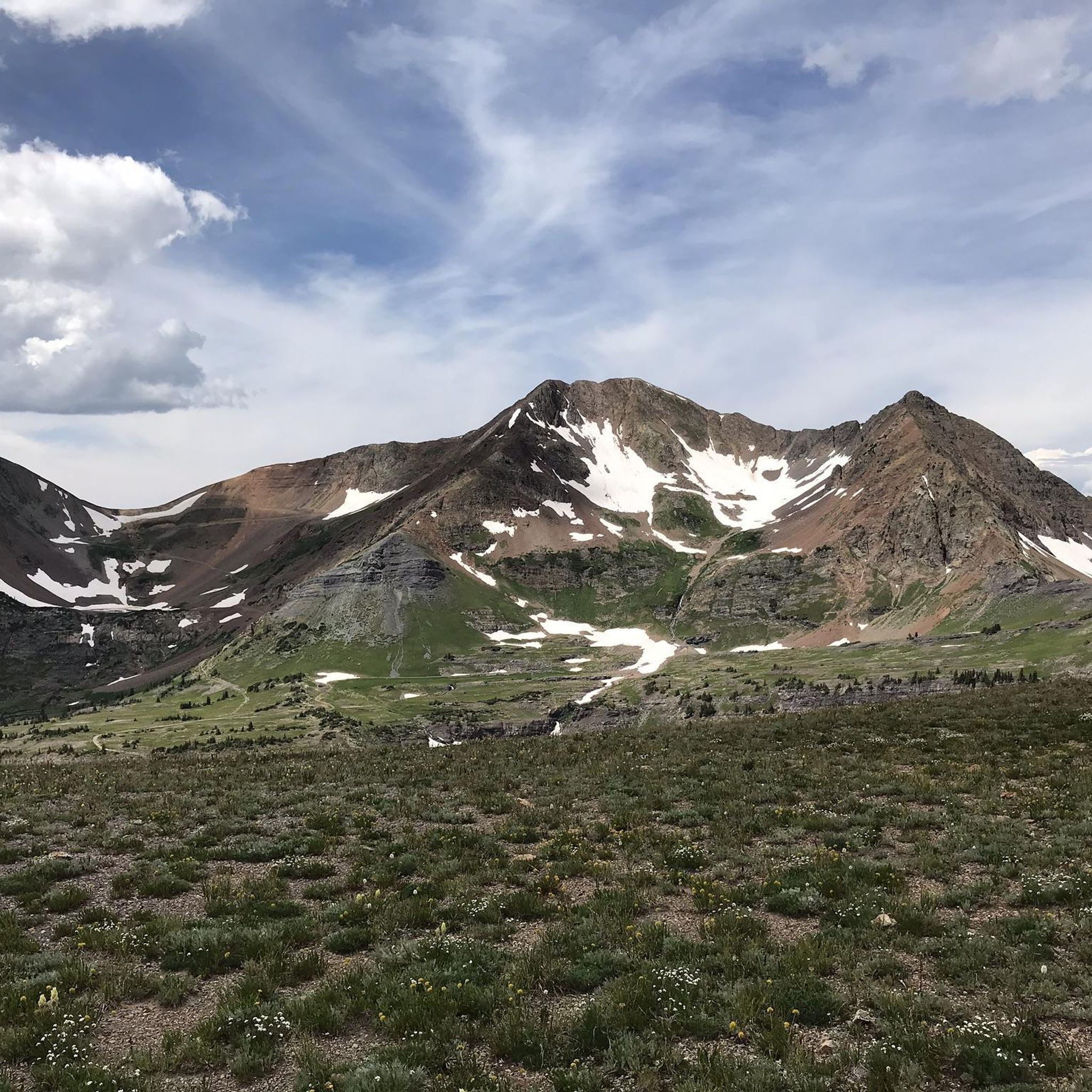
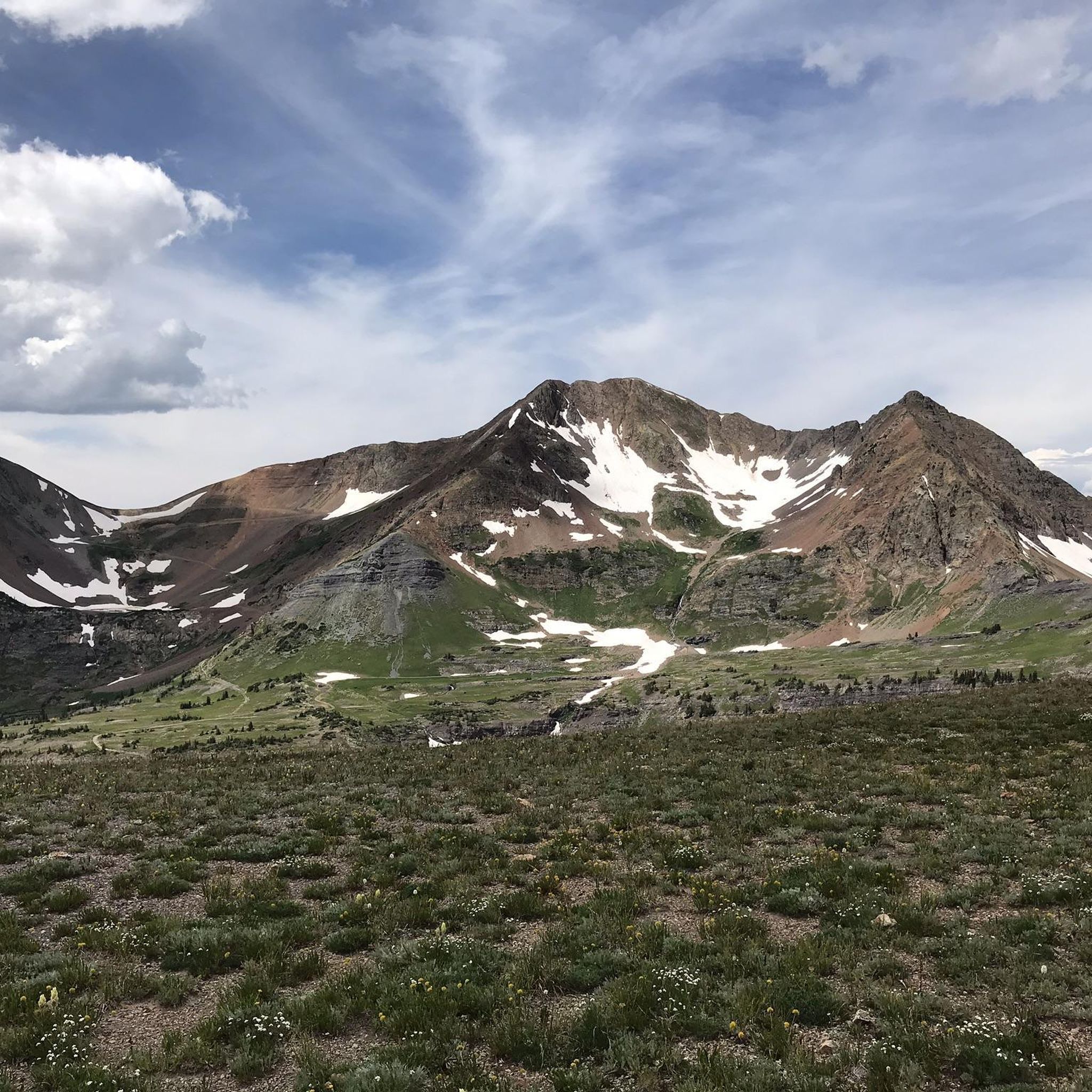
Its red sedimentary rocks contrast with gray volcanic rocks, showing millions of years of Earth's changes. It stands tall, reaching over 12,600 feet.
0
0

Woods Walk Trail is an easy trail open to both mountain bikers and foot-traffic. The trail can get crowded on weekends and summer afternoons, but it's worth the people-dodging if you just want to ride an easy trail with lots of views.
0
0
The Crystal Mill located just outside of Marble is an old powerhouse that was constructed in the 1890s. It's right off the side of the forest road that you run on, so it's pretty much impossible to pass without catching your eye. There is a lot of history in this part of the mountains, and the remnants of these old mines and mills is a reminder of tougher times.
0
0

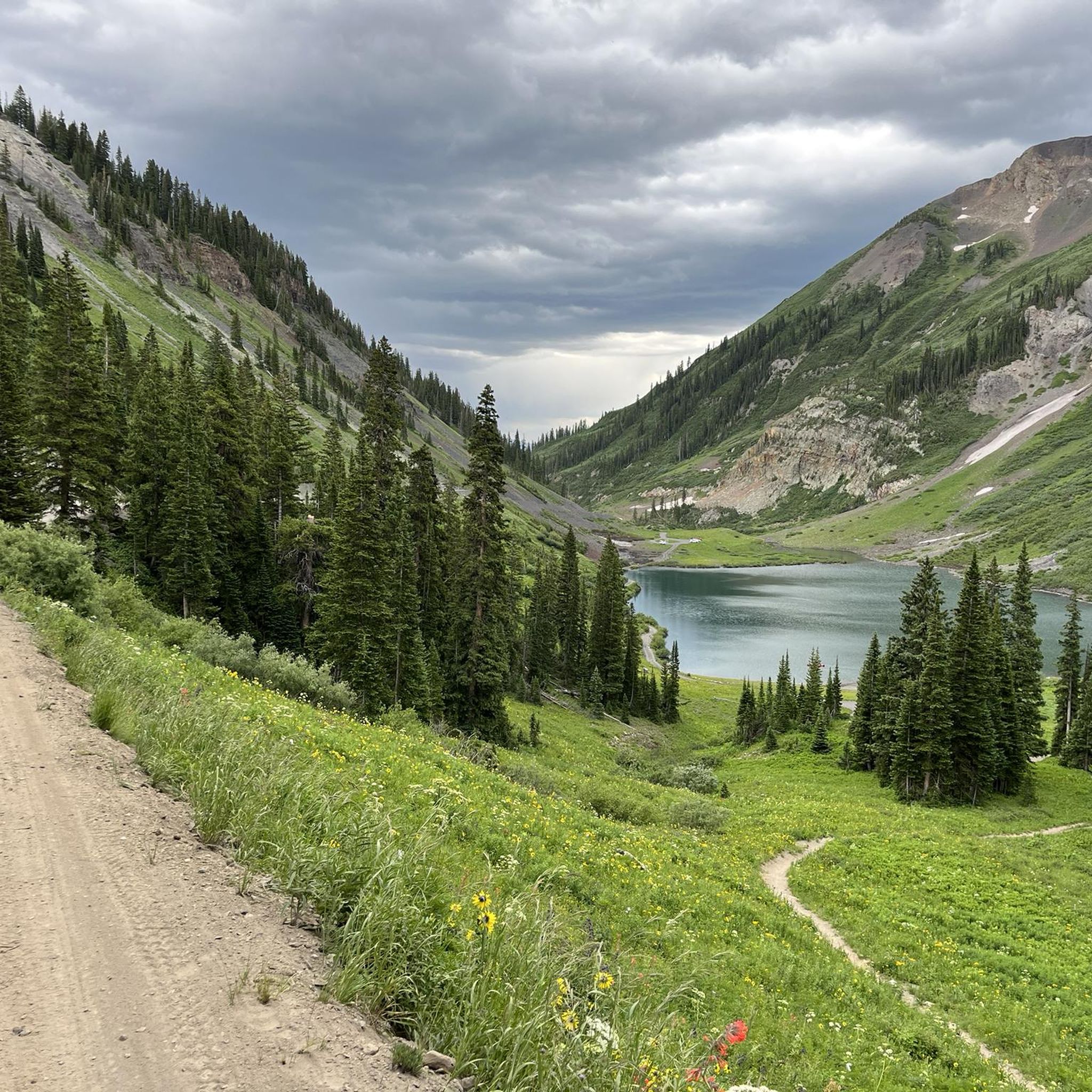
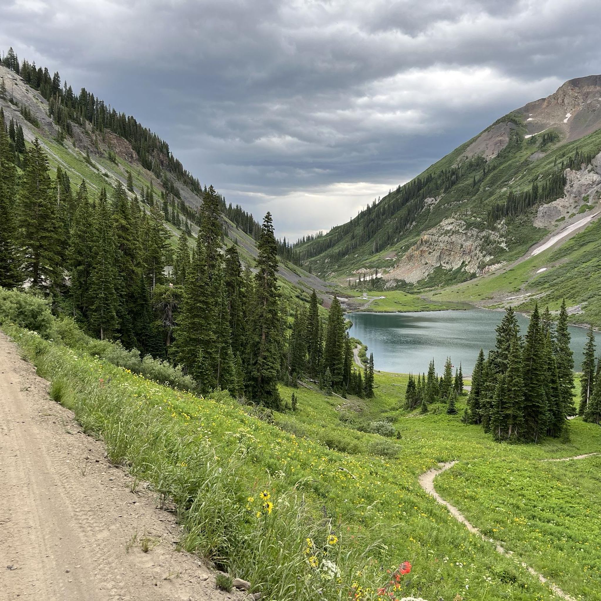
Peanut lake is located right outside of Crested Butte on Peanut Lake Road. It's a stunning alpine lake with great views of the Crested Butte Mountains.
0
0

The Dyke Trail has a little bit of everything on it, from smooth flowy single track, loose technical descents, old growth aspen groves, water crossings and stellar views.
0
0
The Crystal Mill located just outside of Marble is an old powerhouse that was constructed in the 1890s. It's right off the side of the forest road that you hike (or drive) on, so it's pretty much impossible to pass without catching your eye. There is a lot of history in this part of the mountains, and the remnants of these old mines and mills is a reminder of tougher times.
0
0
The Crystal Mill located just outside of Marble is an old powerhouse that was constructed in the 1890s. It's right off the side of the forest road that you run on, so it's pretty much impossible to pass without catching your eye. There is a lot of history in this part of the mountains, and the remnants of these old mines and mills is a reminder of tougher times.
0
0

Frequently Asked Questions
What is the overall difficulty level of mountain biking in Raggeds Wilderness?
Raggeds Wilderness offers a wide range of mountain biking trails suitable for various skill levels. Out of 36 available routes, 18 are classified as difficult, 16 as moderate, and 2 as easy. This diverse selection ensures options for both experienced riders seeking a challenge and those looking for a more relaxed ride.
Are there any family-friendly mountain bike trails in Raggeds Wilderness?
While many trails in Raggeds Wilderness are moderate to difficult, there are a couple of easier options available. For families or beginners, it's best to look for routes specifically marked as 'easy' to ensure a comfortable and enjoyable experience. Always check the trail details for elevation gain and technical features before heading out.
What is the typical length of mountain bike trails in Raggeds Wilderness?
Trail lengths vary significantly. For example, the Aspen Forest Trail loop from Oh-Be-Joyful Campground is about 6.5 miles (10.5 km), while longer routes like the Dyke Trail loop extend to 12.3 miles (19.7 km). The longest route available is the 403 Trail (downhill section) – Schofield Pass Road loop from Snodgrass West Trailhead, which is approximately 30 miles (48 km).
Are there any loop mountain bike trails in Raggeds Wilderness?
Yes, many of the mountain bike trails in Raggeds Wilderness are designed as loops, offering a continuous riding experience without needing to retrace your path. Popular loop options include the Lead King Basin Loop and the Crested Butte Downtown – Views of Mt. Crested Butte loop from Smith Hill Mine.
What is the best time of year for mountain biking in Raggeds Wilderness?
The best time for mountain biking in Raggeds Wilderness is typically from late spring through early fall (June to September), when trails are clear of snow and weather conditions are most favorable. Always check local trail conditions and weather forecasts before planning your ride, as high-elevation areas can retain snow later into the season.
What kind of wildlife might I encounter on the trails?
Raggeds Wilderness is home to diverse wildlife. Riders might spot deer, elk, marmots, and various bird species. Bear and mountain lion sightings are less common but possible. It's always advisable to carry bear spray, make noise on the trails, and store food properly to minimize encounters.
Are permits required for mountain biking in Raggeds Wilderness?
Generally, permits are not required for day-use mountain biking on established trails within Raggeds Wilderness. However, it's always a good practice to check with the local Forest Service office or land management agency for the most current regulations, especially if you plan to camp or ride in specific designated areas.
Where can I find parking for mountain bike trails in Raggeds Wilderness?
Parking availability varies by trailhead. Many popular trailheads, such as those near Oh-Be-Joyful Campground or Snodgrass West Trailhead, offer designated parking areas. It's recommended to research specific trailheads in advance to confirm parking options and any potential fees.
What should I wear for mountain biking in Raggeds Wilderness?
Given the varied terrain and elevations, layering is key. Wear moisture-wicking base layers, a mid-layer for warmth, and a wind/waterproof outer shell. A helmet, gloves, and appropriate mountain biking shoes are essential. Don't forget sunglasses, sunscreen, and plenty of water.
What do other mountain bikers enjoy most about Raggeds Wilderness?
The area is highly rated by the komoot community, with an average score of 5.0 stars from over 10 reviews. Reviewers often praise the stunning natural beauty, the challenging climbs rewarded with exhilarating descents, and the immersive experience of riding through dense aspen and conifer forests.
Are there any hidden gem mountain bike trails in Raggeds Wilderness?
While the popular routes are well-loved, exploring some of the less-trafficked moderate or difficult trails can reveal hidden gems. These often offer a more secluded experience with equally breathtaking views of the mountainous terrain and open basins. Komoot's detailed maps can help you discover these less-known paths.
Are there any cafes or services near the mountain biking areas?
Raggeds Wilderness is a remote area, so services like cafes are not directly on the trails. The nearest towns, such as Crested Butte, offer a variety of dining and supply options. It's crucial to carry all necessary provisions, including food and water, for your ride.
Most popular routes in Raggeds Wilderness

Get inspired with the komoot mobile app


Explore more
Browse the best MTB trails in other regions.
