Attractions and Places To See in Desolation Wilderness - Top 20
Best attractions and places to see in Desolation Wilderness, a federally protected area spanning over 63,000 acres west of Lake Tahoe, features rugged alpine terrain and glacially-formed valleys. The region is characterized by numerous pristine lakes and prominent granite formations. Visitors can explore a variety of natural wonders, notable landmarks, and historical points of interest within its boundaries.
Best attractions and places to see in Desolation Wilderness
- The most popular attractions is Eagle Lake (Desolation Wilderness), a lake that is only 5 miles into the wilderness from the Eagle Falls trailhead. It is known for its clear waters and forested shorelines.
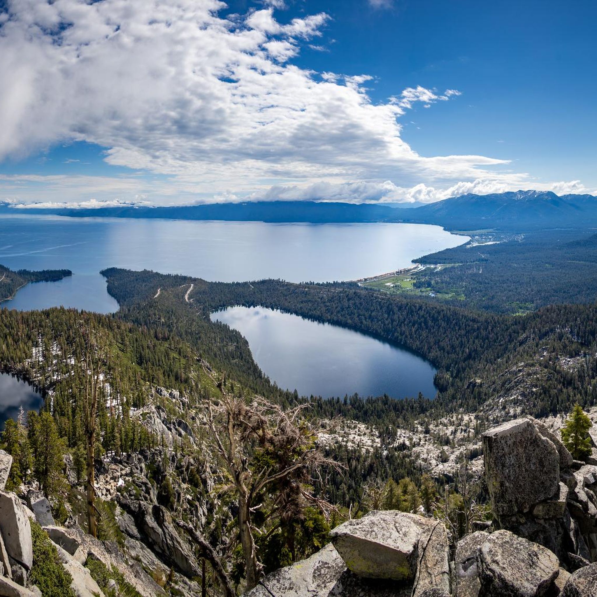
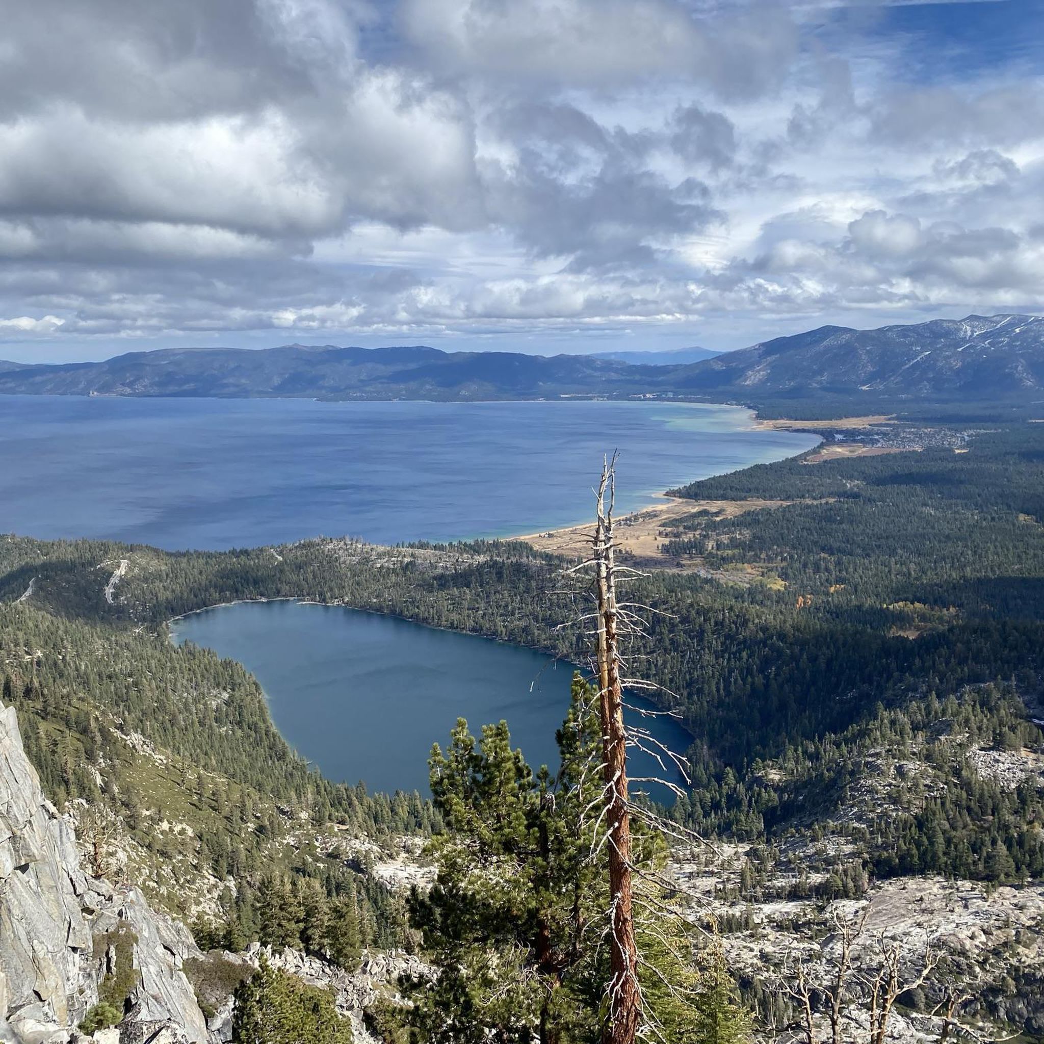
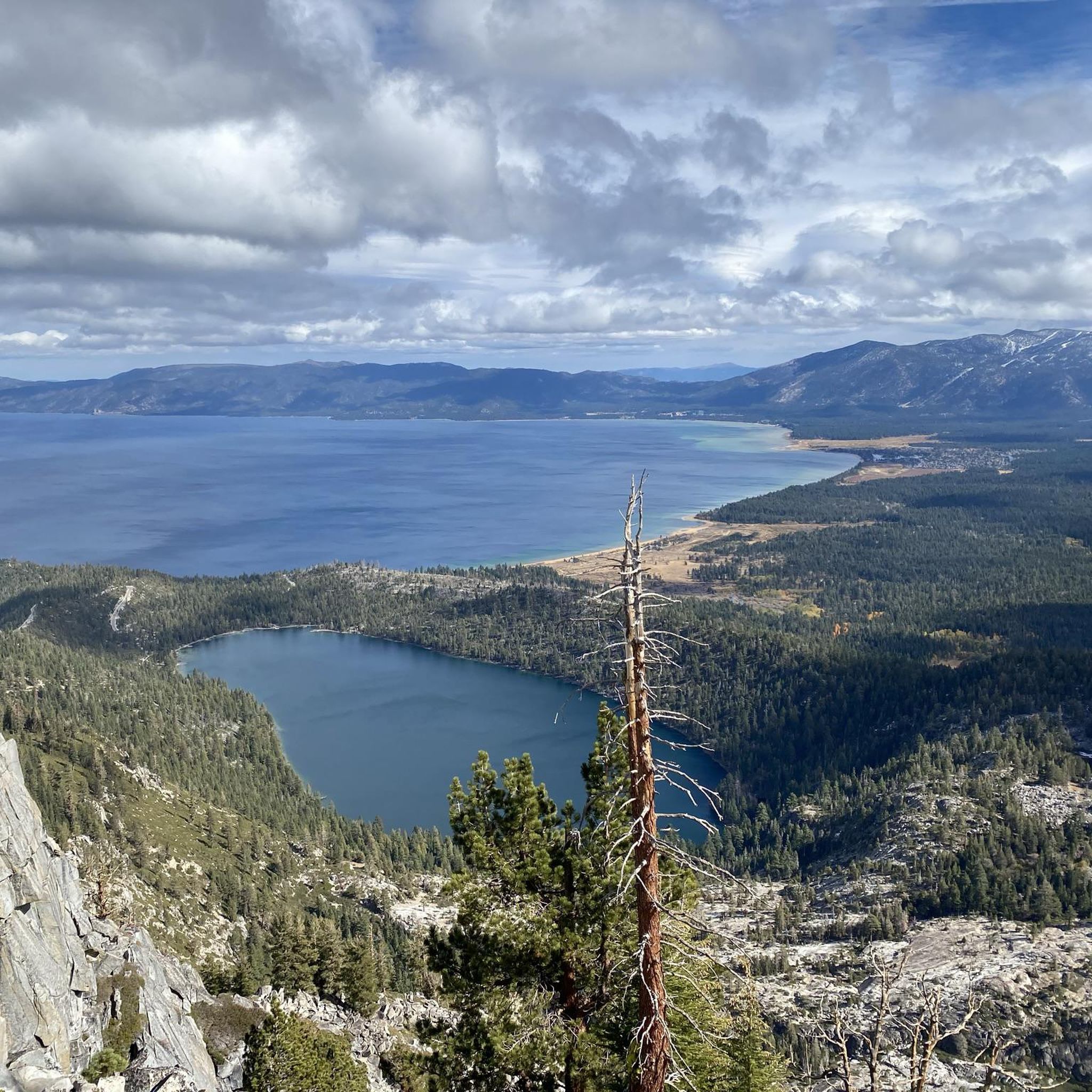
- Another must-see spot is Granite Lake, a lake located at the base of Maggies Peaks. The trail to Granite Lake offers views of Emerald Bay and the surrounding Desolation Wilderness.
- Visitors also love Upper Eagle Falls, a waterfall that is a short walk from the Eagle Lake Trailhead. This 50-foot waterfall is easily accessible.
- Desolation Wilderness is known for its alpine lakes, prominent summits, and scenic waterfalls. The area offers a variety of natural attractions to explore, from high mountain peaks to extensive trail systems.
- The attractions in Desolation Wilderness are appreciated by the komoot community, with more than 30 upvotes and 25 photos shared by visitors.
Last updated: June 23, 2026
Eagle Lake (Desolation Wilderness)
Highlight • Lake
Dicks and Fontanillis lakes are separated by only about a third of a mile. Both lakes press up against 9,374-foot Dicks Peak. Nearby are the Velma Lakes, a cluster of 3 great fishing lakes that draw the majority of campers who come up the trail from Tahoe.
Eagle Falls Trailhead to Bayview Trail Junction, 2.7 miles
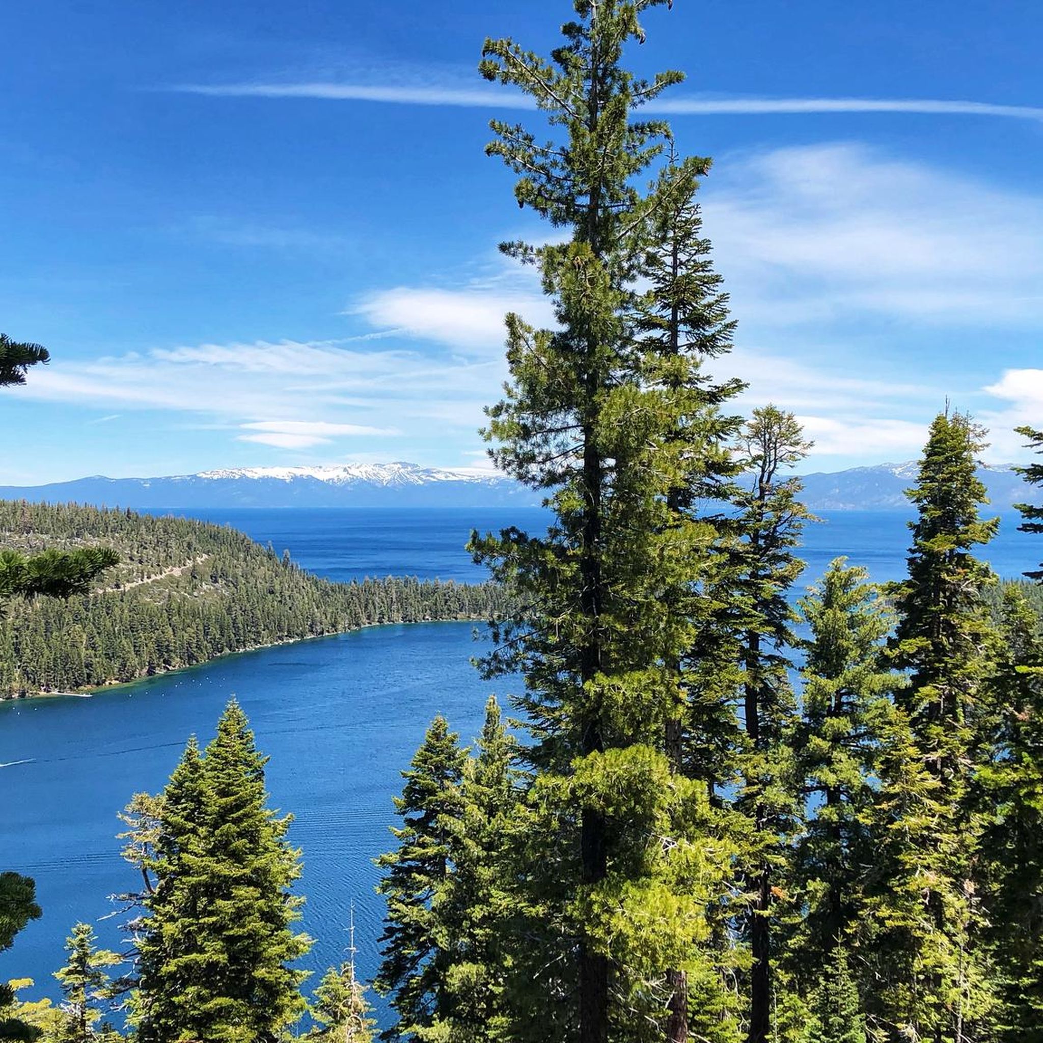
From the Eagle Falls trailhead the hike up to and across a bridge and then begin a steady climb. Stop half way up to catch a view of Emerald Bay. In less than a mile, a side trail splits off to Eagle Lake. Take the Velma Lakes trail.
Despite occasional dips and level spots, most of the hike is uphill, many parts of it with steps. After 2.7 miles arrive at a ridge top and an intersection with the Bayview trail.
Velma Lakes
Bayview Trail to Dicks Lake or Fontanillis Lake,
1.75 miles or 2.5 miles
Continue toward Velma Lakes for 0.7 miles until you spot a trail sign which points you toward Dicks Lake. The trail soon climbs again with switchbacks. Look for views of Velma Lakes to the north. After a mile you strike the Pacific Crest Trail. There, turn right, heading southwest. Very soon, where the trail loops back to the north, you will spy Dicks Lake off through the trees. Follow a short side trail to the lake. By continuing north on the main hiking trail for 0.75 miles you arrive at half-mile-long Fontanillis Lake. Both make excellent places to camp.
highsierratrails.com/fontanillis_dicks_lakes/trail.html
en.wikipedia.org/wiki/Desolation_Wilderness
Tip by

Granite Lake
Highlight • Lake
From the Bayview Trailhead (about 2100 m) head northwest from the trailhead sign board. The trail will climb steeply the entire way. You will pass a great viewpoint for views of Emerald Bay before reaching Granite Lake. The trail continues to climb after Granite Lake before reaching the ridge crest giving you a view of Eagle lake off the back side. To summit South Maggies Peak continue on the trail a short 100 yards after reaching the ridge and then turn off trail and scramble up the back side of the peak. There is a faint trail but its hard to find from the trail and can be found for the return trip off the summit.
You can create a loop hike by combining this hike with Eagle Falls and Eagle Lake. Once you reach the ridge just below South Maggies peak. Continue up the trail along the ridge. At the next trail junction turn right onto the Eagle Falls Trail.
A wilderness permit is needed to hike to both Granite Lake and Maggies Peaks. Wilderness permits are available for free at the trailhead.
How to get there:
From South Lake Tahoe: head north on highway 89 for 7.5 miles. Turn left into Bayview Campground opposite Inspiration Point which is the scenic overlook located one mile before you get to Emerald Bay. A wooden sign points right to the trailhead on the backside of the campground.
From Tahoe City: head south on highway 89 for 19.5 miles. Turn right into Bayview Campground opposite Inspiration Point which is the scenic overlook located one mile before you get to Emerald Bay. A wooden sign points right to the trailhead on the backside of the campground.
trailwiki.org/wiki/Granite_Lake_and_Maggies_Peaks
Tip by
Sign up now to discover places like this
Get recommendations on the best single tracks, peaks, & plenty of other exciting outdoor places.
Sign up for free
Mount Tallac Summit
Highlight • Summit
Tip by

Upper Eagle Falls
Highlight • Waterfall
Tip by

Fontanillis Lake
Highlight • Lake
Tip by

Sign up for free to discover even more attractions in Desolation Wilderness.
Sign up for free
Already have an account?
Start today with a free account
Your next adventure awaits.
Login or Signup
Popular around Desolation Wilderness

Tahoe Rim Trail — Hiking along the Jewel of the Sierra

Circumnavigating Lake Tahoe in the Sierra Nevada – Tahoe Rim Trail
Hiking in Desolation Wilderness
Cycling in Desolation Wilderness
Running Trails in Desolation Wilderness
Road Cycling Routes in Desolation Wilderness
MTB Trails in Desolation Wilderness


Tips from the Community

During our hike in mid October, we couldn’t see the waterfall as it was almost dried up. Considering the height of the bridge it must look stunning after the raining season.
0
0

A stunning alpine lake surrounded by granite peaks, offering breathtaking scenery and a serene atmosphere. Enjoy the clarity of the lake, ideal for fishing, or simply admiring its beauty.
1
0

This backcountry gem is right on the path to and from Maggie's Peaks — a great opportunity to take a relaxing dip or just enjoy the beauty if you want to keep running past.
0
0

Upper Eagle Falls is a 50-foot waterfall in Lake Tahoe Basin Management Unit. The falls are only a short distance to a parking lot, so it is very accessible. This also means that during high season, the falls can be very busy.
0
0
This pretty, 50-foot waterfall is just a 5-minute walk or so from the Eagle Lake Trailhead — but as you might imagine, that gets pretty busy. If that trailhead is full, you can often find parking at the Vikingsholm Trailhead a little farther up the road.
0
0

Mount Tallac, standing at 9,735 feet, is a stunning peak located just three miles from Lake Tahoe's edge. It offers some of the best views of the Tahoe Basin, thanks to its proximity to other lakes and the picturesque Emerald Bay. Situated between Fallen Leaf Lake and Emerald Bay, Mount Tallac is part of the Desolation Wilderness, a beautiful expanse of alpine peaks and valleys near South Lake Tahoe.
0
0

It is possible to stop for a swim in this like, very nice on the way down from Maggie’s peak
0
0
Eagle lake is worth the way up… you can see birds and it’s really charming. And you can swim easily in it, which is absolutely amazing on the way down from a long hike in the Desolation Wilderness…
0
0
Frequently Asked Questions
What are the most notable natural features and landmarks in Desolation Wilderness?
Desolation Wilderness is renowned for its rugged alpine terrain and glacially-formed valleys. Key natural features include over 130 alpine lakes such as Eagle Lake (Desolation Wilderness), Lake Aloha, and Fontanillis Lake. Prominent peaks like Mount Tallac Summit and Pyramid Peak offer breathtaking views, while Horsetail Falls provides a dramatic natural spectacle. You'll also find unique glacial features like polish and erratics, alongside subalpine forests and meadows.
What is the best time of year to visit Desolation Wilderness?
The best time to visit Desolation Wilderness for hiking and exploring is typically from late spring through early fall, when trails are mostly clear of snow and the weather is mild. Summer offers the warmest temperatures for lake activities, while fall brings vibrant colors and fewer crowds. Winter access is limited due to heavy snow.
Are there family-friendly activities or easy hikes in Desolation Wilderness?
Yes, there are several family-friendly options. Upper Eagle Falls is an easily accessible waterfall just a short walk from the Eagle Lake Trailhead. The trail to Eagle Lake (Desolation Wilderness) is also popular with families and casual hikers. For more easy hiking routes, you can explore the Easy hikes in Desolation Wilderness guide.
What kind of permits do I need to visit Desolation Wilderness?
A wilderness permit is required for both day use and overnight stays in Desolation Wilderness. Day use permits are often available for free at trailheads, but overnight permits, especially during peak season, must be reserved in advance. It's crucial to check the current regulations and obtain the necessary permits before your visit to ensure compliance and help preserve the wilderness.
What are some popular hiking trails in Desolation Wilderness?
Desolation Wilderness offers an extensive network of trails, including sections of the Pacific Crest Trail and the Tahoe Rim Trail. Popular routes include the hike to Granite Lake from Bayview Trailhead, or the longer trek to Fontanillis Lake. For a comprehensive list of hiking options, refer to the Hiking in Desolation Wilderness guide.
Are dogs allowed on trails in Desolation Wilderness?
Dogs are generally allowed in Desolation Wilderness, but they must be kept on a leash at all times. Owners are responsible for packing out all pet waste. Specific rules and restrictions may apply in certain areas or during certain seasons, so it's always best to check current regulations before bringing your dog.
Where can I find parking for trailheads in Desolation Wilderness?
Popular trailheads like Eagle Falls, Bayview, Echo Lakes, and Wright's Lake offer parking. However, parking lots can fill up quickly, especially during peak season and on weekends. Arriving early is recommended. Some trailheads, like Eagle Falls, may have alternative parking nearby, such as the Vikingsholm Trailhead, if the primary lot is full.
What historical or cultural sites can be found in Desolation Wilderness?
While primarily known for its natural beauty, Desolation Wilderness also holds historical significance. Evidence of temporary Washoe Indian encampments, used during summer migrations, has been found at Wright's Lake and other areas. The region also has a history of gold mining exploration and cattle grazing from the 1850s to the 1930s. Historic dams, like the first one on Lake Aloha built in 1875, also dot the landscape.
What are some of the best lakes to visit in Desolation Wilderness?
Desolation Wilderness is home to over 130 alpine lakes. Highly recommended lakes include Eagle Lake (Desolation Wilderness), known for its clear waters and forested shorelines, and Granite Lake, a 'little Tahoe gem' at the base of Maggies Peaks. Lake Aloha is another star attraction with its unique granite outcroppings, and the Velma Lakes are popular for camping and fishing.
What outdoor activities, besides hiking, can I do near these attractions?
Beyond hiking, Desolation Wilderness offers opportunities for backpacking, fishing in its numerous alpine lakes, and rock climbing on its granite formations. During winter, cross-country skiing and snowshoeing are popular, though access can be challenging. Many visitors also enjoy wild swimming in the pristine lakes during warmer months.
What are the elevation and terrain like in Desolation Wilderness?
Desolation Wilderness features rugged alpine terrain with significant elevation changes. Peaks like Mount Tallac Summit reach 9,735 feet, and Pyramid Peak is the highest at 9,985 feet. The landscape is characterized by glacially-formed valleys, granite basins, and numerous lakes. Trails can range from easy, relatively flat paths to challenging, steep climbs over rocky and uneven terrain.
Are there any less crowded trails or areas to explore in Desolation Wilderness?
While popular spots can get busy, areas like Rockbound Pass offer a less crowded experience with stunning views of the Crystal Range. Exploring trails from less-frequented trailheads or opting for longer, more challenging routes can also lead to a more solitary wilderness experience. Visiting during the shoulder seasons (late spring or early fall) can also help avoid peak crowds.
Most popular routes in Desolation Wilderness
Most popular attractions in Desolation Wilderness

Get inspired with the komoot mobile app


Explore more
Still not found the Highlight you’re looking for? See guides of the top attractions in other regions:
