The best road cycling routes around South Charleston
188
riders
19
rides
Road cycling routes around South Charleston, West Virginia, traverse a landscape characterized by rolling hills, riverfront roadways along the Kanawha River, and a mix of urban and natural elements. The area offers varied terrain, from relatively flat riverfront paths to more challenging climbs in neighborhoods like South Hills. This geography provides diverse riding experiences for road cyclists.
Best road cycling routes around South Charleston
- The most popular road cycling route is Riverfront Lawn loop from Charleston Station, a 16.9 miles (27.1 km) trail that takes 1 hour 22 minutes to complete. This route offers views along the Kanawha River.
- Another top favourite among local road cyclists is Kanawha Boulevard Trail – Henry Gassaway Davis Park loop from South Charleston, a moderate 27.6 miles (44.4 km) path. This route features varied terrain with an elevation gain of 1129 feet (344 meters).
- Local road cyclists also love the Henry Gassaway Davis Park – Kanawha Boulevard Trail loop from Charleston Station, a 33.1 miles (53.2 km) trail leading through riverfront areas and urban sections, often completed in about 2 hours 38 minutes.
- Road cycling around South Charleston is defined by riverfront roadways, rolling hills, and a blend of urban and natural environments. The network offers options for different ability levels, from easy loops to more challenging moderate routes.
- The guide includes highly-rated routes that showcase the best of the region's landscape. More than 70 road cyclists have used komoot to explore South Charleston's varied terrain.
Last updated: July 9, 2026
12
riders
Moderate road ride. Good fitness required. Mostly well-paved surfaces and easy to ride.
13
riders
Easy road ride. Great for any fitness level. Mostly well-paved surfaces and easy to ride.

Sign up for free
5
riders
The Henry Gassaway Davis Park – Kanawha Boulevard Trail loop from Charleston Station offers a fantastic road cycling experience, allowing you to explore the heart of West Virginia's capital. You'll enjoy long stretches along the Kanawha River, with views of the iconic gold-domed West Virginia State Capitol Complex and the Governor's Mansion. The route combines urban parklands with a dedicated two-lane cycle track, providing a varied and engaging ride for its 33.1 miles (53.3 km).
This moderate route involves 1783 feet (543 metres) of elevation gain, taking approximately 2 hours and 38 minutes to complete. Starting conveniently from Charleston Station, the trail is mostly well-paved, making for a smooth ride. The Kanawha Boulevard Trail section is closed to motor traffic, ensuring a safe and enjoyable journey through the city's core.
Adding a touch of history, the loop connects to Henry Gassaway Davis Park, a quiet oasis featuring an equestrian statue of its namesake, a significant figure in West Virginia's past. This route is an excellent choice for cyclists seeking a substantial workout with scenic riverfront views and a chance to see Charleston's key landmarks, making it one of the more popular cycling routes in Charleston, WV.
7
riders
52.7km
02:43
740m
740m
Moderate road ride. Good fitness required. Mostly well-paved surfaces and easy to ride.
43
riders
31.9km
01:38
360m
360m
Moderate road ride. Good fitness required. Mostly well-paved surfaces and easy to ride.
Get access to more routes and recommendations from other explorers.
Sign up for free
Already have an account?
Our route recommendations are based on thousands of hikes, rides, and runs completed by other people on komoot.
Start today with a free account
Your next adventure awaits.
Login or Signup



Tips from the Community

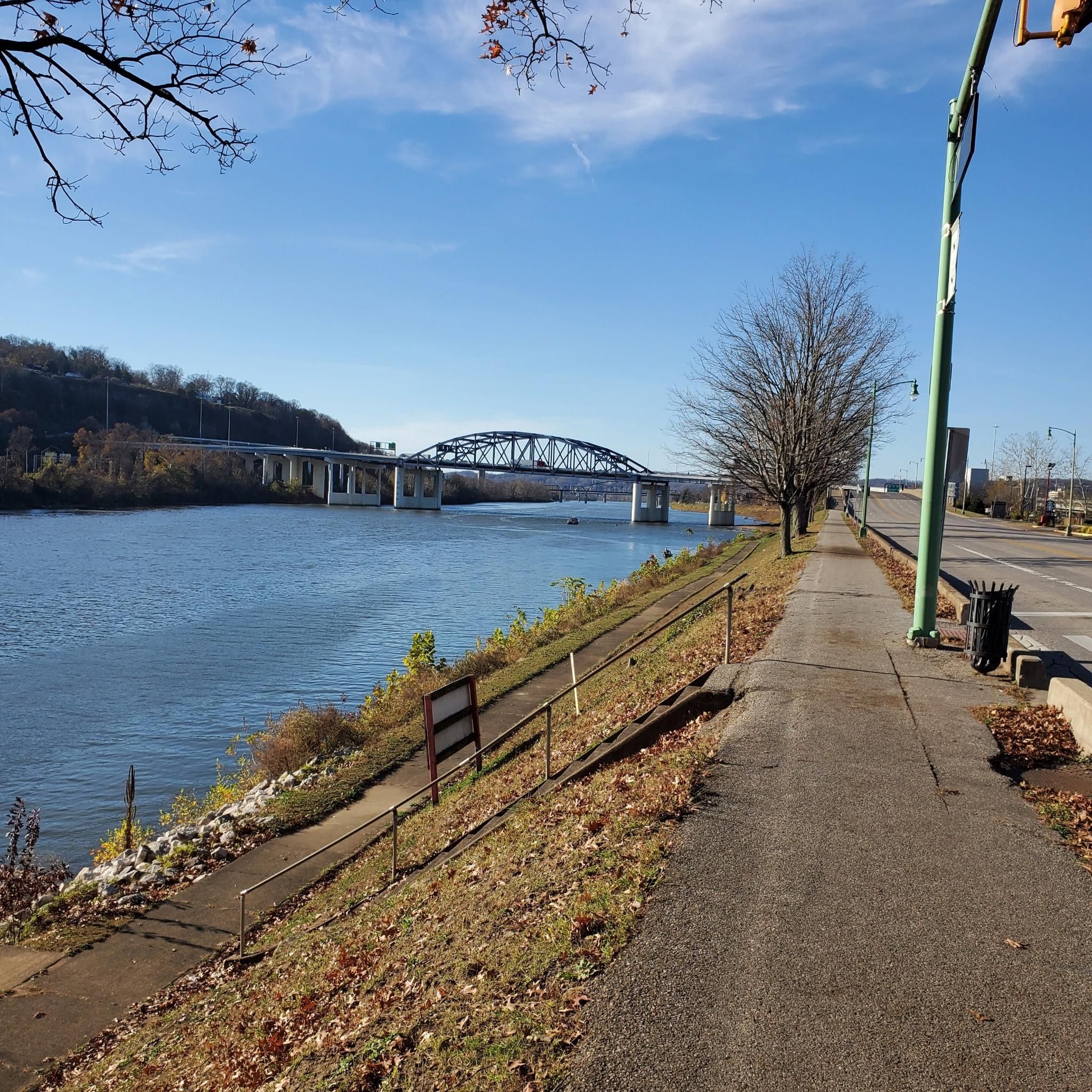
The trail is a walking and biking route through the city of Charleston, West Virginia. As it is closed to motor traffic, it is a great way to move through the city. It follows the Kanawha River.
0
0

Frequently Asked Questions
How many road cycling routes are available around South Charleston, and what are their difficulty levels?
There are over 15 road cycling routes around South Charleston. The area offers a good mix of challenges, with 6 easy routes, 11 moderate routes, and 1 difficult route, catering to various skill levels.
What kind of scenery can I expect on road cycling routes near South Charleston?
Road cycling routes around South Charleston offer diverse scenery, including picturesque riverfront roadways along the Kanawha River, rolling hills, and a blend of urban and natural environments. You'll find sections that provide views of the water and the city skyline, as well as routes that venture into more natural, hilly terrain.
Are there any family-friendly road cycling routes in the South Charleston area?
Yes, the region offers several easy road cycling routes suitable for families. These often include flatter sections along the riverfront, providing a pleasant and accessible experience. For example, the Riverfront Lawn loop from Charleston Station is an easy option that offers scenic views.
Which routes offer the most challenging climbs or significant elevation gain?
For cyclists seeking more challenging terrain, routes that venture into areas like the South Hills neighborhood are known for their steep hills and curvy roads. The Henry Gassaway Davis Park – Kanawha Boulevard Trail loop from Charleston Station, for instance, features over 500 meters of elevation gain, providing a good workout.
Are there any loop-style road cycling routes available?
Many of the road cycling routes around South Charleston are designed as loops, allowing you to start and finish at the same point. Examples include the popular Riverfront Lawn loop from Charleston Station and the more moderate Kanawha Boulevard Trail – Henry Gassaway Davis Park loop from South Charleston.
What is the best time of year for road cycling in South Charleston?
The spring and fall months generally offer the most pleasant conditions for road cycling in South Charleston, with milder temperatures and beautiful foliage. Summer can be warm and humid, while winter may present colder temperatures and potential for snow or ice, especially on less-trafficked roads.
Where can I find parking for road cycling routes in South Charleston?
Parking is typically available near popular trailheads and parks that serve as starting points for routes. For riverfront routes, you can often find parking in areas close to the Kanawha River, such as near Haddad Riverfront Park in downtown Charleston or other public access points along the boulevard.
Are there any specific landmarks or natural features to look out for while cycling?
While cycling, you'll encounter the scenic Kanawha River, which is a prominent feature of many routes. Nearby natural attractions like Little Creek Park, with its historic Devil's Tea Table rock outcrop, and the extensive Kanawha State Forest, offer additional points of interest for exploration off the bike.
What do other road cyclists enjoy most about the routes in South Charleston?
Road cyclists often praise the diverse terrain, which ranges from flat riverfront paths to challenging hills, providing varied experiences. The scenic views along the Kanawha River and the blend of urban and natural settings are frequently highlighted as enjoyable aspects of cycling in the area.
Are there any lesser-known or 'hidden gem' road cycling routes in the area?
Beyond the most popular routes, exploring the network of roads in the South Hills neighborhood can reveal quieter, more challenging rides with unique views. Routes like the Henry Gassaway Davis Park – Kanawha Boulevard Trail loop from Dunbar offer a slightly different starting point and perspective on the region's cycling potential.
Can I access road cycling routes using public transport in South Charleston?
While specific public transport access directly to all trailheads may vary, the greater Charleston area has a public transit system. Cyclists can research bus routes that may provide access to areas near the Kanawha Boulevard or other starting points for routes, though direct access might require some planning.
Are there any easy road cycling routes for beginners?
Yes, beginners can enjoy several easy routes, particularly those that follow the Kanawha River. The Riverfront Lawn loop from Charleston is an excellent choice, offering a relatively flat and manageable distance with pleasant views, ideal for those new to road cycling.
Most popular routes around South Charleston

Get inspired with the komoot mobile app


Explore more
Browse the best Road cycling routes in other regions.
