The best road cycling routes around Charleston
207
riders
18
rides
Road cycling around Charleston features routes that navigate along riverfronts and through urban parklands. The terrain includes relatively flat sections alongside waterways, interspersed with areas offering moderate elevation gains. The region is characterized by its river valleys and green spaces, providing varied landscapes for road cyclists.
Best road cycling routes around Charleston
- The most popular road cycling route is Kanawha Boulevard Trail – Henry Gassaway Davis Park loop from West Virginia State Capitol, a 24.8 miles (40.0 km) trail that takes 2 hours 10 minutes to complete. This moderate route offers a mix of urban and park scenery.
- Another top favourite among local road cyclists is Riverfront Lawn loop from Charleston Station, an easy 16.9 miles (27.2 km) path. This route provides scenic views along the riverfront.
- Local road cyclists also love the Henry Gassaway Davis Park – Kanawha Boulevard Trail loop from Snow Hill, a 33.4 miles (53.7 km) trail leading through parkland and along a boulevard, often completed in about 2 hours 51 minutes.
- Road cycling around Charleston is defined by riverfront paths, urban park loops, and routes with moderate climbs. The network offers options for easy road bike trails Charleston SC, as well as more challenging routes for advanced road cycling trails Charleston.
- The guide includes highly-rated routes that showcase the best of the region's landscape. More than 100 road cyclists have used komoot to explore Charleston's varied terrain.
Last updated: July 2, 2026
13
riders
Easy road ride. Great for any fitness level. Mostly well-paved surfaces and easy to ride.
10
riders
53.7km
02:51
330m
330m
Moderate road ride. Good fitness required. Mostly well-paved surfaces and easy to ride.

Sign up for free
9
riders
Easy road ride. Great for any fitness level. Mostly well-paved surfaces and easy to ride.
5
riders
Moderate road ride. Good fitness required. Mostly well-paved surfaces and easy to ride.
7
riders
52.7km
02:43
740m
740m
Moderate road ride. Good fitness required. Mostly well-paved surfaces and easy to ride.
Get access to more routes and recommendations from other explorers.
Sign up for free
Already have an account?
Our route recommendations are based on thousands of hikes, rides, and runs completed by other people on komoot.
Start today with a free account
Your next adventure awaits.
Login or Signup



Tips from the Community

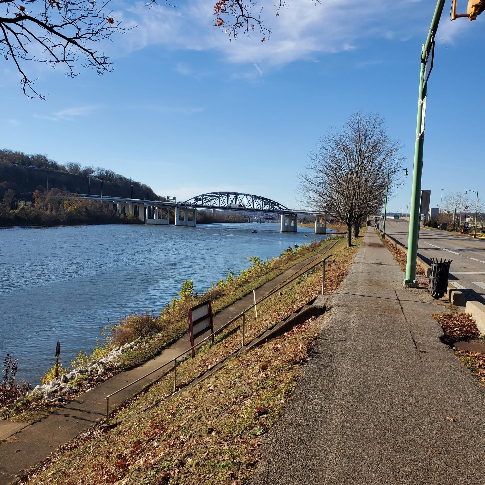
The trail is a walking and biking route through the city of Charleston, West Virginia. As it is closed to motor traffic, it is a great way to move through the city. It follows the Kanawha River.
0
0

Frequently Asked Questions
Are there easy road cycling routes suitable for beginners in Charleston?
Yes, Charleston offers several easy road cycling routes. For instance, the Riverfront Lawn loop from Charleston Station is an easy 16.9-mile path providing scenic views along the riverfront, perfect for those new to road cycling or looking for a relaxed ride. There are 5 easy routes available in total.
What is the typical length of road cycling routes in Charleston?
Road cycling routes in Charleston vary in length, generally ranging from around 11 miles (18 km) to over 33 miles (53 km). Many popular routes, like the Kanawha Boulevard Trail – Henry Gassaway Davis Park loop from West Virginia State Capitol, are about 25 miles (40 km) long, offering a good balance of distance and exploration.
Where can I find parking for road cycling routes in Charleston?
Many road cycling routes in Charleston start from accessible locations that typically offer parking. Routes often begin near landmarks such as the West Virginia State Capitol or Charleston Station, which are common points for public access and parking. It's advisable to check specific starting points for available parking facilities.
Are there any advanced or challenging road cycling routes in Charleston?
While many routes feature moderate elevation gains, Charleston does offer options for more advanced road cyclists. The region's terrain, characterized by river valleys, includes sections with more significant climbs. There is at least one difficult route among the 14 available, providing a greater challenge.
What is the best time of year for road biking in Charleston?
The best time for road biking in Charleston is generally during spring and fall when temperatures are mild and comfortable. These seasons offer pleasant weather for exploring the riverfront paths and parklands without the intense heat of summer or the chill of winter.
Are there road cycling routes in Charleston that are suitable for families?
Yes, routes with flatter sections and scenic riverfront views are well-suited for families. The Riverfront Lawn loop from Charleston Station, for example, is an easy path that provides a pleasant and manageable ride for families looking to cycle together.
Do any road cycling routes in Charleston offer scenic loops?
Charleston is known for its scenic loop trails. Many routes are designed as loops, allowing cyclists to experience varied landscapes without retracing their path. The Henry Gassaway Davis Park – Kanawha Boulevard Trail loop from Snow Hill is a prime example, offering a 33.4-mile loop through parkland and along a boulevard.
What kind of scenery can I expect on road cycling routes in Charleston?
Road cycling routes in Charleston offer a mix of urban and natural scenery. You can expect to cycle along riverfronts, through urban parklands, and past green spaces. The region's river valleys provide varied landscapes, from city views to more serene natural settings.
Are there opportunities for wildlife spotting while road biking in Charleston?
While not specifically highlighted, cycling along riverfronts and through parklands often presents opportunities to observe local wildlife. Keep an eye out for various bird species and other small animals, especially in the quieter, greener sections of routes like those near Henry Gassaway Davis Park.
What do other road cyclists enjoy most about road cycling in Charleston?
Road cyclists frequently praise Charleston's varied terrain, which includes both flat riverfront paths and sections with moderate elevation gains. The komoot community appreciates the mix of urban and park scenery, with many enjoying the well-maintained paths and the accessibility of routes starting from central locations.
Can I find road cycling routes that pass by cafes or places to stop for refreshments?
Given that many routes navigate through urban areas and start from central points like Charleston Station or near the State Capitol, it's common to find cafes and refreshment stops conveniently located along or near these paths. Planning your route can help identify specific spots for a break.
How many road cycling routes are available around Charleston?
There are 14 road cycling routes available around Charleston, catering to various skill levels. This includes 5 easy routes, 8 moderate routes, and 1 difficult route, providing a wide range of options for cyclists.
What are some popular starting points for road cycling in Charleston?
Popular starting points for road cycling in Charleston often include the West Virginia State Capitol and Charleston Station. These locations provide convenient access to several well-known routes, such as the Riverfront Lawn loop from West Virginia State Capitol.
Most popular routes around Charleston

Get inspired with the komoot mobile app


Explore more
Browse the best Road cycling routes in other regions.
