The best walks and hikes around Wolf Creek
5.0
(20)
182
hikers
14
hikes
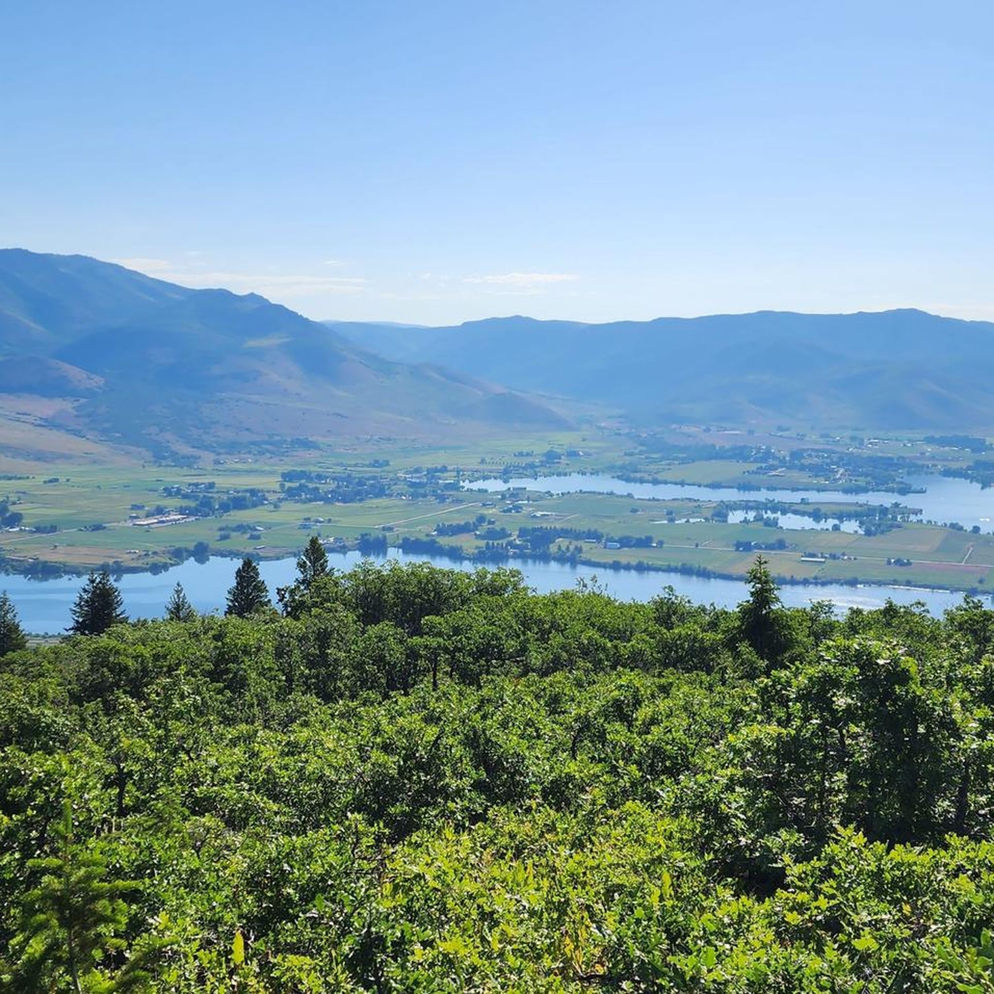
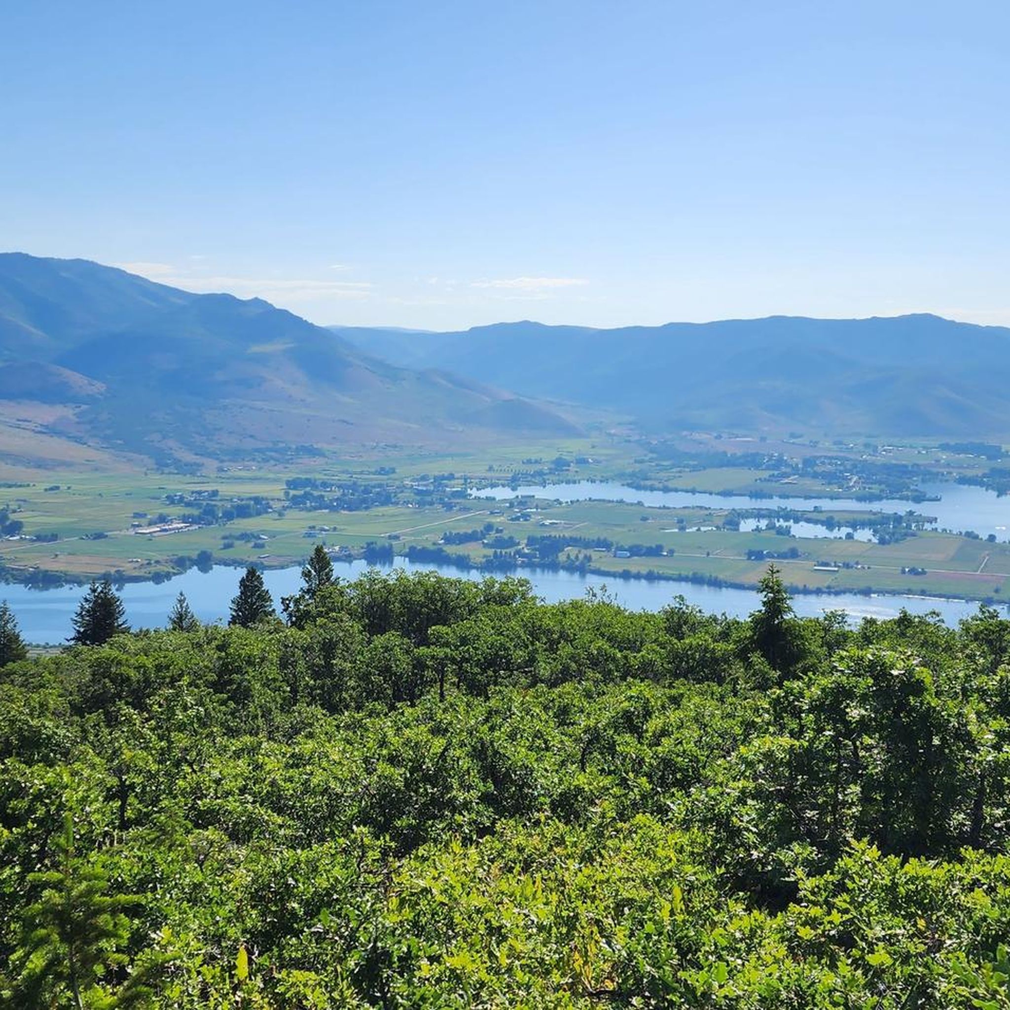
Hikes around Wolf Creek are set within the Ogden Valley, against the backdrop of the Wasatch mountain range. The area is part of the Uinta-Wasatch-Cache National Forest, offering trails that ascend to notable peaks and traverse mountain ridgelines. The network includes challenging ascents with significant elevation gain as well as more moderate paths through the forest.
Best hiking trails around Wolf Creek
- The most popular hiking route is Ben Lomond from North Skyline Trail — Uinta-Wasatch-Cache National Forest, a 15.9 mile (25.6 km) trail that takes about 8 hours to complete. This is a difficult hike with substantial elevation gain leading to the summit of Ben Lomond.
- Another top favourite among local hiking enthusiasts is Lewis Peak — Ogden, Utah, a difficult 10.4 mile (16.7 km) path. The route involves a steady climb to the peak, offering expansive views of the surrounding Ogden area.
- Local hiking enthusiasts also love the Wheeler Creek Trail loop from Huntsville, a 5.1 mile (8.3 km) trail leading through the forest, often completed in about 2 hours 25 minutes.
- Hiking around Wolf Creek is defined by mountain trails, forest paths, and ascents to prominent peaks. The trail network provides options for experienced hikers seeking a challenge as well as those looking for a more moderate day out.
- The routes in Wolf Creek are highly rated by the komoot community with an average score of 4.9 stars from more than 10 reviews. More than 130 hikers have used komoot to explore Wolf Creek's varied terrain.
Last updated: June 25, 2026
3
hikers
6.07km
01:48
180m
180m
Easy hike. Great for any fitness level. Easily-accessible paths. Suitable for all skill levels.
4.82km
01:38
360m
60m
Moderate hike. Good fitness required. Easily-accessible paths. Suitable for all skill levels.

Sign up for free
1.73km
00:34
120m
10m
Easy hike. Great for any fitness level. Easily-accessible paths. Suitable for all skill levels.
2.61km
01:08
380m
0m
Moderate hike. Good fitness required. Easily-accessible paths. Suitable for all skill levels.
4.69km
02:01
660m
10m
Moderate hike. Good fitness required. Easily-accessible paths. Suitable for all skill levels.
Get access to more routes and recommendations from other explorers.
Sign up for free
Already have an account?
Our route recommendations are based on thousands of hikes, rides, and runs completed by other people on komoot.
Start today with a free account
Your next adventure awaits.
Login or Signup


Tips from the Community

The spot along the Bonneville Shoreline Trail can be just a trickle or a full-blown stream crossing depending on the time of year. It's best to just hop off and push your bike across if you can't see the rocks at the bottom.
0
0

Coldwater Creek is a refreshing stream running through Coldwater Canyon, and the perfect stop to freshen up during a hike. Icy and slippery conditions during rainy and snowy weather make for dangerous conditions, so be cautious.
0
0
Frequently Asked Questions
Are there any easy, family-friendly hikes in the Wolf Creek area?
Yes, while the region is known for its challenging peaks, there are more accessible options. The area has a few moderate trails that can be suitable for active families. For a shorter outing, consider the Coldwater Creek via Bonneville Shoreline Trail, which is a manageable 3.7-mile (6 km) hike.
Can I bring my dog on the trails around Wolf Creek?
Dogs are generally welcome on trails within the Uinta-Wasatch-Cache National Forest, but they must be kept on a leash. Trails like the Wheeler Creek Trail loop from Huntsville are popular with dog owners. Always check specific trailhead regulations and be prepared to clean up after your pet.
Are there any circular hikes or loops available?
Yes, you can find some great loop trails. For a moderately challenging loop with rewarding views, the Chilly Peak loop from North Ogden is an excellent choice. It covers about 9.8 miles (15.8 km) and takes you through varied forest terrain.
What kind of scenery can I expect on hikes around Wolf Creek?
The hiking experience in Wolf Creek is defined by the majestic Wasatch mountain range. You can expect trails that wind through the Uinta-Wasatch-Cache National Forest, leading to prominent peaks and high ridgelines. The main attractions are the expansive views over the Ogden Valley rather than features like waterfalls or lakes.
How difficult are the hikes in this region?
The trails cater to a range of abilities, but the area is particularly well-suited for experienced hikers. There are several difficult routes with significant elevation gain, such as the demanding trek to Lewis Peak. However, you will also find a good selection of moderate trails and at least one easier option.
What do other hikers think of the trails in Wolf Creek?
The trails around Wolf Creek are highly rated by the komoot community, with an average score of 4.9 out of 5 stars. Hikers often praise the challenging ascents and the stunning panoramic views from the peaks and ridgelines.
How many hiking trails are there around Wolf Creek?
There are around 9 curated hiking routes available in this guide. They range from difficult all-day treks to shorter, more moderate forest walks, offering a good variety for different fitness levels.
What is the best time of year to hike in Wolf Creek?
The prime hiking season is from late spring to early fall, typically June through October. During this time, the trails are usually free of snow and the weather is favorable. The summer offers lush green landscapes, while autumn provides beautiful fall colors in the forests.
What should I pack for a day hike in Wolf Creek?
For any hike here, you should bring plenty of water, snacks, and sun protection, as many trails are exposed. Layered clothing is essential as weather can change quickly in the mountains. For longer routes like the one to Ben Lomond, navigation tools and sturdy hiking boots are a must.
Where can I park to access the trails?
Most trails in the Wolf Creek area begin from designated trailheads that have parking areas. The popularity of a trail can affect parking availability, especially on weekends. It's always a good idea to arrive early to secure a spot for popular routes.
Are the trails in Wolf Creek suitable for trail running?
Many of the trails are multi-use and suitable for trail running, particularly the moderate routes with less technical terrain. The rolling paths and forest tracks provide excellent opportunities for runners looking for a challenge with elevation.
Most popular attractions around Wolf Creek

Get inspired with the komoot mobile app


Explore more
Browse the best Hikes in other regions.
