The best road cycling routes around Southlake
4.7
(20)
909
riders
10
rides
Road cycling routes around Southlake benefit from well-maintained infrastructure and a diverse network of paths. The region features a blend of suburban environments and natural areas, including the Cross Timbers ecosystem and proximity to Lake Grapevine. Cyclists can find routes ranging from shorter loops to longer excursions, with varying elevation gains. This area offers a mix of paved surfaces and access to parks and preserves that enhance the cycling experience.
Best road cycling routes around Southlake
- The most popular road cycling route is Horseshoe Trail – Snakey Road Trail loop from Southlake, a 27.4 miles (44.2 km) trail that takes 1 hour 59 minutes to complete, offering a well-maintained path through the local landscape.
- Another top favourite among local road cyclists is Cross Timbers Park – Alpacas at CBT Trail loop from Southlake, a moderate 25.9 miles (41.7 km) path. This route provides views of local parks and natural features, including the Cross Timbers ecosystem.
- Local road cyclists also love the Horseshoe Trail – Yates Corner Grocery loop from Southlake, a 24.9 miles (40.0 km) trail leading through varied suburban and natural settings, often completed in about 2 hours 4 minutes.
- Road cycling around Southlake is defined by its well-maintained infrastructure, diverse network of routes, and access to natural features like the Cross Timbers ecosystem and Lake Grapevine. The network offers options for different ability levels, from easy loops to more challenging excursions.
- The routes in Southlake are highly rated by the komoot community with an average score of 4.8 stars from over 6 reviews. More than 600 road cyclists have used komoot to explore Southlake's varied terrain.
Last updated: October 13, 2026
62
riders
40.2km
01:49
220m
220m
Easy road ride. Great for any fitness level. Mostly well-paved surfaces and easy to ride.
40
riders
40.8km
02:06
200m
200m
Moderate road ride. Good fitness required. Mostly well-paved surfaces and easy to ride.

7
riders
53.0km
02:25
370m
370m
Moderate road ride. Good fitness required. Mostly well-paved surfaces and easy to ride.
8
riders
82.1km
03:41
520m
520m
Moderate road ride. Good fitness required. Mostly well-paved surfaces and easy to ride.
12
riders
Easy road ride. Great for any fitness level. Mostly well-paved surfaces and easy to ride.
Get access to more routes and recommendations from other explorers.
Already have an account?
Our route recommendations are based on thousands of hikes, rides, and runs completed by other people on komoot.
Start today with a free account
Your next adventure awaits.


Tips from the Community

Can't go wrong with the CBT. The preferred way to go to Grapevine
0
0

This beautiful 102-acre community park surrounds two lakes with gorgeous green space. It includes a short 1.1 mile (1.77 kilometers) trail for hiking and biking, a nature trail with nice benches and interpretive signs, observation areas, wildflower meadows, picnic tables, a playground, restrooms, a butterfly garden, and plenty of parking. It's an ideal place to stop and stretch your legs or take a long break after a ride.
0
0

The Horseshoe Trail is a great paved trail that runs along Denton Creek. It is a popular trail, so make sure you are respectful to other trail users.
0
0

Timarron Park Features. Basketball courts; BBQ pits; Drinking fountains; Parking spaces; Pavilions / Gazebos; Picnic tables; Play equipment for older children;
1
0

This length of paved trail has a lovely view of the Jones Branch, making it a perfect stretch to cycle on. Take care for other users of the path.
0
0

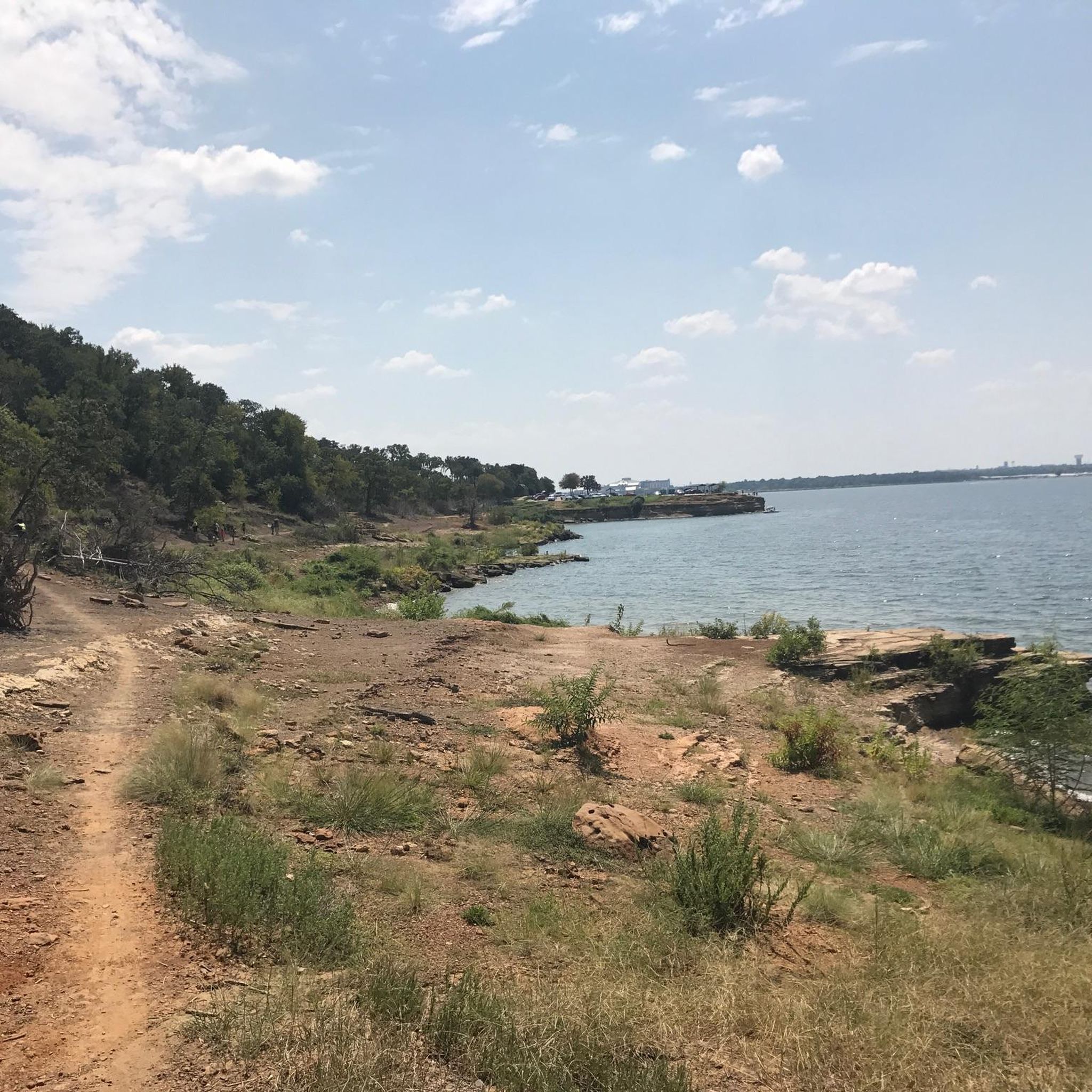
In this area along Jones Branch, the trail offers both paved and dirt options, shaded nicely and presenting stunning views. You'll find plenty of benches and rest areas to take a break, stretch, or simply take in the surroundings.
0
0
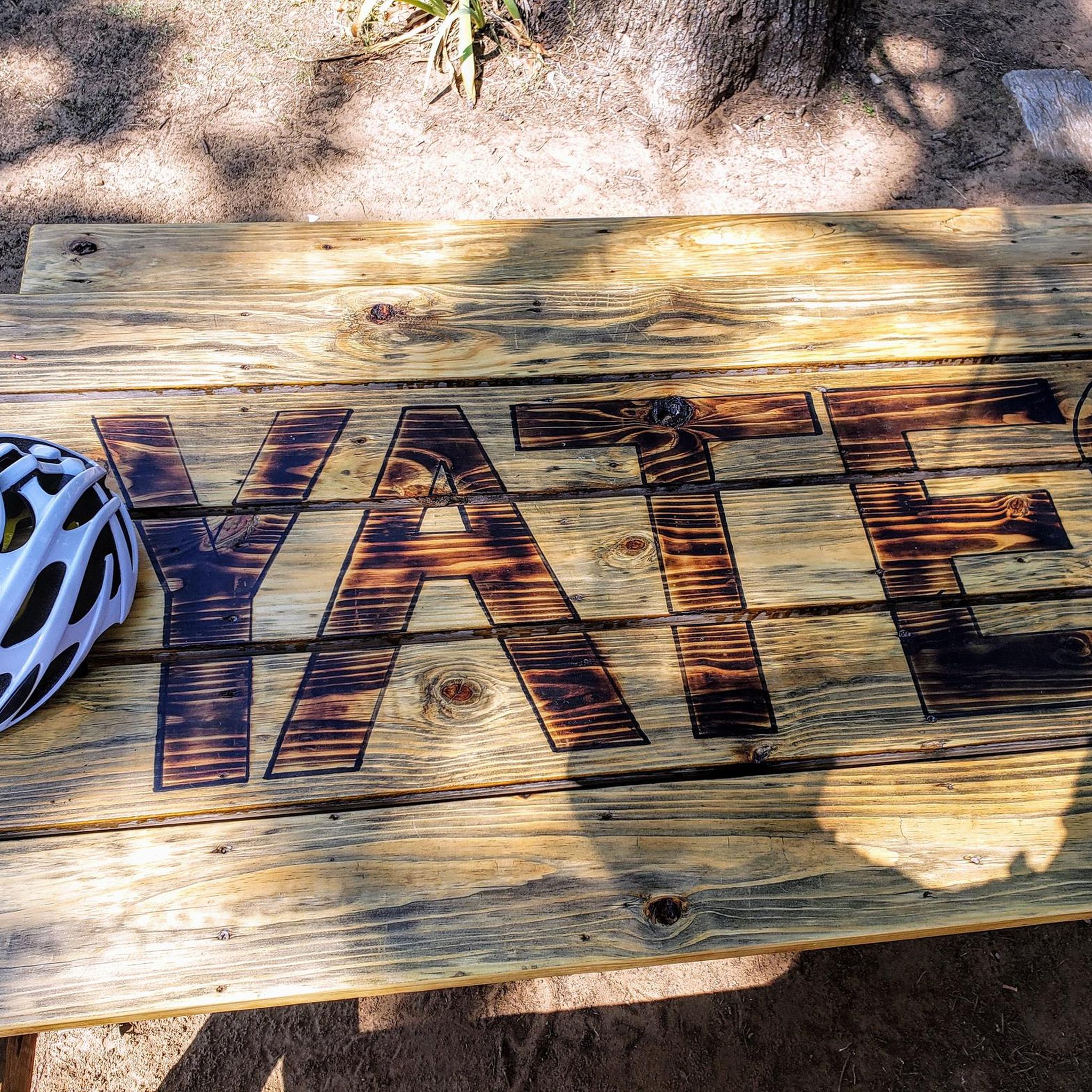
Yates has picnic benches and tables around the back and a great selection of drinks and snacks to fuel your ride. A great spot to take a break.
0
0
This trail is nicely paved and offers plenty of side trails to extend your hike. You'll enjoy some nice views of Jones Branch along the way. It's a popular spot for mountain biking, so stay alert and share the trail.
0
0
Frequently Asked Questions
How many road cycling routes are available around Southlake?
There are over 80 road cycling routes available around Southlake, offering a wide range of options for different skill levels and preferences.
Are there easy road cycling routes suitable for beginners in Southlake?
Yes, Southlake offers nearly 30 easy road cycling routes perfect for beginners. A popular choice is the Horseshoe Trail – Snakey Road Trail loop from Southlake, which provides a well-maintained path through the local landscape.
What kind of challenging road cycling routes can I find in Southlake?
For those seeking a challenge, Southlake features over 50 moderate routes and one difficult route. These routes can offer significant elevation gains, with some extending up to 5 hours and 3,000 feet of elevation, requiring good fitness. An example of a moderate route is the Fast Hill loop from Westlake.
Are there family-friendly road cycling options in Southlake?
Southlake's well-maintained infrastructure and numerous parks make it suitable for family cycling. Many of the easier routes are ideal for families, offering pleasant rides through suburban areas and green spaces like Bicentennial Park, which features scenic trails and picnic areas.
What are some scenic road cycling routes in the Southlake area?
Many routes in Southlake offer scenic views, often passing through the unique Cross Timbers ecosystem or near natural features. The Cross Timbers Park – Alpacas at CBT Trail loop from Southlake provides views of local parks and natural features. Additionally, routes near Lake Grapevine offer picturesque lake views.
What attractions can I see along road cycling routes near Southlake?
While cycling, you can explore various attractions. Near Lake Grapevine, you might encounter the Grapevine Lake Trail or the North Shore Trail at Grapevine Lake. The Alpacas at CBT Trail is another unique point of interest you might pass.
What is the typical length and duration of road cycling routes in Southlake?
Route lengths vary significantly. For instance, the Horseshoe Trail – Snakey Road Trail loop from Southlake is about 27.4 miles (44.2 km) and takes around 2 hours. Longer routes can extend up to 5 hours, covering greater distances and elevation.
Are there less crowded road cycling routes in Southlake?
While some routes are popular, Southlake's extensive network of over 80 routes means you can often find quieter paths. Exploring routes that venture slightly further from the main urban centers or riding during off-peak hours can help you discover more serene cycling experiences.
What do other road cyclists enjoy most about cycling in Southlake?
The komoot community highly rates road cycling in Southlake, with an average score of 4.8 stars from over 6 reviews. Cyclists often praise the well-maintained infrastructure, the diverse network of routes, and the blend of suburban environments with natural areas like the Cross Timbers ecosystem.
Is there public transport access to road cycling trails in Southlake?
Southlake is primarily a suburban area, and while public transport options exist, they may not directly serve all trailheads. It's generally recommended to drive to a suitable starting point or use local ride-sharing services to access the routes.
Where can I find parking for road cycling routes in Southlake?
Many parks in Southlake, such as Bicentennial Park, Bob Jones Park, and North Park, offer dedicated parking facilities that can serve as convenient starting points for road cycling routes. Check the specific route details on komoot for recommended parking areas.
What is the best time of year to road bike in Southlake?
The spring and fall months generally offer the most pleasant weather for road cycling in Southlake, with milder temperatures. Summers can be hot, so early morning or late afternoon rides are advisable. Winters are typically mild, allowing for year-round cycling, though occasional cold fronts can occur.
Most popular routes around Southlake
Most popular attractions around Southlake

Get inspired with the komoot mobile app


Explore more
Browse the best Road cycling routes in other regions.
