The best walks and hikes around Euratsfeld
4.5
(746)
5,258
hikers
341
hikes
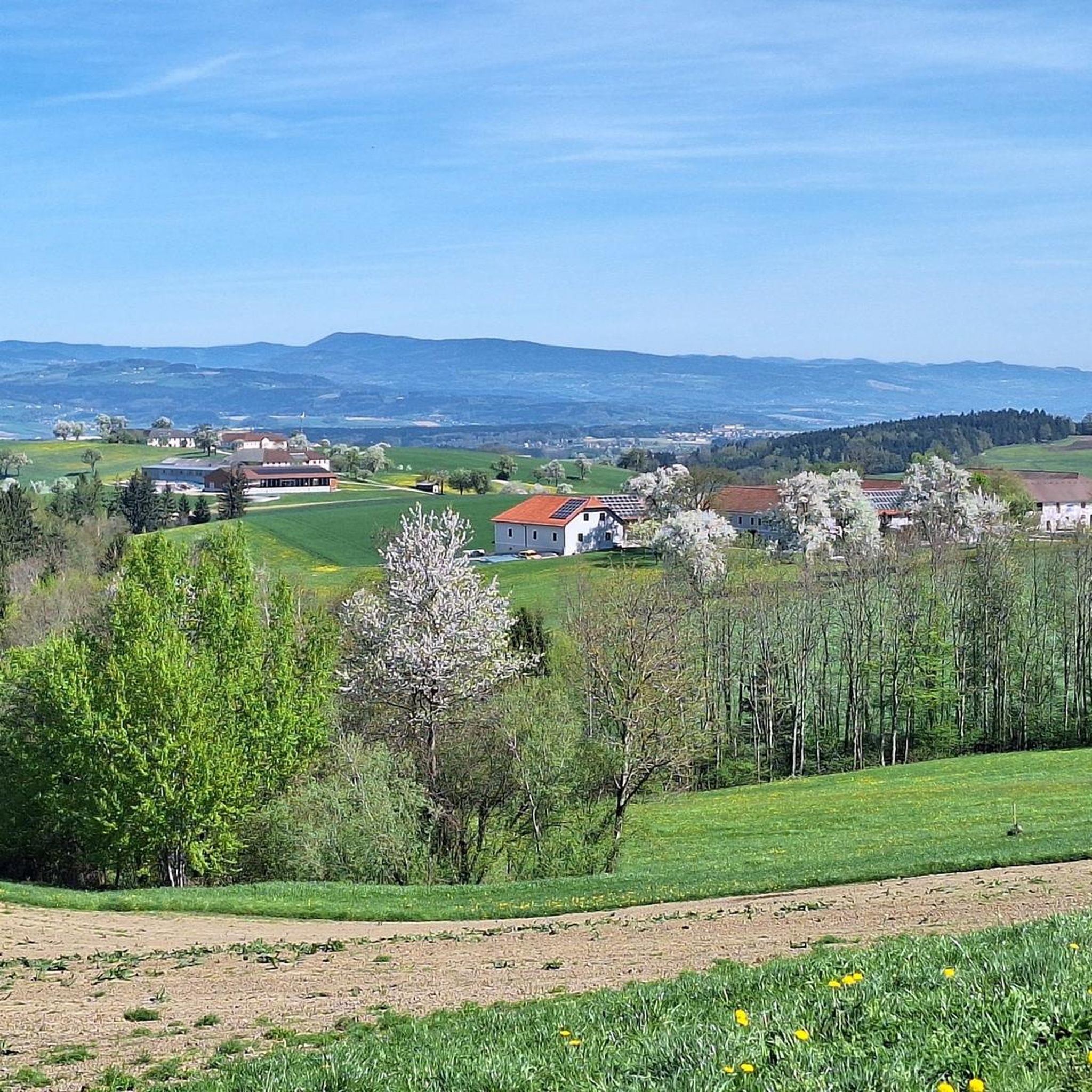
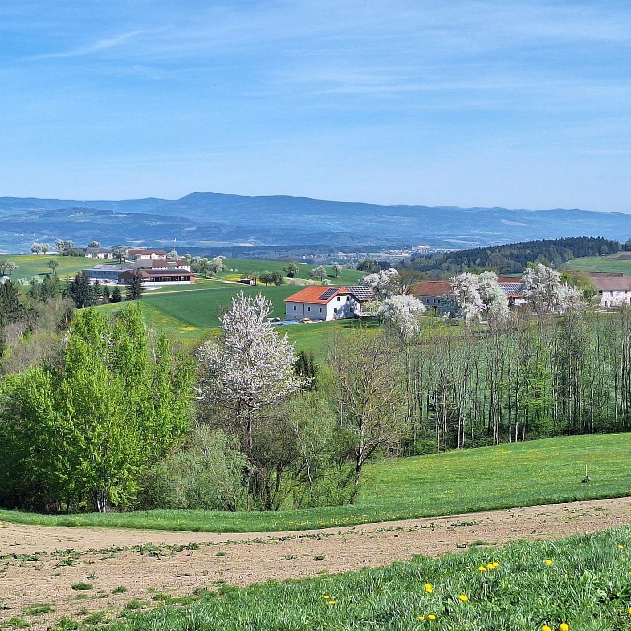
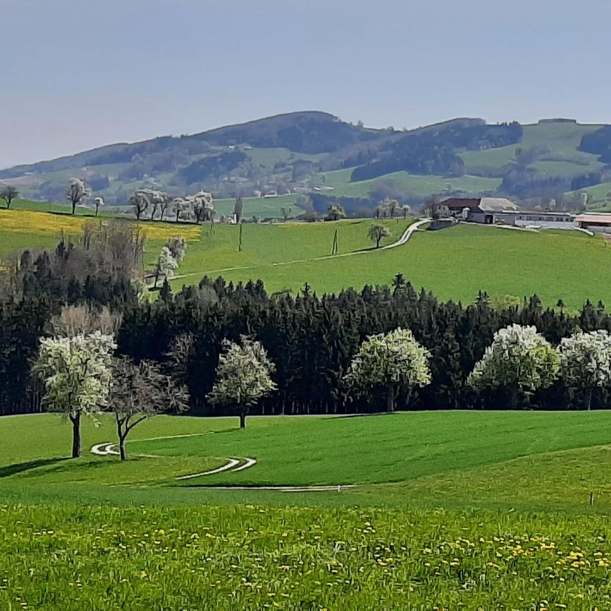
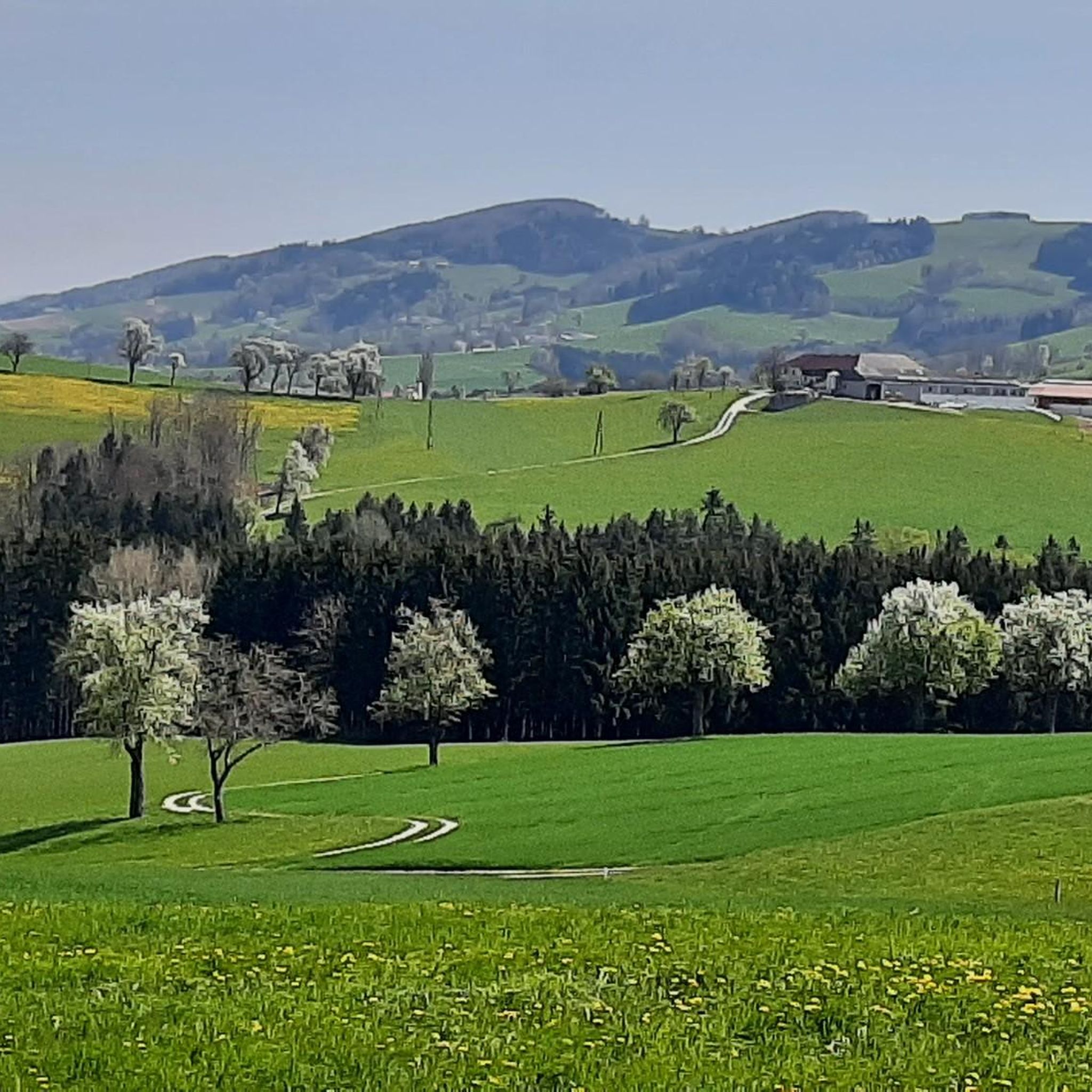
Hiking around Euratsfeld offers diverse landscapes within the Mostviertel region of Austria. The area is characterized by rolling hills, green meadows, and forests, with streams often accompanying the trails. Elevated points like the Hochkogelberg provide panoramic views, extending to the Danube Valley and the Gesäuse mountains. The countryside also features gnarled pear trees, particularly notable during bloom, which are integral to the local Mostviertel culture.
Best hiking trails around Euratsfeld
- The most popular hiking route is Hochkogel Summit – Hochkogel…
Last updated: October 17, 2026
4.8
(56)
334
hikers
5.92km
01:38
100m
100m
Easy hike. Great for any fitness level. Easily-accessible paths. Suitable for all skill levels.
4.7
(6)
36
hikers
Moderate hike. Good fitness required. Easily-accessible paths. Suitable for all skill levels.

4.3
(4)
33
hikers
Easy hike. Great for any fitness level. Easily-accessible paths. Suitable for all skill levels.
4.0
(1)
15
hikers
17.6km
05:08
460m
460m
Hard hike. Very good fitness required. Easily-accessible paths. Suitable for all skill levels.
24
hikers
12.7km
03:50
420m
420m
Moderate hike. Good fitness required. Easily-accessible paths. Suitable for all skill levels.
Get access to more routes and recommendations from other explorers.
Already have an account?
Our route recommendations are based on thousands of hikes, rides, and runs completed by other people on komoot.
Start today with a free account
Your next adventure awaits.


Other adventures around Euratsfeld

Tips from the Community

What is the highlight there? On the wall of a large farm hangs this sign - Otherwise?
0
0
On the ridge path to this formation, you have a clear view over the Mostviertel around Amstetten
0
0
The view to the north is already largely blocked by the trees below, the view to the south is clear
0
0

Added to the collection: https://www.komoot.com/de-de/collection/3600632/-naturdenkmaeler-besondere-baeume-und-weitere-schaetze-der-natur
1
0
A restaurant that is also open on Tuesdays 😋
0
0

A very good restaurant with affordable food, set menus, delicious pastries, and a cozy garden with a small chapel. It's best to reserve a table by phone, even during the week. Closed on Wednesdays.
0
0

It's not just the great view that's attractive on this path. The trees along the path are also worth a second look.
0
0

This restaurant is located along the mountain bike path and is ideal for a short break and refreshment.
1
0
Frequently Asked Questions
How many hiking trails are available around Euratsfeld?
Euratsfeld offers a wide variety of hiking options, with over 350 routes recorded on komoot. These range from easy strolls to more challenging paths, ensuring there's something for every fitness level.
What kind of terrain can I expect on hikes in Euratsfeld?
The landscape around Euratsfeld is characterized by rolling hills, lush green meadows, and serene forests. Many trails follow streams, offering varied scenery. From elevated points like the Hochkogelberg, you can enjoy expansive panoramic views stretching towards the Danube Valley and the Gesäuse mountains.
Are there any easy hiking routes suitable for beginners or casual walkers?
Yes, Euratsfeld has numerous easy trails. For example, the Gasthaus Waidahammer – Seppelbauer Mostheuriger loop from Euratsfeld is an easy 3.8-mile (6.1 km) route that takes about 1 hour 40 minutes. Another easy option is the Hochkogel Panorama Inn – Gruber Kreuz Summit loop from tut gut Wanderwege, which is just under 6 km.
What are some of the more challenging hikes in the area?
For those seeking a challenge, the Hochkogel Summit – Hochkogel Panorama Inn loop from Euratsfeld is a difficult 10.9-mile (17.6 km) trail with significant elevation gain, typically taking over 5 hours to complete. It offers rewarding, expansive views from the Hochkogel.
Can I find circular hiking routes around Euratsfeld?
Yes, many trails in Euratsfeld are designed as circular routes. Popular options include the Reidlingberg with summit cross – Hochkogel Panorama Inn loop from Katastralgemeinde Reidlingberg, a moderate 5.9-mile (9.5 km) path, and the Gasthaus Waidahammer – Seppelbauer Mostheuriger loop from Euratsfeld.
Are there specific viewpoints or landmarks worth visiting on a hike?
Absolutely. The Hochkogel Summit offers spectacular panoramic views over the Mostviertel. You can also visit the Gruber Kreuz Summit or the Reidlingberg with summit cross. For unique natural features, look for the Mostviertel Solstice Circle on Haberg or the Jakobsbrunnen.
Is Euratsfeld a good destination for family hikes?
Yes, Euratsfeld is suitable for family hikes, especially with its many easy and moderate trails. The diverse landscapes, including meadows and forests, provide an engaging environment for children. The Feel-Good Trail Hochkogelberg, for instance, is an easy 10.6 km route designed to encourage observation and experiencing nature.
What is the best time of year to go hiking in Euratsfeld?
The spring, particularly April and May, is a beautiful time to visit when the gnarled pear trees, a signature feature of the Mostviertel, are in full bloom. Summer offers pleasant temperatures for hiking, and autumn brings vibrant colors to the landscape. The region is generally accessible for hiking throughout the warmer months.
Are there options for refreshments or accommodation along the trails?
Yes, many routes pass by traditional taverns and inns, known as "Mostheuriger," where you can sample local culinary delights and the region's famous cider. The Hochkogel Panorama Inn is a popular stop on several routes. You'll find various accommodations in and around Euratsfeld.
How can I reach the trailheads, and is parking available?
Many trailheads in Euratsfeld are easily accessible. While specific public transport details vary, the region is generally well-connected. Parking is typically available near popular starting points for trails, especially at attractions like the Hochkogel Panorama Inn or in the village center.
What do other hikers say about their experience in Euratsfeld?
The hiking routes in Euratsfeld are highly rated by the komoot community, with an average score of 4.5 stars from over 600 reviews. Hikers often praise the stunning panoramic views, the well-maintained paths, and the unique cultural experience offered by the Mostviertel landscape, especially the pear tree-lined routes.
Are there any unique natural features to look out for while hiking?
Beyond the panoramic views, keep an eye out for the distinctive gnarled pear trees that dot the landscape, particularly beautiful when in bloom. Trails often follow streams and pass through diverse forests. You might also encounter unique natural monuments like the Prasdorfer Sandlöcher or the Tree With a Face-Like Trunk.
Most popular routes around Euratsfeld
Most popular attractions around Euratsfeld

Get inspired with the komoot mobile app


Explore more
Browse the best Hikes in other regions.
