The best cycling routes around Johnson City
5.0
(6)
90
riders
12
rides
Touring cycling routes around Johnson City, TN, traverse a landscape characterized by rolling hills, river valleys, and converted rail trails. The region offers a mix of terrain, from relatively flat, accessible paths suitable for family friendly bike trails Johnson City Tennessee, to more challenging ascents. Many routes follow waterways like the Watauga River, providing scenic views and varied cycling experiences. This area is well-suited for those seeking circular bike routes Johnson City TN, with options for different skill levels.
Best touring cycling routes around Johnson City
- The most popular touring cycling route is Tweetsie Trail and Watauga River Loop, a 26.9 miles (43.4 km) trail that takes 2 hours 42 minutes to complete. This route combines a historic rail-trail with riverside sections.
- Another top favourite among local touring cyclists is Tweetsie Trail Loop, a moderate 20.0 miles (32.2 km) path. This route offers a substantial ride along the popular Tweetsie Trail, known for its accessible surface.
- Local touring cyclists also love the Powder Mary Loop from Lyons Field Park, a 17.7 miles (28.5 km) trail leading through varied terrain, often completed in about 1 hour 54 minutes.
- Touring cycling around Johnson City is defined by rolling hills, river valleys, and converted rail trails. The network offers options for different ability levels, from easy touring bike trails Johnson City TN to more challenging routes.
- The routes in Johnson City are highly rated by the komoot community with an average score of 5.0 stars from more than 7 reviews. More than 90 touring cyclists have used komoot to explore Johnson City's varied terrain.
Last updated: June 24, 2026
1
riders
32.2km
02:08
320m
320m
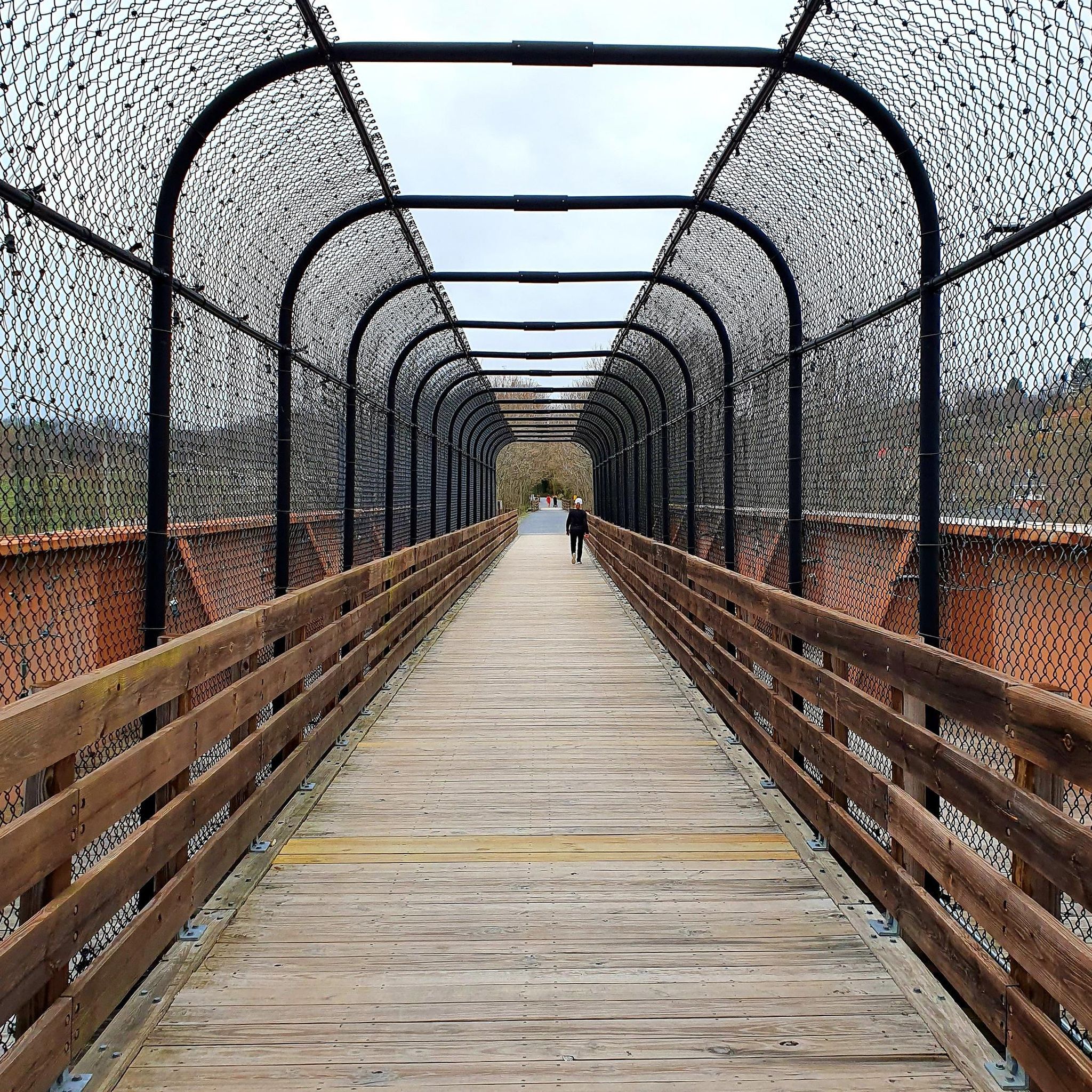
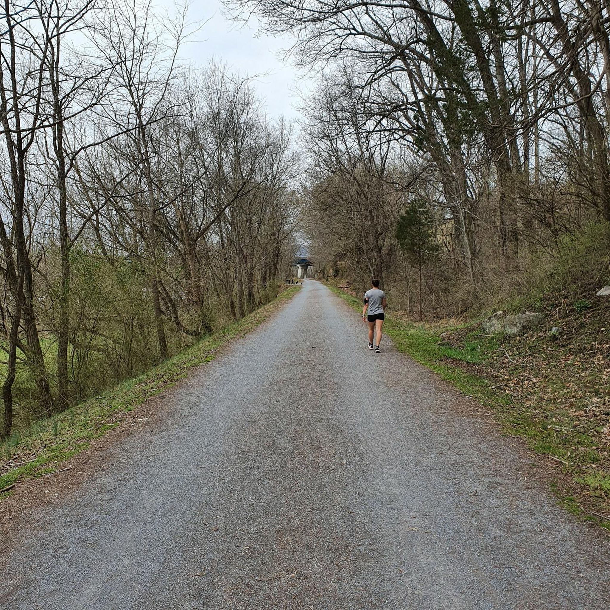
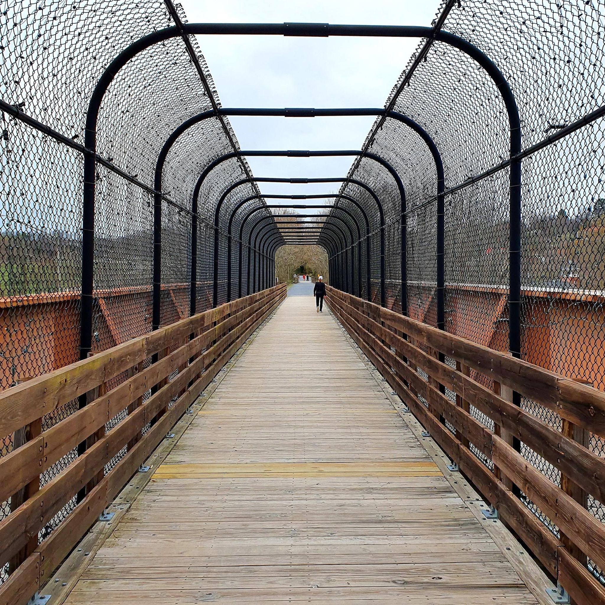
Embark on the Tweetsie Trail Loop for a moderate touring cycling adventure spanning 20.0 miles (32.2 km). You will pedal through picturesque pastures and alongside hardwood forests, gaining 1060 feet (323 metres) in elevation over approximately 2 hours and 7 minutes. The route offers a pleasant experience, winding past scenic overlooks, such as one near the Cranberry Quarry. You'll also cross seven bridges, including a distinctive enclosed bridge that carries you over U.S. Highway 321. This trail provides a refreshing escape into nature, especially vibrant with autumnal colors if you visit in the fall.
Planning your ride on the Tweetsie Trail Loop is straightforward, as the route is accessible year-round. Convenient amenities await you at the trailheads, particularly in Johnson City, where you will find paved parking, benches, and water fountains. There is even a bike repair station available for any quick adjustments you might need before setting off. Restrooms are also strategically placed along the trail, including one in Elizabethton designed to accommodate your bicycle.
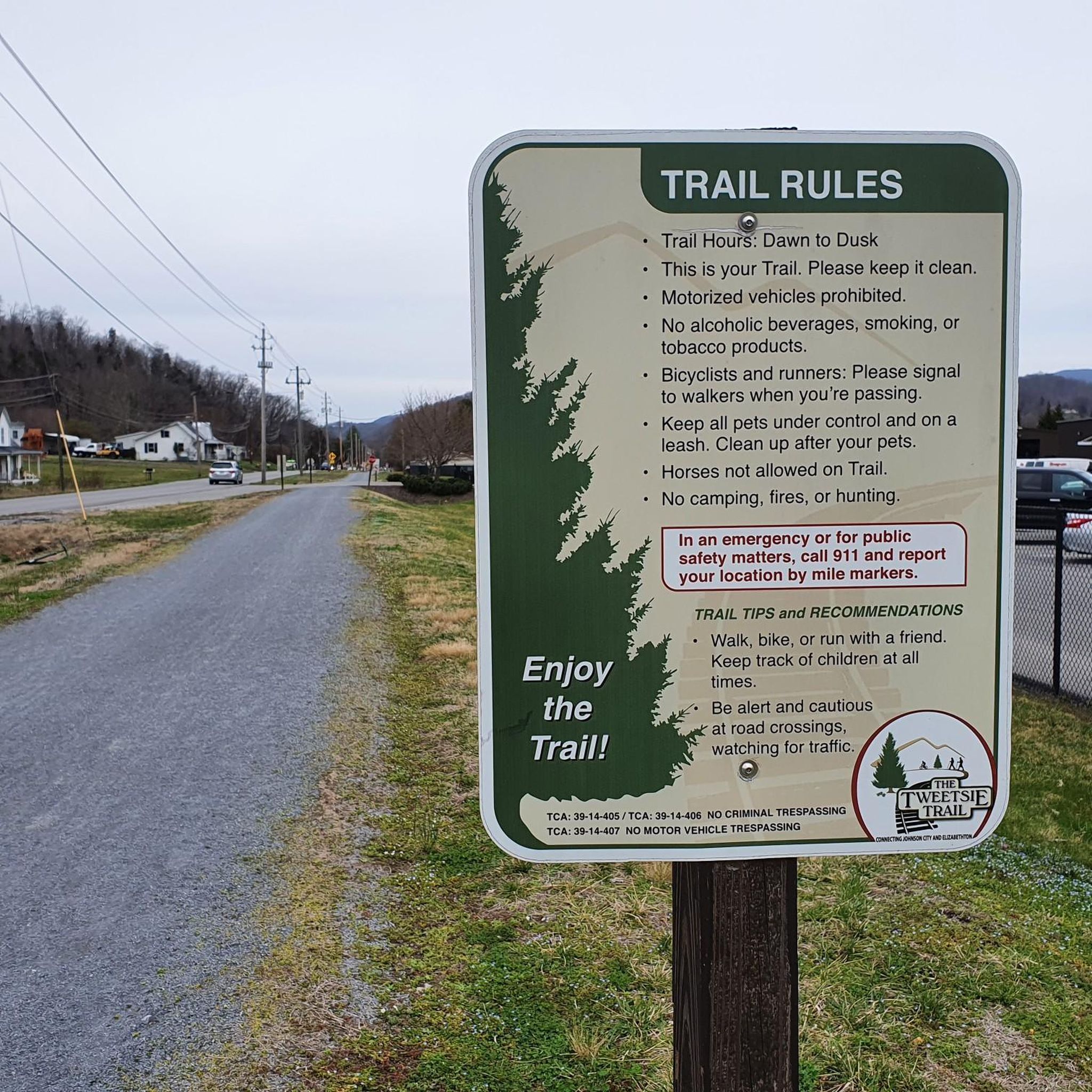
The Tweetsie Trail holds a unique place in the region, built upon a historic rail-trail corridor. This path once served the East Tennessee and Western North Carolina Railroad, affectionately known as the "Tweetsie" due to the sound of its steam whistles. Today, it offers a blend of natural beauty and historical significance, allowing you to cycle through landscapes that have witnessed over a century of local history. The trail's well-maintained surface makes it a popular choice for cyclists seeking both exercise and a connection to the past.
43.4km
02:43
350m
360m
The Tweetsie Trail and Watauga River Loop offers a delightful touring cycling experience, blending the smooth, crushed-stone surface of the historic Tweetsie Trail with scenic stretches along the Watauga River. You'll pedal through shaded woodlands, open pastures, and past the iconic Elizabethton Covered Bridge, enjoying a diverse landscape that changes with the seasons. The route provides a moderate challenge, covering 27.0 miles (43.4 km) with 1162 feet (354 metres) of elevation gain, making it a rewarding ride for those who appreciate both natural beauty and a touch of history.
Planning your visit is straightforward, with the trail being well-maintained and offering amenities like restrooms and water fountains, especially near Elizabethton. If you're traveling light, bike rentals are available in Johnson City, providing a convenient starting point for your journey. The varied terrain, from flat rail-trail sections to rolling rural roads, means a gravel bike or hybrid is a great choice, ensuring comfort and capability throughout the approximately 2 hours and 42 minutes ride.
This loop is steeped in local heritage, following the path of the former East Tennessee & Western North Carolina Railroad, affectionately known as the "Tweetsie." Beyond the cycling, you can explore historical sites like Fort Watauga and Sycamore Shoals State Historic Park, which are easily accessible from the trail. It's a fantastic way to combine a good workout with a journey through Northeast Tennessee's past, offering more than just a ride but an immersive cultural experience.

Sign up for free
28.5km
01:54
430m
430m
The Powder Mary Loop from Lyons Field Park offers a varied touring cycling experience, blending smooth paved sections with some challenging unpaved singletrack. You'll navigate through pleasant natural surroundings, including light forests and foothills meadows, typical of the Lyons area. The route's mix of surfaces and elevation ensures a dynamic ride, keeping you engaged from start to finish.
This moderate 17.7-mile (28.5 km) loop features a notable 1408 feet (429 metres) of elevation gain, which typically takes around 1 hour and 54 minutes to complete. The trail starts conveniently from Lyons Field Park. While specific parking details aren't provided, planning your visit during good weather is recommended to fully enjoy the diverse terrain and scenery.
Lyons is a recognized hub for cycling, offering routes that ascend into the Rocky Mountains or cruise through eastern plains. The Powder Mary Loop contributes to this reputation, providing a moderately challenging option for touring cyclists. Its combination of length, elevation, and varied terrain makes it a comprehensive choice for exploring the natural beauty around Lyons.
40.6km
02:36
420m
410m
The Siam and Blue Springs loops offer a rewarding touring cycling experience around Elizabethton, blending natural beauty with historical interest. You'll pedal through diverse landscapes, encountering scenic overlooks and the iconic Elizabethton Covered Bridge, a true highlight of the journey. This moderate route spans 25.2 miles (40.6 km) with 1362 feet (415 metres) of elevation gain, typically taking around 2 hours and 35 minutes, making it a great option for those seeking a substantial ride with varied scenery.
When planning your visit, be aware that while much of the route is paved, some segments may include unpaved sections. For this reason, a touring bike equipped with more robust tires is advisable to handle the mixed surfaces comfortably. Convenient general parking is available in Elizabethton, providing easy access to the start of the loops.
What sets this route apart is its unique combination of a challenging workout and picturesque surroundings, offering a genuine taste of the region's character. The presence of the historic Elizabethton Covered Bridge adds a significant cultural element, making the Siam Blue Springs bike trail landmarks viewpoints natural features a memorable ride for cyclists exploring the area.
31.8km
02:01
330m
330m
The Hampton to Gap Creek Road loop from Elizabethton offers a delightful touring cycling experience, guiding you through a landscape rich with green pastures and charming old country homes. You'll navigate winding roads that transition from open countryside to forested sections, with the route touching on Gap Creek Road, known for its connection to the flatter Tweetsie Trail. This blend of terrain ensures a varied ride, showcasing the natural beauty of the region around Elizabethton.
This moderate 19.8-mile (31.8 km) cycling route features 1081 feet (329 metres) of elevation gain, typically taking about 2 hours and 1 minute to complete. It's a great option for cyclists looking for a rewarding ride that isn't overly strenuous but still provides a good workout. Parking can generally be found in Elizabethton, a town known for its cycling-friendly infrastructure, making it a convenient starting point for your adventure.
Beyond the ride itself, the area is steeped in history and natural charm, with landmarks like the Elizabethton Covered Bridge adding to the scenic appeal. This loop provides a fantastic way to explore the diverse cycling opportunities in Washington and Carter County, offering a taste of both challenging ascents and more relaxed sections, perfect for a day out on two wheels.
Get access to more routes and recommendations from other explorers.
Sign up for free
Already have an account?
Our route recommendations are based on thousands of hikes, rides, and runs completed by other people on komoot.
Start today with a free account
Your next adventure awaits.
Login or Signup
Tips from the Community

Fort Watauga is a historic fortification constructed by early frontier settlers in the Watauga region during the late 18th century. It served as a key defensive outpost designed to protect the community from external threats. It is now open to visitors who want to learn more about the history of the local area.
0
0
The Elizabethton Covered Bridge, was built in 1882 over the Doe River It is a 154-foot-long truss bridge that has survived numerous floods, including the 1901 flood and Hurricane Helene in 2024. It is closed to vehicles but open to pedestrians and cyclists.
0
0

Gap Creek Road offers a nice alternative to Mary Patton Highway. It is much smaller and less traffic. It also a small country road instead of a highway. It is not as quick as Mary Patton Highway and the highway does have a large shoulder but I find it nicer.
0
0
There are two large parking lots at this location. One is specifically for Harmon Park where you will find a nice covered picnic area and a playground for children. The other seems to be for the Carter Compassion Center and a Historical Train. The Carter Compassion Center, located between the two parking lots, is a non-profit that works to alleviate poverty in the area. At the far end of the parking lot you will find a plaque and an old train engine. The plaque gives you information about the history of trains in this area. This is an interesting place to visit or just park your car before a ride.
0
0
Fort Watauga is actually a reconstruction of the original fort that was here. Each year there are several different educational events that take place here. Sycamore Shoals State Historic Park surrounds the fort and is also interesting to visit. It is not far off the Tweetsie Trail, making it an easy and interesting stop while out on a bike.
0
0
Smalling Road is a great road to cycle. It runs from Watauga Road all the way down to the Watauga River. It is a rolling, winding, country road with forest and fields all around. There is little to no traffic on it normally. When you get down near the river you can sometimes see the Betty Range Cliff through the trees in the winter. There is a nice old iron bridge that crosses the river at the bottom.
0
0
This lovely road is barely one lane wide and perfect for cycling. You won't find much traffic here and the views of the fields with the mountains surrounding them are spectacular.
0
0
This bridge was built in 1882 in order to allow the town of Elizabethton to grow to the south. Each June there is a festival/parade that honors the bridge. Although the bridge is no longer open to motor vehicle traffic, it is still open to both bicycles and pedestrians throughout the year. Cyclists must dismount before crossing.
0
0
Frequently Asked Questions
How many touring cycling routes are available in Johnson City?
There are over 10 touring cycling routes detailed for the Johnson City area, offering a variety of experiences from easy rides to more challenging ascents.
Are there any easy or beginner-friendly touring cycling routes in Johnson City?
Yes, Johnson City offers routes suitable for beginners. The region's converted rail trails, like sections of the Tweetsie Trail and Watauga River Loop, provide relatively flat and accessible paths. Look for routes marked as 'easy' in the guide.
What are some challenging touring cycling routes around Johnson City?
For those seeking a challenge, Johnson City's landscape includes rolling hills that provide more demanding rides. While specific 'difficult' routes are available, many 'moderate' routes, such as the Powder Mary Loop from Lyons Field Park, feature significant elevation changes to test your endurance.
Are there family-friendly touring cycling options in Johnson City?
Absolutely. The converted rail trails in the area, including parts of the Tweetsie Trail Loop, are generally flat and well-maintained, making them ideal for families with children. These paths often avoid heavy traffic and offer a safe environment for all ages.
Can I find circular touring cycling routes in Johnson City?
Yes, the Johnson City area is well-suited for those seeking circular bike routes. Many of the listed tours, such as the Siam and Blue Springs loops from Elizabethton, are designed as loops, allowing you to start and end at the same point without retracing your path.
What kind of scenery can I expect on touring cycling routes in Johnson City?
Touring cycling routes in Johnson City offer diverse scenery, characterized by rolling hills, picturesque river valleys, and sections along waterways like the Watauga River. Many routes also follow historic converted rail trails, providing a blend of natural beauty and local heritage.
What are some notable attractions or landmarks along the touring cycling routes?
Along the routes, you can explore several interesting spots. The Tweetsie Trail itself is a highlight, offering a historic path. You might also encounter areas near Warriors' Path State Park or historical sites like Fort Watauga. For more natural viewpoints, consider routes that ascend towards areas like Tip Top (Buffalo Mountain Highpoint).
What is the best season for touring cycling in Johnson City?
The spring and fall seasons generally offer the most pleasant conditions for touring cycling in Johnson City, with mild temperatures and beautiful foliage. Summer can be warm and humid, while winter may bring colder temperatures, though many routes remain accessible year-round.
Are there routes that follow the Watauga River?
Yes, several routes incorporate sections along the Watauga River, providing scenic riverside views. The Tweetsie Trail and Watauga River Loop is a prime example, combining a historic rail-trail with beautiful riverside cycling.
What do other touring cyclists say about the routes in Johnson City?
The touring cycling routes in Johnson City are highly rated by the komoot community, with an average score of 5.0 stars from more than 7 reviews. Cyclists often praise the varied terrain, the combination of rail trails and river sections, and the options available for different skill levels.
Are there any less crowded touring cycling routes in the area?
While popular routes like the Tweetsie Trail can see more activity, exploring some of the less-trafficked loops or routes further from the immediate city center, such as the Hampton to Gap Creek Road loop from Elizabethton, may offer a more tranquil experience, especially during off-peak hours or weekdays.
Most popular attractions around Johnson City

Get inspired with the komoot mobile app


Explore more
Browse the best Cycling routes in other regions.
