The 7 Most Amazing Peaks around Stadtkyll
Best mountain peaks around Stadtkyll are characterized by elevated hills and viewpoints within the scenic Eifel region. These areas provide expansive panoramic views over the town and the picturesque Wirft valley. The charm of these elevated points lies in their accessibility through well-maintained hiking trails, offering diverse vistas of forested hills and valleys. Visitors can experience the tranquility of the Eifel forest and explore the region's natural features.
Best mountain peaks around Stadtkyll
- The most popular mountain peaks is Kalvarienberg…
Last updated: August 23, 2026
Kalvarienberg Trail (Alendorf)
Highlight • Trail
Translated by Google •
Tip by

Schwarzer Mann (Ski and Recreation Area)
Highlight • Summit
Translated by Google •
Tip by

Sign up now to discover places like this
Get recommendations on the best single tracks, peaks, & plenty of other exciting outdoor places.
Sign up for free
Langer Stein and Seimersberg
Highlight • Summit
Translated by Google •
Tip by

Eifel-Bärbelkreuz Transmitter
Highlight • Monument
Translated by Google •
Tip by

The Invisible Third
Highlight • Summit
Translated by Google •
Tip by

Sign up for free to discover even more peaks around Stadtkyll.
Sign up for free
Already have an account?
Start today with a free account
Your next adventure awaits.
Login or Signup
Other adventures around Stadtkyll

Tips from the Community

The WDR transmitter "Bärbelkreuz" is named after the "Bärbelkreuz" summit, which is 1.1 km away.
2
0

"To the west of the Langer Stein (640m) and Seimersberg (662m) we move to the Prümer Kopf. The gradients have so far proven to be very moderate, as they are today. In the surrounding spruce forest we repeatedly discover up to two meter high anthills ( https://www.das-tierlexikon.de/ameise/) and these are often surprisingly close together. We also encounter an unusually large number of hard-working dung beetles; we often have to be very careful not to step on them. (https://www .biologie-schule.de/mistkaefer-steckbrief.php)" https://www.komoot.de/tour/778942841
0
0

Just a few more meters and you've made it. At the top there is a great view and nice seating. Top!
8
0

Der Schwarze Mann is 697.3 meters high. And of course has nothing to do with the children's song – what nonsense! The internet knows: Der Schwarze Mann is the highest elevation of the Schneifel as well as the third highest mountain in the Eifel (after the Hohe Acht and the Erresberg) and is considered an Eldorado for winter sports enthusiasts and hikers, seven kilometers northwest of Prüm, not far from the Belgian border, in the High Fens Nature Park. And if anyone can't make anything of the word Schneifel – it doesn't mean Schnee-Eifel, in which the Schneifel is located, but rather encompasses a larger area, but comes from the word "Schneise" and denotes the mountain range to which Der Schwarze Mann also belongs. https://susanne-wingels.de/tag/forstmeisterjansenstein
0
0

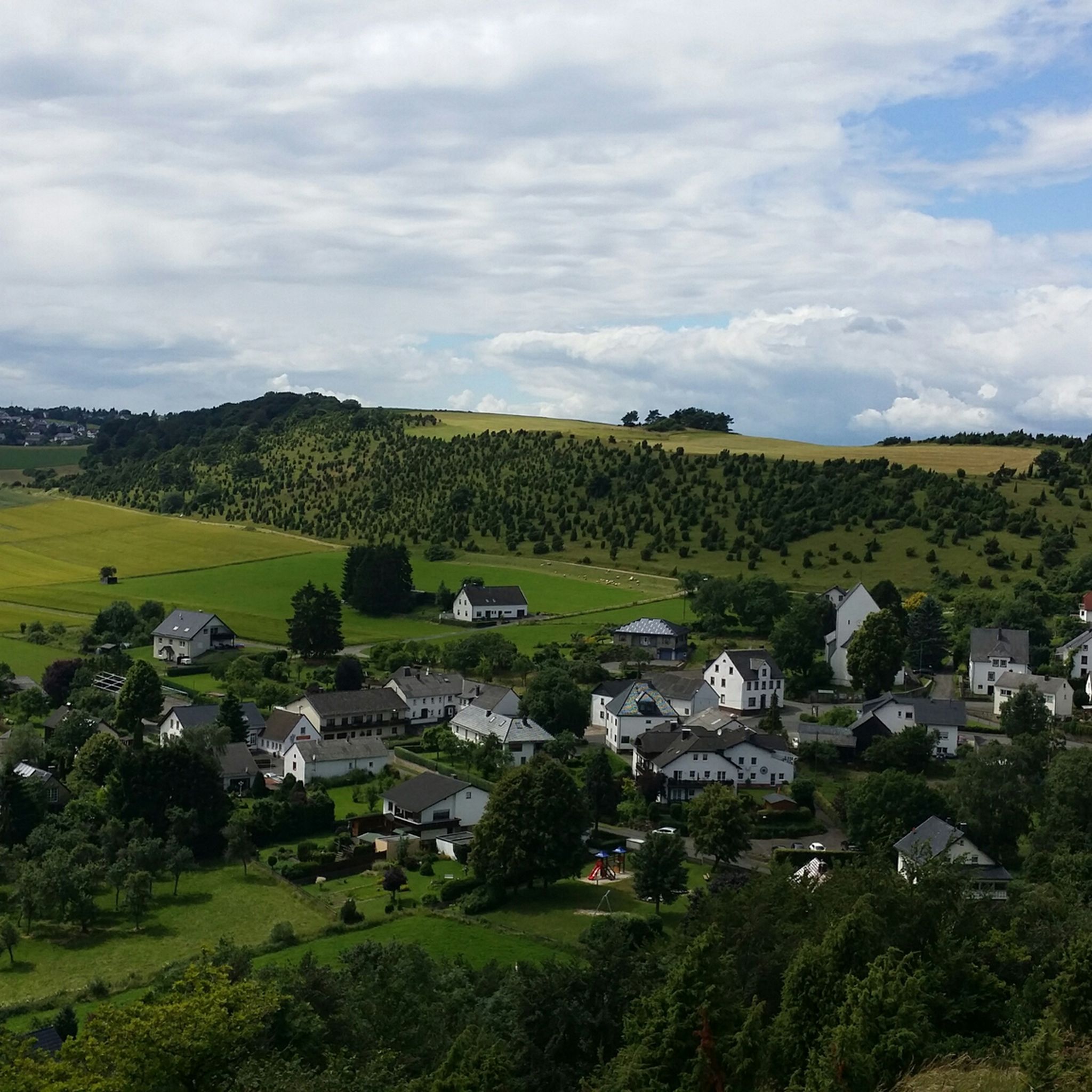
The mountain path leads through an extremely barren and beautiful juniper landscape. Loosened up by the Stations of the Cross and peppered with beautiful views of the valley.
9
0

Here, skiers and snowboarders are transported to the starting point with two tow lifts. From there, two blue-marked descents lead back down. The Schwarzer Mann ski area offers a total of 1.5 km of slopes for beginners, families and advanced skiers. www.skigebiete-test.de
3
0

In addition to Hellenthal-Udenbreth, one of the most famous winter sports areas in the Eifel. The Schwarzer Mann ski area is about 14 km northwest of Prüm in the Eifel. On the Schwarzen Mann ridge (697 meters peak) it offers an easy and a medium-difficulty downhill slope for relaxed skiing and snowboarding. An alternative to skiing is the natural toboggan run with its own toboggan lift. For children, the Schwarzer Mann winter sports center not only offers the two ski slopes, but also its own mini children's toboggan run. For cross-country skiers there are around ten kilometers of groomed cross-country trails. And hikers can look forward to around five kilometers of signposted winter hiking trails in the Schwarzen Mann winter sports area. To stop off, the Blockhaus Schwarzer Mann offers Eifel specialties, home-style cooking, coffee and cake and more. Source: https://www.skiresort.de/skigebiet/schwarzer-mann-pruem/
4
0

The approach is a bit steep, but the little effort is worth it. Must be done or seen. Of course, the weather has to play along.
25
0
Frequently Asked Questions
What kind of "mountain peaks" can I expect around Stadtkyll?
Around Stadtkyll, you'll find elevated hills and scenic viewpoints rather than towering mountain peaks like those in the Alps. These areas offer expansive panoramic views over the town and the picturesque Wirft valley, accessible via well-maintained hiking trails. The charm lies in the stunning vistas of the Eifel's characteristic forested hills and valleys.
Which elevated points offer the best panoramic views near Stadtkyll?
For breathtaking panoramic views, consider visiting the Kalvarienberg Trail (Alendorf), which provides beautiful views of juniper heaths. Another excellent spot is the View of Nürburg and Hohe Acht, offering a great perspective of the Nürburgring and the highest mountain in the Eifel. The Eifel view Steinbüchel and "Auf Zimmers" Height also provide magnificent vistas of Stadtkyll and the Wirft valley.
Are there any family-friendly elevated areas or viewpoints around Stadtkyll?
Yes, the Schwarzer Mann (Ski and Recreation Area) is known for being family-friendly, especially in winter with its ski slopes and toboggan run. The Wirfttal Nature Reserve also includes elevated sections and viewpoints that are suitable for families, often integrated into easier day hikes.
What are some popular hiking trails that lead to these elevated points?
Many elevated points are integrated into well-signposted hiking trails. For example, the Eifel view Steinbüchel is part of a circular trail (SY 5), and "Auf Zimmers" Height is accessible via the SY 6 hiking trail. The Wirfttal Nature Reserve features the SY 4 day hike. You can find more hiking options in the region by exploring the Hiking around Stadtkyll guide.
What is the best time of year to visit the elevated points around Stadtkyll?
The views are particularly enchanting in spring, with fresh greenery, and in autumn, when the foliage displays vibrant colors. Autumn also offers clear distant views before the trees are in full leaf. While accessible year-round, these seasons enhance the natural beauty of the Eifel landscape.
Can I visit these elevated points during winter?
Yes, some elevated points are popular in winter. The Schwarzer Mann (Ski and Recreation Area) is a significant peak in Rhineland Palatinate and a well-known winter sports area, offering slopes and cross-country trails. Other trails might be accessible, but it's advisable to check local conditions for snow and ice.
What kind of wildlife or natural features can I observe near these elevated points?
The Eifel region is rich in nature. Near elevated points like Langer Stein and Seimersberg, you might encounter large anthills and industrious dung beetles in the surrounding spruce forests. The juniper heaths near Kalvarienberg Trail (Alendorf) also support diverse flora and fauna. The Wirfttal Nature Reserve is excellent for observing local wildlife.
Are there any historical or man-made landmarks on these elevated points?
Yes, the Eifel-Bärbelkreuz Transmitter is a notable man-made landmark located on the forested plateaus of the Zitterwald. It's a broadcasting system at an altitude of 652 meters, named after the nearby Bärbelkreuz summit.
What other outdoor activities can I do near the elevated points around Stadtkyll?
Beyond hiking to viewpoints, the region offers a variety of outdoor activities. You can explore numerous road cycling routes, such as the 'Pig iron ladle car Jünkerath – Historic Watermill Birgel loop'. Mountain biking is also popular, with trails like the 'Wirfttal Nature Reserve – Bob-Etzel Memorial Stone loop'. For more details, check out the Road Cycling Routes around Stadtkyll and MTB Trails around Stadtkyll guides.
What do visitors enjoy most about the elevated points around Stadtkyll?
Visitors frequently praise the rewarding panoramic views after a climb, the tranquility of the Eifel forest, and the well-maintained hiking trails. The opportunity to immerse oneself in nature and experience the diverse flora and fauna is also highly valued. The Kalvarienberg Trail (Alendorf), for instance, is often highlighted for its beautiful views of the juniper heaths.
Are there any challenging routes to reach these elevated points?
While many trails are moderate, some routes involve steeper ascents. For example, the approach to the Kalvarienberg Trail (Alendorf) is described as a bit steep, and reaching "Auf Zimmers" Height involves a longer ascent through the forest. The Lieserpfad, a longer hiking trail, also offers more challenging sections with diverse scenery.
Most popular routes around Stadtkyll
Most popular attractions around Stadtkyll

Get inspired with the komoot mobile app


Explore more
See even more amazing summits around Stadtkyll with these guides:
