The best running trails around Knightdale
5.0
(3)
270
runners
27
runs
Jogging around Knightdale, North Carolina, offers access to an extensive greenway system and numerous parks. The region is characterized by a mix of paved trails, natural walking surfaces, and connections to larger networks like the Neuse River Trail. Jogging routes often feature scenic ponds, river views, and diverse landscapes within community parks and environmental preserves.
Best jogging routes around Knightdale
- The most popular jogging route is Two Pond and Little Falls loops, a 7.7 miles (12.4 km) trail that takes 1 hour 17 minutes to complete. This moderate route connects distinct water features, offering varied scenery for runners.
- Another top favourite among local runners is Milburnie Overlook – Skycrest Suspension Bridge loop from Buffalo Road Athletic Park Trailhead #88 Parking, a moderate 7.5 miles (12.1 km) path. This route features an overlook and a suspension bridge, providing scenic points along the way.
- Local runners also love the Neuse River Bridge loop from Wheatleigh at the Preserve, a 14.6 miles (23.5 km) trail leading through riverine landscapes, often completed in about 2 hours 27 minutes.
- Jogging around Knightdale is defined by extensive greenway systems, community parks, and river trails. The network offers options for different ability levels, from easy paved paths to longer, more challenging routes.
- The routes in Knightdale are highly rated by the komoot community with an average score of 5.0 stars from 8 reviews. Nearly 200 visitors have used komoot to explore Knightdale's varied terrain.
Last updated: May 28, 2026
5
runners
12.4km
01:17
70m
70m
Moderate run. Good fitness required. Mostly paved surfaces. Suitable for all skill levels.
5.0
(2)
17
runners
Hard run. Very good fitness required. Mostly paved surfaces. Suitable for all skill levels.

13
runners
Moderate run. Good fitness required. Mostly paved surfaces. Suitable for all skill levels.
8
runners
5.70km
00:35
40m
40m
Moderate run. Good fitness required. Mostly paved surfaces. Suitable for all skill levels.
8
runners
Moderate run. Good fitness required. Mostly paved surfaces. Suitable for all skill levels.
Get access to more routes and recommendations from other explorers.
Already have an account?
Our route recommendations are based on thousands of hikes, rides, and runs completed by other people on komoot.
Start today with a free account
Your next adventure awaits.
Popular around Knightdale
Tips from the Community

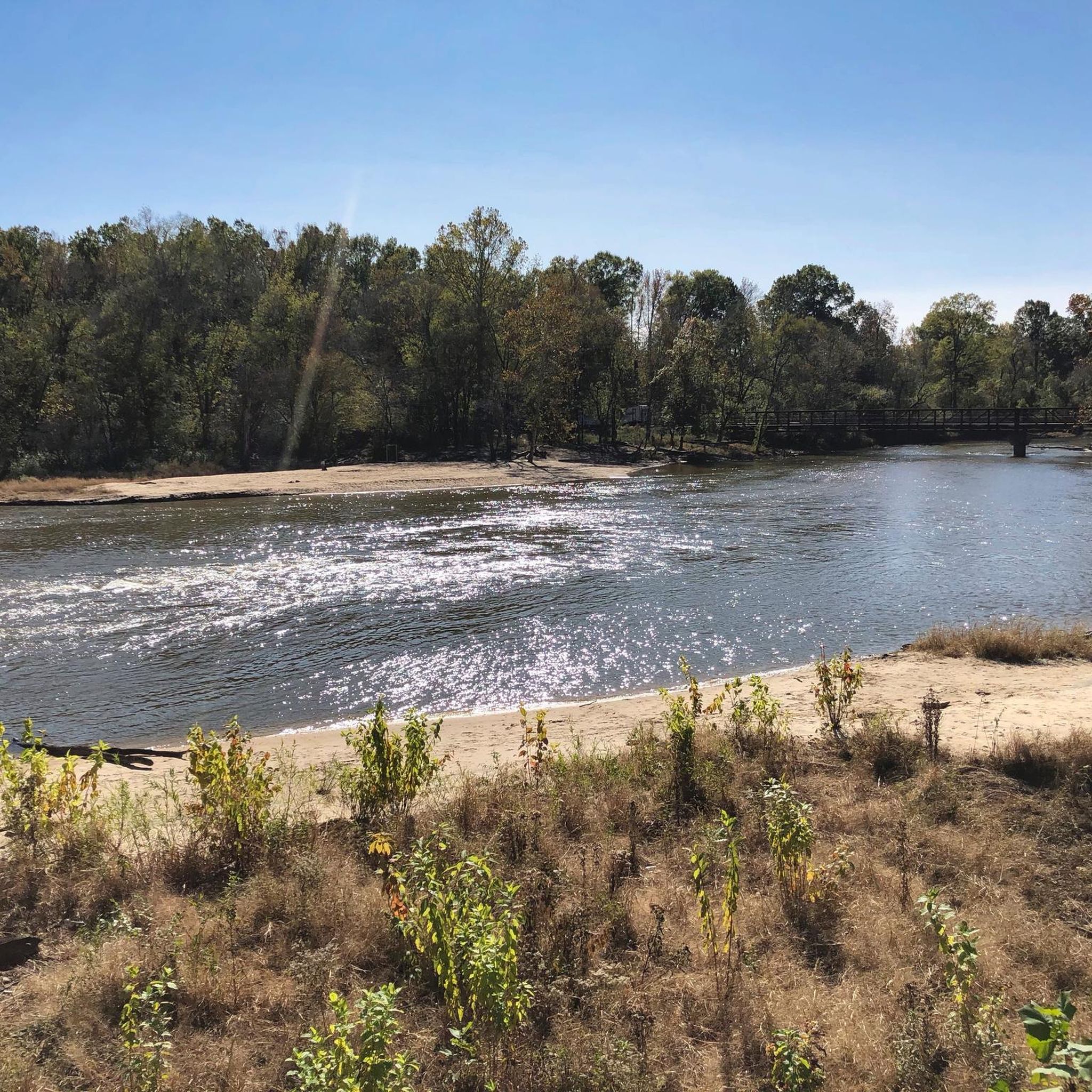
The Neuse River Greenway Trail stretches 34.6 miles from Falls Lake Dam to the Sam's Branch Greenway in Clayton. This multi-use path runs along the Neuse River with lush, tree-lined paths and multiple river crossings over bridges, including two suspension bridges. There are also short boardwalks through wetland areas that provide excellent wildlife viewing opportunities. On the southern end, the trail merges with the Clayton River Walk, extending the river's scenic views over an additional 4 miles. The trail connects to several other paths, including the Abbotts Creek Trail and Walnut Creek Trail, and is part of the East Coast Greenway network. There is drinking water and restrooms at the Buffaloe Road Athletic Park and Anderson Point Park.
0
0
The Neuse River Greenway Trail stretches 34.6 miles from Falls Lake Dam to the Sam's Branch Greenway in Clayton. This multi-use path runs along the Neuse River with lush, tree-lined paths and multiple river crossings over bridges, including two suspension bridges. There are also short boardwalks through wetland areas that provide excellent wildlife viewing opportunities. On the southern end, the trail merges with the Clayton River Walk, extending the river's scenic views over an additional 4 miles. The trail connects to several other paths, including the Abbotts Creek Trail and Walnut Creek Trail, and is part of the East Coast Greenway network. There is drinking water and restrooms at the Buffaloe Road Athletic Park and Anderson Point Park. Currently, there are closures between mile markers 13.75 and 17.25 until December 2024 and at mile marker 8 until January 2025, with a detour available for the latter. For the latest updates, including detour details, visit the City of Raleigh's trail page.
0
0

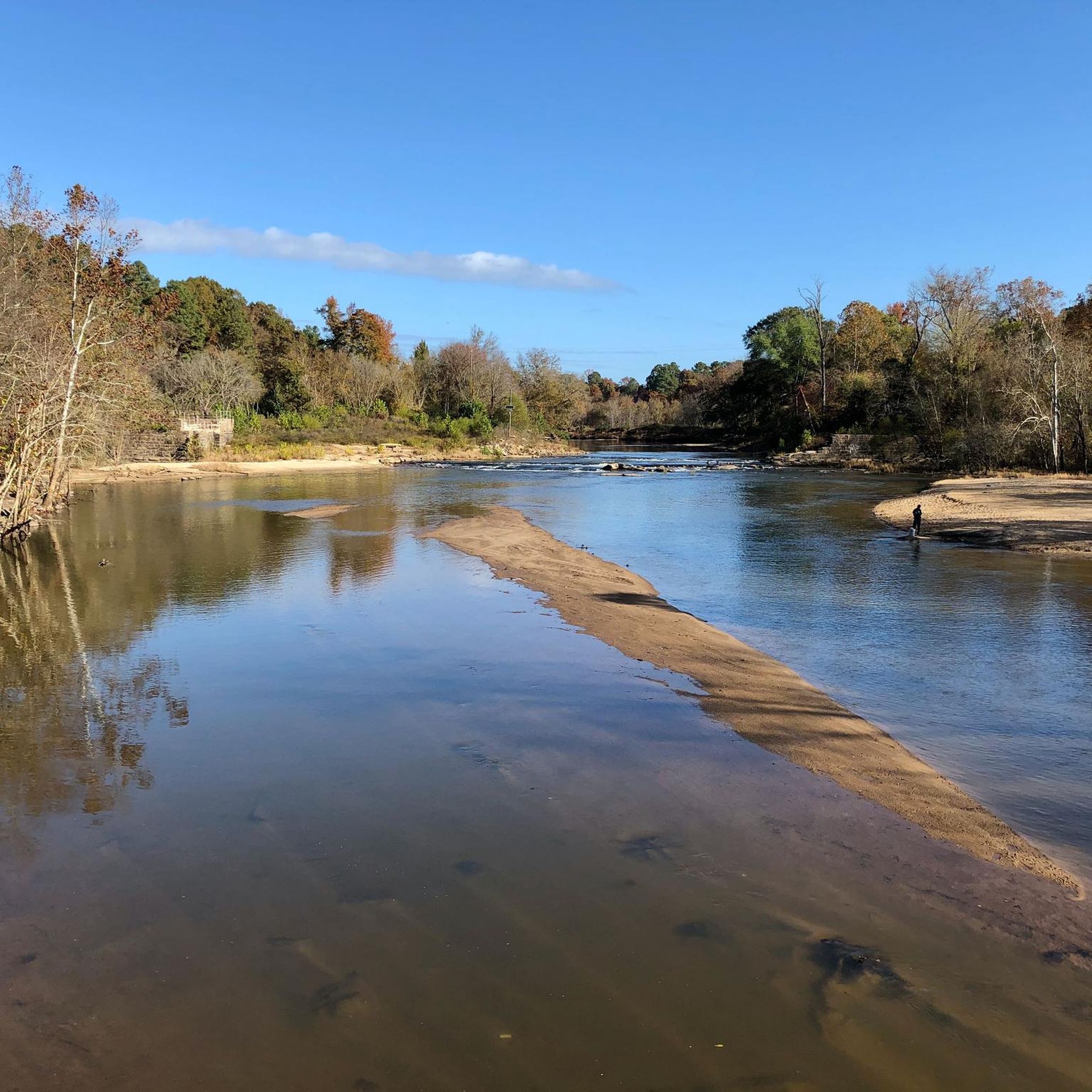
This was the site of the Milburnie Dam, which was built on centuries old mills and dams. Now, it has been removed and this section of the Neuse River is being cleaned up. There is an overlook spot that gives you a great view of the river.
1
0

Anderson Point Park is a 90-acre park that is home to the historic Anderson Family Homestead, as well as walking trails, an amphitheater, and sports fields.
0
0
This is one of two suspension bridges that span the Neuse River. The bridge is 275 feet long and has two 45-foot-tall steel towers.
0
0

Spanning 34.5 miles, The Neuse River Trail traces a paved greenway in the Raleigh region of North Carolina. It meanders alongside the Neuse River, extending from Falls Lake Dam to Clayton town. This scenic route traverses Raleigh, Wake Forest, Knightdale, and Clayton, spanning Wake and Johnston counties.
0
0
This is one of two suspension bridges that span the Neuse River. The bridge is 275 feet long and has two 45-foot-tall steel towers.
1
0
Anderson Point Park is a 90-acre park that is home to the historic Anderson Family Homestead, as well as walking trails, an amphitheater, and sports fields.
0
0
Frequently Asked Questions
How many running routes are available around Knightdale?
Komoot offers over 20 running routes around Knightdale, North Carolina. These routes vary in length and difficulty, providing options for different preferences and fitness levels.
What types of terrain can I expect on jogging trails in Knightdale?
Jogging routes in Knightdale feature a mix of surfaces. You'll find paved trails, especially within parks like Knightdale Station Park and along the Mingo Creek Greenway, which connects to the extensive Neuse River Trail. Some areas, such as the Knightdale Environmental Education Park, offer natural walking surfaces and boardwalks, allowing for a more immersive nature experience.
Are there running routes suitable for beginners in Knightdale?
Yes, Knightdale offers several easy jogging routes, particularly within its park system. For instance, Knightdale Station Park features two miles of paved trails ideal for casual runs. The broader greenway system also includes sections that are flat and well-maintained, perfect for those new to running or looking for a relaxed pace.
What do other runners say about the trails in Knightdale?
The running routes in Knightdale are highly rated by the komoot community, with an average score of 5.0 stars from 8 reviews. Runners often praise the diverse landscapes, well-maintained paths, and the scenic beauty of areas like the Neuse River Trail and local parks.
Are there any scenic viewpoints or landmarks along the jogging routes?
Yes, several routes offer scenic points. For example, the Milburnie Overlook – Skycrest Suspension Bridge loop features the Milburnie Overlook and the impressive Skycrest Suspension Bridge. The Neuse River Trail, accessible from Knightdale, also provides continuous river views and connections to other parks like Anderson Point Park.
Can I find trails with water features like rivers or ponds?
Absolutely. Many jogging routes in Knightdale incorporate water features. Knightdale Station Park has a central pond, and the Knightdale Environmental Education Park features a scenic pond. The Two Pond and Little Falls loops route specifically connects distinct water features. Additionally, the extensive Neuse River Greenway Trail offers continuous views of the Neuse River.
Are the jogging trails in Knightdale dog-friendly?
Many parks and greenways in Knightdale are dog-friendly, provided dogs are kept on a leash. Knightdale Station Park, for instance, includes a dedicated dog park, and its paved trails are suitable for running with your canine companion. Always check specific park rules before heading out.
Are there family-friendly running options in Knightdale?
Yes, Knightdale's parks and greenways are excellent for families. Knightdale Station Park offers paved, easy trails and amenities like playgrounds, making it ideal for families with children. The Knightdale Environmental Education Park also provides a tranquil setting with a boardwalk and natural trails that are suitable for a family outing.
Are there circular running routes available in Knightdale?
Yes, many of the running routes in Knightdale are designed as loops, offering a convenient way to start and finish at the same point. Examples include the Two Pond and Little Falls loops and the Milburnie Overlook – Skycrest Suspension Bridge loop.
Where can I find parking for the jogging trails in Knightdale?
Parking is generally available at the major parks and trailheads. For example, Knightdale Station Park offers ample parking. For routes connecting to the Neuse River Trail, various access points along the greenway system often have designated parking areas. You can find more information on specific park facilities at Knightdale's official parks website.
What is the longest running route available in Knightdale?
One of the longer running routes is the Neuse River Bridge loop from Wheatleigh at the Preserve, which spans 14.6 miles (23.5 km). This route takes you through riverine landscapes and is often completed in about 2 hours and 27 minutes.
Are there any challenging running routes for experienced joggers?
Yes, for more experienced runners, there are routes classified as difficult. The Neuse River Bridge loop from Wheatleigh at the Preserve is one such route, offering a longer distance and more sustained effort. The extensive network of greenways, particularly the Neuse River Trail, also allows for combining sections to create longer, more challenging runs.
Most popular attractions around Knightdale

Get inspired with the komoot mobile app


Explore more
Browse the best Running Trails & Routes in other regions.
