The best walks and hikes around Shelter Island
4.5
(8)
82
hikers
19
hikes
Hiking around Shelter Island, located between Long Island's North and South Forks, offers diverse landscapes for outdoor activities. The island, approximately 27 square miles, features protected wetlands, nature preserves, and extensive coastlines. Trails wind through habitats including tidal creeks, mature oak woodlands, prairie-like fields, and freshwater marshes, with generally flat terrain. The region is characterized by coastal paths, serene woodlands, and expansive nature preserves.
Best hiking trails around Shelter Island
- The most popular hiking route is Mashomack Preserve loop — Shelter Island, an 8.1 miles (13.1 km) trail that takes 3 hours 21 minutes to complete. This route explores a significant portion of the Mashomack Preserve, known for its diverse habitats including woodlands and tidal creeks.
- Another top favourite among local hikers is Grace Estate Preserve loop via Fosters & Paumanok Paths, a moderate 10.6 miles (17.1 km) path. This trail winds through varied terrain, including old-growth forests and farmlands, offering dramatic vistas.
- Local hikers also love the Arshamomaque Preserve Trail loop, a 1.7 miles (2.8 km) trail leading through woodlands and past an observation tower overlooking a pond, often completed in about 41 minutes.
- Hiking around Shelter Island is defined by coastal paths, serene woodlands, and expansive nature preserves. The network offers options for different ability levels, from easy strolls to moderate hikes.
- The routes in Shelter Island are highly rated by the komoot community with an average score of 4.4 stars from 6 reviews. More than 70 hikers have used komoot to explore Shelter Island's varied terrain.
Last updated: July 6, 2026
19
hikers
8.91km
02:18
50m
50m
Embark on the Mashomack Red, Yellow, Green and Jone C. Coles Loop for a moderate hike that spans 5.5 miles (8.9 km) with a gentle elevation gain of 157 feet (48 metres). You can expect to complete this diverse route in about 2 hours and 18 minutes. As you hike, you will move through dense forests, open meadows, and past tranquil ponds, offering a varied and engaging outdoor experience.
Before you head out, remember that the Mashomack Preserve is managed by The Nature Conservancy, so it is wise to check for any specific visitor guidelines or seasonal hours. Parking is generally available right at the preserve entrance, making access straightforward. Always plan your visit to ensure a smooth and enjoyable time on the trails.
This loop is a fantastic way to explore the natural beauty of Shelter Island, taking you along sections like the barrier-free Jone C. Coles Memorial Trail, which features a boardwalk. You will also pass Sanctuary Pond, a known habitat for various birds and turtles, adding to the preserve's rich biodiversity. It is a great opportunity to connect with nature and observe local wildlife.
10
hikers
2.81km
00:44
10m
10m
Explore the Mashomack Red Trail, an easy hiking route that guides you through a diverse landscape of freshwater marshes, tidal creeks, and serene oak forests. This pleasant path offers intimate views of natural surroundings, including Nicoll's Creek, making it a relaxing outdoor experience. You can complete the 1.7 miles (2.8 km) journey, with its gentle 46 feet (14 metres) elevation gain, in approximately 43 minutes.
When planning your visit, remember that the Mashomack Preserve is generally open from dawn to dusk, seven days a week. However, be aware that during January, the trails are only accessible on weekends. Dogs are not permitted anywhere within the preserve, so leave your furry friends at home. You can also enhance your hike by utilizing a free audio guide available on your mobile device.
Managed by The Nature Conservancy, the Mashomack Preserve is a significant natural area known for its rich biodiversity. As you hike, keep an eye out for the abundant wildlife, which includes wild turkeys and over 200 species of birds. This makes the trail an excellent spot for nature observation and a unique feature that sets it apart in the region.

Sign up for free
1
hikers
5.56km
01:26
30m
30m
The Grace Estate offers a delightful escape into nature, winding through a diverse landscape of oak-pine forests and unique kettle-hole wetlands. You'll discover centuries-old cart tracks, pass by the preserve's largest freshwater pond, and eventually reach a historic home site with sweeping views of Northwest Harbor. This easy 3.5-mile (5.6 km) hike, with a gentle 96 feet (29 metres) of elevation gain, is perfect for a relaxed outing, taking approximately 1 hour and 26 minutes to complete.
Planning your visit is straightforward, as the Grace Estate is open from dawn to dusk, allowing flexibility for your schedule. While there are no specific parking details provided, maps are available at the Town Clerk's Office if you wish to explore the full network of Grace Estate hiking trails. This trail is ideal for families and beginners looking for an accessible and rewarding outdoor experience.
Beyond its natural beauty, the Grace Estate holds significant historical and ecological importance. This 516-acre preserve was once home to three Native American villages and later formed part of the bustling port of Northwest Harbor. You can still find remnants of old farmsteads and enjoy birdwatching, with species like ovenbirds and peewees inhabiting the woodlands, making it a rich spot for wildlife at Grace Estate trails.
5.52km
01:25
30m
30m
The Linda Gronlund Trail Loop offers a delightful escape into nature, winding through a diverse landscape of coastal and pine barrens habitat. You'll experience the tranquility of white pinewoods and verdant moss beds, with the trail frequently opening up to panoramic views of Sag Harbor Bay, Peconic Bay, and Northwest Harbor. This easy 3.4-mile (5.5 km) hike, with only 93 feet (28 metres) of elevation gain, takes about 1 hour and 25 minutes, making it a perfect choice for a relaxing outing with stunning scenery.
Planning your visit requires a seasonal access permit for NYSDEC managed lands on Long Island, so secure that beforehand. Roadside parking is available, but always park with care. If you're bringing a canine companion, dogs are permitted on leashes in certain areas of the preserve.
This trail is part of the Linda Gronlund Memorial Nature Preserve, dedicated to a Sag Harbor resident who was a victim of the 9/11 attacks, adding a layer of historical significance to its natural beauty. The preserve's diverse ecosystem includes high-quality tidal wetlands and unique "blow-outs" along the trail that provide expansive harbor views, making it a notable natural area in Suffolk County.
3.20km
00:50
20m
40m
The Chatfields Hole via Northwest Path offers a serene journey through a historic woodland, perfect for a quick nature escape. You'll wander through an oak forest, where towering pitch pines and white pines create a soft, needle-covered path leading to the tranquil Chatfield's Hole, a beautiful glacial kettle hole. This easy 2.0-mile (3.2 km) hike, with only 67 feet (20 metres) of elevation gain, takes about 50 minutes, making it an accessible and rewarding experience for all.
Planning your visit is straightforward, with the trailhead offering easy access to this peaceful route. While specific parking information isn't detailed, arriving earlier in the day is always a good idea to ensure a spot, especially during peak times. The trail is enjoyable throughout the year, but the vibrant fall foliage around Chatfield's Hole, with its red maples and highbush blueberries, makes autumn a particularly scenic time to go.
This trail is part of the historic Northwest Woods, notable for having some of Long Island's largest white pine stands. Chatfield's Hole itself is a significant glacial feature, home to diverse wildlife like painted turtles, green frogs, and various fish, making it an excellent spot for nature observation. The Northwest Path also connects to the larger Paumanok Path, offering a glimpse into a broader network of trails across Long Island.
Get access to more routes and recommendations from other explorers.
Sign up for free
Already have an account?
Our route recommendations are based on thousands of hikes, rides, and runs completed by other people on komoot.
Start today with a free account
Your next adventure awaits.
Login or Signup
Popular around Shelter Island
Tips from the Community

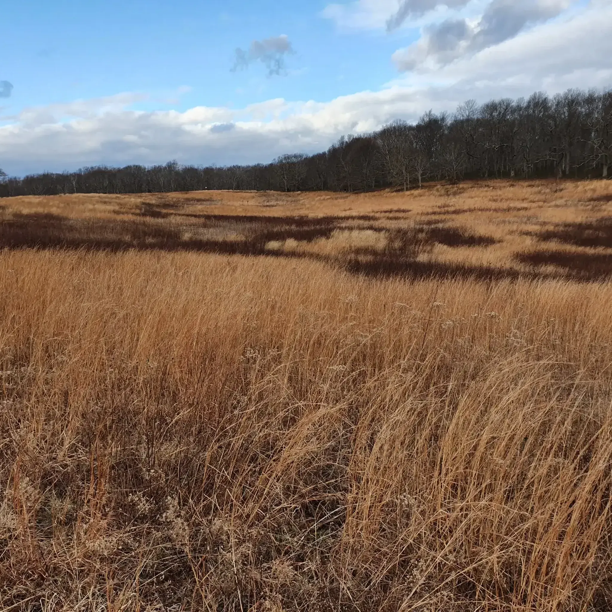
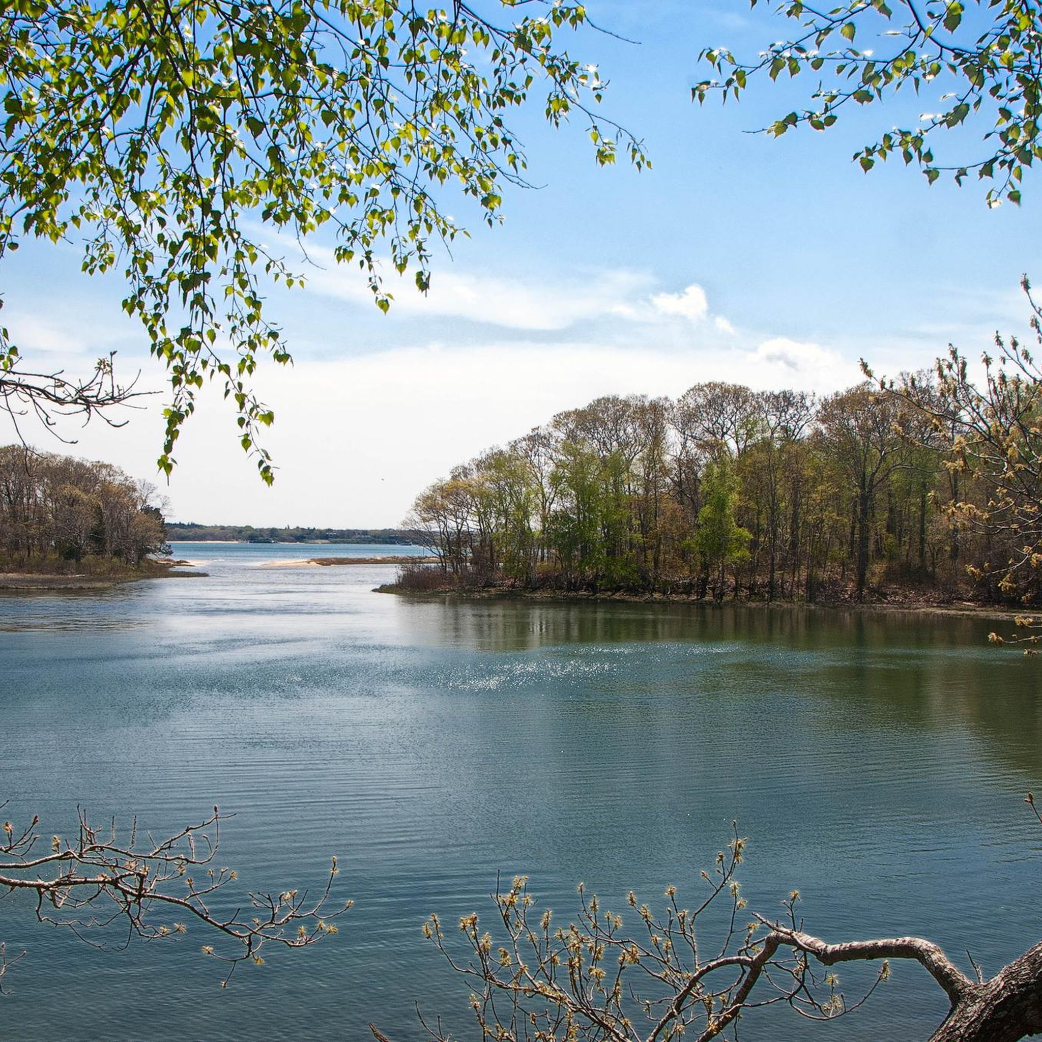
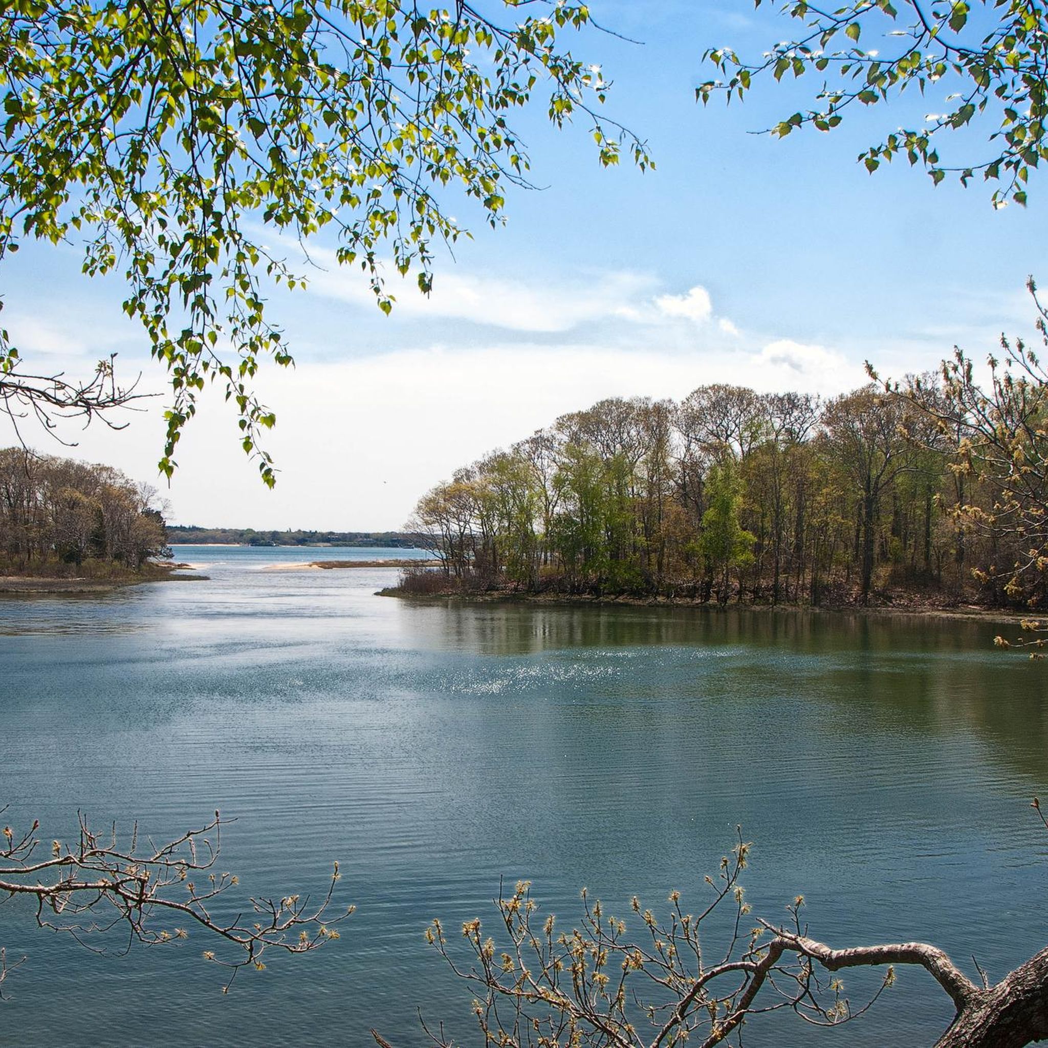
You can walk almost all the way around the ponds of this small park on wide, well-maintained trails that lead you deeper into the South Fork trail systems. There are a couple parking spots along the road with views of the water.
0
0

Grace Estate Preserve offers over 500 acres of water and woods for exploring. It has miles of trails and nice views of Northwest Harbor, and it's ideal for bird watching, hiking, running, and photography. The park is open year-round, from sunrise to sunset. Note that swimming is prohibited, and there is no lifeguard on duty. Dogs are welcome on the condition that owners pick up after them.
0
0
Nicoll's Creen is a marshy bay, part of Mashomack Preserve. This area is great for birdwatching and a scenic spot for a break.
0
0

Grace Estate Preserve, on Long Island, is a natural sanctuary, encompassing diverse habitats and scenic trails.
0
0
Frequently Asked Questions
What kind of terrain can I expect on Shelter Island hiking trails?
Shelter Island's hiking trails are characterized by generally flat terrain, winding through protected areas, along shorelines, and across open fields. You'll encounter diverse ecosystems including coastal paths, serene woodlands, and expansive nature preserves, with habitats like tidal creeks, mature oak woodlands, prairie-like fields, and freshwater marshes.
Are there any easy hiking trails suitable for beginners on Shelter Island?
Yes, Shelter Island offers several easy trails perfect for beginners or those seeking a relaxed stroll. For instance, the Arshamomaque Preserve Trail loop is a 1.7-mile path through woodlands, and the Elizabeth A. Morton National Wildlife Refuge also features an easy loop trail leading to a scenic beach.
Can I bring my dog on the hiking trails on Shelter Island?
While many areas on Shelter Island are dog-friendly, it's important to note that dogs are generally not permitted in the Mashomack Preserve, which covers a significant portion of the island. Always check specific preserve rules before bringing your dog. For other trails, dogs are often welcome on a leash.
What natural features or landmarks can I see while hiking on Shelter Island?
Shelter Island's trails offer a variety of natural beauty. You can explore the diverse habitats of Mashomack Preserve, including tidal creeks and oak woodlands, or visit the historic Sylvester Manor Educational Farm with its old-growth forests and shorefronts. Other notable spots include the observation towers at Arshamomaque Preserve overlooking a pond, and the scenic beach at Elizabeth A. Morton National Wildlife Refuge. You might also spot wildlife like birds, deer, and wild turkeys.
Are there any circular hiking routes on Shelter Island?
Yes, many of Shelter Island's trails are designed as loops, offering convenient circular routes. Examples include the Mashomack Preserve loop, the Arshamomaque Preserve Trail loop, and the Grace Estate Preserve loop, which winds through varied terrain.
What is the best time of year to go hiking on Shelter Island?
Shelter Island offers enjoyable hiking year-round. Spring brings blooming flora and active birdlife, while summer provides warm weather for coastal walks. Autumn showcases beautiful fall foliage, and winter offers quiet, serene trails, though some facilities might have reduced hours. The generally mild climate makes it a pleasant destination for outdoor activities in most seasons.
Are there family-friendly hiking options on Shelter Island?
Absolutely. Shelter Island has many trails suitable for families. The easy loop at Elizabeth A. Morton National Wildlife Refuge is known for its friendly birds and leads to a beautiful beach, making it a great option for children. Shorter, less strenuous loops like the Arshamomaque Preserve Trail loop are also ideal for families.
What do other hikers enjoy most about hiking on Shelter Island?
The hiking experiences on Shelter Island are highly rated by the komoot community, with an average score of 4.4 stars from 6 reviews. Hikers often praise the island's serene woodlands, diverse natural preserves, and the peaceful coastal paths that offer a refreshing escape into nature.
Is parking available at Shelter Island trailheads?
Parking is generally available at the entrances to many of Shelter Island's preserves and trailheads. For popular spots like Mashomack Preserve, designated parking areas are provided. It's always a good idea to check specific preserve websites or local signage for detailed parking information before your visit.
Are there any permits or fees required to hike on Shelter Island?
For most public preserves and trails on Shelter Island, there are no specific permits or fees required for hiking. However, the Mashomack Preserve, managed by The Nature Conservancy, may have specific entry guidelines or suggested donations. It's advisable to check their official website for the most current information regarding access.
How can I get to Shelter Island and its trailheads using public transport?
Shelter Island is accessible by ferry from Greenport on the North Fork or North Haven on the South Fork. Once on the island, public transportation options are limited. While some local services might exist, reaching specific trailheads often requires a car, bicycle, or taxi. Planning your route in advance is recommended.
Are there any less crowded hiking trails on Shelter Island?
For a quieter hiking experience, consider exploring some of the smaller preserves. Sachem's Woods offers a serene, mile-plus loop through an oak and beech forest, known for its low-key quality. Other options like Arshamomaque Preserve or the trails on Ram Island (including Section 9/Dressel Preserve) can also provide a more tranquil setting away from the busiest spots.
Most popular attractions around Shelter Island

Get inspired with the komoot mobile app


Explore more
Browse the best Hikes in other regions.
