The best road cycling routes around Mill Neck
4.5
(16)
332
riders
41
rides
Road cycling around Mill Neck features a landscape characterized by a mix of coastal proximity, gentle hills, and wooded areas. The region offers varied terrain suitable for road cyclists, with routes often passing by historic sites and natural water bodies. The area's topography provides a balance of flat stretches and moderate ascents.
Best road cycling routes around Mill Neck
- The most popular road cycling route is Sagamore Hill National Historic Site loop via Syosset, a 26.1 miles (42.0 km)…
Last updated: July 2, 2026
20
riders
42.8km
01:51
250m
250m
Easy road ride. Great for any fitness level. Mostly well-paved surfaces and easy to ride.
5.0
(1)
13
riders
43.5km
01:57
320m
320m
Moderate road ride. Good fitness required. Mostly well-paved surfaces and easy to ride.

Sign up for free
10
riders
19.9km
00:51
80m
80m
The Mill Pond – Centre Island loop from Oyster Bay offers a truly delightful road cycling experience, perfect for those seeking beauty without the burn. You'll wind through the tranquil,…
8
riders
12.2km
00:41
100m
100m
Easy road ride. Great for any fitness level. Mostly well-paved surfaces and easy to ride.
5.0
(1)
6
riders
38.2km
01:41
270m
270m
Easy road ride. Great for any fitness level. Mostly well-paved surfaces and easy to ride.
Get access to more routes and recommendations from other explorers.
Sign up for free
Already have an account?
Our route recommendations are based on thousands of hikes, rides, and runs completed by other people on komoot.
Start today with a free account
Your next adventure awaits.
Login or Signup


Tips from the Community

Theodore Roosevelt Sanctuary and Audubon Center is a nature preserve and educational facility for environmental conservation and education. It was named in honor of President Theodore Roosevelt, known for his progress in conservation. Theodore Roosevelt is buried right next door in the Youngs Memorial Cemetery.
0
0
Centre Island Beach is located off Bayville-Centre Island Road and is open to Oyster Bay residents and non-residents. Visitors can swim in Oyster Bay Harbor and Long Island Sound and use the showers to rinse off afterwards. Lifeguards are on duty from 9 a.m. to 5 p.m. on weekends and holidays from May 27th to June 18th and daily from June 24th to September 4th.
0
0
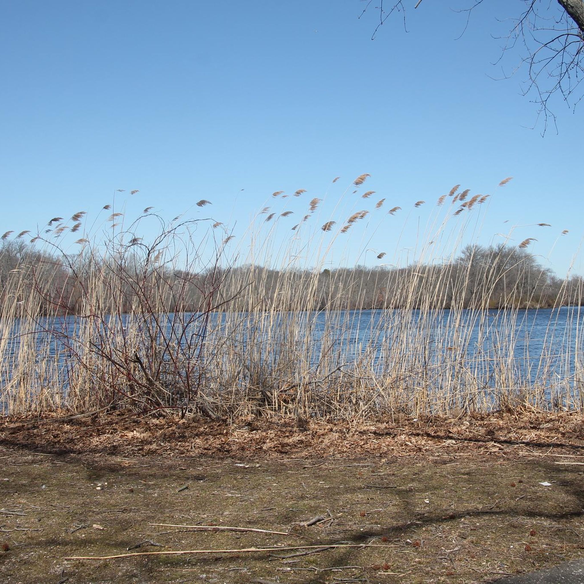
Allsop-Fisher Saltmarsh is not directly open for the public to explore, as it is a protected area, but you can get a good look down into the marsh from the bridge running over it on Cleft Road. This saltmarsh, like many others, is vital to the natural area and to the locals who live here due to its role as a storm buffer, nutrient supply, and diverse ecosystem.
0
0

Centre Island offers quiet roads, waterfront views, and lush greenery. The Island is home to about 400 people and is 92% white. Based on the median home price, the air has a strong smell of G-Wagon leather and Costco memberships.
1
0

Theodore Roosevelt Memorial Park caters to cyclists with picturesque views of Oyster Bay Harbor and Long Island Sound. You will find scenic resting spots along the waterfront, where you can relax, appreciate the coastal beauty, and enjoy glimpses of boats passing by, creating a tranquil and rejuvenating experience in this New York park.
1
0

For a small beach this has an absolutely stunning seascape view. It simply is a wonderful place to stop off for a few minutes to look out across Oyster Bay.
0
0
Allsop-Fisher Saltmarsh is not directly open for the public to explore, as it is a protected area, but you can get a good look down into the marsh from the bridge running over it on Cleft Road. This saltmarsh, like many others, is vital to the natural area and to the locals who live here due to its role as a storm buffer, nutrient supply, and diverse ecosystem.
1
0
Frequently Asked Questions
How many road cycling routes are available around Mill Neck?
There are over 35 road cycling routes available around Mill Neck, catering to various skill levels. These routes explore the region's mix of coastal areas, gentle hills, and wooded landscapes.
Are there any easy road cycling routes for beginners or families in Mill Neck?
Yes, Mill Neck has several easy road cycling options. For a pleasant ride with minimal elevation gain, consider the Old Westbury Pond loop from Syosset, which is about 26 miles long. Another accessible option is the Mill Pond – Muttontown Road loop from Oyster Bay.
What kind of terrain can I expect on road cycling routes in Mill Neck?
Road cycling around Mill Neck features a diverse landscape. You'll find routes with coastal paths, gentle hills, and stretches through wooded areas. The topography provides a good balance of flat sections and moderate ascents, often passing by historic sites and natural water bodies.
Are there any challenging road cycling routes or climbs in the Mill Neck area?
While Mill Neck is known for its gentle hills, some routes offer more significant elevation. The East Shore Road – Sands Point - Lighthouse Road loop from Syosset, for example, is a moderate route spanning over 50 miles with nearly 700 meters of elevation gain, providing a more demanding ride.
What are some scenic highlights or attractions I can see along the road cycling routes?
Many routes in Mill Neck pass by scenic points and historic sites. You might cycle near the Cold Spring Harbor State Park, or the historic Walled Garden of Knollwood Estate. Coastal routes can offer views of Tappen Beach or salt marshes.
Are there road cycling routes that are loops around Mill Neck?
Yes, many of the road cycling routes in the Mill Neck area are designed as loops, offering convenient starting and ending points. Examples include the popular Sagamore Hill National Historic Site loop via Syosset and the Jones Beach State Park – Jones Beach Bike Path loop from Syosset.
What is the best season for road biking in Mill Neck?
The spring and fall seasons generally offer the most pleasant conditions for road biking in Mill Neck, with mild temperatures and beautiful foliage. Summer can also be enjoyable, especially on coastal routes, but be prepared for warmer weather. Winters can be cold, with potential for icy conditions.
Are there any cafes or places to stop for refreshments along the road cycling routes?
While specific cafes vary by route, many routes pass through or near charming towns and villages on Long Island where you can find local eateries and cafes. Planning your route with komoot allows you to discover points of interest and refreshment stops along the way.
What do other road cyclists enjoy most about road cycling in Mill Neck?
The road cycling routes in Mill Neck are highly rated by the komoot community, with an average score of 4.7 stars. Reviewers often praise the varied terrain, the scenic coastal views, and the opportunity to cycle past historic sites.
Is there public transportation access to road bike trails near Mill Neck?
Mill Neck is located on Long Island, and while some areas are accessible by the Long Island Rail Road (LIRR), direct public transport access to specific trailheads can vary. It's advisable to check LIRR schedules and local bus routes for the most convenient access points to your chosen cycling route.
Are there less crowded road cycling routes available in Mill Neck?
To find less crowded routes, consider exploring some of the lesser-known paths further inland or during off-peak hours. While popular routes like those near Sagamore Hill can attract more riders, komoot's route planner can help you discover quieter alternatives based on community data and local knowledge.
Most popular routes around Mill Neck
Most popular attractions around Mill Neck

Get inspired with the komoot mobile app


Explore more
Browse the best Road cycling routes in other regions.
