The best road cycling routes around Stanhope
4.3
(11)
232
riders
62
rides
Road cycling routes around Stanhope are situated within the North Pennines National Landscape, an area characterized by its upland terrain. The region features a network of quiet roads and lanes, often presenting challenging gradients and significant elevation changes. Stanhope itself is nestled in Weardale, known for its varied countryside and geological formations. This landscape provides a diverse setting for road cyclists, from rolling hills to more demanding climbs.
Best road cycling routes around Stanhope
- The most popular road cycling route…
Last updated: October 19, 2026
4.5
(2)
3
riders
78.4km
03:34
740m
740m
Moderate road ride. Good fitness required. Mostly well-paved surfaces and easy to ride.
4.5
(2)
19
riders
36.2km
01:46
340m
340m
Moderate road ride. Good fitness required. Mostly well-paved surfaces and easy to ride.

3.0
(1)
14
riders
90.4km
04:30
1,100m
1,100m
Hard road ride. Very good fitness required. Some segments of this route may be unpaved and difficult to ride.
10
riders
72.7km
03:14
540m
540m
Moderate road ride. Good fitness required. Mostly well-paved surfaces and easy to ride.
8
riders
98.1km
04:52
1,280m
1,280m
Hard road ride. Very good fitness required. Mostly well-paved surfaces and easy to ride.
Get access to more routes and recommendations from other explorers.
Already have an account?
Our route recommendations are based on thousands of hikes, rides, and runs completed by other people on komoot.
Start today with a free account
Your next adventure awaits.

Tips from the Community

The old train station was built in the late 1800s for the Central Railroad of New Jersey. Today, it serves as a hub for the Califon Historical Society and access point for the Columbia Rail Trail. Supposedly, the name Califon comes from a shortening of "California", since the painter creating the station map didn't leave enough room for the original title.
0
0


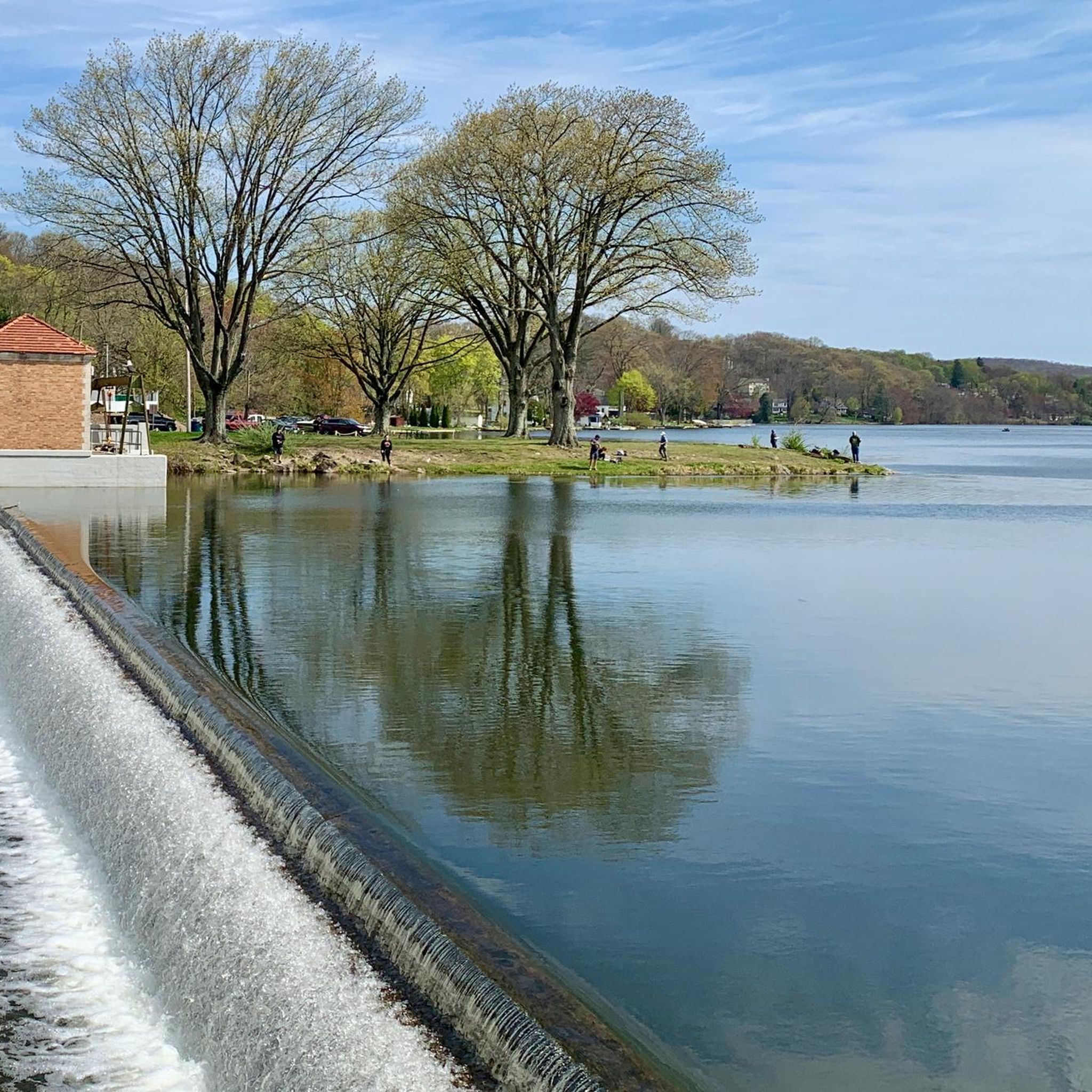
Brady Bridge on Lake Hopatcong connects Brady Marina with Prospect Point. The views out over the lake with its tree-lined residential shores, complete with its jetties of boats, make this crossing a bit special, as the views are simply stunning.
1
0

This Thomas Edison Monument is a quick pull-off from Edison Road and gives visitors the chance to learn about the inventor of the practical electric light bulb.
0
0
Kittatinny Valley State Park has over 5,000 acres of scenic green space. Once used for agriculture and mining, it is now popular for hiking, biking, and fishing. Keep an eye out for deer and wild turkey. Visitors can also enjoy water activities at nearby Lake Aeroflex and Gardner's Pond.
0
0
Heaters Pond, the main attraction of Heaters Pond Park, can be seen while riding on Edison Road. For a fee of $7 per season, visitors can swim and hang out on the beach. Heaters Pond has not only swimming areas but also a dock, a bathroom, an island with a large overhang, grills, and picnic tables.
0
0

The Columbia Trail is a gorgeous Greenway along the South Branch Raritan River from this trail head to High Bridge, almost 15.5 miles to the south. Absolutely incredible views all the way through, autumn could be the best time to enjoy the trail. This parking at the northern trailhead isn't very big, but a couple of cars can fit in it.
0
0

Walk, bike, or jog along the park's trails, soaking in the panoramic views of the lake and surrounding woodlands. Take a break at one of the picnic areas and savor a delicious lunch with a breathtaking backdrop.
0
0
Frequently Asked Questions
What kind of terrain can I expect on road cycling routes around Stanhope?
Road cycling around Stanhope is characterized by hilly terrain and significant elevation changes, set within the stunning North Pennines National Landscape. You'll find a network of quiet country roads and lanes, offering everything from rolling hills to demanding climbs. The region is known for some of England's highest roads, providing a challenging yet rewarding experience for cyclists.
Are there road cycling routes suitable for beginners or those looking for an easier ride?
Yes, while many routes in Stanhope are known for their challenging gradients, there are options for less experienced riders. The komoot community has identified approximately 10 easy road cycling routes in the area. These routes offer a gentler introduction to the region's beautiful scenery without the most demanding climbs.
How many road cycling routes are available in the Stanhope area?
There are over 60 road cycling routes available around Stanhope, catering to various fitness levels. The majority, around 50, are classified as moderate, offering a balanced ride with some elevation changes, while about 6 routes are considered difficult for those seeking a significant challenge.
What natural features or landmarks can I see while road cycling near Stanhope?
The Stanhope area, nestled in the North Pennines National Landscape, offers breathtaking natural beauty. You can explore the dramatic dales of Weardale, open heather moors, and flower-rich hay meadows. Keep an eye out for impressive waterfalls like High Force and Low Force in Upper Teesdale, or enjoy the stunning views over Stanhope from the Dickerson Mine Preserve. You might also pass by serene spots like Whites Pond or Lake Musconetcong.
Are there any circular road cycling routes from Stanhope?
Yes, many road cycling routes around Stanhope are designed as circular loops, allowing you to start and finish in the same location. For example, the 35-mile circular route from Stanhope to Killhope offers challenging hills and scenic vistas. You can also find routes like the Cage Hill – Lake Musconetcong loop from Mount Olive, which provides a moderate circular ride.
What do other cyclists say about road cycling in Stanhope?
The road cycling routes around Stanhope are highly rated by the komoot community, with an average score of 4.2 stars from over 11 reviews. Cyclists often praise the quiet country roads, the challenging yet rewarding gradients, and the stunning panoramic views across the North Pennines National Landscape.
Can I find challenging road cycling routes in the Stanhope area?
Absolutely. Stanhope is renowned for its challenging road cycling. The region features demanding climbs, with some routes reaching over 2,000 feet (610 m) in elevation. Routes like the 59.1km 'St Johns Chapel and Middleton-in-Teesdale loop' or the Saffin Pond – Sharp climb Minnesink Road loop from Lake Hopatcong are particularly suited for experienced cyclists seeking a significant test of their fitness.
What is the best time of year for road cycling in Stanhope?
The best time for road cycling in Stanhope is generally from spring through autumn. During these seasons, the weather is more favorable, and the stunning landscapes of the North Pennines are at their most vibrant. While winter cycling is possible, be prepared for colder temperatures, potential ice, and shorter daylight hours, especially given the region's higher elevations.
Are there any long-distance road cycling routes that pass through Stanhope?
Yes, Stanhope is integrated into larger cycling networks. An alternative route of the famous Coast to Coast (C2C) cycle route passes through Weardale, offering spectacular views and a challenging ride. This makes Stanhope a great base or stopover for longer cycling adventures.
Where can I find places to eat or drink along the road cycling routes in Stanhope?
Stanhope itself, as a hub in Weardale, offers various cafes and pubs where cyclists can refuel. While specific establishments along every route aren't detailed, the charming historic settlements scattered throughout Weardale often provide opportunities for refreshments. Planning your route to pass through these villages will ensure you have options for breaks.
Are there any trails or parks nearby that offer different types of outdoor activities?
Yes, beyond road cycling, the area offers diverse outdoor activities. Nearby Kittatinny Valley Park and Hamsterley Forest provide extensive woodlands with trails for mountain biking, walking, and horse riding. You can also explore the Sussex Branch Trail or the Highlands Trail for different experiences.
Most popular attractions around Stanhope

Get inspired with the komoot mobile app


Explore more
Browse the best Road cycling routes in other regions.
