The best road cycling routes around Millis-Clicquot
4.8
(22)
672
riders
117
rides
Road cycling routes around Millis-Clicquot traverse a landscape characterized by a blend of rural charm and natural environments. The region features extensive wetlands, dense woodlands, and open fields, often with rolling terrain. Over half of Millis's border is defined by the Charles River, providing scenic spots. The area offers a mix of quiet, scenic roads and dedicated cycling infrastructure, including sections of the Upper Charles Trail.
Best road cycling routes around Millis-Clicquot
- The most popular road cycling route is Norfolk…
Last updated: May 30, 2026
5
riders
54.9km
02:20
390m
390m
Moderate road ride. Good fitness required. Mostly well-paved surfaces and easy to ride.
44.9km
01:52
290m
290m
Easy road ride. Great for any fitness level. Mostly well-paved surfaces and easy to ride.

Sign up for free
5.0
(2)
33
riders
75.8km
03:23
590m
590m
Moderate road ride. Good fitness required. Mostly well-paved surfaces and easy to ride.
5.0
(2)
37
riders
38.8km
01:48
210m
210m
Moderate road ride. Great for any fitness level. Some segments of this route may be unpaved and difficult to ride.
5.0
(1)
10
riders
48.5km
02:01
340m
340m
Moderate road ride. Good fitness required. Some segments of this route may be unpaved and difficult to ride.
Get access to more routes and recommendations from other explorers.
Sign up for free
Already have an account?
Our route recommendations are based on thousands of hikes, rides, and runs completed by other people on komoot.
Start today with a free account
Your next adventure awaits.
Login or Signup



Tips from the Community

There is a bit of everything here at Louisa Lake. It is a very scenic area and along with nearby Milford Pond, it provides a great venue for a variety of recreational activities, especially bicycling. Nearby is the Upper Charles Trail, a super good cycling trail.
0
0

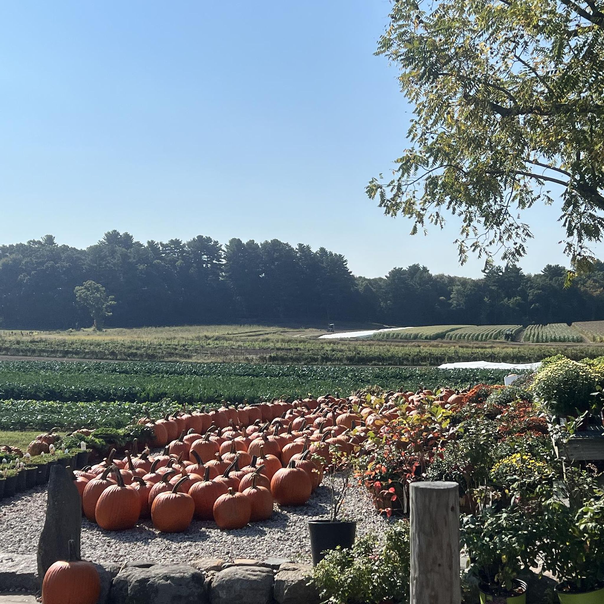
This very pleasant section of road leads you to Moose Hill Farm. Moose Hill is a very old wildlife reserve created in 1916. This place is also home to the Nature Cooperative School, where students explore the surrounding pastures, meadows, woods, and wetlands on a daily basis.
0
0

This 107-acre sanctuary, located adjacent to Bristol Blake State Reservation, features a one-mile trail that circles Stony Brook Pond and ends up at the site of a former mill, where there is a beautiful waterfall. A long boardwalk along the trail allows visitors to observe birds and wildlife, including turtles, ducks, blue herons, and the wetland habitat over Teal Marsh and Kingfisher Pond. The refuge also features natural history exhibits, a picnic area, and a butterfly garden
0
0

You'll gain wonderful views of Willett Pond on both side of the road giving a lovely feeling of being immersed in nature. As much of the pond is surrounded by private property, this is one of the best views you can gain of it whilst cycling.
0
0
This 107-acre sanctuary, located adjacent to Bristol Blake State Reservation, features a one-mile trail that circles Stony Brook Pond and ends up at the site of a former mill, where there is a beautiful waterfall. A long boardwalk along the trail allows visitors to observe birds and wildlife, including turtles, ducks, blue herons, and the wetland habitat over Teal Marsh and Kingfisher Pond. The refuge also features natural history exhibits, a picnic area, and a butterfly garden.
0
0

This unpronounceable pond is a popular fishing and bird watching area. It is a little harder to see the pond from the road in the summertime when the trees are in leaf, but easy to see in the winter months.
0
0
This very pleasant section of road leads you to Moose Hill Farm. Moose Hill is a very old wildlife reserve created in 1916. This place is also home to the Nature Cooperative School, where students explore the surrounding pastures, meadows, woods and wetlands on a daily basis.
0
0
The Upper Charles Trail in Massachusetts offers cyclists a scenic route through historic mill towns, verdant woodlands, and along the Charles River. This multi-use trail spans diverse landscapes, showcasing the region's industrial heritage.
0
0
Frequently Asked Questions
What kind of terrain can I expect on road cycling routes around Millis-Clicquot?
Road cycling routes in Millis-Clicquot feature a diverse landscape with a blend of rural charm and natural environments. You'll encounter extensive wetlands, dense woodlands, and open fields, often with rolling terrain. Over half of Millis's border is defined by the Charles River, providing many scenic spots. Roads like Claybrook Road are known for being winding, smooth, and rolling with minimal traffic, offering gentle gradients.
Are there any easy or beginner-friendly road cycling routes in the area?
Yes, there are several easy routes suitable for beginners. For instance, the Medfield to Moose Hill Reservation loop via Willet Pond is an easy 27.9-mile path that offers a scenic journey through the rural character of Millis on country roads. Overall, about 36 of the 121 routes in the region are classified as easy.
What are some scenic points of interest or landmarks I can see while road cycling?
Millis-Clicquot offers several scenic points. You can cycle along the Charles River, which defines much of Millis's border. Specific highlights include the Claybrook Road itself, known for views of trees, ponds, and swans. The Upper Charles Trail is also a significant cycling infrastructure. You might also pass by the King Philip's Overlook or the Hartford Street route, which runs between the Fork Factory Brook Reservation and Rocky Woods Reservation.
Are there any long-distance road cycling routes available?
For those seeking longer rides, the Claybrook Road – Gregg Conservation Land loop from Norfolk is a substantial 47.3-mile (76.1 km) trail, typically completed in about 3 hours 25 minutes. Another option is the Norfolk to Gregg Conservation Land loop via Claybrook Road, which covers 34.1 miles (54.9 km).
What do other road cyclists say about the routes in Millis-Clicquot?
The road cycling routes around Millis-Clicquot are highly rated by the komoot community, with an average score of 4.7 stars from over 20 reviews. Cyclists often praise the quiet, scenic roads, the blend of rural charm, and the dedicated cycling infrastructure like sections of the Upper Charles Trail. Many appreciate the rolling terrain and natural features such as the Charles River and woodlands.
Can I find loop routes for road cycling in Millis-Clicquot?
Yes, many of the road cycling routes in the area are designed as loops, offering convenient starting and ending points. Examples include the Norfolk to Gregg Conservation Land loop via Claybrook Road and the Medfield to Moose Hill Reservation loop via Willet Pond. These loops allow you to experience the diverse landscapes without retracing your path.
Are there any family-friendly paved bike paths near Millis-Clicquot?
The Upper Charles Trail is highlighted as a 'super good cycling trail' and is part of a larger plan to connect several communities, making it an excellent option for family-friendly cycling. While the region offers many quiet country roads, dedicated paved paths like sections of the Upper Charles Trail provide a safer and more accessible experience for families.
What is the best time of year for road biking in Millis-Clicquot?
The region is particularly beautiful in autumn when the woodlands, such as those around Oak Grove Farm, boast spectacular tree colors. Spring and summer also offer pleasant conditions for cycling, with lush greenery and opportunities to observe waterfowl and other wildlife around spots like South End Pond and Richardson's Pond. Always check local weather conditions before heading out.
Where can I find parking for cyclists in Millis-Clicquot?
While specific parking areas for cyclists are not detailed in the route descriptions, the rural character of Millis and its connection to multi-town trail networks suggest that parking may be available near trailheads or in town centers of Millis and neighboring communities like Medway and Sherborn. It's advisable to check local municipal websites or specific route starting points for designated parking facilities.
Are there any routes that pass by lakes or ponds?
Yes, several routes offer views of or pass near local water bodies. The Medfield to Moose Hill Reservation loop via Willet Pond, for example, goes by Willett Pond. You might also encounter Sawmill Pond or Shapiro Beach on other routes, offering picturesque views and opportunities for wildlife spotting.
What are some advanced road cycling routes in the Millis-Clicquot area?
While most routes are easy to moderate, the region does offer more challenging options. For instance, the Upper Charles Trail – Louisa Lake loop from Medway is a moderate 39-mile route with notable elevation gain. The overall network includes 84 moderate routes and 1 difficult route, providing options for experienced cyclists looking for a challenge.
Are there any cafes or places to stop for refreshments along the routes?
Millis-Clicquot and its surrounding towns like Medway and Sherborn, which are often connected by the cycling routes, offer local amenities. While specific cafes on routes are not listed, the general rural character means you'll find small town centers where you can stop for refreshments. It's a good idea to plan your route with potential stops in mind or carry sufficient supplies.
What is the overall difficulty level of road cycling in Millis-Clicquot?
The road cycling routes around Millis-Clicquot cater to various ability levels. Out of 121 total routes, 36 are classified as easy, 84 as moderate, and 1 as difficult. This means you can find everything from gentle rides through scenic countryside to more challenging routes with greater distances and elevation changes, such as the Claybrook Road – Gregg Conservation Land loop from Medfield.
Most popular attractions around Millis-Clicquot

Get inspired with the komoot mobile app


Explore more
Browse the best Road cycling routes in other regions.
