The best running trails around Point Of Rocks
117
runners
8
runs
Jogging around Point Of Rocks offers access to a network of trails characterized by the historic Chesapeake and Ohio Canal and the scenic Potomac River. The terrain primarily features flat, multi-use paths, often with a compact gravel or concrete surface, ideal for consistent running. While many routes are relatively flat, some longer options include gentle elevation changes, providing variety for different fitness levels. The region is defined by its waterside landscapes and historical landmarks along the canal.
Best jogging routes around Point Of Rocks
- The most popular jogging route is Chesapeake and Ohio Canal Trail, a 12.9 miles (20.8 km) trail that takes 2 hours 8 minutes to complete. This route follows the historic canal, offering consistent waterside views and a generally flat surface.
- Another top favourite among local runners is Chesapeake and Ohio Canal Towpath, a moderate 7.7 miles (12.4 km) path. This section of the towpath provides a mix of flat running with some gentle elevation, showcasing the natural beauty of the Potomac River valley.
- Local runners also love the Monocacy River Bridge – Monocacy Aqueduct loop from Monocacy Aqueduct, a 18.3 miles (29.4 km) trail leading through historic aqueducts and river scenery, often completed in about 3 hours 2 minutes.
- Jogging around Point Of Rocks is defined by the historic Chesapeake and Ohio Canal, the Potomac River, and notable aqueducts. The network offers options for various ability levels, from long, flat runs to routes with moderate elevation gain.
- The guide includes highly-rated routes that showcase the best of the region's landscape. More than 76 runners have used komoot to explore Point Of Rocks's varied terrain.
Last updated: July 7, 2026
20
runners
20.8km
02:08
20m
20m
Lace up for a challenging jogging adventure on the Chesapeake and Ohio Canal Trail. This difficult route spans 13.0 miles (20.8 km) and involves a gentle 60 feet (18 metres) of elevation gain, taking approximately 2 hours and 8 minutes to complete. As you jog, you'll follow the historic C&O Canal, enjoying the consistent shade from a lush tree canopy. The path runs alongside the Potomac River, offering serene water views and opportunities to spot local wildlife. You'll also encounter the impressive Monocacy Aqueduct, a notable historical landmark along your journey. While mostly flat crushed stone, be prepared for some rougher sections with roots or potholes.
Planning your visit is straightforward, as parking is typically available at various access points along the C&O Canal Towpath. You won't need any special permits or have to worry about fees to access the trail. The route is open year-round, but spring and fall offer the most pleasant temperatures for jogging. Starting your journey earlier in the day can help you avoid crowds, especially on weekends. Always check local conditions before you go, as weather can impact trail surfaces.
This section of the Chesapeake and Ohio Canal is part of a larger National Historical Park, preserving a significant piece of American history. The canal itself was a vital transportation route in the 19th century, and jogging its towpath offers a unique connection to the past. You might spot turtles and herons in the canal waters, adding to the natural charm of the experience. The trail's consistent beauty and historical context make it a standout option for a dedicated jogging session.
7
runners
12.4km
01:17
70m
70m
Jog the moderate 7.7-mile Chesapeake and Ohio Canal Towpath, enjoying Potomac River views and historic aqueducts.

Sign up for free
14
runners
12.0km
01:14
10m
10m
Moderate run. Good fitness required. Mostly paved surfaces. Suitable for all skill levels.
13
runners
Hard run. Very good fitness required. Mostly paved surfaces. Suitable for all skill levels.
12
runners
Hard run. Very good fitness required. Mostly paved surfaces. Suitable for all skill levels.
Get access to more routes and recommendations from other explorers.
Sign up for free
Already have an account?
Our route recommendations are based on thousands of hikes, rides, and runs completed by other people on komoot.
Start today with a free account
Your next adventure awaits.
Login or Signup

Tips from the Community

You can walk along the side or bike through the middle
0
0


Constructed in 1937, this fourteen-span bridge gracefully spans the Potomac River in the charming community of Point of Rocks, Maryland. It offers a picturesque backdrop for picnics, fishing, kayaking, walking, and cycling, making it an ideal destination for families as well.
0
0

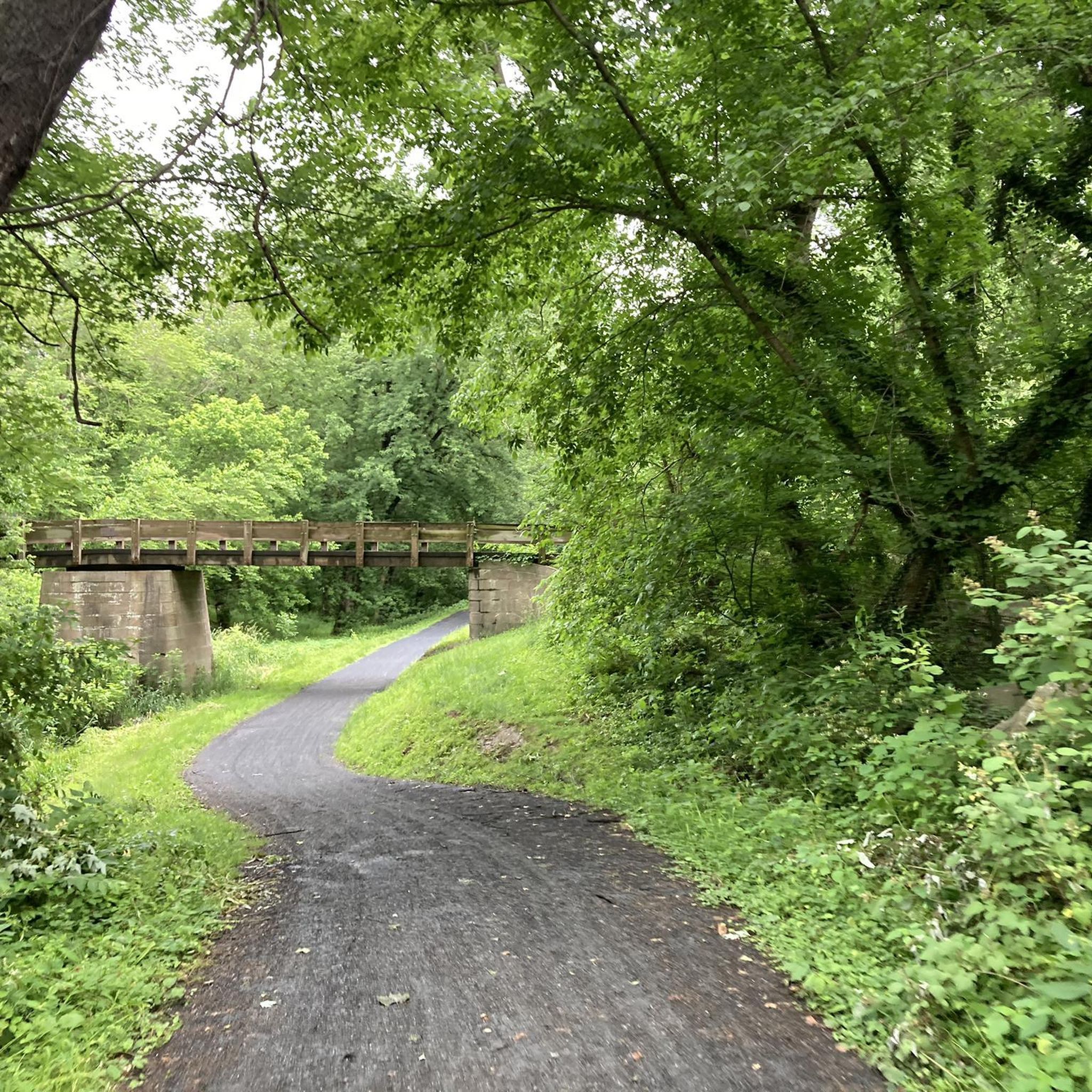
Lovely, entirely flat compact gravel and concrete multi-use trail that runs along the Potomac River. This ground is perfect for running and offers glorious waterside and forest scenes throughout.
0
0
Lovely, entirely flat compact gravel and concrete multi-use trail that runs along the Potomac River. This ground is perfect for running and offers glorious waterside and forest scenes throughout.
0
0
Lovely, entirely flat compact gravel and concrete multi-use trail that runs along the Potomac River. This ground is perfect for running and offers glorious waterside and forest scenes throughout.
1
0
Lovely, entirely flat compact gravel and concrete multi-use trail that runs along the Potomac River. This ground is perfect for running and offers glorious waterside and forest scenes throughout.
2
0

This 2.2-acre park is located on the banks of the Potomac River and offers a picnic shelter, restrooms, historic storyboards, and water fountains.
0
0
Frequently Asked Questions
What kind of terrain can I expect on running routes around Point Of Rocks?
The running routes in Point Of Rocks primarily feature flat, multi-use paths, often with a compact gravel or concrete surface. These are ideal for consistent running. While many routes, especially along the C&O Canal, are relatively flat, some longer options include gentle elevation changes, providing variety for different fitness levels. The region is defined by its waterside landscapes and historical landmarks.
Are there any easy or beginner-friendly running routes in Point Of Rocks?
Yes, the area offers routes suitable for beginners. The Point of Rocks Bridge loop from Point of Rocks is a moderate 5.2-mile (8.4 km) option with minimal elevation gain, making it a great choice for those new to running or looking for a relaxed pace. The C&O Canal Trail sections are generally flat and accessible.
What historical landmarks or natural features can I see along the jogging trails?
The routes in Point Of Rocks are rich with history and scenic views. You can encounter several notable landmarks such as the historic Monocacy Aqueduct, the restored Lock 27, Spinks Ferry, and the Catoctin Creek Aqueduct. Consistent views of the Potomac River are also a highlight, providing a serene backdrop for your run.
Are there any long-distance running options for experienced runners?
Absolutely. For those seeking longer distances, the Monocacy River Bridge – Monocacy Aqueduct loop from Monocacy Aqueduct is a challenging 18.3-mile (29.4 km) trail that leads through historic aqueducts and river scenery. Another excellent option is the Monocacy Aqueduct – Lock 25 Large Maple loop from Tuscarora, which covers 18 miles (28.9 km) and offers varied terrain along the canal.
Are the running routes in Point Of Rocks suitable for families or those with dogs?
Many sections of the Chesapeake and Ohio Canal Trail are generally flat and wide, making them suitable for families. The consistent surface and picturesque environment are great for a leisurely run or walk. For dog owners, the C&O Canal Towpath is a popular choice, but always ensure your dog is on a leash and you follow local regulations regarding pet waste.
What is the best time of year to go running in Point Of Rocks?
Point Of Rocks offers enjoyable running conditions throughout much of the year. Spring and fall provide pleasant temperatures and beautiful scenery with blooming foliage or vibrant autumn colors. Summer can be warm and humid, so early morning or late evening runs are recommended. Winter running is possible, but be mindful of potential ice on paths, especially after freezing rain or snow.
Are there any circular running routes available?
Yes, you can find circular routes in the area. The Monocacy River Bridge – Monocacy Aqueduct loop from Monocacy Aqueduct is a significant loop that allows you to experience diverse scenery without retracing your steps. Another option is the Point of Rocks Bridge loop from Point of Rocks, which is a shorter, moderate circular route.
Where can I find parking or access public transport for the running trails?
Parking is generally available at various access points along the Chesapeake and Ohio Canal Trail. For instance, the Point of Rocks Community Commons Park, located near the historic train station, offers amenities including parking. While public transport options might be limited directly to trailheads, checking local bus schedules or ride-sharing services for connections to Point Of Rocks could be an option.
What do other runners enjoy most about the trails in Point Of Rocks?
Runners frequently praise the historic Chesapeake and Ohio Canal Trail for its consistent, generally flat surface and the beautiful waterside views of the Potomac River. The blend of natural scenery with historical aqueducts and locks provides a unique and engaging running experience. The variety of route lengths also allows runners of all levels to find a suitable challenge.
Are there any amenities like restrooms or picnic areas near the running paths?
Yes, the Point of Rocks Community Commons Park, situated near the historic train station along the Potomac River, offers amenities such as a picnic shelter and restrooms. Along the C&O Canal Trail, you may find additional facilities at various lockhouses or visitor centers, though these can be spaced out.
Are there any sections of the C&O Canal Trail that are less crowded?
While popular, the C&O Canal Trail is quite extensive. To find less crowded sections, consider exploring parts of the trail further away from major access points or popular landmarks during peak times. Early mornings or weekdays generally offer a more serene running experience compared to weekends.
Most popular routes around Point Of Rocks
Most popular attractions around Point Of Rocks

Get inspired with the komoot mobile app


Explore more
Browse the best Running Trails & Routes in other regions.
