The best road cycling routes around Camp Springs
3.9
(26)
902
riders
29
rides
Road cycling routes around Camp Springs, Maryland, benefit from an extensive network of paved multi-use trails. The area features a blend of urban greenways and natural riverfront environments, particularly along the Anacostia and Potomac Rivers. Cyclists can navigate relatively flat terrain with occasional moderate elevation gains, making it suitable for various fitness levels. Its strategic location provides access to a diverse network of cycling routes and scenic landscapes.
Best road cycling routes around Camp Springs
- The most popular road cycling…
Last updated: July 13, 2026
5.0
(3)
137
riders
40.4km
01:48
200m
200m
Easy road ride. Great for any fitness level. Mostly well-paved surfaces and easy to ride.
5.0
(2)
74
riders
Moderate road ride. Good fitness required. Mostly well-paved surfaces and easy to ride.

Sign up for free
4.5
(2)
45
riders
41.8km
01:52
190m
190m
Easy road ride. Great for any fitness level. Mostly well-paved surfaces and easy to ride.
21
riders
39.5km
01:42
230m
230m
Easy road ride. Great for any fitness level. Mostly well-paved surfaces and easy to ride.
23
riders
17.0km
00:50
90m
90m
Easy road ride. Great for any fitness level. Mostly well-paved surfaces and easy to ride.
Get access to more routes and recommendations from other explorers.
Sign up for free
Already have an account?
Our route recommendations are based on thousands of hikes, rides, and runs completed by other people on komoot.
Start today with a free account
Your next adventure awaits.
Login or Signup
Popular around Camp Springs
Tips from the Community

You should not miss this if you are visiting or living in the area
0
0

This site is famous for a very important and unfortunate event in American history: the Battle of Bladensburg during the War of 1812. You can learn about the battle, see historical markers, and understand how this event shaped the nation.
0
0


Once a working gristmill in the 1800s, Pierce Mill offers a glimpse into early Washington industry amid the woodland calm of Rock Creek Park. Today, its restored stone walls and waterwheel stand as a quiet counterpoint to the city just beyond the trees.
0
0

Peace Monument for the dead of the civil war?
1
0

The final (or beginning) mile of the C&O Canal stands here, next to the Tide Lock on the Potomac, the true birthplace of the canal. The spot is marked with a stone pillar. Stretching from Cumberland to Washington, DC, this route ends at Mile Post 0, where hikers and bikers can definitively mark the start or finish of their journey along the historic canal. The towpath follows the canal’s full 184.5 miles to its Cumberland, MD, terminus, often extending to 333 miles for those who begin in Pittsburgh on the Great Allegheny Passage (GAP) trail.
1
0

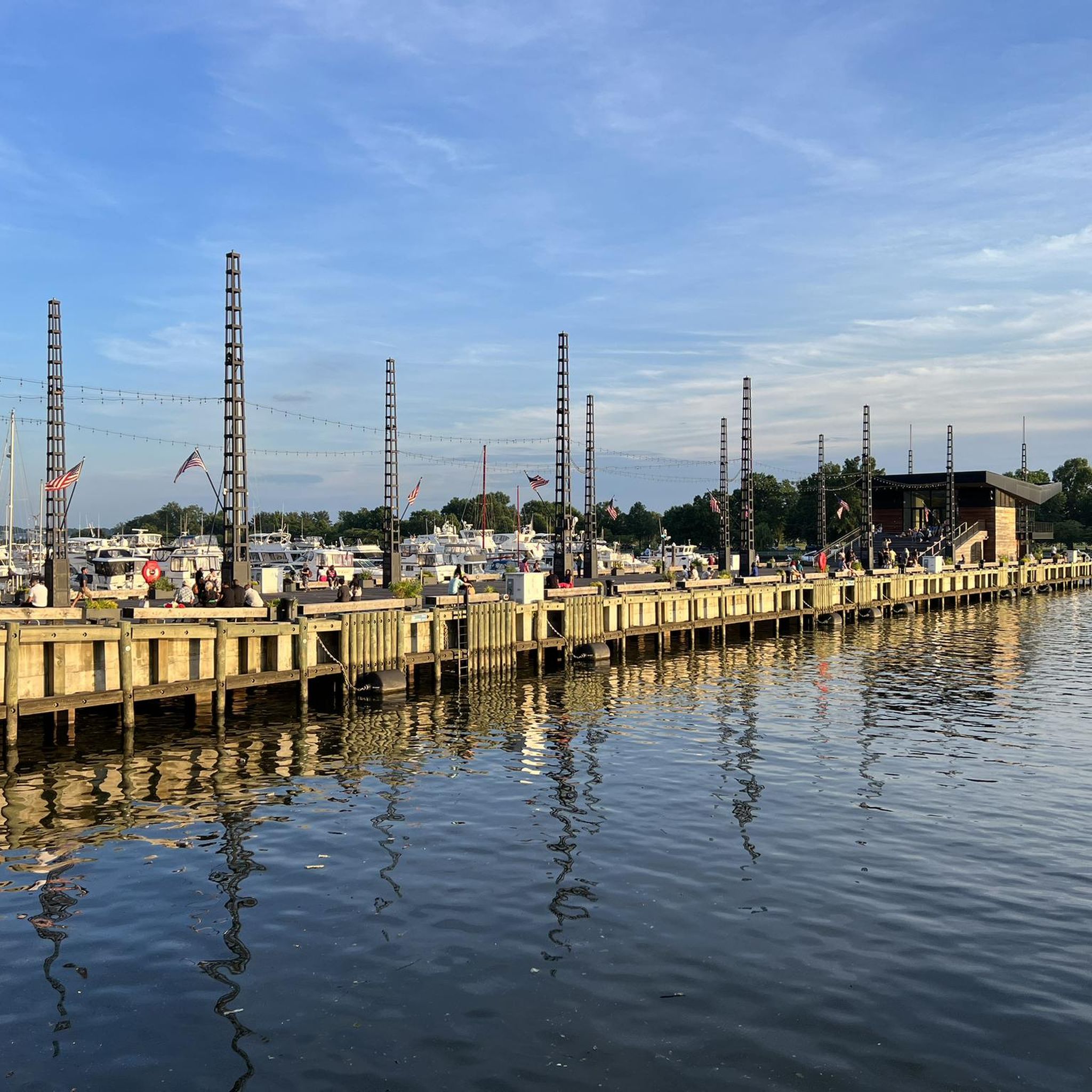
Founders Park is a great park on the banks of the Potomac River. There are some gravel walking paths that wind through the park.
0
0

This point marks the start of the 185-mile C&O Canal Towpath Trail that runs from Washington D.C. to Cumberland, Maryland. Originally built as a way for mules to tow boats along the canal, it is now converted into a multi-use trail for outdoor enthusiasts of all stripes.
1
0
Frequently Asked Questions
What kind of terrain can I expect on road cycling routes around Camp Springs?
Road cycling routes around Camp Springs primarily feature paved multi-use trails. The terrain is generally relatively flat, especially along riverfront areas like the Anacostia and Potomac Rivers, with occasional moderate elevation gains. This makes the routes suitable for various fitness levels.
Are there family-friendly road cycling routes near Camp Springs?
Yes, many of the paved multi-use trails in the area are suitable for families. The Hains Point – Tidal Basin loop from Minnesota Avenue is an easy route through urban green spaces and waterfront areas. The extensive Anacostia Tributary Trail System also offers numerous accessible sections perfect for family outings.
What are some notable landmarks or natural features I can see while cycling?
While cycling, you can enjoy views of the Potomac River, especially along trails like the Mount Vernon Trail. The Anacostia Riverwalk Trail winds past National Harbor Waterfront & Capital Wheel and Kingman Lake. Other points of interest include Daingerfield Island and Oronoco Bay Park.
What is the best time of year for road cycling in the Camp Springs area?
The mid-Atlantic region, including Camp Springs, experiences distinct seasonal changes. Spring and fall generally offer the most pleasant weather for road cycling, with comfortable temperatures and vibrant natural scenery. Summer can be warm and humid, while winter may bring colder temperatures, though many paved trails remain accessible.
Are there any circular road cycling routes available?
Yes, there are several excellent loop routes. A popular option is the Anacostia Riverwalk Trail – Anacostia Riverwalk Trail loop from Stadium–Armory, which follows the Anacostia River. Another favorite is the Thomas Jefferson Memorial – Hains Point loop from Stadium–Armory, connecting significant landmarks.
Where can I find parking for road cycling trails near Camp Springs?
Many of the major trail systems, such as the Anacostia Tributary Trail System and the Mount Vernon Trail, have designated parking areas at various access points. For specific trailheads, it's advisable to check local park and trail websites for detailed parking information.
Can I access road cycling trails using public transport?
Given Camp Springs' proximity to Washington D.C. and major transportation routes, several trails are accessible via public transport. The Anacostia Riverwalk Trail, for instance, can be reached from various Metro stations in D.C. and surrounding areas. Cyclists often combine public transport with their rides to extend their range.
Are dogs allowed on the paved road cycling trails?
Generally, dogs are permitted on most paved multi-use trails in the Camp Springs area, provided they are kept on a leash and owners adhere to local regulations regarding waste disposal. Always check specific trail rules before heading out, as policies can vary slightly between different parks and jurisdictions.
What do other road cyclists enjoy most about cycling in Camp Springs?
The area is highly rated by the komoot community, with an average score of 4.6 stars from over 40 reviews. Reviewers often praise the extensive network of paved trails, the blend of urban greenways and natural riverfront scenery, and the accessibility for various skill levels.
Are there any challenging road cycling routes for experienced riders?
While many routes are moderate, experienced riders can find longer distances and some elevation gain. For example, the Anacostia Riverwalk Trail – Anacostia Riverwalk Trail loop from Stadium–Armory covers over 50 miles with moderate elevation, offering a good challenge. Combining multiple trail sections can also create longer, more demanding rides.
Are there cafes or restaurants near the road cycling routes in Camp Springs?
Yes, especially along the more urban sections of trails or in nearby communities. The Anacostia Riverwalk Trail and routes connecting to Washington D.C. often pass through areas with cafes, restaurants, and amenities. National Harbor, about 15 minutes away, is a vibrant waterfront destination with numerous dining options that can be incorporated into a longer ride or visited post-ride.
Do I need any special permits for road cycling on trails in Maryland?
For most paved multi-use trails in the Camp Springs and surrounding Maryland/D.C. area, no special permits are typically required for road cycling. However, it's always a good practice to check the specific regulations for any particular park or trail system you plan to visit, especially if it's a less common route or a protected area.
Most popular routes around Camp Springs
Most popular attractions around Camp Springs

Get inspired with the komoot mobile app


Explore more
Browse the best Road cycling routes in other regions.
