The best running trails around Annalong Wood
4.7
(12)
2,086
runners
105
runs
Jogging around Annalong Wood offers diverse landscapes within the Mourne Area of Outstanding Natural Beauty. The region features tranquil coniferous woodlands with the Annalong River meandering through, providing a peaceful atmosphere for running. Situated at the foothills of the Mourne Mountains, routes often present views of the peaks and a mix of terrain, from well-maintained paths to more rugged sections. This area provides a variety of running experiences for different fitness levels.
Best jogging routes around Annalong Wood
- The most…
Last updated: June 27, 2026
7
runners
26.6km
04:19
1,530m
1,530m
Hard run. Very good fitness required. Mostly paved surfaces. Suitable for all skill levels.
7
runners
Hard run. Very good fitness required. Mostly paved surfaces. Suitable for all skill levels.

Sign up for free
5
runners
24.0km
03:49
1,270m
1,270m
Hard run. Very good fitness required. Mostly accessible paths. Some sure footedness required.
2
runners
4.04km
00:35
180m
0m
Moderate run. Good fitness required. Mostly paved surfaces. Suitable for all skill levels.
73
runners
Hard run. Very good fitness required. Mostly paved surfaces. Suitable for all skill levels.
Get access to more routes and recommendations from other explorers.
Sign up for free
Already have an account?
Our route recommendations are based on thousands of hikes, rides, and runs completed by other people on komoot.
Start today with a free account
Your next adventure awaits.
Login or Signup
Tips from the Community

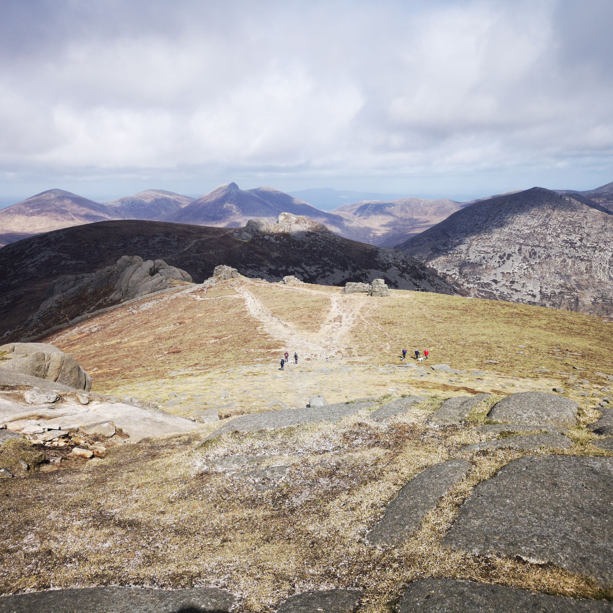
Slieve Binnian is absolute magic. Standing as the third-highest peak in Northern Ireland (747 meters), it easily claims the title for the most dramatic silhouette in the Mournes, thanks to the massive, weathered granite towers—called tors—that guard its summit. https://www.expresstollpass.com
0
0

Hare's Gap is a dramatic mountain pass nestled in the heart of the Mourne Mountains. This striking pass, situated between Slieve Bearnagh and Slievenaglogh, offers hikers a blend of natural beauty and historical intrigue. From this vantage point, hikers are treated to panoramic views of the surrounding peaks and valleys. The pass itself is historically significant, having once served as a route for smuggling goods across the mountains, adding a layer of intrigue to the hike. Hare's Gap is a popular starting point for various hikes, including ascents of Slieve Bearnagh and Slieve Meelmore.
2
0
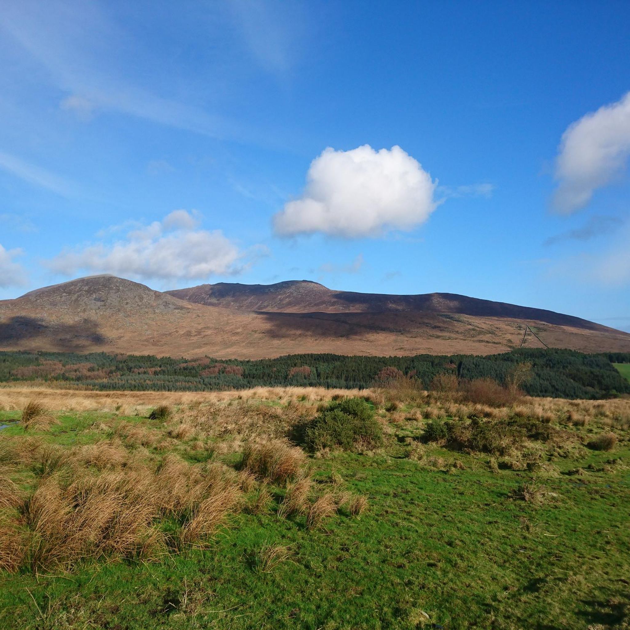
Annalong Wood offers a serene and immersive experience in the heart of the Mourne Mountains. This tranquil woodland, nestled near the Annalong River, provides a refreshing escape into nature. The path meanders through lush greenery, with the gentle sounds of the river accompanying your journey.
1
0
Starting from Carrick Little Car Park, the hiking path to Slieve Binnian offers a rewarding journey through the heart of the Mourne Mountains. This moderate to challenging loop, approximately 11.2 km in length, follows the Mourne Wall, a historic dry-stone structure built in the early 1900s, guiding hikers toward the summit of Slieve Binnian (747 m). The ascent is steady, with a mix of rocky terrain and scenic views. As you approach the summit, the path becomes more rugged, leading to the iconic South and North Tors. From the summit, panoramic vistas unfold, offering breathtaking views of the Silent Valley and the surrounding peaks.
1
0
Hare’s Gap is one of the most iconic passes in the Mourne Mountains, marked by its rugged stile and dramatic views that open up across the range. Once a historic smuggling route, it remains a natural gateway into the high Mournes, with steep paths and striking rock formations framing the way. From here, the landscape unfolds in every direction, making it a perfect spot to pause, take in the scenery, and appreciate the wild beauty of these mountains.
4
0
The Mourne Wall is one of the most iconic landmarks of the Mourne Mountains, stretching for 35 kilometers across 15 summits. Built by hand in the early 20th century to enclose the Silent Valley Reservoir catchment area, it’s an impressive feat of craftsmanship and endurance. Today, hikers crossing its path are struck not only by its scale and history but also by the way it weaves naturally into the dramatic mountain landscape. Following the wall offers some of the best ridge walks in the Mournes, making it both a cultural treasure and a perfect guide for exploring these rugged peaks.
4
0
Silent Valley Reservoir, nestled in the Mourne Mountains, is a peaceful retreat surrounded by sweeping granite peaks and heathered slopes. Built in the early 20th century to supply water to Belfast and much of County Down, the reservoir combines striking engineering with natural beauty. Visitors can stroll along well-kept paths, admire the Victorian-style dam and impressive Mourne Wall, or simply enjoy the quiet atmosphere by the lakeshore.
4
1
Two wooden ladders cross the wall on the way to the Silver Muck mountain peak
2
0
Frequently Asked Questions
What types of running routes can I find in Annalong Wood?
Annalong Wood and its surrounding area offer a wide variety of running experiences. You'll find everything from tranquil paths winding through coniferous woodlands alongside the Annalong River to more challenging ascents into the Mourne Mountains. The terrain varies from well-maintained trails to rugged, unpaved sections, catering to different fitness levels.
How many running trails are available in the Annalong Wood area?
There are over 100 running routes around Annalong Wood, offering a diverse range of options for runners. This includes 5 easy routes, 39 moderate routes, and 72 difficult routes, ensuring there's something for every skill level.
Are there any easy running routes suitable for beginners or families in Annalong Wood?
Yes, Annalong Wood offers several easy running routes, perfect for beginners or a family outing. These trails typically feature minimal elevation gain and well-maintained paths within the tranquil woodland, allowing for a peaceful and accessible run.
What kind of elevation gain should I expect on runs around Annalong Wood?
The elevation gain varies significantly depending on the route. Within Annalong Wood itself, you can find relatively flat paths. However, if you venture into the Mourne Mountains foothills, you'll encounter more demanding ascents. For example, the challenging The Devil's Coach Road – View of the Mourne Mountains loop from Moneydorragh More Upper features over 470 meters of elevation gain, while the Carrick Little to Blue Lough run — Mourne has a more moderate 184 meters.
What natural features or landmarks can I see while running in Annalong Wood?
Runners in Annalong Wood can enjoy the serene beauty of the coniferous woodlands and the soothing presence of the Annalong River, which often parallels the paths. Many routes also offer stunning glimpses and panoramic views of the majestic Mourne Mountains. The area is also adjacent to the Silent Valley Reservoir, providing additional scenic opportunities.
Are there any circular running routes in the Annalong Wood region?
Yes, there are several excellent circular running routes. For instance, the challenging The Devil's Coach Road – View of the Mourne Mountains loop from Moneydorragh More Upper is a popular circular option. Another notable one mentioned in regional research is the 'Annalong Wood and Blue Lough Circular Walk', which balances woodland scenery with more rugged sections and mountain views.
What do other runners enjoy most about the trails in Annalong Wood?
The running routes in Annalong Wood are highly rated by the komoot community, with an average score of 4.7 stars from over 10 reviews. Runners frequently praise the tranquil atmosphere of the coniferous woodlands, the picturesque Annalong River, and the stunning views of the Mourne Mountains that many trails offer. The variety of terrain and difficulty levels also receives positive feedback.
Can I bring my dog on the running trails in Annalong Wood?
While the guide data does not specify dog-friendly policies for individual routes, Annalong Wood is a popular outdoor destination. Generally, dogs are permitted on trails in such areas, but it's always advisable to keep them on a lead, especially in areas with livestock or wildlife, and to check local signage for any specific restrictions.
Are there any particularly challenging running routes for experienced trail runners?
Absolutely. For experienced trail runners seeking a challenge, routes like the Mourne Wall – View of the Mourne Mountains loop from Moneydorragh More Upper offer a demanding experience. This route is a hard 24.3 km run with significant elevation gain, following the historic Mourne Wall towards Slieve Binnian's summit. Another difficult option is the View of the Mourne Mountains loop from Moneydorragh More Upper, an 11 km trail with over 570 meters of ascent.
What is the terrain like on the running paths in Annalong Wood?
The terrain around Annalong Wood is quite varied. Within the wood itself, you'll find peaceful paths that are often well-maintained. However, as you venture towards the Mourne Mountains, the trails can become more rugged, featuring rocky and unpaved sections. This mix provides options for both casual jogs and more demanding trail runs.
Are there any running routes that offer views of the Irish Sea?
While Annalong Wood is primarily inland, its proximity to the village of Annalong means that nearby coastal paths offer stunning views of the Irish Sea. These routes provide a different dimension to running in the area, allowing you to enjoy both mountain and sea vistas.
Is there parking available for runners visiting Annalong Wood?
The region research indicates that access to Annalong Wood is often managed through the Silent Valley entrance, suggesting that parking facilities are likely available there or at other common trailheads. It's always recommended to check specific trailhead information for parking details before your visit.
Most popular routes around Annalong Wood

Get inspired with the komoot mobile app


Explore more
Browse the best Running Trails & Routes in other regions.
