The best running trails around Robie Creek
197
runners
19
runs
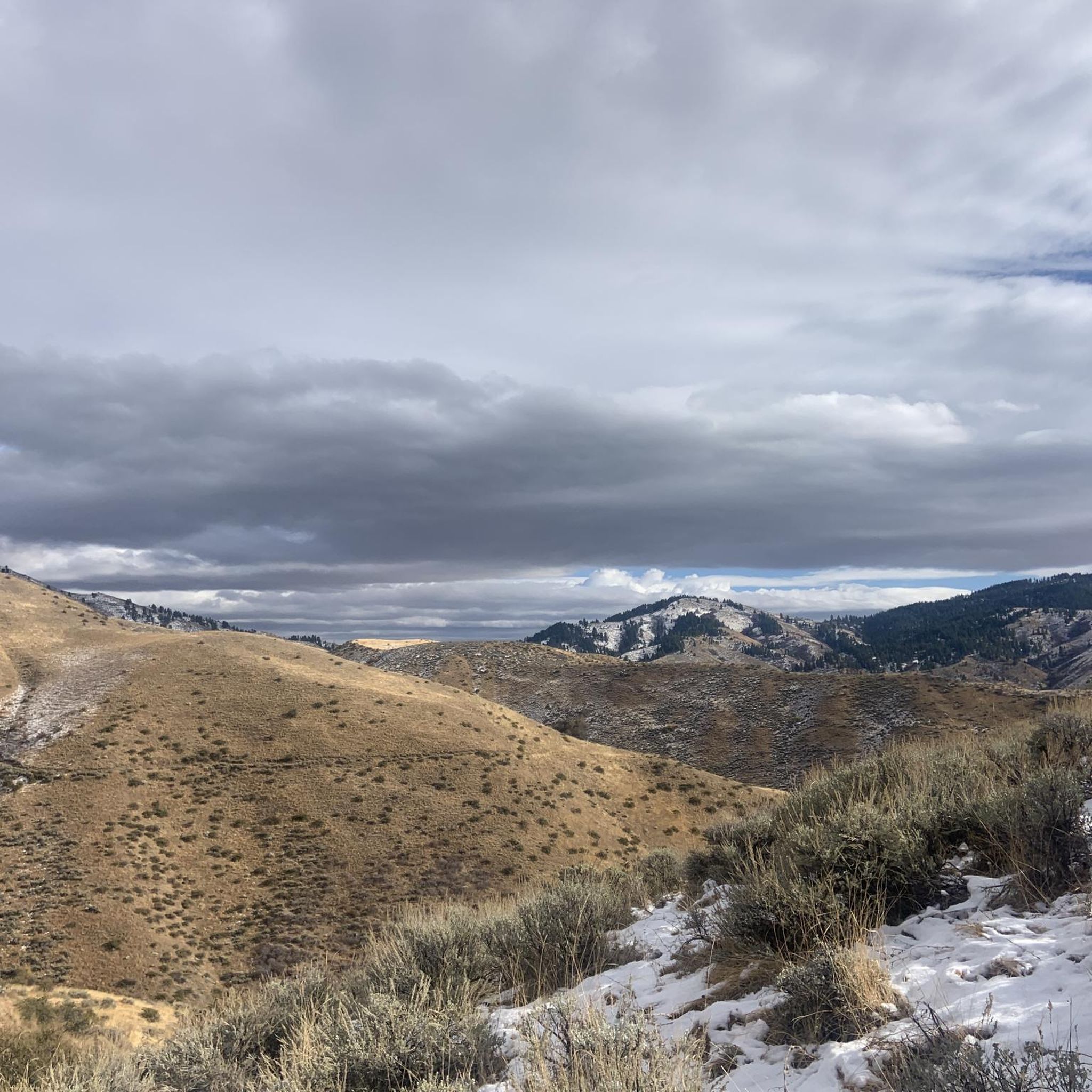
Jogging around Robie Creek offers diverse landscapes within the Boise National Forest, characterized by significant elevation changes and varied terrain. The area features a mix of forested hills, creeks, and proximity to the Boise River, providing a blend of natural surroundings. Running routes here range from challenging uphill climbs to more moderate paths, catering to different fitness levels. This region is known for its rugged trails and scenic views, including glimpses of the Sawtooth Mountains from certain vantage points.
Best…
Last updated: June 28, 2026
30
runners
Moderate run. Good fitness required. Mostly accessible paths. Some sure footedness required.
21
runners
5.13km
00:38
140m
140m
Moderate run. Good fitness required. Mostly paved surfaces. Suitable for all skill levels.

Sign up for free
20
runners
13.5km
01:48
380m
380m
Hard run. Very good fitness required. Mostly paved surfaces. Suitable for all skill levels.
22
runners
23.9km
03:01
620m
620m
Hard run. Very good fitness required. Mostly accessible paths. Some sure footedness required.
21
runners
Hard run. Very good fitness required. Mostly paved surfaces. Suitable for all skill levels.
Get access to more routes and recommendations from other explorers.
Sign up for free
Already have an account?
Our route recommendations are based on thousands of hikes, rides, and runs completed by other people on komoot.
Start today with a free account
Your next adventure awaits.
Login or Signup
Popular around Robie Creek
Tips from the Community

wide enough for 2-way traffic; some blind spots, so be careful. Trail is smooth, so downhill bikers are often riding pretty fast.
0
0

Bogus Basin is overseen by the non-profit organization Bogus Basin Recreation Association. In the summer, visitors can go mountain biking and go gravel riding, and in the winter, there is skiing and snowboarding.
0
0

East Shaw Mountain Road is one of many dirt roads in the Boise Front ACEC area. The road tops out near the Aldape Summit where it connects to a bunch of other dirt roads. There are some double-track and singletrack trails that cross the road in several spots, too.
0
0
Bogus Basin is overseen by the non-profit organization Bogus Basin Recreation Association. In the summer, visitors can go mountain biking and go gravel riding, and in the winter, there is skiing and snowboarding.
0
0
East Shaw Mountain Road is one of many dirt roads in the Boise Front ACEC area. The road tops out near the Aldape Summit where it connects to a bunch of other dirt roads. There are some double-track and singletrack trails cross the road in several spots, too.
0
0

If you're heading further out on the trail you'll be on the pedestrian only section of Hulls Gulch. Walking down towards town on Lowers Hulls Gulch will have you sharing the trail with bikers. Both options are great, you just need to be aware of fast moving bikers on the lower section.
0
0
This road is popular with bikers, and off-roaders so you won't want to walk on it for too far. However, it does provide access to some great trails.
0
0
This intersection marks the terminus of the bikeable Lower Hull's Gulch trail. Beyond this point is pedestrian only but Lower Hull's Gulch is a great little ride that riders need to take care on due to its popularity with hikes, runners, etc.
0
0
Frequently Asked Questions
What kind of terrain can I expect on running routes around Robie Creek?
The Robie Creek area, nestled within the Boise National Forest, offers a diverse range of terrain for runners. You'll find everything from challenging uphill climbs with significant elevation changes, like those featured in the famous 'Race to Robie Creek' half marathon, to more moderate paths. Expect a mix of forested landscapes, creeks, and rugged trails, with some routes extending over 10 miles with more than 1000 feet of elevation gain. There are also some mostly paved surfaces available for easier runs.
Are there any easy or beginner-friendly jogging routes in the Robie Creek area?
While many routes around Robie Creek are known for their challenging elevation, there are options suitable for varying fitness levels. For a moderate run with scenic views, consider the Crestline Trail – Red Cliffs Trail loop from Hulls Gulch Reserve. This 3.2-mile (5.1 km) path offers natural beauty within the Hulls Gulch Reserve and is a good choice for those seeking a less strenuous experience.
What natural features or scenic viewpoints can I enjoy while running near Robie Creek?
Robie Creek's location provides access to stunning natural beauty. You can enjoy views of the Boise National Forest, the nearby Boise River, and even glimpses of the Sawtooth Mountains from certain trails. The Hulls Gulch Reserve offers scenic views of both the city of Boise and the natural beauty of Hulls Gulch. Additionally, the area around Lucky Peak Lake and Mores Creek features beautiful mountain scenery and basalt cliffs. For specific viewpoints, consider visiting Table Rock Viewpoint or Camel's Back.
Are there any family-friendly running trails around Robie Creek?
Yes, Robie Creek Park itself offers amenities like picnic shelters, playground equipment, and a kid-friendly swim area, making it a good base for families. While specific 'family-friendly' running trails are not explicitly detailed in the guide, the Boise River Greenbelt, which is nearby, provides 25 miles of tree-lined paths perfect for running, biking, and wildlife observation, suitable for all ages and fitness levels. You can explore sections of the Boise River Greenbelt for a gentler family outing.
Can I bring my dog on the jogging routes in Robie Creek?
Many trails in the Boise National Forest and surrounding areas are dog-friendly, but it's always best to check local regulations for specific trails. Generally, dogs are welcome on leash. The diverse landscapes mean there are plenty of opportunities for you and your canine companion to enjoy the outdoors together. Always remember to pack water for both yourself and your dog, and clean up after them.
What is the best time of year to go running in Robie Creek?
The best time to go running in Robie Creek largely depends on your preference for weather and trail conditions. Spring and fall offer milder temperatures, which are ideal for tackling the area's challenging routes. Summers can be hot, so early morning or late evening runs are recommended, and winter brings snow, making some trails suitable for snowshoeing or cross-country skiing rather than traditional jogging, especially at higher elevations like Bogus Basin.
Are there any loop running routes available in the Robie Creek area?
Yes, the Robie Creek area features several excellent loop running routes. A popular choice is the Running loop from Hackberry North, an 8.4-mile (13.5 km) trail that winds through forested landscapes with notable elevation gain. Another option is the Hull's Gulch Reserve – Hulls Gulch Reserve loop from Highlands, a 12.3 km (7.6 miles) route offering a different perspective of the area's natural beauty.
Where can I find parking for the jogging trails around Robie Creek?
Parking availability varies by trailhead. For routes starting near Hulls Gulch Reserve, you can typically find parking at designated trailheads within or adjacent to the reserve. For routes originating from areas like Hackberry North or Deer Point, there are often small parking areas or roadside pull-offs. It's advisable to check specific route details on komoot for the most accurate parking information for your chosen trail.
Is public transport available to reach the running trails near Robie Creek?
Public transport options directly to the more remote running trails in the Robie Creek area are limited. The region is best accessed by car, especially for reaching trailheads within the Boise National Forest or further afield. However, for trails closer to the Boise metropolitan area, such as sections of the Boise River Greenbelt, local bus services might provide closer access points.
What amenities like cafes or accommodation are available near Robie Creek for runners?
While Robie Creek itself is a more rural community, its proximity to the larger Boise metropolitan area means urban amenities are accessible. You'll find a wider selection of cafes, pubs, and accommodation options in Boise, which is a short drive away. For a unique experience, Flowing Springs Ranch in the broader area offers guided activities and potentially accommodation, showcasing streams and abundant wildlife.
How many running routes are available in the Robie Creek region?
The Robie Creek region offers a wide array of running opportunities, with over 16 distinct routes detailed in this guide alone. These routes cater to various preferences, from moderate paths to challenging trails with significant elevation changes, ensuring there's something for every runner.
What makes running in Robie Creek unique compared to other areas?
Running in Robie Creek is unique due to its blend of rugged, challenging terrain within the scenic Boise National Forest and its proximity to the Boise River. The area is famous for hosting the 'Race to Robie Creek,' known as the 'hardest half marathon in the Pacific Northwest,' highlighting its significant elevation changes and demanding trails. This makes it ideal for runners seeking an intense and rewarding experience amidst diverse landscapes, from forested hills to views of the Sawtooth Mountains.
Most popular routes around Robie Creek
Most popular attractions around Robie Creek

Get inspired with the komoot mobile app


