The best walks and hikes around Carsington Water
4.6
(4764)
30,711
hikers
706
hikes
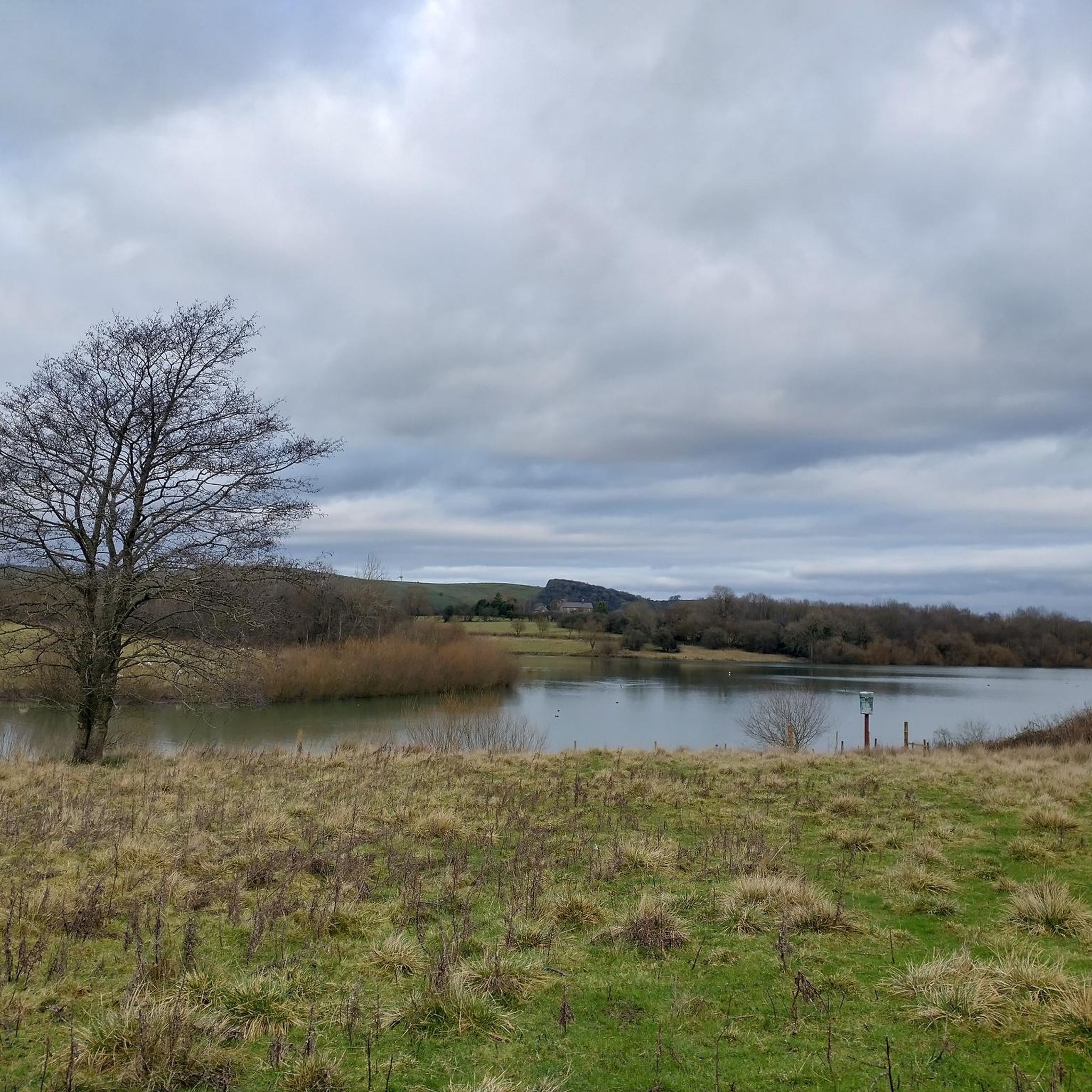
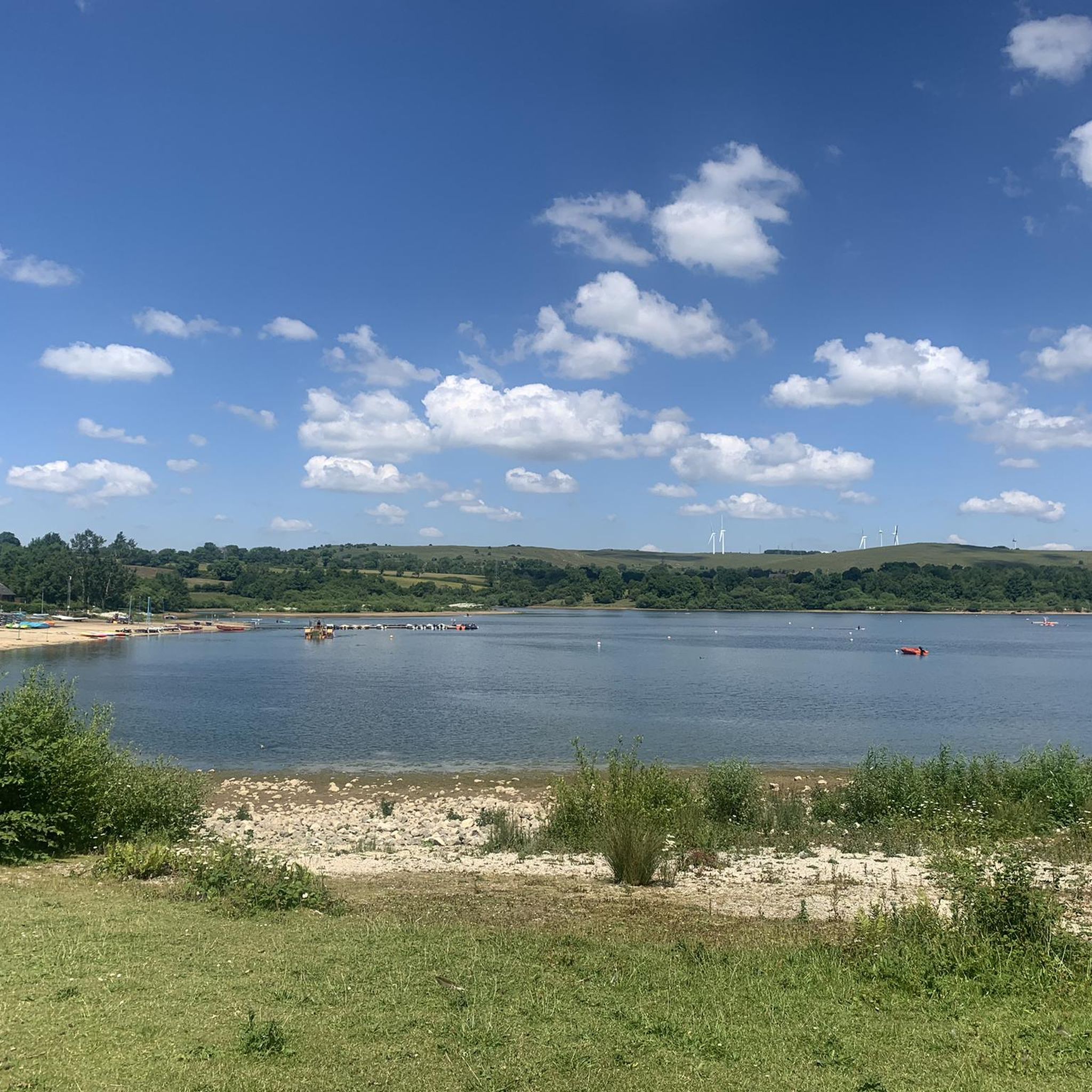
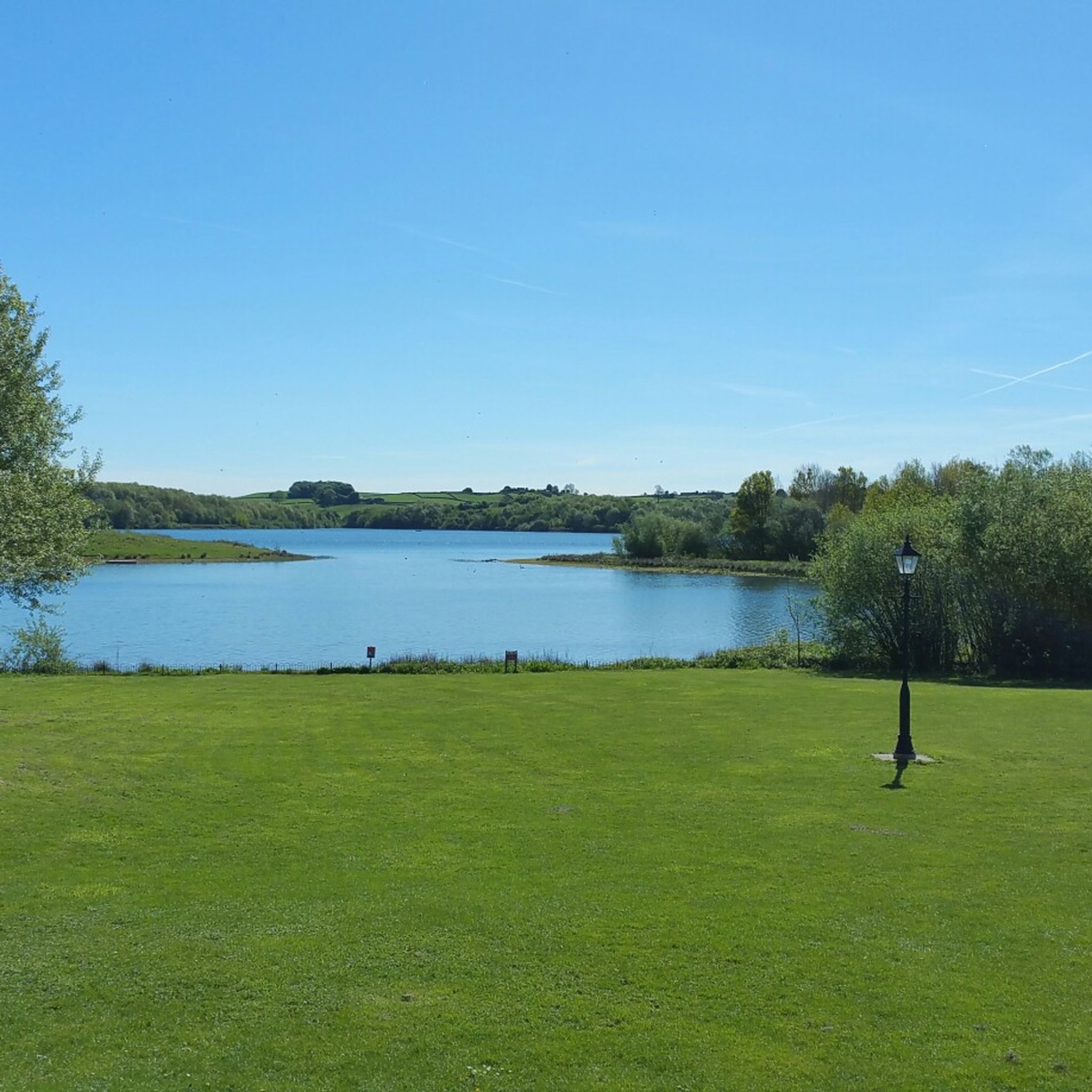
Hiking around Carsington Water offers diverse landscapes within the Derbyshire Dales, centered around England's ninth-largest reservoir. The region features well-maintained shoreline paths, gentle rolling hills, and native woodlands. These areas provide varied terrain, from accessible routes to more moderate trails. The area is also a designated nature reserve, supporting a rich array of wildlife habitats.
Best hiking trails around Carsington Water
- The most popular hiking route is Carsington Water circular, a 7.7 miles (12.4 km) trail that takes 3 hours 16 minutes to complete. This route follows the shoreline, offering continuous views of the water.
- Another top favourite among local hikers is Carsington Water Loop, a moderate 7.6 miles (12.2 km) path. This trail explores the reservoir's perimeter with varied views and takes approximately 3 hours 14 minutes.
- Local hikers also love the Brassington Village – Golconda Lead Mine Ruins loop from Carsington CP, a 6.6 miles (10.5 km) trail leading through historic lead mine ruins and offering valley views, often completed in about 2 hours 57 minutes.
- Hiking around Carsington Water is defined by scenic reservoir views, rolling hills, and native woodlands. The network offers routes suitable for various fitness levels, from easy strolls to more moderate routes.
- The routes in Carsington Water are highly rated by the komoot community with an average score of 4.6 stars from over 4,300 reviews. More than 29,000 hikers have used komoot to explore Carsington Water's varied terrain.
Last updated: July 7, 2026
4.8
(268)
2,311
hikers
12.4km
03:16
110m
110m
Hike the Carsington Water circular trail and experience a diverse landscape around England's ninth-largest reservoir. You will follow mixed terrain, including gravel paths, paved sections, and unpaved trails, winding through cool woodlands and past open grassy areas. Enjoy continuous views of Carsington Water and the surrounding Derbyshire hills, keeping an eye out for unique wooden sculptures that dot the route. This moderate hike covers 7.7 miles (12.4 km) with 367 feet (112 metres) of elevation gain, typically taking about 3 hours and 16 minutes to complete.
The main circular trail is generally considered a moderate hike, but the paths are largely accessible and suitable for various skill levels. If you prefer a shorter outing, you can opt for a 3-mile moderate walk along the dam or a 1-mile accessible walk around Stones Island, which is suitable for pushchairs. To potentially avoid busier sections, consider starting your hike in an anti-clockwise direction or from one of the smaller car parks, such as Millfields or Sheepwash. Be aware that some parts of the path may run alongside roads, requiring you to be mindful of traffic at a few crossings.
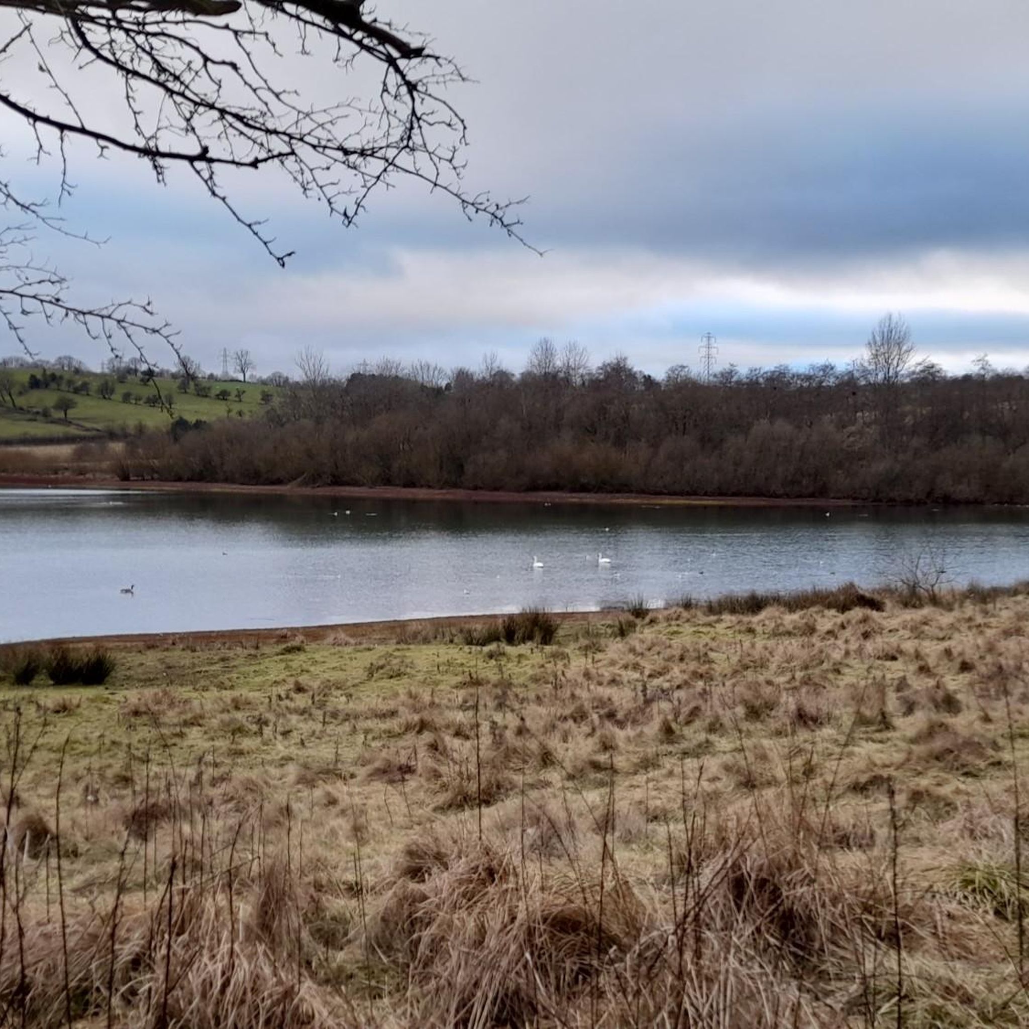
Carsington Water is a designated nature reserve, making it an excellent spot for wildlife enthusiasts. You can observe diverse birdlife from numerous hides along the route, including swans, mallards, and Canada geese, amidst woodlands, wetlands, and wildflower meadows. The reservoir itself holds historical significance as England's ninth-largest and the last major British reservoir constructed in the 20th century. Beyond hiking, the visitor center offers amenities like shops and cafes, and the area provides opportunities for watersports and fishing.
4.8
(264)
2,290
hikers
12.2km
03:14
120m
120m
Embark on the Carsington Water Loop, a moderate hike that takes you around the scenic reservoir. You'll encounter a mix of well-maintained gravel paths, paved sections, and natural trails, offering varied footing throughout your journey. As you walk, enjoy expansive views across Carsington Water, especially from the impressive dam wall. This route covers 7.6 miles (12.2 km) with a gentle elevation gain of 395 feet (120 metres), making it accessible for most hikers. Plan for about 3 hours and 14 minutes to complete the loop at a comfortable pace, allowing you to soak in the peaceful surroundings.
For a convenient start to your hike, head to the Carsington Water Visitor Centre. This location offers ample parking, restrooms, and a café, providing all the amenities you might need before and after your adventure. The trail itself is well-waymarked, ensuring straightforward navigation as you make your way around the water. While some sections are suitable for prams, be prepared for the full 12 kilometres if you are hiking with small children.
Beyond the natural beauty, the Carsington Water Loop offers unique artistic touches to discover along the way. Keep an eye out for various wooden sculptures thoughtfully placed around the route, adding an element of surprise to your walk. One notable spot is the Carved Wooden Bench With View of Carsington Water, which provides a perfect opportunity to pause, rest, and capture a memorable photo of the landscape.

Sign up for free
4.5
(19)
348
hikers
5.76km
01:32
50m
60m
Easy hike. Great for any fitness level. Easily-accessible paths. Suitable for all skill levels.
4.7
(25)
141
hikers
10.5km
02:57
210m
210m
Moderate hike. Good fitness required. Easily-accessible paths. Suitable for all skill levels.
4.6
(5)
299
hikers
9.02km
02:23
90m
90m
Moderate hike. Good fitness required. Easily-accessible paths. Suitable for all skill levels.
Get access to more routes and recommendations from other explorers.
Sign up for free
Already have an account?
Our route recommendations are based on thousands of hikes, rides, and runs completed by other people on komoot.
Start today with a free account
Your next adventure awaits.
Login or Signup

Tips from the Community

I always seem to hit this climb when I've already got plenty of miles in my legs! So it's always a challenge but a measured pace is key. Road surface is good and there's enough room for cars to get past you and not be breathing down your neck. 😉
0
0

A decent longish climb up through Brassington to Longcliffe. Pretty steep through the village then keeps on giving as you leave!
0
0

Planning for the reservoir started in the 1960s and construction started in 1979. In 1984, there was a partial collapse of the dam before it was filled. The dam was removed before the construction of a new dam began in 1989. The finished reservoir was opened by Queen Elizabeth II in 1992.
0
0
A warm sanctuary on a cold day... Sit behind the glass, watching the water. 🌊
0
0

Nice enclosed watching space with heating. A good shelter on a rough day.
1
0

Take a silly pic and post on this highlight, enjoying the ones so far!
0
0
Nice little tower nearer to the end of our walk. Informative board with the details and its nice you can walk to the top of the tower!
1
0
Very nice spot for a break with a view. The benches are comically tall though!
0
0
More Information
FAQs about hikes in Carsington Water
- What are the most popular hiking trails around Carsington Water?
The most popular routes include the "Carsington Water circular" (12.40 km, moderate, 03:16), "Carsington Water loop from Millfields" (12.22 km, moderate, 03:14), and for an easier option, "Roadford Lake Dam – Drip Off Tower loop from Hognaston" (6.01 km, easy, 01:36). - Are there easy hikes suitable for families or beginners around Carsington Water?
Yes, Carsington Water offers numerous easy hikes, with 318 routes designated as easy. These trails are generally well-maintained and suitable for all fitness levels, making them perfect for families and beginners. - What is the typical terrain like for hiking around Carsington Water?
The terrain around Carsington Water is varied, featuring a mix of gravel paths, paved sections, unpaved trails, and dedicated hiking paths. You can expect a comfortable walking experience with easily accessible routes. - When is the best time of year to go hiking around Carsington Water?
While hiking is enjoyable year-round, spring, summer, and early autumn are particularly pleasant for exploring Carsington Water, offering vibrant natural scenery and milder weather conditions ideal for outdoor activities. - Are hikes around Carsington Water dog-friendly?
Many outdoor areas in the Derbyshire Dales, including Carsington Water, are generally dog-friendly. However, it's always advisable to keep dogs on a leash, especially near livestock or designated wildlife areas, to ensure the safety and enjoyment of all visitors and local fauna. - Are there challenging hikes for experienced hikers around Carsington Water?
For those seeking a more strenuous adventure, there are 46 difficult hikes available around Carsington Water. These routes may feature greater distances and significant elevation gains, requiring good fitness. - What kind of scenic views can I expect on hikes around Carsington Water?
Hikes around Carsington Water offer beautiful and expansive views of the lake itself, framed by the picturesque landscapes of the Derbyshire Dales. You can enjoy tranquil waterside vistas and rolling countryside. - Are there facilities or points of interest along the hiking trails at Carsington Water?
Yes, along the routes, you can find facilities such as the Carsington Water Visitor Centre, a dedicated Wildlife Centre, a Wildlife Hide for birdwatching, and a Sailing Club, providing amenities and additional points of interest for visitors.
Frequently Asked Questions
How many hiking trails are available around Carsington Water?
Carsington Water offers a wide network of over 700 hiking routes. These trails cater to various preferences, ranging from easy strolls to more moderate routes with some uphill sections, exploring both the reservoir's shoreline and the surrounding rolling hills and woodlands.
What kind of terrain can I expect on hikes around Carsington Water?
The terrain around Carsington Water is diverse. You'll find well-maintained shoreline paths, many of which are suitable for wheelchairs and pushchairs. Beyond the water, routes venture into gentle rolling hills, native woodlands, and open fields enclosed by traditional dry stone walls, offering varied scenery and experiences.
Are there any easy or accessible walks suitable for families or those with limited mobility?
Yes, Carsington Water is known for its accessible paths. Many sections of the main circular trail around the reservoir are well-surfaced and suitable for wheelchairs and pushchairs. There are also shorter, easy routes available, such as the Troll's Bridge – Roadford Lake Dam loop from Hognaston CP, which is 3.9 km long and takes just over an hour.
What notable landmarks or points of interest can I see while hiking around Carsington Water?
Hikers can discover several points of interest. Along the reservoir, you might encounter Carsington Water itself, the Roadford Lake Dam, and the Draw Off Tower. The area also features the Carsington Carved Chair and the historic Golconda Lead Mine Ruins on routes further afield.
Is Carsington Water a good place for wildlife spotting?
Absolutely. Carsington Water is a designated nature reserve with diverse habitats including ancient hedgerows, wildflower meadows, woodlands, and reedbeds. It supports over 200 bird species, such as buzzards, kingfishers, and lapwings, as well as mammals like deer. Strategically placed bird hides around the reservoir offer excellent opportunities for birdwatching.
Are there any circular walks around Carsington Water?
Yes, circular walks are a highlight of the area. The most popular is the Carsington Water circular, a 12.4 km (7.7 miles) trail that follows the shoreline. Another option is the Roadford Lake Dam – Carsington Water loop from Hognaston CP, an easier 5.5 km (3.4 miles) route.
How long does it typically take to walk around Carsington Water?
The main circular walk around Carsington Water, which is about 12.4 km (7.7 miles), typically takes around 3 hours and 15 minutes to complete at a moderate pace. Shorter loops are also available if you're looking for a quicker stroll.
What do other hikers enjoy most about hiking in Carsington Water?
The area is highly rated by the komoot community, with an average score of 4.6 stars from over 4,300 reviews. Hikers often praise the continuous views of the water, the well-maintained paths, and the diverse landscapes that combine tranquil reservoir scenery with rolling hills and woodlands.
Are there facilities like cafes or restrooms available along the trails?
The Visitor Centre at Carsington Water serves as a convenient starting and ending point for many hikes, offering amenities such as parking, restrooms, a café, and a restaurant. While specific facilities directly on all trails may vary, the Visitor Centre provides a central hub for refreshments and services.
Is Carsington Water dog-friendly?
Carsington Water generally welcomes dogs, but it's important to keep them under control, especially given the abundant wildlife and livestock in surrounding fields. Always check specific signage on trails for any restrictions, and ensure you clean up after your pet.
What are the parking options at Carsington Water?
There is a large Visitor Centre at Carsington Water which provides ample parking facilities. This is a convenient starting point for many of the trails around the reservoir. Details on costs and opening hours are usually available on-site or through local information sources.
Can I connect to other long-distance trails from Carsington Water?
Yes, Carsington Water's cycle tracks connect with other traffic-free routes in the region, such as the High Peak Trail and the Tissington Trail. This allows for extended explorations beyond the immediate reservoir area, offering opportunities for longer hikes or multi-day adventures.
Most popular routes around Carsington Water
Most popular attractions around Carsington Water

Get inspired with the komoot mobile app


Explore more
Browse the best Hikes in other regions.
