The best walks and hikes around Burnmoor Tarn
4.5
(2187)
24,607
hikers
397
hikes
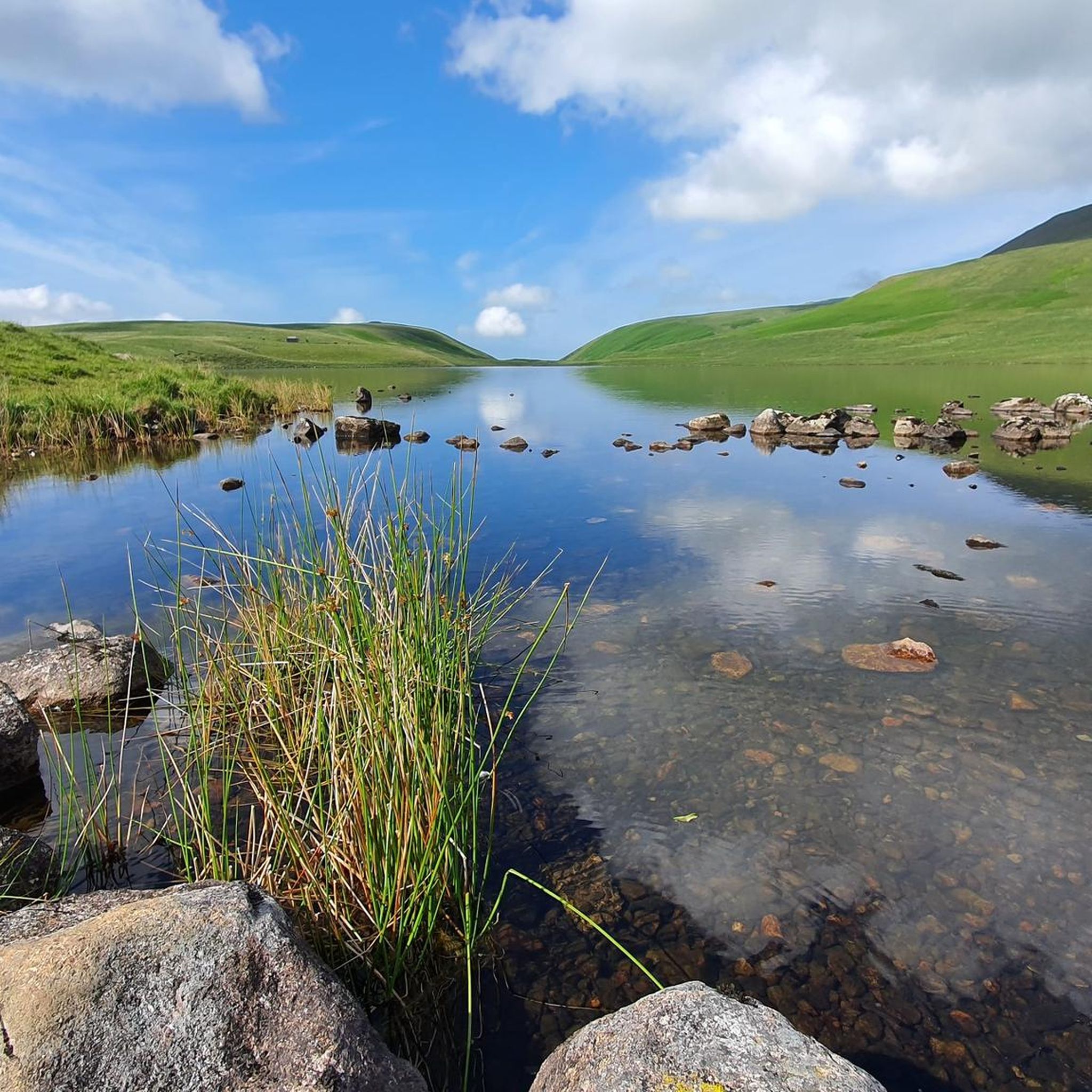
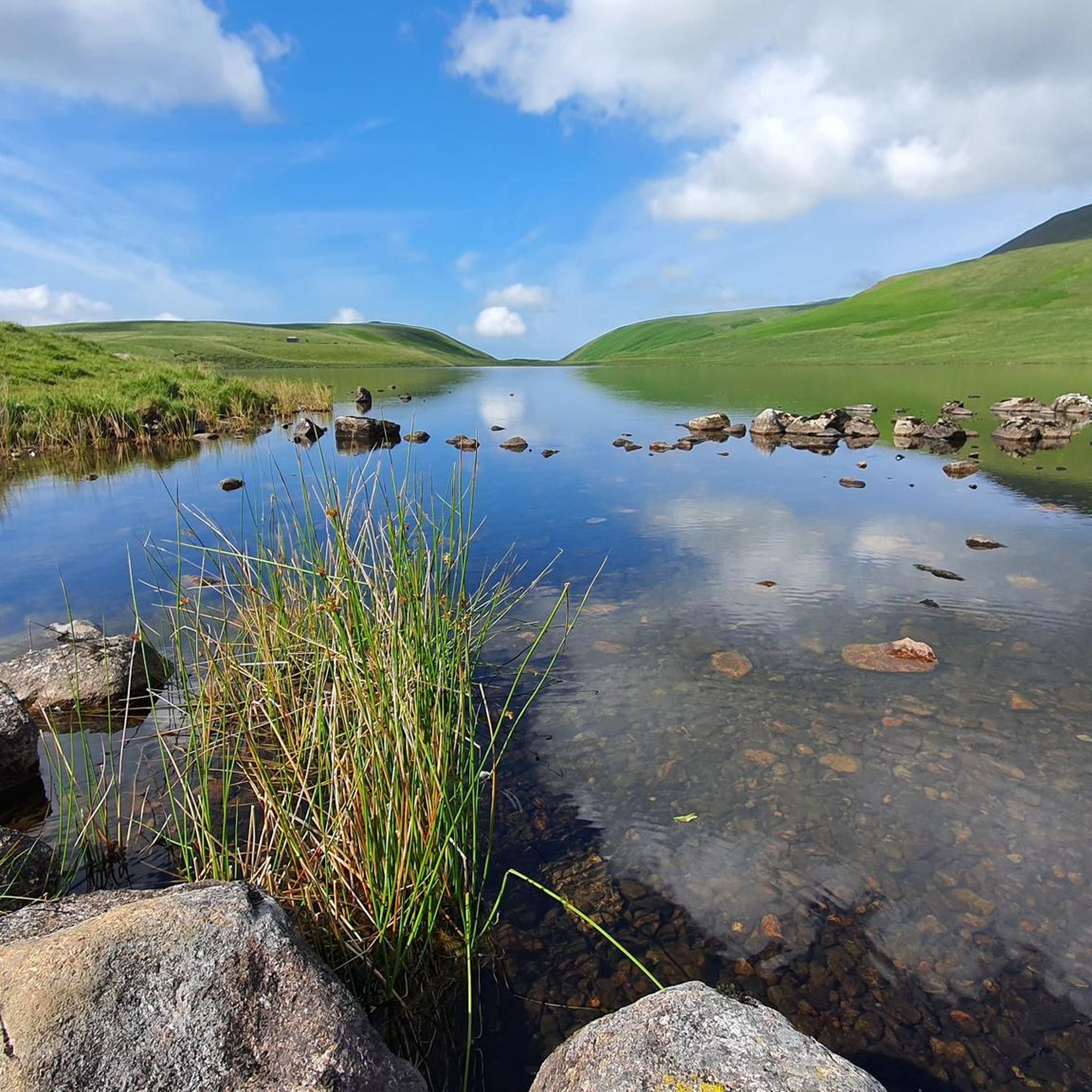
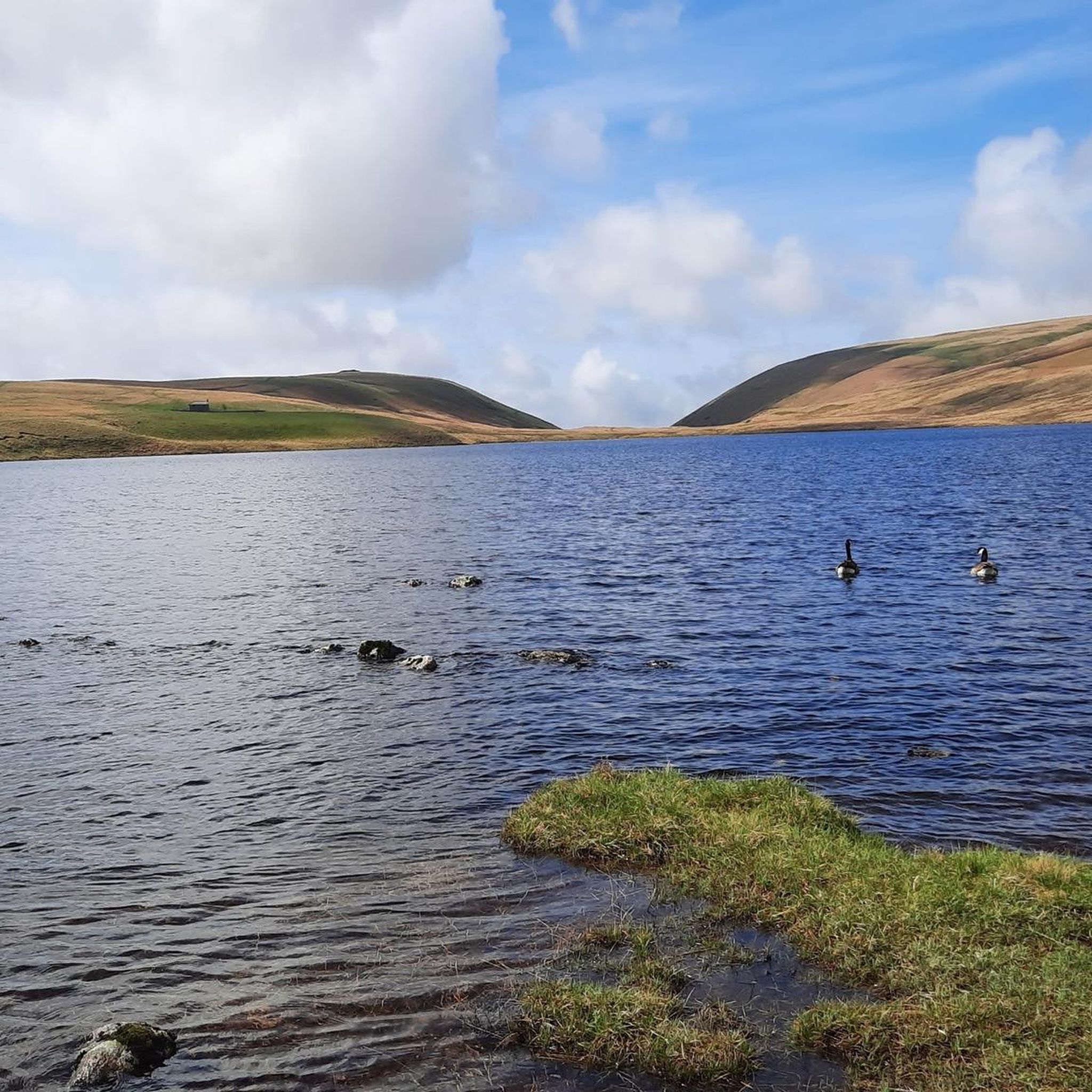
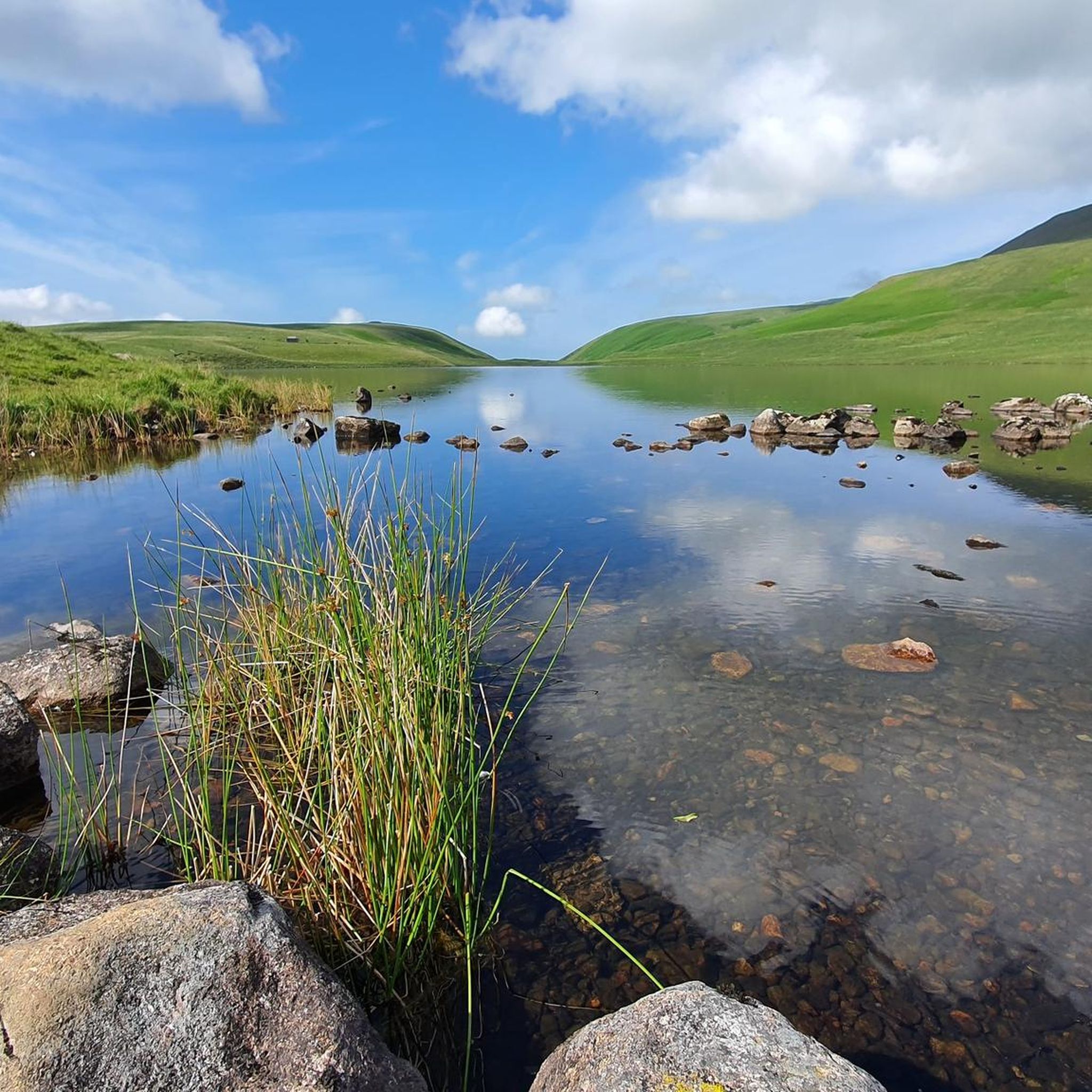
Hiking around Burnmoor Tarn offers access to a remote area within the Lake District, characterized by expansive moorland and a dramatic mountain backdrop. The tarn itself is one of the largest natural tarns in the region, situated at an altitude of 830 feet (253 meters) between Wastwater and Eskdale. The terrain includes rugged fells, such as Scafell and Scafell Pike, and historical features like an ancient corpse road, providing varied hiking experiences.
Best hiking trails around Burnmoor Tarn
- The most popular hiking route is Scafell Pike loop from Wasdale — Lake District National Park, a 5.7 miles (9.1 km) trail that takes 5 hours 9 minutes to complete. This difficult route ascends to England's highest peak, offering extensive views.
- Another top favourite among local hikers is View of Wast Water – View of Wast Water loop from Wasdale, a difficult 7.4 miles (12.0 km) path. This route provides panoramic views of Wast Water and the surrounding fells.
- Local hikers also love the Black Sail Pass – Yewbarrow loop from Wasdale, an 11.3 miles (18.1 km) trail leading through challenging mountain terrain, often completed in about 7 hours 50 minutes.
- Hiking around Burnmoor Tarn is defined by expansive moorland, dramatic mountain fells, and historical paths like the ancient corpse road. The network offers options for various ability levels, from challenging ascents to more moderate moorland traverses.
- The routes in Burnmoor Tarn are highly rated by the komoot community with an average score of 4.5 stars from over 1900 reviews. More than 22000 hikers have used komoot to explore Burnmoor Tarn's varied terrain.
Last updated: June 25, 2026
4.6
(159)
1,075
hikers
9.14km
05:09
940m
940m
Embark on a difficult hike to England's highest mountain with the Scafell Pike loop from Wasdale. This 5.7-mile (9.1 km) route, typically taking around 5 hours and 9 minutes, challenges you with a significant ascent of 3077 feet (938 metres) through dramatic Lake District scenery. You will navigate steep sections like Brown Tongue and a rocky path that can become indistinct, leading to a "giant boulder field of shattered rock" near the summit. From the top, enjoy panoramic views of the Lakeland Fells, and on clear days, you might even spot the Isle of Man, Scotland, Wales, and Ireland.
While the Wasdale Head route is popular, especially for those attempting the National Three Peaks Challenge, be prepared for strenuous conditions. The terrain is demanding, with loose scree and challenging navigation, particularly on the summit plateau where mist, rain, or wind are common. Good fitness, appropriate gear, and strong navigational skills are essential for this demanding mountain environment. Always check weather conditions before you set out.
This route leads you to the summit of Scafell Pike, which stands at 978 metres (3,209 feet) and holds historical significance as a war memorial. The entire summit was donated to the National Trust in 1919 to honor the men of the Lake District who died in World War I. The Wasdale valley itself is an iconic and awe-inspiring location, featuring glacial carved valleys and views over Wastwater, England's deepest lake, adding to the wild and remote feel of your adventure.
4.8
(69)
702
hikers
12.0km
05:19
790m
790m
Hard hike. Very good fitness required. Sure-footedness, sturdy shoes and alpine experience required.

Sign up for free
4.9
(27)
461
hikers
18.1km
07:51
1,110m
1,110m
Hard hike. Very good fitness required. Sure-footedness, sturdy shoes and alpine experience required.
4.6
(13)
75
hikers
10.4km
05:59
1,150m
1,150m
Hard hike. Very good fitness required. Sure-footedness, sturdy shoes and alpine experience required.
4.3
(8)
125
hikers
17.9km
07:41
1,010m
1,010m
Hard hike. Very good fitness required. Sure-footedness, sturdy shoes and alpine experience required.
Get access to more routes and recommendations from other explorers.
Sign up for free
Already have an account?
Our route recommendations are based on thousands of hikes, rides, and runs completed by other people on komoot.
Start today with a free account
Your next adventure awaits.
Login or Signup

Tips from the Community

hiking boots are a must rocky and boulder fields make hard hiking
0
1

Brilliant little scramble, very safe and managable 😊
0
0
This is a short but high ascent of a scramble called Foxes Rake. It is a relatively easy scramble but if wet would be very slippy. This takes you up to a plateau where Foxes Tarn should be if not in drought (it was) and then you can choose if you want to play and scramble again up stagger up what was grass banking as such. Once at the top you can tap out on Scafell Cairn the 2nd highest Fell in the Lakes.
0
0
The hike up to Scafell Pike is surrounded in BEAUTY don't forget to look up and around, take it all in and take your time. Closer to the top the terrain is rocky and screen and it tires you out. Save your energy before hand 👌💪🦵
0
0


Real sense of acheivment until you finish the walk and realise there was so much more to do!
0
0
Stunning look back across Wastwater and the road you come in on.
0
0
Frequently Asked Questions
How many hiking trails are available around Burnmoor Tarn?
There are over 390 hiking routes around Burnmoor Tarn, catering to various skill levels. You'll find a good mix, with approximately 90 easy, 190 moderate, and 120 difficult trails to explore.
What kind of terrain can I expect when hiking near Burnmoor Tarn?
The terrain around Burnmoor Tarn is characterized by expansive moorland and rugged fells, offering a true sense of wilderness. You'll encounter dramatic mountain backdrops, including views of Scafell and Scafell Pike, and historical paths like the ancient corpse road. Be prepared for potentially boggy areas, especially after rainfall.
Are there any family-friendly hiking options around Burnmoor Tarn?
Yes, there are nearly 90 easy routes suitable for families. While the area is known for its ruggedness, shorter, less strenuous walks can be found, particularly starting from areas like Wasdale Head. These often provide a good introduction to the stunning scenery without requiring extensive elevation gains.
Can I bring my dog on the hiking trails around Burnmoor Tarn?
Yes, many trails around Burnmoor Tarn are dog-friendly. However, as it's a wild and often remote area, it's essential to keep dogs under close control, especially near livestock or ground-nesting birds. Always follow the Countryside Code and be prepared for varied terrain.
What interesting landmarks or historical features can I see while hiking?
Burnmoor Tarn is rich in history and natural beauty. You can discover the historic Medieval Corpse Road, which passes by the eastern shore of the tarn. There's also the former Victorian fishing lodge, Burnmoor Lodge, on the southern shore, and the ancient fort site of Maiden Castle nearby, which once guarded the pass between Wasdale and Eskdale.
Are there any circular walks available around Burnmoor Tarn?
Yes, the area offers several circular routes. For instance, the View of Wast Water – View of Wast Water loop from Wasdale is a challenging 12 km circular path providing panoramic views. You can also find circuits that incorporate other nearby tarns like Blea Tarn and Eel Tarn.
What is the best time of year to hike around Burnmoor Tarn?
The best time to hike around Burnmoor Tarn is generally from late spring to early autumn (May to October) when the weather is milder and daylight hours are longer. However, the area's remote beauty can be enjoyed year-round, with winter offering a stark, dramatic landscape for experienced hikers prepared for challenging conditions.
Where can I park when visiting Burnmoor Tarn?
Parking is typically available at trailheads in nearby valleys. For routes accessing Burnmoor Tarn from Wasdale, you can usually find parking at the Wasdale Head car park. If approaching from Eskdale, parking options are available in Boot. Always check local signage for specific parking regulations and fees.
Are there any public transport options to reach the Burnmoor Tarn area?
Public transport to the immediate vicinity of Burnmoor Tarn is limited due to its remote nature. However, you can reach nearby villages like Boot in Eskdale via the Ravenglass and Eskdale Railway, which connects to the main rail network. From these villages, you would typically need to walk or arrange local transport to reach specific trailheads.
What do other hikers enjoy most about hiking in Burnmoor Tarn?
The area is highly rated by the komoot community, with an average score of 4.5 stars from over 1900 reviews. Hikers frequently praise the remote tranquility, the dramatic mountain views, and the sense of wilderness. Many appreciate the diverse landscapes and the historical elements found along the trails.
Are there opportunities for wild swimming near Burnmoor Tarn?
Yes, Burnmoor Tarn itself is known as an appealing spot for wild swimming. Its secluded nature and rocky bottom offer a private and refreshing experience for those looking to take a dip in the Lake District's natural waters. Always exercise caution and be aware of water temperatures and conditions.
What are some of the more challenging hikes in the area?
For experienced hikers seeking a challenge, routes leading to major peaks are abundant. The Scafell Pike loop from Wasdale is a difficult 9.1 km trail ascending England's highest peak. Another strenuous option is the Black Sail Pass – Yewbarrow loop from Wasdale, an 18.1 km trail through demanding mountain terrain.
Most popular routes around Burnmoor Tarn

Get inspired with the komoot mobile app


Explore more
Browse the best Hikes in other regions.
