The best walks and hikes around Grassholme Reservoir
4.7
(639)
4,473
hikers
104
hikes
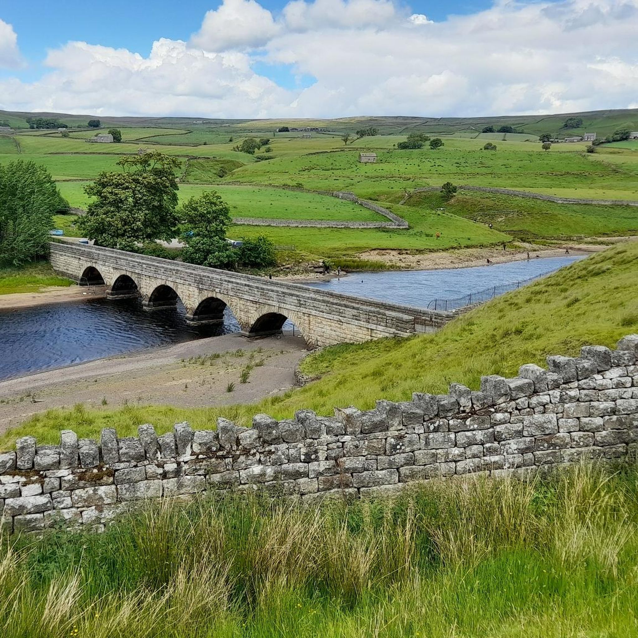
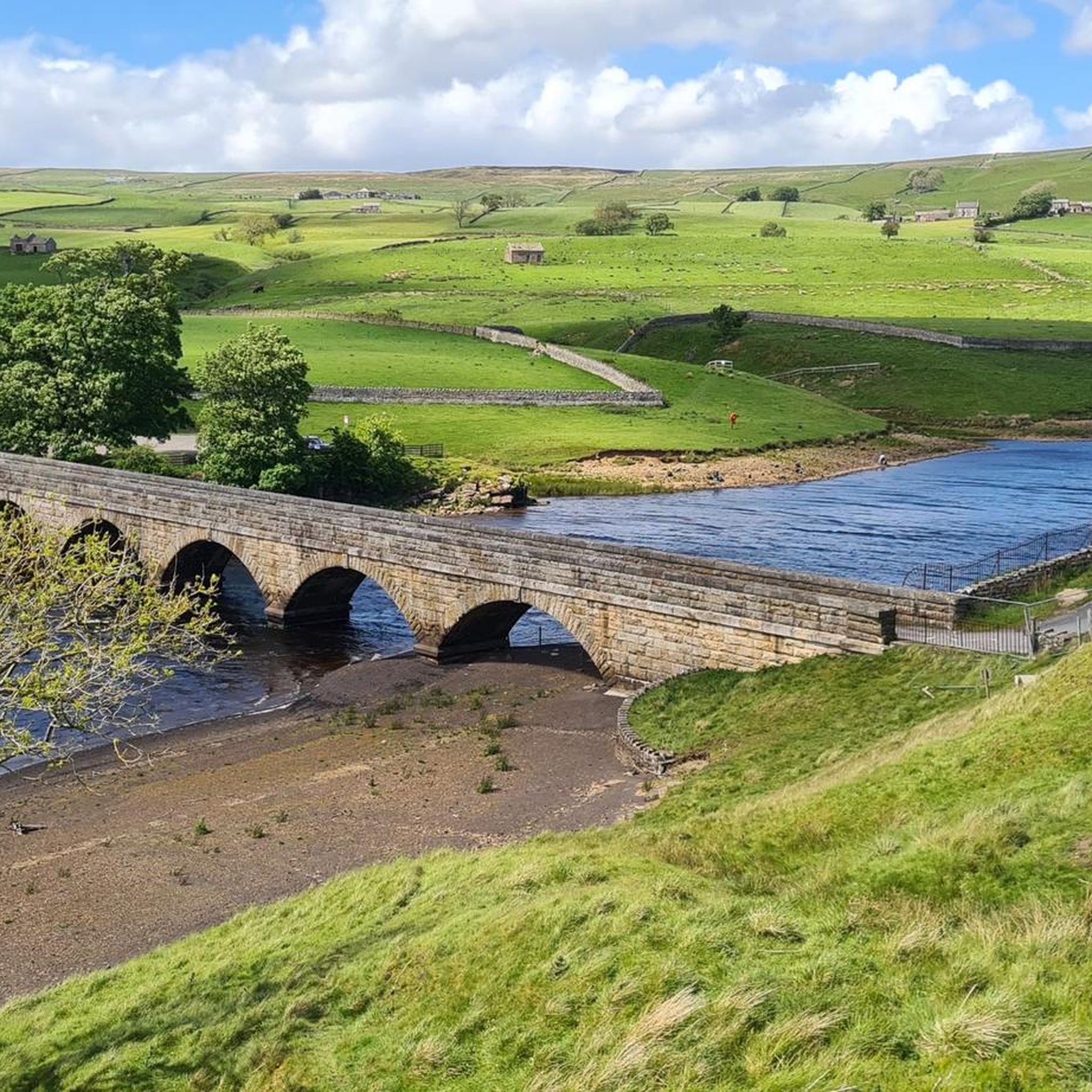
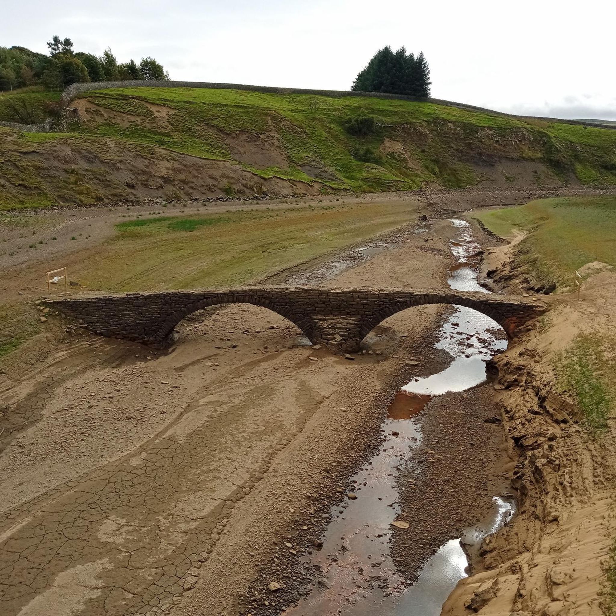
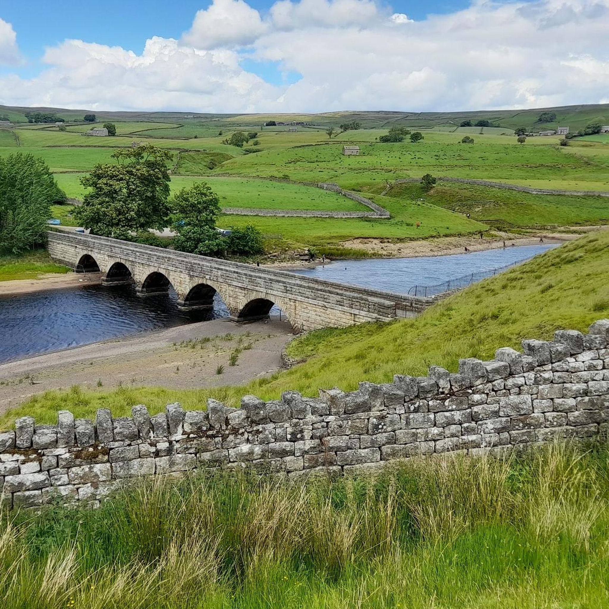
Hiking around Grassholme Reservoir explores the landscape of Teesdale within the North Pennines National Landscape. The area is characterized by rolling pastures and the tranquil shorelines of several reservoirs, including Grassholme, Hury, and Blackton. The terrain primarily consists of waterside paths and countryside tracks with some gentle ascents. This network of trails offers options for various ability levels.
Best hiking trails around Grassholme Reservoir
- The most popular hiking route is the Grassholme Reservoir loop from Romaldkirk, a 2.9 miles (4.6…
Last updated: October 12, 2026
5.0
(3)
22
hikers
23.5km
06:41
520m
520m
Hard hike. Very good fitness required. Easily-accessible paths. Suitable for all skill levels.
5
hikers
Moderate hike. Good fitness required. Easily-accessible paths. Suitable for all skill levels.

4.6
(36)
145
hikers
17.5km
04:37
150m
160m
Embark on the High Force and Low Force Circular, a moderate hiking route that guides you through the scenic North Pennines Area of Outstanding Natural Beauty. This 10.9-mile (17.5 km)…
4.6
(22)
85
hikers
12.5km
03:29
240m
240m
Hike the Grassholme Reservoir loop in the North Pennines for a moderate experience through rolling pastures and along tranquil shorelines. This 7.8-mile (12.5 km) route involves 794 feet (242 metres)…
4.7
(11)
35
hikers
9.87km
02:41
140m
140m
Embark on a moderate hike around Balderhead Reservoir, a route that offers quiet, remote, and expansive scenery in the North Pennines. This circular trail spans 6.1 miles (9.9 km) and…
Get access to more routes and recommendations from other explorers.
Already have an account?
Our route recommendations are based on thousands of hikes, rides, and runs completed by other people on komoot.
Start today with a free account
Your next adventure awaits.
Tips from the Community

Best views from the north side of the river i.e. before crossing Wynch bridge
0
0

This is among the more interesting of the bridges that cross the river Tees. This suspension footbridge owes its existence to the Holwick lead miners who used it to get to the lead mine at Little Eggleshope in the fells to the north.
0
0
Low Force is a beautiful spot. With a series of low cascades, it is not as dramatic as nearby High Force, but it is an area still worth visiting. You can park nearby at Bowlees Visitor Centre, which has a decent car park with a donations payment box.
0
0


This viaduct was used as a railway for the Tees Valley Railway Company, for which it was built in 1868. Now, out of use, you can cross it on foot.
1
0
If you fancy a peaceful run in the area, you should definitely consider doing it around this beautiful spot. Besides the joy of running near the water, it's an ideal way to discover this rural gem and the landscapes that surround it.
1
0
Frequently Asked Questions
Are the walking trails around Grassholme Reservoir dog-friendly?
Yes, dogs are generally welcome on the trails around Grassholme Reservoir. However, the area features rolling pastures with grazing livestock, so it's essential to keep your dog on a lead and under close control, especially during lambing season in the spring. Always follow local signage regarding dogs.
Where can I park to start a walk at Grassholme Reservoir?
There is a dedicated car park at Grassholme Reservoir which serves as a convenient starting point for many walks. It's also the location of the visitor centre and other facilities. For some routes, alternative starting points in nearby villages like Romaldkirk may also offer parking options.
Are there any easy, family-friendly walks available?
Absolutely. The area is well-suited for families. A great option is the Grassholme Reservoir loop from Romaldkirk, which is a relatively flat and short walk of about 4.6 km (2.9 miles) along the shoreline, making it manageable for walkers of all ages.
What is the terrain like on the hikes around the reservoir?
The terrain primarily consists of waterside footpaths and countryside tracks through open pastures. While many paths are gentle, some sections can be undulating and rough underfoot. You can expect beautiful views across the Teesdale valley and the serene reservoir waters.
Can I find a walk that includes a pub stop?
Many walks start or finish in nearby villages like Romaldkirk or Middleton-in-Teesdale, which have traditional pubs for refreshments after your hike. Planning a route that passes through one of these villages is the best way to incorporate a pub stop into your day.
Are there any circular walking routes?
Yes, circular walks are very popular here. One of the most rewarding is the Grassholme Reservoir loop — North Pennines. This 12.5 km (7.8 mile) trail offers a comprehensive tour of the reservoir and the beautiful surrounding countryside.
How many hiking trails are there to choose from?
There are over 100 hiking routes to explore around Grassholme Reservoir. The network of trails offers a wide variety, from easy waterside strolls to more challenging moderate hikes connecting multiple reservoirs.
Is it possible to walk to other nearby reservoirs like Hury or Blackton?
Yes, several trails connect the reservoirs in the area. For a longer, more challenging day out, the Footbridge Over Hury Reservoir – Blackton Reservoir loop from Romaldkirk is a fantastic 16.8 km (10.4 mile) moderate hike that takes you past all three reservoirs.
What do other hikers say about the trails in this area?
The hikes around Grassholme Reservoir are highly rated by the komoot community, with an average score of 4.6 stars. Hikers often praise the magnificent, uninterrupted views of the Teesdale valley and the peaceful, well-maintained paths along the water's edge.
Are there any notable waterfalls to see on a hike?
While the immediate reservoir walks focus on the shoreline, the wider Teesdale area is famous for its waterfalls. A popular nearby hike is the High Force & Low Force loop, which takes you to two of the region's most spectacular waterfalls.
What is the best time of year to hike around Grassholme Reservoir?
Hiking is possible year-round, but the area is particularly beautiful from late spring to autumn when the wildflowers are in bloom and the weather is generally milder. The paths can become muddy after heavy rain, so good footwear is recommended regardless of the season.
What kind of wildlife might I see while walking?
The area is a haven for nature lovers. Keep an eye out for a rich variety of birdlife, including ospreys over the water and bullfinches in the surrounding woodlands. The rolling pastures and reservoir banks are also home to rabbits and a diverse range of insects.
Most popular routes around Grassholme Reservoir

Get inspired with the komoot mobile app


Explore more
Browse the best Hikes in other regions.
