The best road cycling routes around Oorid Lough
5.0
(6)
403
riders
8
rides
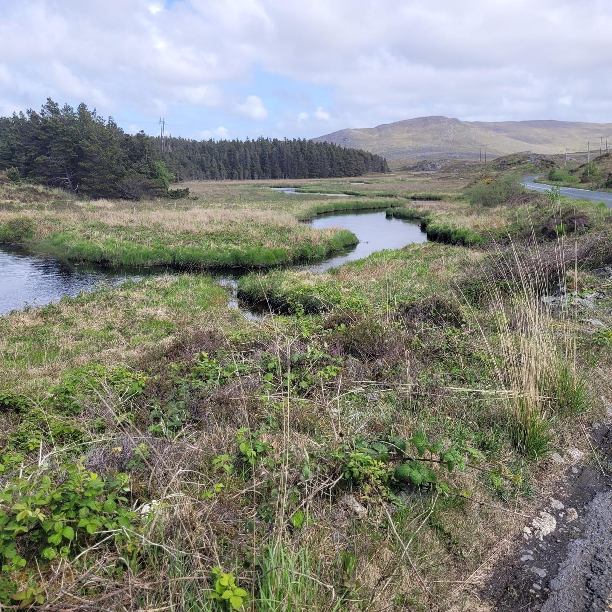
Road cycling around Oorid Lough, located in the Connemara region of County Galway, Ireland, offers routes through diverse and picturesque landscapes. The area is characterized by expansive boglands, a freshwater lake with small islands, and varied terrain that includes both paved country roads and quieter lanes. Cyclists can experience the distinctive ecosystem of the Connemara Bog Complex Special Area of Conservation, with routes often integrated into larger circuits along the N59 Galway-Clifden road. The region provides an immersive experience through natural features and significant landscapes.
Best road cycling routes around Oorid Lough
- The most popular road cycling route is Lough Corrib, Maam Cross and Ballynahown from Galway, an 80.6 miles (129.7 km) trail that takes 5 hours 9 minutes to complete. This difficult route features significant elevation gain through the Connemara landscape.
- Another top favourite among local road cyclists is Roundstone, Clifden, and Leenaun loop from Maam Cross, a difficult 96.8 miles (155.8 km) path. This extensive loop explores coastal and inland areas, offering varied scenery.
- Local road cyclists also love the View of Killary Lough – Owenglin River Stone Bridge loop from Maam Cross, an 87.1 miles (140.2 km) trail leading through scenic viewpoints, often completed in about 5 hours 46 minutes.
- Road cycling around Oorid Lough is defined by boglands, freshwater lake views, and varied Connemara landscapes. The network offers options for easy, moderate, and difficult routes, catering to different ability levels.
- The routes in Oorid Lough are highly rated by the komoot community with an average score of 5.0 stars from over 3 reviews. More than 300 road cyclists have used komoot to explore Oorid Lough's varied terrain.
Last updated: July 12, 2026
14
riders
130km
05:09
610m
610m
This difficult 80.6-mile road cycling route from Galway circles Lough Corrib, offering spectacular views of Connemara and Maam Cross Moorlan
7
riders
156km
06:57
1,060m
1,060m
This difficult 96.8-mile road cycling loop from Maam Cross explores Connemara's boglands and coast, with 3479 feet of elevation gain.

Sign up for free
5.0
(6)
336
riders
Hard road ride. Very good fitness required. Mostly well-paved surfaces and easy to ride.
10
riders
90.3km
03:47
680m
680m
Moderate road ride. Good fitness required. Mostly well-paved surfaces and easy to ride.
8
riders
120km
05:15
910m
910m
Hard road ride. Very good fitness required. Mostly well-paved surfaces and easy to ride.
Get access to more routes and recommendations from other explorers.
Sign up for free
Already have an account?
Our route recommendations are based on thousands of hikes, rides, and runs completed by other people on komoot.
Start today with a free account
Your next adventure awaits.
Login or Signup
Popular around Oorid Lough

Tips from the Community

At this spot, the landscape opens up towards Killary Lough, Ireland's only true fjord. From the slight elevation, you see the long, narrow water between the Mweelrea mountains (Mayo) and the Twelve Bens/Maumturks (Galway). The view is broad and clear: a deep, straight fjord valley with steep flanks, tidal water, and often a strikingly silvery light. The road runs here along open peatland and low rocks, causing the fjord to suddenly come fully into view — a classic Connemara moment of space, water, and rugged mountains.
7
0
This is THE postcard moment of your tour through Connemara. From this elevated point along the N59, you have an unobstructed view over the deep blue fjord and the steep walls of the Mweelrea mountain on the other side. It's the perfect spot to get off your bike for a moment, breathe in the salty sea air, and take in the scale of this unique glacial landscape. Don't forget to wave to the dolphins that sometimes swim by in the depths below!
7
0
One of the most beautiful beaches in the world: secluded, serene, stunning and all yours, for the afternoon. Occasionally a curragh drifts in with the tide, laden with the finest treats the sea has to offer, and then it's quiet again. A tangible reminder of the power of the sea. This enormous rusty anchor belonged to the Norwegian ship the 'Varity', which ran aground here in 1890 during a severe storm. The ship was en route from Canada to Belfast with a cargo of timber when it was wrecked near Aughris Beach. For cyclists on the Lower Sky Road, this is an impressive stop just 4 metres above sea level. As you gaze out over the white sands of Aughris Beach, you realise how untameable the Connemara coast can be.
5
0
This historic stone arch bridge marks the spectacular entrance to Clifden. From the bridge, you look down on the wild rapids of the Owenglin River, which thunders down here via a series of small waterfalls into the bay. The contrast between the crashing water, the old grey stone, and the colourful facades of the town further on is magnificent.
6
0
The charming fishing village of Roundstone, with its colourful houses and active harbour, is the ideal place for a stop. You'll find excellent fresh fish here (try the chowder!) and a lively atmosphere. For cyclists, the road along the bay is relatively flat, but be aware of the wind that has free rein here from the Atlantic Ocean.
7
0

Relatively quiet roads, good tarmac, wild and dramatic scenery
1
0

Nice climb and nice decent, be care of cross winds on the decent
0
0
Frequently Asked Questions
What kind of terrain can I expect when road cycling around Oorid Lough?
Road cycling around Oorid Lough offers a diverse experience, traversing expansive boglands, picturesque coastlines, and varied Connemara landscapes. You'll encounter a mix of well-paved country roads and quieter country lanes, providing an immersive taste of the Irish countryside. The region is known for its distinctive ecosystem, part of the Connemara Bog Complex Special Area of Conservation.
Are there road cycling routes for different skill levels near Oorid Lough?
Yes, the Oorid Lough area caters to various skill levels. While many routes feature significant elevation gains, there are options available for easy, moderate, and difficult rides. For instance, you can find challenging routes like Lough Corrib, Maam Cross and Ballynahown from Galway, which covers over 129 km with substantial climbing, alongside more accessible options.
What natural features or viewpoints can I see while cycling near Oorid Lough?
Cycling around Oorid Lough provides stunning views of the freshwater lake itself, with its small islands, and the surrounding expansive boglands. Routes often offer panoramic vistas of the Connemara landscape and coastline. One route, View of Killary Lough – Owenglin River Stone Bridge loop from Maam Cross, specifically highlights scenic viewpoints including Killary Lough.
What do other road cyclists enjoy most about road cycling in Oorid Lough?
The road cycling routes around Oorid Lough are highly rated by the komoot community, with an average score of 5.0 stars. Cyclists often praise the immersive experience through wild and untouched nature, the tranquility, and the breathtaking scenery of the boglands and coastal areas. The varied terrain and challenging climbs are also frequently highlighted by those seeking adventure.
Are there any family-friendly road cycling routes around Oorid Lough?
While many routes in the immediate Oorid Lough area feature significant distances and elevation, the region does offer varied terrain. For family-friendly options, it's best to look for routes specifically designated as 'easy' or 'moderate' and consider shorter segments of larger loops that might be less demanding. Always check the route details for distance and elevation to ensure it suits your family's abilities.
Can I bring my dog on road cycling routes near Oorid Lough?
Road cycling routes around Oorid Lough are generally on public roads and lanes, so bringing a dog would depend on your specific setup (e.g., a bike trailer). However, as the area is part of the Connemara Bog Complex Special Area of Conservation, it's important to be mindful of local wildlife and livestock. Always keep dogs under control and adhere to any local regulations regarding pets in natural areas.
Where can I find parking facilities for road cycling near Oorid Lough?
Oorid Lough is located along the N59 Galway-Clifden road, just west of Maam Cross. Parking is generally available in nearby villages or designated areas along the main routes that serve as starting points for many cycling tours. For specific routes, checking the tour details on komoot will often provide information on recommended starting points and parking options.
What is the best time of year to go road cycling around Oorid Lough?
The best time for road cycling around Oorid Lough is typically during the warmer and drier months, from late spring to early autumn (May to September). During this period, you can expect more favorable weather conditions, longer daylight hours, and the full beauty of the Connemara landscape. However, weather in Ireland can be unpredictable, so always be prepared for changing conditions.
Are there cafes, pubs, or accommodation options near Oorid Lough?
While Oorid Lough itself is primarily a natural area, you can find cafes, pubs, and accommodation in nearby towns and villages. Maam Cross, located just east of Oorid Lough on the N59, is a key hub in the region and offers some services. Larger towns like Clifden or Oughterard, which are often part of longer cycling loops, provide more extensive options for refreshments and overnight stays.
Are there any permits required for road cycling in the Oorid Lough area?
Generally, no specific permits are required for road cycling on public roads and lanes around Oorid Lough or in Ireland. However, if you plan to venture onto private land or participate in organized events, different rules may apply. Always respect private property and adhere to standard road safety regulations.
How long are the road cycling routes around Oorid Lough?
The road cycling routes around Oorid Lough vary significantly in length. You can find extensive loops like Roundstone, Clifden, and Leenaun loop from Maam Cross, which spans over 155 km, or shorter, more moderate options. The total distance and estimated duration for each route are detailed on komoot, allowing you to choose a ride that fits your schedule and fitness level.
Can I access Oorid Lough by public transport for cycling?
Oorid Lough is situated along the N59 Galway-Clifden road, which is served by some regional bus routes. However, public transport options directly to the lough itself might be limited. Maam Cross, a nearby village, is a more accessible point. It's advisable to check current bus schedules and routes to plan your journey, keeping in mind that transporting bicycles on public transport can sometimes be restricted.
Most popular routes around Oorid Lough

Get inspired with the komoot mobile app


Explore more
Browse the best Road cycling routes in other regions.
