The best walks and hikes around Sylvensteinspeicher
4.4
(10679)
52,704
hikers
31
hikes
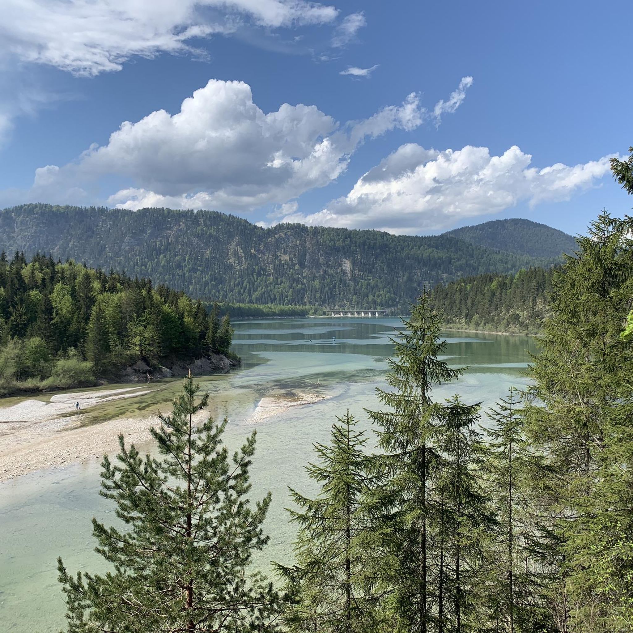
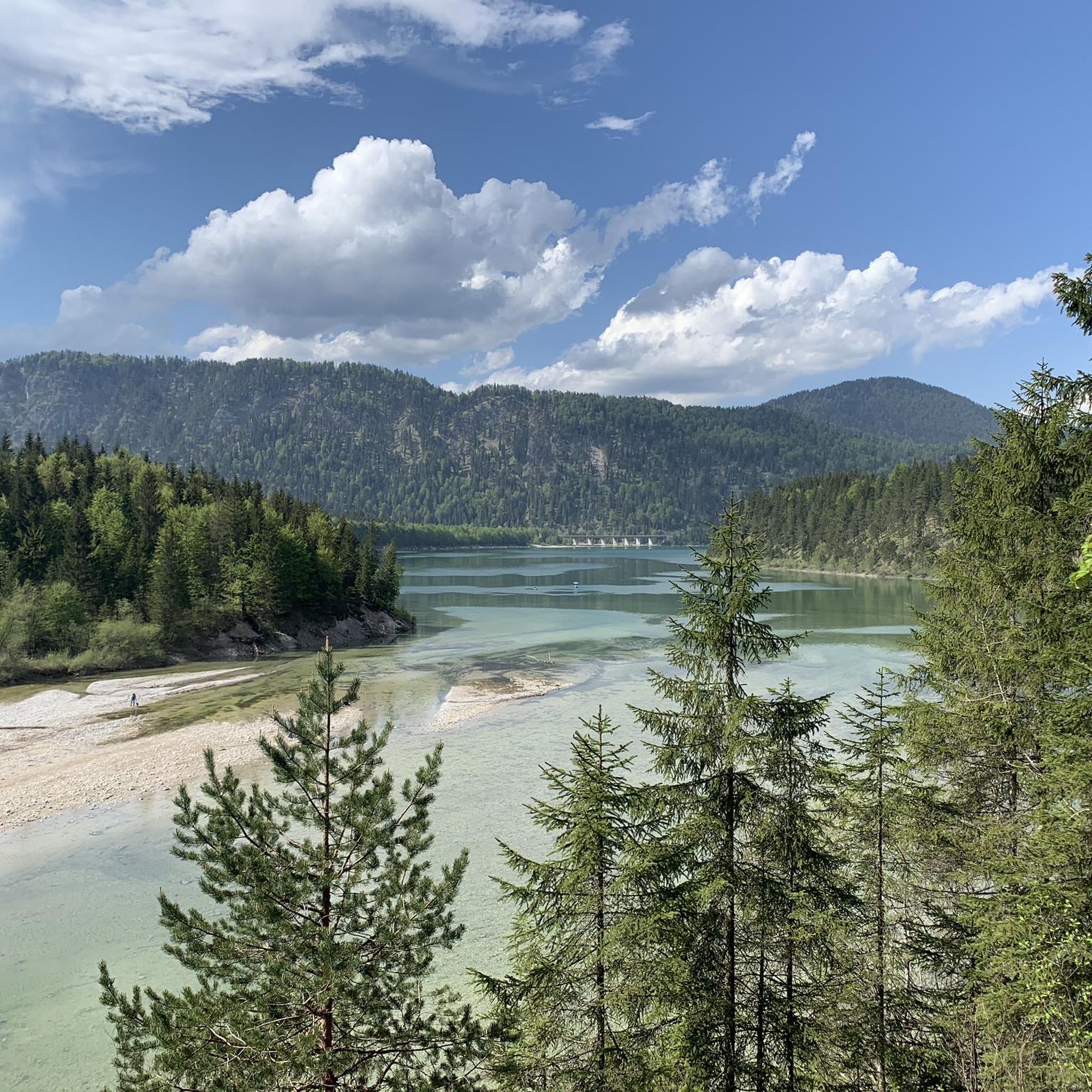
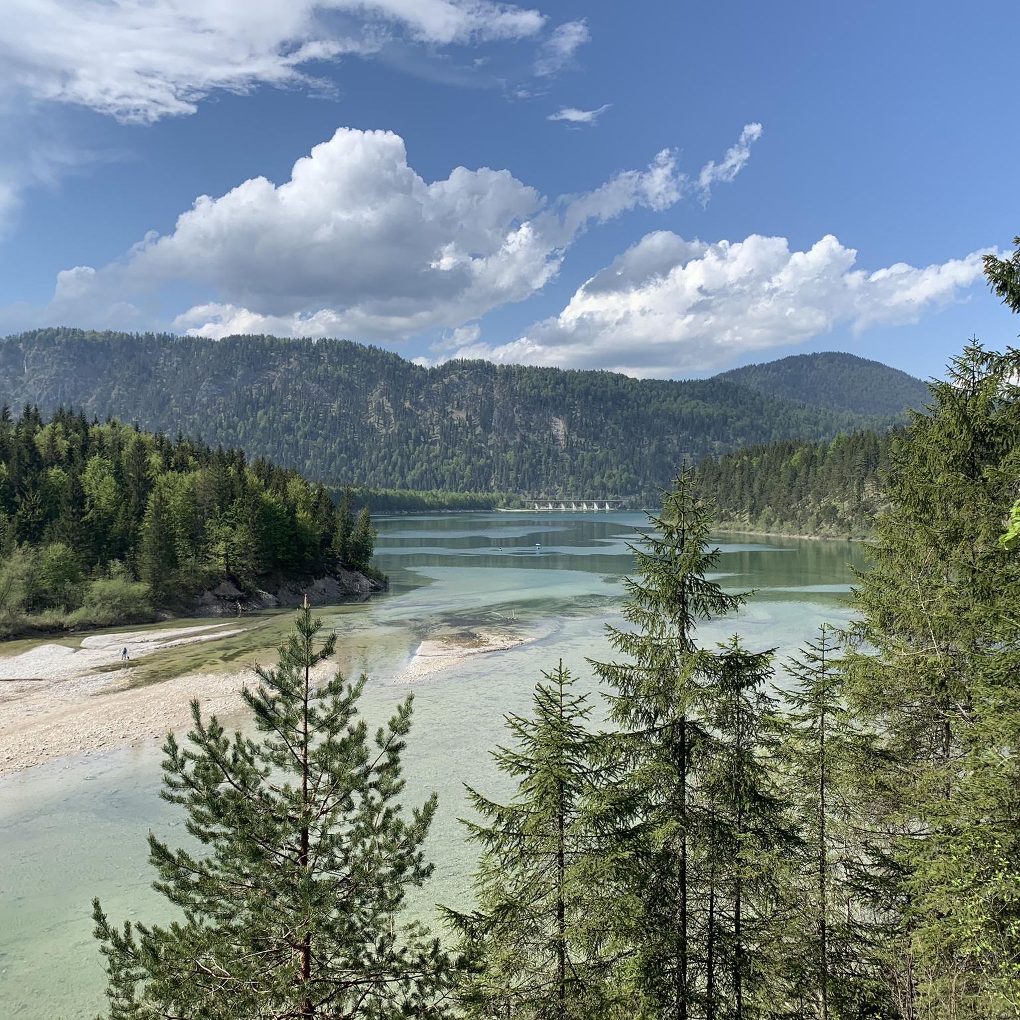
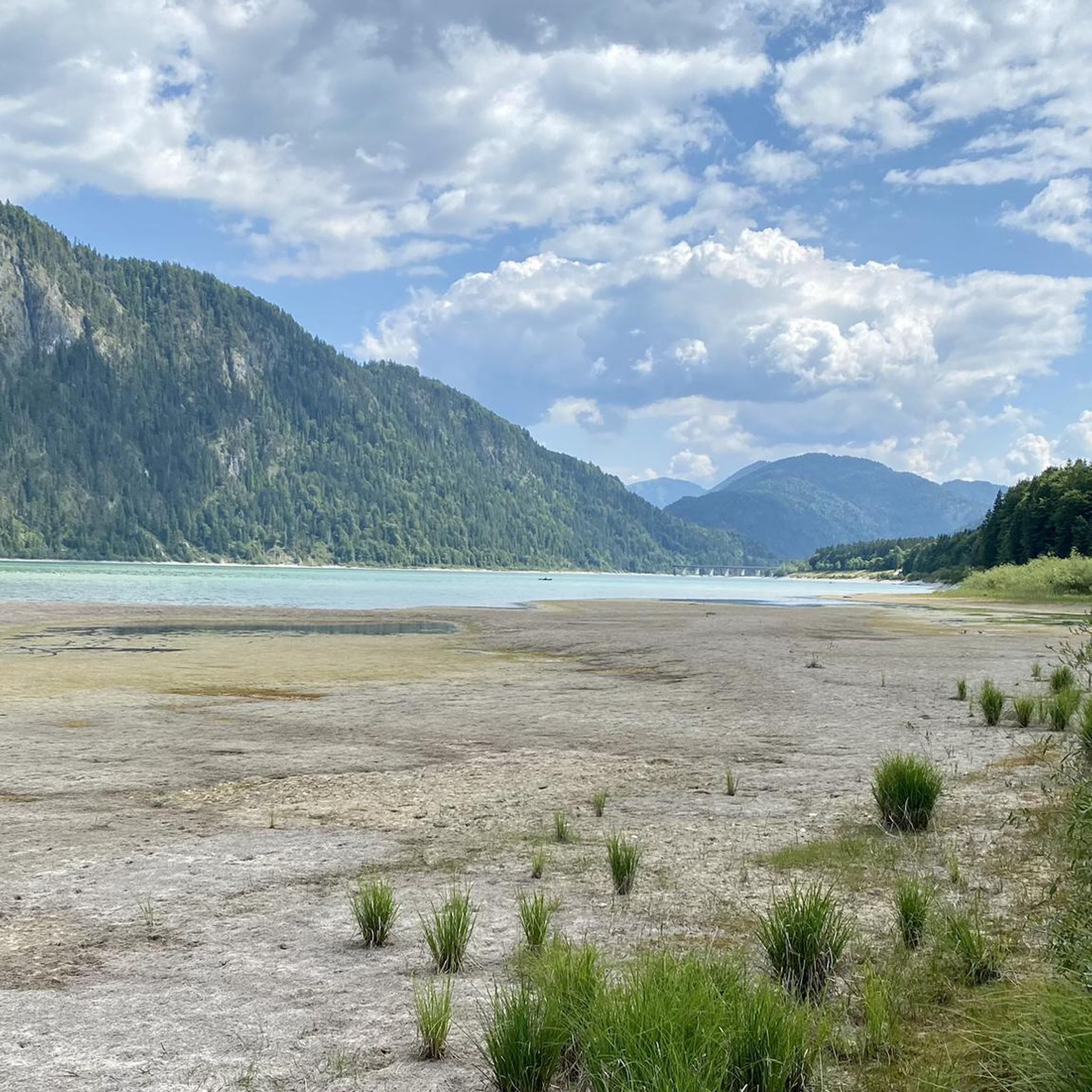
Hiking around Sylvensteinspeicher offers diverse trails set against a fjord-like reservoir and surrounding alpine peaks. The region is characterized by the turquoise waters of Sylvensteinsee, encircled by mountains such as Brauneck and the Karwendel Alps. Located in the picturesque Isar Valley, the area features varied landscapes from reservoir shores to mountain ascents. The terrain includes forest paths, open viewpoints, and sections along the reservoir's dam.
Best hiking trails around Sylvensteinspeicher
- The most popular hiking route is Walchen Gorge – Walchen Riverbank loop from Walchenbergl, an easy 1.6 miles (2.5 km) trail that takes about 41 minutes to complete, offering views along the Walchen River.
- Another top favourite among local hikers is Walchen Riverbank – Walchen Gorge loop from Walchenbergl, a difficult 3.0 miles (4.8 km) path. This route features varied terrain through the Walchen Gorge and along the riverbank.
- Local hikers also love the View of Sylvenstein Reservoir – Forest Rest Area loop from Walchenbergl, a 4.0 miles (6.4 km) trail leading through forest and offering reservoir views, often completed in about 3 hours 18 minutes.
- Hiking around Sylvensteinspeicher is defined by its fjord-like reservoir, majestic mountain ranges, and the scenic Isar Valley. The network offers options for different ability levels, from leisurely walks to challenging mountain ascents.
- The routes in Sylvensteinspeicher are highly rated by the komoot community with an average score of 4.4 stars from over 1800 reviews. More than 9500 hikers have used komoot to explore Sylvensteinspeicher's varied terrain.
Last updated: October 17, 2026
4.4
(225)
939
hikers
Moderate hike. Good fitness required. Mostly accessible paths. Sure-footedness required.
4.2
(35)
104
hikers
2.51km
00:41
30m
30m
Easy hike. Great for any fitness level. Easily-accessible paths. Suitable for all skill levels.

4.4
(25)
99
hikers
4.85km
01:20
60m
60m
Hard hike. Great for any fitness level. Sure-footedness, sturdy shoes and alpine experience required.
4.1
(16)
51
hikers
5.92km
01:42
110m
110m
Moderate hike. Great for any fitness level. Mostly accessible paths. Sure-footedness required.
3.3
(3)
19
hikers
6.46km
03:19
510m
510m
Moderate hike. Good fitness required. Mostly accessible paths. Sure-footedness required.
Get access to more routes and recommendations from other explorers.
Already have an account?
Our route recommendations are based on thousands of hikes, rides, and runs completed by other people on komoot.
Start today with a free account
Your next adventure awaits.
Popular around Sylvensteinspeicher
Other adventures around Sylvensteinspeicher

Tips from the Community


The tour is not secured on the north side of the reservoir and requires sure-footedness, very good footwear, and stamina - in warm weather, please bring enough provisions! Otherwise, the view and the hike are highly recommended!
0
0

A beautifully situated reservoir. Different seasons and lighting conditions have very different optics and charms. Top and very worth seeing.
0
0

Built between 1954 and 1959 for flood control in the Isar Valley Two hydroelectric power plants generate almost 6 MW of electrical power.
0
0
Built between 1954 and 1959 for flood control in the Isar Valley Two hydroelectric power plants generate almost 6 MW of electrical power.
0
0

Parking lot Radlbrücke
0
0

A very pleasant gravel path along the Syvenstein reservoir; past the Fall bathing area, then here near the fishing boats, and later, after a short up/down, even to the sediment barrier with its emerald-green water.
0
0

beautiful view of Little Canada
0
0
Frequently Asked Questions
How many hiking trails are available around Sylvensteinspeicher?
The Sylvensteinspeicher region offers a diverse network of over 25 hiking trails. These routes cater to various skill levels, ranging from leisurely strolls along the reservoir to more challenging mountain ascents into the surrounding alpine peaks.
What kind of terrain can I expect on hikes around Sylvensteinspeicher?
You'll find a varied landscape around Sylvensteinspeicher. The terrain includes forest paths, open viewpoints offering panoramic vistas, and sections that follow the reservoir's dam. Some routes feature the unique experience of passing through tunnels, like on the Toni-Sebert-Weg, where temperatures drop and water drips from the ceiling.
Are there any family-friendly hiking options in the Sylvensteinspeicher area?
Yes, the region offers trails suitable for families. While specific family-friendly routes are not detailed, the overall network includes easier paths. Look for routes described as 'easy' to find suitable options for all ages. The scenic beauty and varied landscapes ensure an engaging experience for everyone.
Can I bring my dog on the hiking trails around Sylvensteinspeicher?
Many trails in the Sylvensteinspeicher area are dog-friendly, allowing you to enjoy the stunning scenery with your canine companion. However, it's always advisable to keep dogs on a leash, especially in nature reserve areas or near wildlife, and to respect local regulations.
What are the notable natural features or landmarks to see while hiking?
The primary natural feature is the fjord-like Sylvenstein Reservoir itself, with its crystal-clear, turquoise water. You can also see the imposing dam, and the Faller Klamm Bridge which offers beautiful views. The surrounding majestic mountains, including the Brauneck and Karwendel Alps, provide dramatic backdrops and panoramic viewpoints.
Are there any circular hiking routes around Sylvensteinspeicher?
Yes, there are several circular routes available. For example, the Sylvenstein Reservoir – Sylvenstein Reservoir loop from Fall is a moderate 7.2 km (4.5 miles) trail. Another option is the View of Sylvenstein Reservoir – Forest Rest Area loop from Walchenbergl, which is 6.4 km (4 miles) and offers great reservoir views.
What is the best time of year to go hiking around Sylvensteinspeicher?
The Sylvensteinspeicher region offers beauty year-round. Spring and summer bring lush greenery, while autumn transforms the landscape with vibrant colors. Even winter offers a snow-covered wonderland for those prepared for colder conditions. The clear air and stunning views are consistent throughout the seasons.
How can I get to the hiking trails around Sylvensteinspeicher using public transport?
Sylvensteinspeicher is accessible by public transport, though options might be limited depending on your starting point. Buses serve the area, connecting to nearby towns like Lenggries or Fall. It's recommended to check local bus schedules in advance to plan your journey to trailheads.
Are there places to eat or stay near the hiking trails?
Yes, there are options for refreshments and accommodation. The region has mountain huts, such as those on recommended tours to Gindelalm or Kotalm, where you can enjoy regional delicacies. Nearby villages like Fall and Lenggries also offer restaurants, cafes, and hotels for visitors.
What do other hikers say about the trails around Sylvensteinspeicher?
The trails around Sylvensteinspeicher are highly rated by the komoot community, with an average score of 4.4 stars from over 1800 reviews. Hikers often praise the stunning fjord-like reservoir, the majestic mountain views, and the diverse network of trails suitable for various abilities.
Are there any unique experiences or 'hidden gems' on the trails?
Beyond the main trails, the region offers unique experiences. The Sylventrail is a themed path providing educational insights into local flora and fauna. Hikers on the Toni-Sebert-Weg can experience a notable tunnel where the temperature drops and water drips, adding an adventurous element. The nearby Ettaler Weidmoos nature reserve is also a 'hidden gem' for discovering rare plant species.
Are there opportunities for swimming after a hike?
Yes, the Sylvensteinsee offers opportunities for swimming in its refreshing, clear waters. There are designated swimming areas where you can cool off after your hike, though be aware that the water can be quite chilly even in summer.
Where can I park my car when hiking around Sylvensteinspeicher?
Parking is generally available at various trailheads and access points around Sylvensteinspeicher. Popular starting points like Walchenbergl or Fall often have designated parking areas. It's advisable to arrive early during peak season to secure a spot.
Most popular routes around Sylvensteinspeicher
Most popular attractions around Sylvensteinspeicher

Get inspired with the komoot mobile app


Explore more
Browse the best Hikes in other regions.
