The best MTB trails around North Auburn
4.9
(24)
476
riders
22
rides
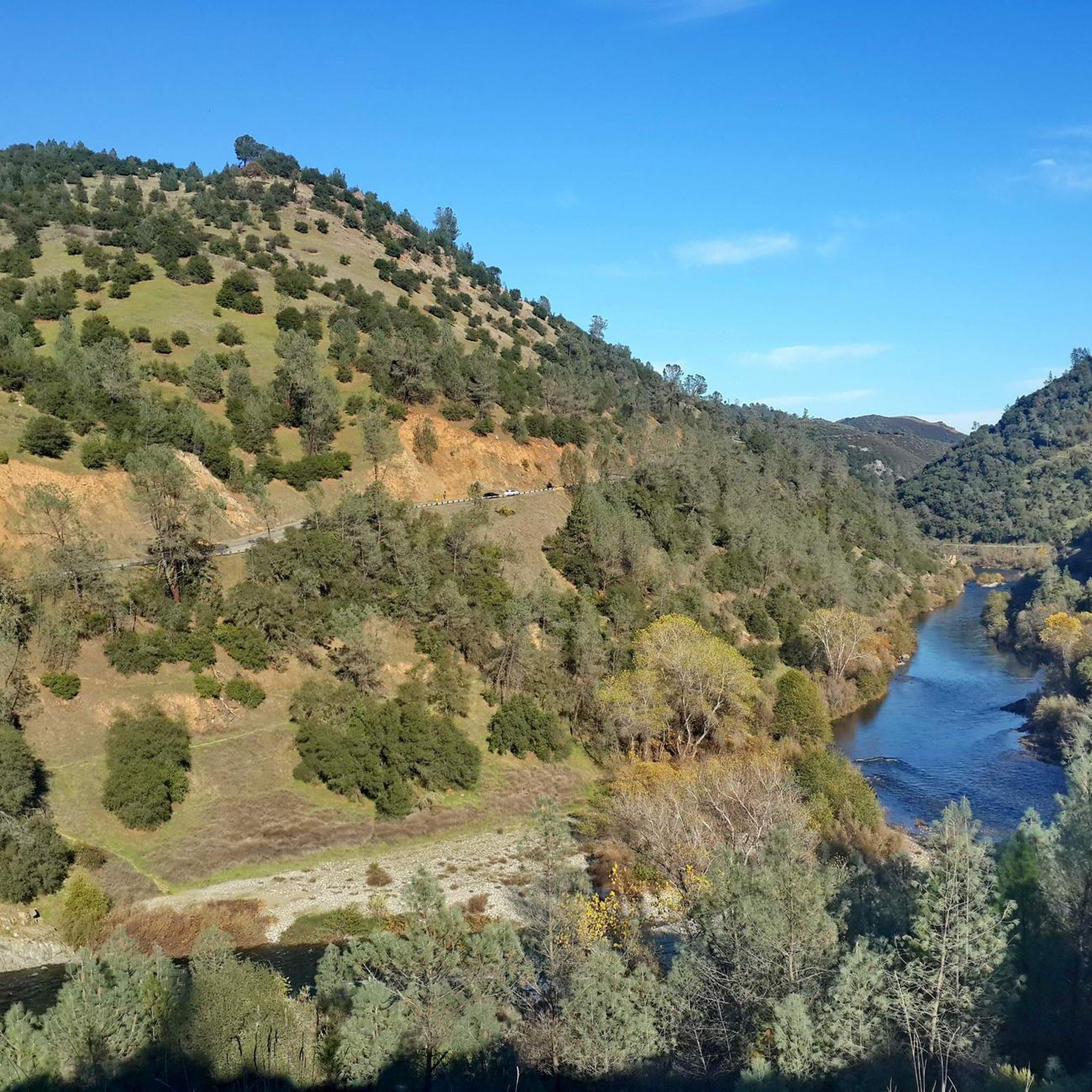
Mountain biking around North Auburn offers a diverse landscape characterized by forested hills, river confluences, and varied terrain. The region features a network of trails that wind through natural areas, providing both challenging climbs and scenic descents. Riders can expect paths that traverse along river valleys and ascend through wooded sections, offering a mix of natural surfaces. The elevation changes across the area contribute to a dynamic mountain biking experience.
Best mountain bike trails around North Auburn
- The most popular mountain bike trail is Foresthill Divide and Stagecoach Loop, a 31.1 miles (50.1 km) trail that takes 4 hours 51 minutes to complete. This difficult route offers extensive views and varied terrain across the divide.
- Another top favourite among local mountain bikers is Auburn Confluence and Clementine Loop, a moderate 14.3 miles (23.0 km) path. This trail provides scenic river views and winds through diverse forest sections.
- Local mountain bikers also love the Confluence and Clementine Trail Loop, a 6.3 miles (10.1 km) trail leading through riverine landscapes and wooded areas, often completed in about 1 hour 3 minutes.
- Mountain biking around North Auburn is defined by its forested hills, river valleys, and varied elevation changes. The network offers options for different ability levels, from moderate loops to more difficult, longer routes.
- The routes in North Auburn are highly rated by the komoot community with an average score of 4.9 stars from over 20 reviews. More than 500 mountain bikers have used komoot to explore North Auburn's varied terrain.
Last updated: June 24, 2026
5.0
(2)
66
riders
50.1km
04:51
1,200m
1,200m
This difficult 31.2-mile mountain biking loop in Auburn State Recreation Area offers diverse scenery and challenging climbs.
5.0
(1)
61
riders
23.0km
02:33
790m
790m
The Auburn Confluence and Clementine Loop offers a dynamic mountain biking experience, weaving through varied terrain from narrow singletrack to wider double-track. You'll encounter everything from flow trails with optional drops to rocky sections with significant exposure, all while enjoying views of the Middle Fork of the American River and Lake Clementine. A highlight is riding directly beneath the impressive Foresthill Bridge, and in spring, the chaparral and grasslands burst with wildflowers.
This moderate 14.3-mile (23.0 km) route involves a substantial 2586 feet (788 metres) of elevation gain, typically taking around 2 hours and 32 minutes. As a popular multi-use trail within the Auburn State Recreation Area, you'll share the path with hikers and equestrians, so always ride with awareness. Parking is available at the trailhead, and arriving early is often a good idea, especially on weekends.
Beyond the varied terrain and scenic river views, the trail features unique elements like a

Sign up for free
4.3
(4)
39
riders
10.1km
01:04
310m
310m
Get ready for a dynamic mountain biking experience on the Confluence and Clementine Trail Loop, a moderate route spanning 6.2 miles (10.1 km). You will climb 1028 feet (313 metres) over an estimated 1 hour and 3 minutes, navigating varied terrain from narrow singletrack with significant drop-offs to smoother sections. Enjoy excellent views of the American River, especially its Middle Fork, as you ride through the Auburn State Recreation Area. Keep an eye out for the impressive Lake Clementine Dam, which sometimes features a cascading waterfall and rainbows, adding to the scenic beauty of your ride.
This popular loop is accessible year-round, making it a great option for any season. Since it is a multi-use trail, you will share the path with hikers, so please be mindful of your speed and surroundings to ensure a safe and enjoyable experience for everyone. No specific warnings about snow, road closures, permits, or fees are typically noted for this route, simplifying your planning.
One of the unique features that sets this trail apart is the memorable 'Spooky Tunnel' that plunges into darkness, offering a distinct moment during your ride. The diverse landscape and the combination of challenging and flowing sections make this loop a favorite among local mountain bikers. It provides a great way to explore the natural beauty and varied terrain of the American River canyon.
25
riders
20.7km
02:11
630m
630m
Moderate mountain bike ride. Good fitness required. Suitable for all skill levels.
10
riders
15.2km
01:23
330m
330m
Moderate mountain bike ride. Good fitness required. Suitable for all skill levels.
Get access to more routes and recommendations from other explorers.
Sign up for free
Already have an account?
Our route recommendations are based on thousands of hikes, rides, and runs completed by other people on komoot.
Start today with a free account
Your next adventure awaits.
Login or Signup
Tips from the Community

The Fuel Break Trail near Foresthill is a short connector fire road providing access to the Culvert trail. This route passes through scenic oak meadows and woodlands and offers breathtaking views of the surrounding area once you reach the ridgeline.
0
0
This trail offers captivating bird's eye views of the confluence area and American River Canyon. With a history dating back to the mid-1800s, it's a testament to the region's rich cultural heritage. It's a popular multiuse trail, so keep an eye out for hikers and runners, especially around corners.
1
0

Foresthill Divide Loop, in the Auburn State Recreation Area, is a multi-use trail for hiking and biking. You'll encounter diverse landscapes, including pine and oak woodlands, as well as panoramic views of the American River Canyon.
0
0

Middle Fork of the American River is a popular spot for rafting, with many trails around it. Be careful swimming in some spots as the current is strong.
0
0
Foresthill Road is a scenic highway going through the Auburn State Recreation Area. It's not great for running on, as it has no good shoulders and can be very trafficked, but it is a good turn-around spot.
0
0
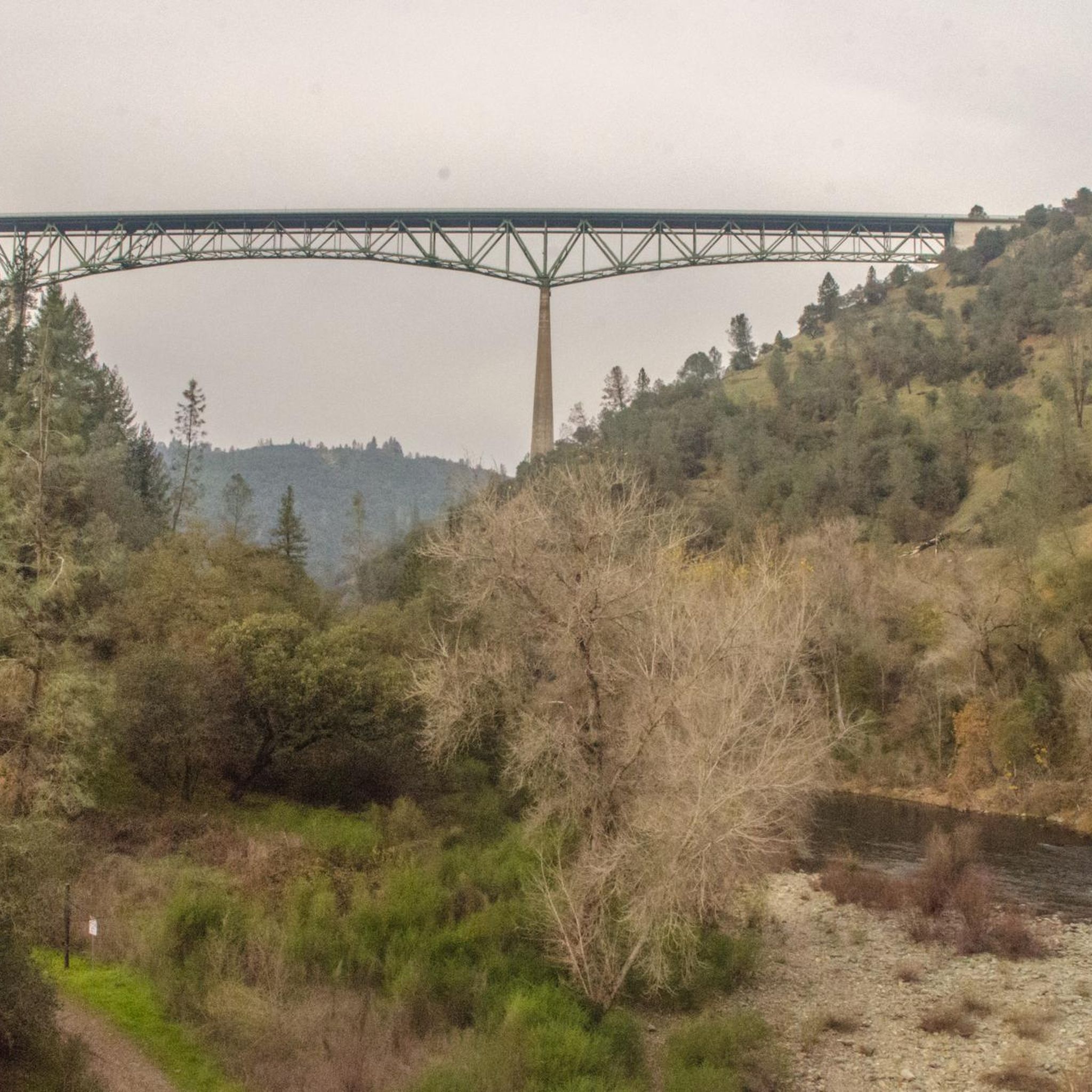
The Foresthill Bridge, spanning 2,428 feet over the North Fork American River, holds the title of the tallest bridge in California. Does it look familiar? Movie buffs might recognize it from Xander Cage's parachute jump in "XXX" and John Travolta's 1996 blockbuster "Phenomenon."
0
0
The Foresthill Bridge, spanning 2,428 feet over the North Fork American River, holds the title of the tallest bridge in California. Does it look familiar? Movie buffs might recognize it from Xander Cage's parachute jump in "XXX" and John Travolta's 1996 blockbuster "Phenomenon."
0
0
Old Auburn Foresthill Road has a fraction of the car traffic as Foresthill Road does so it's a more mellow road to ride. It winds through the woods and usually has a good shoulder to stay on. If taking this road from east to west, it is a nice smooth downhill ride, and the opposite way is a climb up to Foresthill Road.
0
0
Frequently Asked Questions
How many mountain bike trails are available in North Auburn?
North Auburn offers a selection of over 20 mountain bike trails. These routes cater to various skill levels, including 6 easy, 15 moderate, and 1 difficult trail.
Are there mountain bike trails suitable for beginners in North Auburn?
Yes, North Auburn has several trails suitable for beginners. There are 6 routes classified as easy, providing a good starting point for those new to mountain biking or looking for a more relaxed ride.
What is the typical length and duration of mountain bike trails in North Auburn?
Trail lengths vary significantly. For example, the Confluence and Clementine Trail Loop is about 10.1 km (6.3 miles) and takes around 1 hour 3 minutes. Longer, more challenging routes like the Foresthill Divide and Stagecoach Loop extend to 50.1 km (31.1 miles) and can take nearly 5 hours to complete.
Are there any challenging mountain bike trails for experienced riders?
Experienced riders seeking a challenge can explore routes like the Foresthill Divide and Stagecoach Loop. This difficult 50.1 km (31.1 miles) trail features significant elevation changes and varied terrain, offering an extensive and demanding ride.
What kind of terrain can I expect on North Auburn's mountain bike trails?
The trails in North Auburn are characterized by forested hills, river confluences, and varied natural surfaces. You'll encounter paths that traverse along river valleys and ascend through wooded sections, providing a dynamic riding experience with diverse elevation changes.
Are there any loop trails for mountain biking in North Auburn?
Yes, many of North Auburn's mountain bike routes are loops. Examples include the Auburn Confluence and Clementine Loop, the Confluence and Clementine Trail Loop, and the Fuel Break Trail loop from Foresthill Bridge.
What do other mountain bikers enjoy most about the trails in North Auburn?
The mountain bike trails in North Auburn are highly rated by the komoot community, with an average score of 4.9 stars. Riders frequently praise the diverse terrain, scenic river views, and the well-maintained paths that wind through varied forest sections.
What are some notable landmarks or attractions I might see along the mountain bike trails?
While riding, you might encounter several interesting points. The Foresthill Bridge is a prominent landmark. You can also explore sections of the Clementine Trail and the Poppy Trail. For a natural highlight, consider visiting Hidden Falls.
Are there any trails that offer scenic river views?
Absolutely. The Auburn Confluence and Clementine Loop is particularly known for its scenic river views as it winds through diverse forest sections along the water.
What is the best time of year for mountain biking in North Auburn?
North Auburn generally offers good mountain biking conditions for much of the year. Spring and fall provide pleasant temperatures and vibrant scenery. Summer can be warm, so early morning rides are often preferred, while winter rides are possible but may require checking local conditions for rain or cooler temperatures.
Are there any trails that pass by waterfalls?
Yes, the region features Hidden Falls, which is a notable attraction. While not all trails pass directly by it, some routes in the area offer access or views towards this beautiful waterfall.
Most popular attractions around North Auburn

Get inspired with the komoot mobile app


Explore more
Browse the best MTB trails in other regions.
