The best road cycling routes around Alamo
4.5
(140)
5,856
riders
16
rides
Road cycling routes around Alamo, California, traverse a landscape characterized by rolling hills, open spaces, and suburban areas. The region offers varied terrain, from the foothills of Mount Diablo to flatter, paved multi-use paths. Road cyclists can find routes that explore local reservoirs and connect to regional trail networks. The area features diverse ecosystems, including forested hills and varied plant life, providing scenic views for cyclists.
Best road cycling routes around Alamo
- The most popular road cycling route is Livermore…
Last updated: July 8, 2026
4.8
(4)
575
riders
59.9km
03:22
1,200m
1,200m
Hard road ride. Very good fitness required. Mostly well-paved surfaces and easy to ride.
36
riders
81.9km
03:53
770m
770m
Moderate road ride. Good fitness required. Mostly well-paved surfaces and easy to ride.

Sign up for free
15
riders
14.2km
00:44
90m
90m
Easy road ride. Great for any fitness level. Mostly well-paved surfaces and easy to ride.
16
riders
15.7km
00:48
40m
40m
Easy road ride. Great for any fitness level. Mostly well-paved surfaces and easy to ride.
8
riders
Moderate road ride. Good fitness required. Mostly well-paved surfaces and easy to ride.
Get access to more routes and recommendations from other explorers.
Sign up for free
Already have an account?
Our route recommendations are based on thousands of hikes, rides, and runs completed by other people on komoot.
Start today with a free account
Your next adventure awaits.
Login or Signup

Tips from the Community

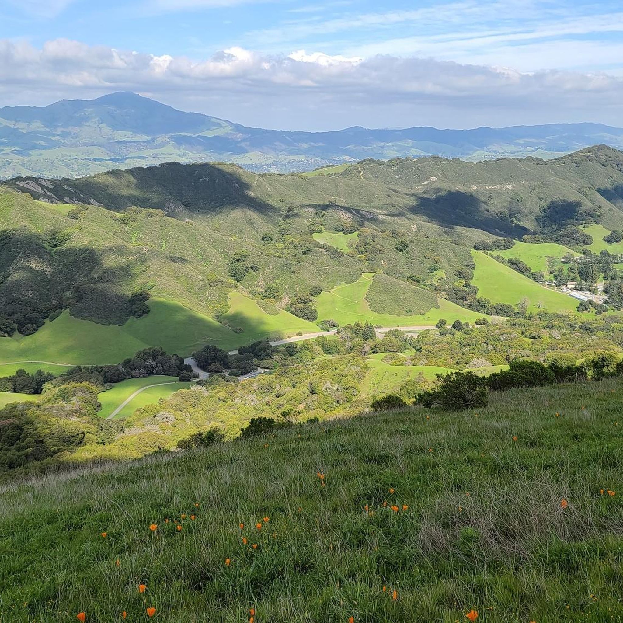
Mount Diablo, is the Bay Area second-highest peak at 1173m (3849ft). The challenging climb features constantly fluctuating gradients averaging 8%, with tough sections up to 18% and a brutal 23% finish in the last 200m. The equally demanding descent requires good bike handling due to tight corners, potholes, and strong winds. The road to the top is open daily from 8 AM till sunset.
0
0

The Del Amigo Swim Club, officially known as the Del Amigo Pool Association, is a member-owned, nonprofit community pool that features two pools. The pool closes every year from mid‑September to March for major renovation.
0
0

The Iron Horse Trail is a 32-mile multi-path that connects the towns of Concord and Pleasanton. It follows the route of the abandoned Southern Pacific Railroad. With its access to schools, business centers, and parks, the path is popular with commuters and recreationalists.
1
0
The Iron Horse Trail is a 32-mile multi-path that connects the towns of Concord and Pleasanton. It follows the route of the abandoned Southern Pacific Railroad. With its access to schools, business centers, and parks, the path is popular with commuters and recreationalists.
0
0
Here, at the northwest corner of Alvarez Ninth Street Park, is a nice vista point over the Carquinez Strait. There is a wooden viewpoint, and it is a nice stop to snap a few photos.
0
0
This charming lake sits along the Ygnacio Canal Trail at Heather Farm Park. The park features two lakes, open grassy areas, playgrounds, picnic tables, and other facilities. The lake and surrounding areas are a great spot to take a break while cycling the Ygnacio Canal Trail.
0
0


A natural lake, mostly used for fishing, that has the paved Ygnacio Canal Trail on the west side and some unpaved trails along the east.
0
0
Frequently Asked Questions
How many road cycling routes are available around Alamo?
Alamo offers a wide selection of road cycling routes, with over 140 options available on komoot. These routes cater to various skill levels, from easy rides to more challenging ascents.
What kind of terrain can I expect on road cycling routes in Alamo?
Road cycling routes around Alamo feature a diverse landscape, including rolling hills, expansive open spaces, and suburban areas. You'll find varied terrain, from the foothills of Mount Diablo to flatter, paved multi-use paths, often exploring local reservoirs and connecting to regional trail networks.
Are there easy road cycling routes suitable for beginners in Alamo?
Yes, Alamo has numerous easy road cycling routes perfect for beginners. Approximately 62 routes are classified as easy. A great option is the Black Hills Reservoir – Blackhawk Road Bike Path loop from Alamo, which is about 10 miles long and leads through reservoir areas on dedicated bike paths.
Are there challenging road cycling routes for experienced cyclists in Alamo?
For experienced cyclists seeking a challenge, Alamo offers several routes with significant elevation gain. There are 17 routes classified as difficult. A notable option is the Mount Diablo Scenic Boulevard – Curry Point loop from Sycamore Valley Open Space Regional Preserve, which includes over 600 meters of ascent.
Can I find loop road cycling routes in Alamo?
Yes, many road cycling routes in Alamo are designed as loops, allowing you to start and finish at the same point. Examples include the popular Livermore loop and the Iron Horse Regional Trail Loop.
Are there family-friendly road cycling options in Alamo?
Absolutely. Many of Alamo's routes, especially those utilizing paved multi-use paths like sections of the Iron Horse Trail, are suitable for families. These routes often have gentler gradients and are away from heavy traffic, providing a safer and more enjoyable experience for all ages.
What is the typical length and duration of road cycling routes in Alamo?
Route lengths and durations vary widely. You can find shorter rides like the Black Hills Reservoir – Blackhawk Road Bike Path loop, which is about 10 miles and takes under an hour. Longer routes, such as the Livermore loop, can extend to over 47 miles and take more than three hours to complete.
What scenic viewpoints or landmarks can I see while road cycling near Alamo?
Road cycling near Alamo offers access to several scenic spots and landmarks. You might encounter views from Mount Diablo Summit, Eagle Peak, or Las Trampas Ridge. The region is known for its open space preserves and the foothills of Mount Diablo, providing picturesque backdrops for your ride.
What do other road cyclists enjoy the most about road cycling in Alamo?
The road cycling experience in Alamo is highly rated by the komoot community, with an average score of 4.5 stars from over 100 reviews. Cyclists frequently praise the varied terrain, from rolling hills to well-maintained paved trails, and the accessibility to regional trail networks.
Are there any routes that connect Alamo to nearby towns like Danville?
Yes, the regional trail networks often connect Alamo to neighboring communities. For instance, the Del Amigo Swim Club – Iron Horse Trail horses 🐴 loop from Danville utilizes the Iron Horse Trail, providing a smooth, paved connection between these areas.
What is the best time of year for road biking in Alamo?
Alamo generally offers good road cycling conditions for much of the year. Spring and fall provide pleasant temperatures, ideal for longer rides. Summers can be warm, so early morning or late afternoon rides are often preferred. Winters are typically mild, though occasional rain may occur.
Most popular routes around Alamo
Most popular attractions around Alamo

Get inspired with the komoot mobile app


Explore more
Browse the best Road cycling routes in other regions.
