The best walks and hikes around Agua Dulce
4.3
(16)
180
hikers
19
hikes
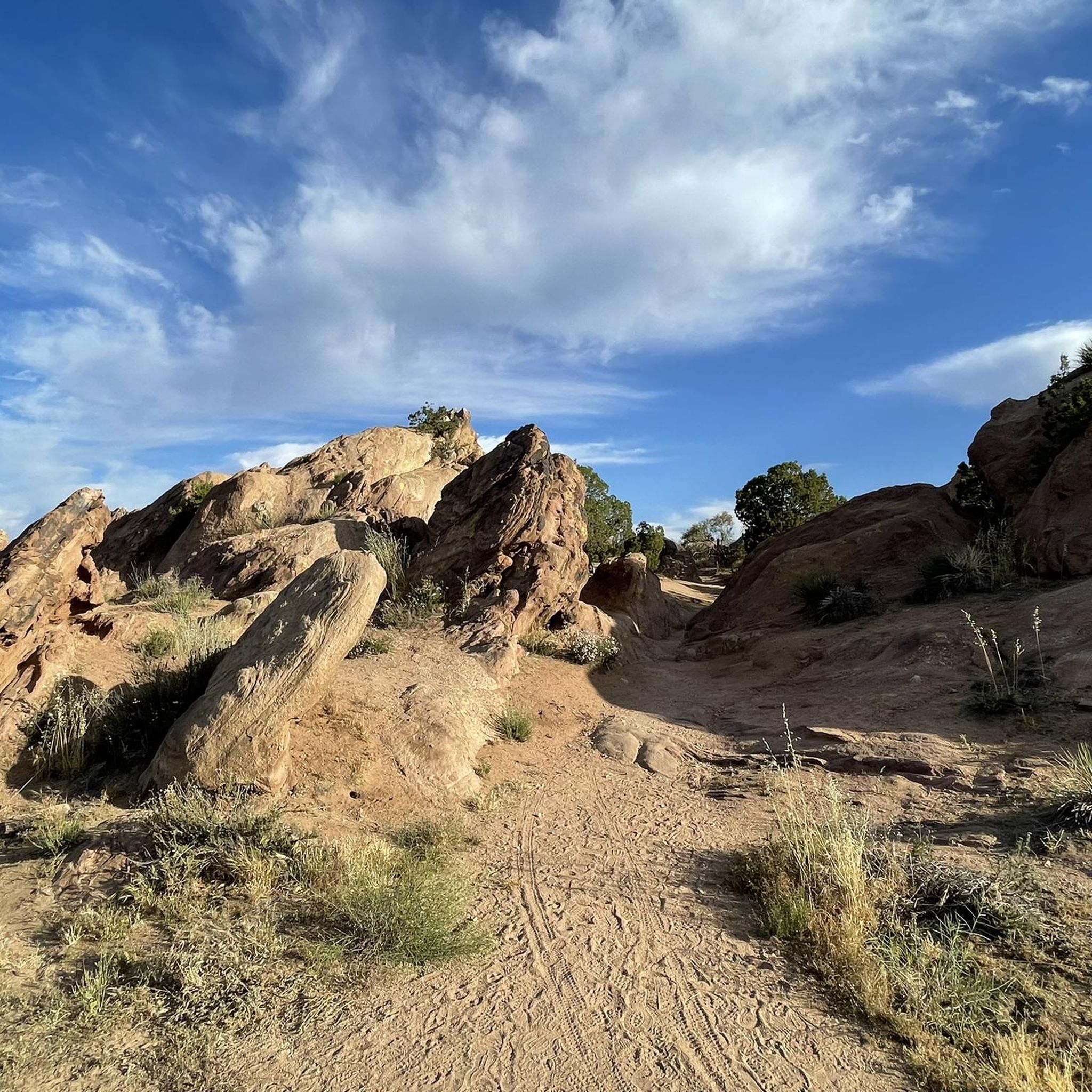
Hikes around Agua Dulce explore a high desert landscape within the Sierra Pelona Mountains of Los Angeles County. The region is defined by the dramatic, tilted sandstone formations of Vasquez Rocks Natural Area Park. Many trails follow sections of the Pacific Crest Trail through characteristic chaparral environments and canyons.
Best hiking trails around Agua Dulce
- The most popular hiking route is Vasquez Rocks via Pacific Crest Trail loop — Santa Clarita, California, a 3.4 mile (5.5 km) trail that…
Last updated: October 11, 2026
13
hikers
12.9km
04:05
730m
150m
Embark on the Pacific Crest Trail: Soledad Canyon to North Fork, a rewarding hike through the Angeles National Forest's unique shrubland. You'll traverse corrugated hills and deep valleys, offering continuous…
1
hikers
3.32km
01:03
210m
20m
This segment of the Pacific Crest Trail offers a quick, immersive experience into Southern California's high desert. Starting from Soledad Canyon, you'll cross the Santa Clara River and railroad tracks…

1
hikers
9.67km
02:53
320m
210m
Hike the moderate 6.0-mile Pacific Crest Trail to Spunky Canyon, gaining 1066 feet through chaparral hills with reservoir views.
1.44km
00:23
20m
20m
Hike the easy 0.9-mile Vasquez Rocks Loop to explore dramatic, angular rock formations and desert scenery in Vasquez Rocks Natural Area Park
5.43km
01:50
460m
0m
Mount McDill Summit via Lincoln Crest offers a moderate hiking experience through varied terrain in Angeles National Forest. You will navigate dirt roads, fire roads, and single-track paths as you…
Get access to more routes and recommendations from other explorers.
Already have an account?
Our route recommendations are based on thousands of hikes, rides, and runs completed by other people on komoot.
Start today with a free account
Your next adventure awaits.


Other adventures around Agua Dulce

Tips from the Community


Interesting rock formation in the Sierra Pelona. The setting has been used in many different movies and TV shows, including Star Trek, Bill & Ted's Bogus Journey and Zorro.
1
0


Start of the seasonal stream that carved the entire canyon from here all the way down to the paved road and beyond.
3
0
Nice view of the reservoir in the valley to the west, best in the morning light
2
0

The Santa Clara River is flowing in different streams that you will have to cross over some logs.
1
0
If you want to learn more about how the unique Vasquez Rocks were created by earthquakes along the San Andreas Fault, visit the Interpretive Center. There is also a water fountain inside the center as well as restrooms. You can use the picnic benches close to the parking lot. Opening hours: http://www.vrnca.org/visit-us.html
3
0
After a long waterless stretch, North Fork Ranger Station is a little oasis. You will find shade, picnic benches, pit toilets and water that is provided in hiker season.
3
0
Frequently Asked Questions
What is the hiking terrain like around Agua Dulce?
The hiking around Agua Dulce is characterized by a high desert landscape. Expect trails that wind through dramatic, tilted sandstone formations, especially in Vasquez Rocks. You'll also encounter sections of chaparral, scattered scrub oaks, and canyon paths. Elevations can vary, offering both gradual climbs and more challenging ascents.
Are there any easy, family-friendly hikes in the area?
Yes, there are several options suitable for families and beginners. The Vasquez Rocks – Vasquez Rocks County Park trail is a relatively short and flat walk that allows you to explore the famous rock formations up close. The park itself has many smaller paths perfect for a gentle stroll.
Can I bring my dog on the trails?
Dogs are generally welcome in the area, but rules can vary. In Vasquez Rocks Natural Area Park, dogs are permitted but must be kept on a leash at all times. Always check the specific regulations for trails within the Angeles National Forest before you go, and be sure to bring plenty of water for your pet, as the climate is very dry.
What are some popular places to start a hike in Agua Dulce?
There are several well-regarded starting points for hikes in the region.
Vasquez Rocks Natural Area and Nature Center is the most famous, offering access to numerous trails among its iconic rock formations. For access to the Angeles National Forest, the Agua Dulce Trailhead on Mount Laguna is a popular choice, providing entry to a great network of trails. A little further out, Placerita Canyon Nature Center is another favorite spot with well-maintained paths and historical points of interest.
Are there any circular or loop hikes available?
Yes, loop hikes are common. For a challenging day out, the Bouquet Canyon loop via the PCT offers a substantial circular route through the Angeles National Forest with significant elevation changes.
What should I know about hiking the Pacific Crest Trail (PCT) near Agua Dulce?
Agua Dulce is a well-known stop for PCT thru-hikers. The section here takes you through the region's typical chaparral environment. The Pacific Crest Trail to Vasquez Rocks route is a long and difficult segment that showcases the rugged beauty and challenging terrain of the PCT in this area.
Are there any hikes with waterfalls near Agua Dulce?
Water features are rare in this arid landscape and are usually dependent on recent rainfall. While there are no major, year-round waterfalls directly on these primary trails, some canyons, like Whitney Canyon, can have seasonal water flow and small cascades after a wet winter. It's best to check recent trail reports if you're specifically looking for water.
What is the best time of year to hike in Agua Dulce?
The best seasons for hiking in Agua Dulce are fall, winter, and spring. The weather during these months is cooler and more pleasant for hiking. Summers can be extremely hot and dry, making strenuous activity difficult and risky. Spring is particularly beautiful, as the landscape is often covered in wildflowers.
Are there challenging hikes for experienced hikers?
Absolutely. The region offers several difficult hikes that will test seasoned hikers. The Indian Canyon Trail to North Fork Ranger Station loop is a demanding full-day trek in the Angeles National Forest, featuring over 3,000 feet (950 m) of elevation gain.
What do other hikers think of the trails around Agua Dulce?
The trails in this region are highly rated by the komoot community. Hikers frequently praise the unique and dramatic scenery of the sandstone formations and the well-maintained sections of the Pacific Crest Trail. The sense of being in a classic Hollywood western landscape is a commonly mentioned highlight.
What should I pack for a hike in this area?
Given the high desert environment, it's crucial to be prepared. Always carry more water than you think you'll need. Sun protection is essential, so bring a hat, sunglasses, and sunscreen. Sturdy hiking shoes with good grip are recommended for the rocky and sometimes uneven terrain. Finally, pack some snacks and a basic first-aid kit.
How do I get to the trailheads and is there parking?
Most trailheads in the Agua Dulce area are best accessed by car. Major starting points like Vasquez Rocks Natural Area Park and the Agua Dulce Trailhead have dedicated parking areas. Parking can fill up, especially on weekends, so arriving early is a good idea. Public transport options are very limited in this rural part of Los Angeles County.
Most popular routes around Agua Dulce
Most popular attractions around Agua Dulce

Get inspired with the komoot mobile app


Explore more
Browse the best Hikes in other regions.
