The best walks and hikes around Tankumsee
4.6
(2886)
12,667
hikers
804
hikes
Hiking around Tankumsee offers diverse trails through a recreational area centered on Lake Tankum, one of Lower Saxony's cleanest lakes. The terrain features fine white sand banks and expansive sunbathing areas around the lake, with surrounding paths varying from easy, flat strolls to more challenging routes. While elevation gains are generally modest, some trails extend into broader natural areas, providing varied landscapes for hikers.
Best hiking trails around Tankumsee
- The most popular hiking route is Tankumsee Beach – Tankumsee Beach…
Last updated: August 20, 2026
4.7
(250)
1,162
hikers
4.54km
01:09
10m
10m
Easy hike. Great for any fitness level. Easily-accessible paths. Suitable for all skill levels.
4.7
(15)
52
hikers
8.80km
02:15
20m
20m
Moderate hike. Good fitness required. Easily-accessible paths. Suitable for all skill levels.

Sign up for free
5
hikers
24.7km
06:15
40m
40m
Hard hike. Very good fitness required. Easily-accessible paths. Suitable for all skill levels.
5.0
(3)
34
hikers
3.10km
00:47
10m
10m
Easy hike. Great for any fitness level. Easily-accessible paths. Suitable for all skill levels.
5.0
(2)
11
hikers
14.7km
03:43
30m
30m
Moderate hike. Good fitness required. Easily-accessible paths. Suitable for all skill levels.
Get access to more routes and recommendations from other explorers.
Sign up for free
Already have an account?
Our route recommendations are based on thousands of hikes, rides, and runs completed by other people on komoot.
Start today with a free account
Your next adventure awaits.
Login or Signup
Tips from the Community

There is a beautiful cycle path that is recommendable, great view of the water and the nature
2
0

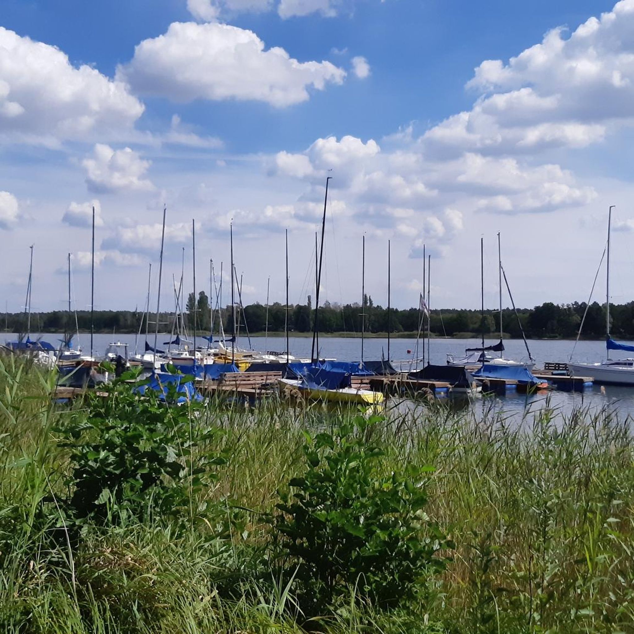
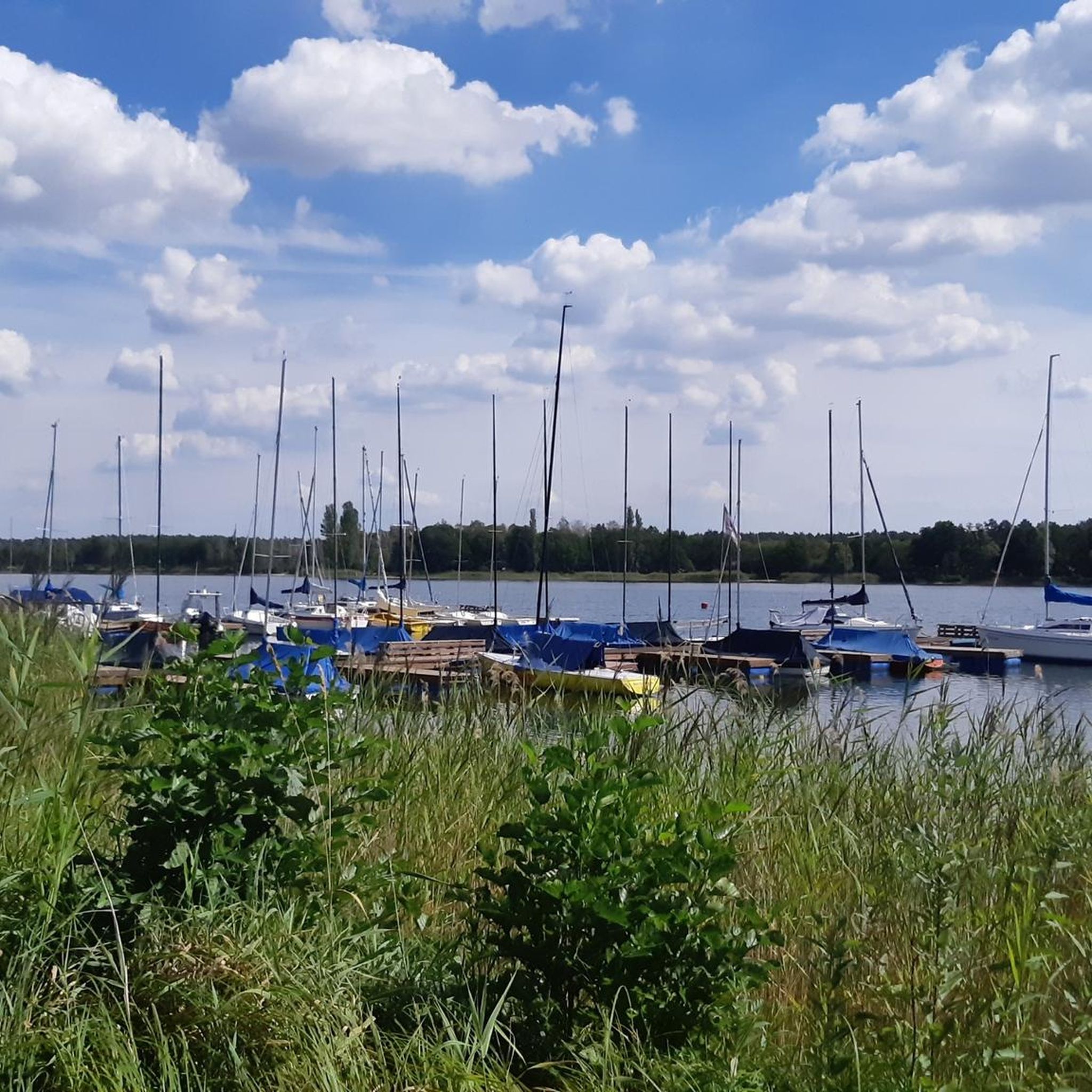
The Elbe-Seitenkanal at Tankumsee is really good for a short break in nature. Right next to it is the beautiful combination of waterway and recreational area – perfect for walking, cycling, or simply switching off. The canal appears calm, but ships still pass by regularly, giving it a special "industry in nature" charm.
0
1
The 9-basket course at Tankumsee is a very nice introduction to Disc Golf – ideal for beginners, families, or even small groups. The facility is located directly in nature around the lake and offers a relaxed yet varied round between trees and open spaces.
0
0
The adventure tower at Tankumsee is a really good destination for everyone who likes action and nature. The climbing tower offers several levels with different difficulty degrees, so both beginners and experienced climbers will get their money's worth. Particularly exciting are the zipline over the lake and the giant swing at a lofty height, which provide extra adrenaline.
0
0

with high ropes course and other activities
0
0
The "Schleusentor" (sluice gate) near Weyhausen is a central hydraulic engineering element in the Barnbruch nature reserve. It marks a historically and ecologically significant point where the Aller river is regulated. The sluice gate serves to regulate the water flow between the canal and the old riverbed. In times of high water, it plays a crucial role in flood protection for the downstream areas (such as Gifhorn).
0
0
Frequently Asked Questions
What kind of terrain can I expect on hiking trails around Tankumsee?
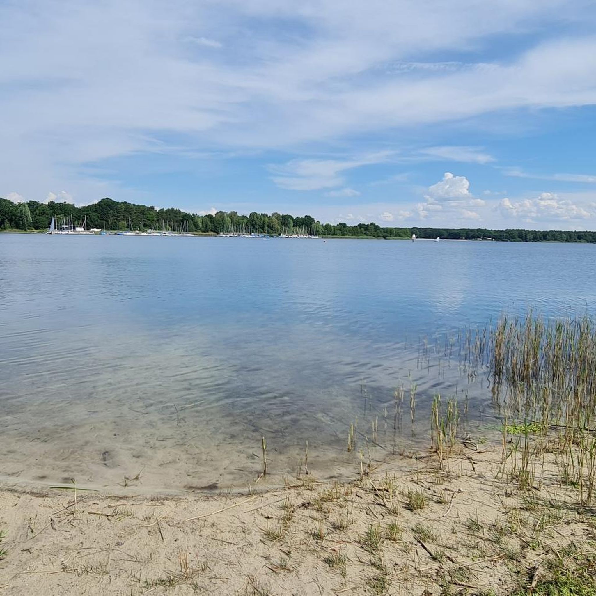
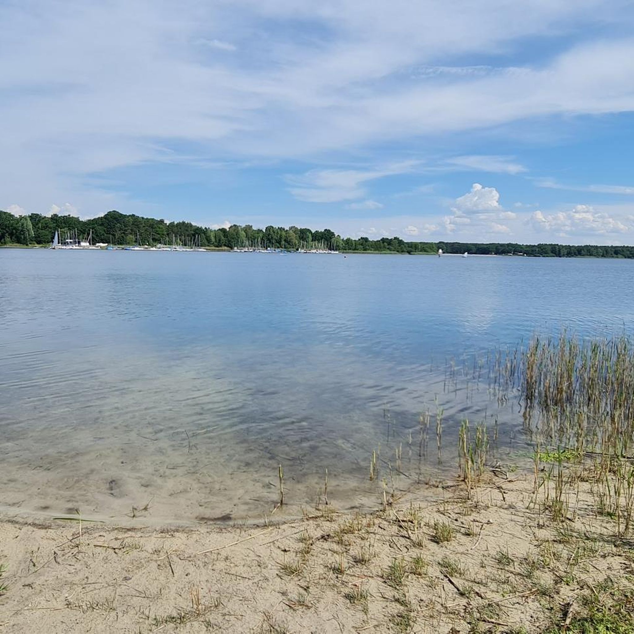
The terrain around Tankumsee is characterized by fine white sand banks and expansive sunbathing areas directly around the lake. Paths vary from easy, flat strolls to routes extending into broader natural areas. While elevation gains are generally modest, some trails offer more varied landscapes.
Are there many hiking trails available in the Tankumsee area?
Yes, Tankumsee offers a wide variety of hiking options. There are over 700 routes available, catering to different preferences and fitness levels. This includes more than 470 easy trails, over 220 moderate routes, and a selection of more challenging hikes.
What are the typical durations and difficulties of hikes around Tankumsee?
Hiking trails around Tankumsee vary significantly. You can find easy paths suitable for all skill levels, taking up to two hours with minimal elevation gain. For those seeking a moderate challenge, there are routes up to five hours long with greater elevation. More experienced hikers can tackle harder trails exceeding five hours and significant elevation gain, which demand very good fitness.
Are there any circular hiking routes around Tankumsee?
Yes, circular routes are a popular option. For an easy loop directly around the lake, consider the Tankumsee Beach – Tankumsee Beach loop from Kranichsmoorsee, which is 4.5 km long and takes about 1 hour 10 minutes. A longer, moderate circular option is the 8.8 km Tankumsee Beach – Tankumsee Beach loop from Kranichsmoorsee.
What natural features or landmarks can I see while hiking near Tankumsee?
While hiking, you'll primarily experience the beauty of Lake Tankum itself, known as one of the cleanest lakes in Lower Saxony. You can also explore the sandy shores and sunbathing areas. Notable points of interest include the Tankumsee Beach, the Beach at the DLRG tower, and the unique Stilt Cabins on Tankumsee.
Are there any family-friendly hiking options around Tankumsee?
Yes, many of the easy, flat paths around Lake Tankum are ideal for families. The fine white sand banks and accessible paths make for pleasant strolls suitable for all ages. Routes like the 4.5 km Tankumsee Beach – Tankumsee Beach loop from Kranichsmoorsee are particularly well-suited for families.
What do other hikers say about the trails in Tankumsee?
The hiking routes in Tankumsee are highly rated by the komoot community, with an average score of 4.6 stars from over 2,500 reviews. Hikers often praise the scenic views of the lake, the well-maintained paths, and the diverse options available for different fitness levels.
Can I bring my dog on the hiking trails around Tankumsee?
While the region is generally welcoming to outdoor enthusiasts, specific dog rules can vary, especially around designated beach or recreational areas. It's advisable to keep dogs on a leash and check local signage for any restrictions in particular zones to ensure a pleasant experience for everyone.
Are there any longer or more challenging hikes in the Tankumsee area?
Yes, for those seeking a longer and more challenging experience, the Tankumsee – Stilt Houses at Tankumsee loop from Kranichsmoorsee is a difficult 24.7 km route. Another moderate option that extends beyond the immediate lake area is the Tankumsee – Barnbruch Nature Reserve loop from Kranichsmoorsee, which is 14.7 km long and takes about 3 hours 45 minutes.
What is the best season to go hiking around Tankumsee?
Tankumsee is a versatile location for hiking throughout the year. The fine white sand banks and lake views are pleasant in warmer months, offering opportunities for relaxation. Even in colder months, winter walking around the beach provides a peaceful experience. The diverse trails ensure there's always something to enjoy, regardless of the season.
Is there parking available for hikers at Tankumsee?
Yes, the Tankumsee recreational area is well-equipped for visitors arriving by car. There are designated parking facilities available, making it convenient to access the various hiking trails around the lake. Specific parking locations may vary, so checking local maps upon arrival is recommended.
Are there places to eat or drink near the hiking trails?
The Tankumsee area, being a popular recreational destination, offers various facilities. While specific cafes or pubs directly on every hiking path might be limited, there are options within the broader recreational area where you can find refreshments and meals after your hike.
Most popular routes around Tankumsee
Most popular attractions around Tankumsee

Get inspired with the komoot mobile app


Explore more
Browse the best Hikes in other regions.
