The best walks and hikes around Lawndale
4.6
(18)
1,342
hikers
85
hikes
Hiking around Lawndale offers access to diverse outdoor experiences, primarily due to its strategic location within the Los Angeles South Bay area. While direct extensive hiking trails are limited within the city limits, the region is characterized by its proximity to coastal paths, regional parks, and the broader Southern California landscape. This allows for varied terrain, from urban green spaces to ocean-side routes, providing opportunities for different types of outdoor activity.
Best hiking trails in Lawndale
- The most popular hiking route is South Bay Bike Path, a 7.2 miles (11.6 km) trail that takes 2 hours 58 minutes to complete, offering coastal views and passing beaches and piers.
- Another top favourite among local hikers is Veteran's Parkway, an easy 4.3 miles (6.9 km) path. This route leads through lush greenery and ocean-side suburbs.
- Local hikers also love the Hermosa City Beach to Manhattan Beach Pier, a 6.9 miles (11.0 km) trail leading through vibrant beach town scenery, often completed in about 2 hours 48 minutes.
- Hiking around Lawndale is defined by coastal paths, urban green spaces, and access to broader regional parks. The network offers options for different ability levels, from leisurely strolls to moderate coastal hikes.
- The routes in Lawndale are highly rated by the komoot community with an average score of 4.8 stars from over 10 reviews. More than 1000 hikers have used komoot to explore Lawndale's varied terrain.
Last updated: June 30, 2026
3
hikers
11.6km
02:58
40m
60m
Hike the 7.2-mile South Bay Bike Path for moderate coastal views, passing beaches and piers, with minimal elevation gain.
1
hikers
6.93km
01:47
30m
40m
The Veteran's Parkway, often called the Hermosa Valley Greenbelt, offers a unique urban escape with its soft, woodchip surface that's gentle on your feet. This linear park, converted from an old railway line, meanders through residential areas, providing a serene green corridor shaded by eucalyptus and pine trees. You'll find it's a pleasant, largely level walk, perfect for unwinding amidst the city buzz.
Planning your visit to this easy 4.3-mile (6.9 km) route, which takes about 1 hour and 46 minutes with only 83 feet (25 metres) of elevation gain, is straightforward. The trail is pedestrian-only, so leave the bikes at home, but feel free to bring your leashed dog. You'll find benches and drinking fountains along the way, and its location in Hermosa Beach means cafes and shops are just a short walk away for pre or post-hike refreshments.
What makes the Veteran's Parkway particularly special is its history as a former Pacific Electric railway corridor, now transformed into a vibrant public green space. It serves as a tranquil connector between local streets, offering a car-free environment in a busy area. Look for the Veterans' Memorial and a Peace Pole as you explore, and know that the Pacific beaches are only about a quarter-mile away if you wish to extend your outing.

Sign up for free
1
hikers
2.53km
00:38
10m
0m
The Laguna Dominguez Bike Path offers a straightforward, easy hiking experience on a paved surface, perfect for a quick outing. This 1.6-mile (2.5 km) route features a negligible 18 feet (6 metres) of elevation gain, making it accessible for nearly everyone, and you can comfortably complete it in about 38 minutes. You'll follow the Dominguez Channel, observing native grasses and urban greening efforts, with the path eventually leading to Alondra Community Regional Park where a lake hosts ducks and geese.
Planning your visit is simple, as the trail connects Lawndale and Hawthorne, offering convenient access to public transport like the Crenshaw Green Line Station. While the path is generally uncrowded and usable year-round, be prepared for some unmarked road crossings that require extra attention. It's a dog-friendly option, ideal for a casual walk when you need a dose of fresh air without a strenuous climb.
This trail stands out for its role in transforming urban stormwater infrastructure into a functional open space, providing active transportation options within Los Angeles County. It's a practical route for local residents and students, offering a glimpse of urban nature and a quiet alternative to more crowded recreational areas, despite some sections occasionally presenting less-than-pristine conditions like garbage or rough tracks.
5.0
(1)
70
hikers
11.0km
02:48
30m
30m
Hike 6.9 miles along the Hermosa City Beach to Manhattan Beach Pier route, enjoying ocean views and lively beach towns.
2
hikers
2.90km
00:45
10m
10m
The North Redondo Bikeway provides a pleasant, easy urban escape on a fully paved, concrete surface. It's more of a city stroll than a wilderness hike, winding through residential areas and under power lines, earning it the local moniker "Powerline Trail." This 1.8-mile (2.9 km) route with just 38 feet (12 metres) of elevation gain is perfect for a quick walk or jog, offering a consistent, flat experience that takes around 44 minutes.
Planning your visit is straightforward, as the trail is easily accessible within Redondo Beach. You'll find it's well-used by the community, and some sections are even lit at night, making it suitable for evening activities. Be mindful of street crossings, where motion sensors help alert drivers to pedestrians, but always exercise caution.
This multi-use path is a key community asset, connecting various local points and even linking to the Los Angeles Metro's Redondo Beach station. While the North Redondo Beach bike path scenery is primarily urban, it's part of the larger Marvin Braude Bike Trail system, offering extensive coastal views if you choose to extend your journey beyond this segment.
Get access to more routes and recommendations from other explorers.
Sign up for free
Already have an account?
Our route recommendations are based on thousands of hikes, rides, and runs completed by other people on komoot.
Start today with a free account
Your next adventure awaits.
Login or Signup

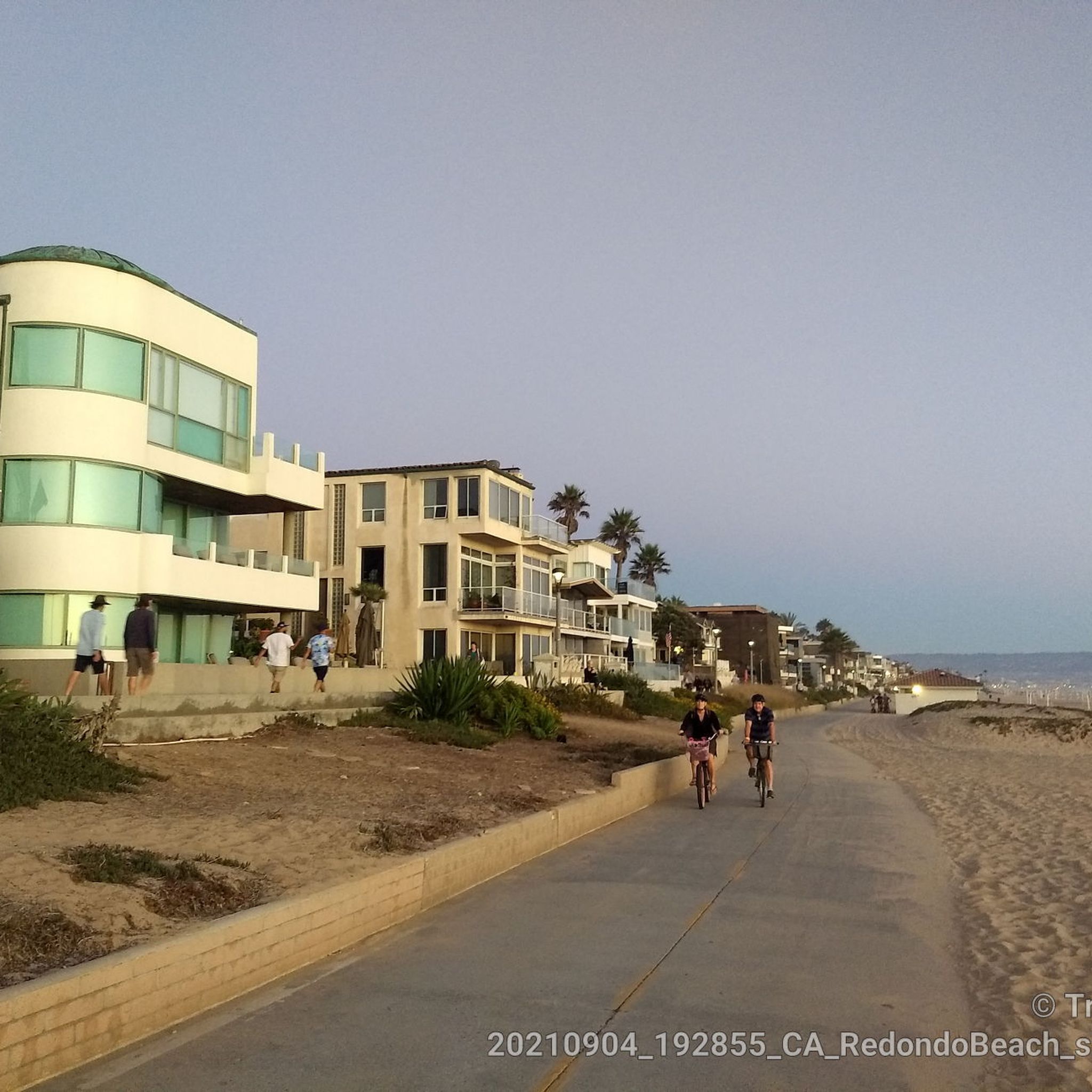


Tips from the Community


Scenic beach ride just watch for distracted walkers.
0
0

Dale Page Park is a small green space operated by the City of Redondo Beach. It is conveniently located next to Beach Cities Cafe and Confections and Panela’s Brazilian Cuisine. The park has basketball courts, children’s play areas, and a senior center, making it a great spot for visitors of all ages.
0
0
The North Redondo Beach Bikeway runs through North Redondo residential areas, under the powerlines, also giving it the nickname "Powerline Trail.". This signed bike route features designated bike lanes, shared low-stress streets, and a segment of separated, wide, lit trail along an overhead electric utility corridor. The trail spans from Rockefeller Ln. and Felton Ln. to Robinson St. and Phelan Ln., with a concrete surface throughout.
0
0

The natural rock jetty marks the southern border between Dockweiler State Beach to El Segundo Beach that begins a few hundred yards and continues to the south
0
0
Free public showers and restrooms with taps to refill your drinking water bottle are provided every one or two miles along the bike trail in this beach park.
1
0
Access trails lead down from the aptly-named Vista del Mar Boulevard down to the long sandy beach. A paved service road and the paved South Bay Bike Trail run at the bottom of the dunes along the beach.
1
0
Frequently Asked Questions
How many hiking trails are available around Lawndale?
Lawndale offers a wide variety of hiking and walking opportunities, with over 80 routes available. These range from easy strolls in local parks to more moderate coastal paths, catering to different preferences and fitness levels.
What are the difficulty levels of hikes around Lawndale?
The trails around Lawndale primarily feature easy to moderate difficulty levels. There are over 60 easy routes perfect for leisurely walks, and about 17 moderate trails for those seeking a bit more challenge. Only a few routes are considered difficult, making the area accessible for most hikers.
What do other hikers say about the trails around Lawndale?
The hiking routes around Lawndale are highly regarded by the komoot community, boasting an average rating of 4.8 stars from over 10 reviews. Hikers frequently praise the scenic coastal views, the well-maintained paths, and the accessibility to diverse outdoor experiences, from urban green spaces to ocean-side routes.
Are there any family-friendly hiking options near Lawndale?
Yes, Lawndale and its surrounding areas offer several family-friendly options. Local parks like Alondra Park and William Green Park provide well-maintained trails for leisurely walks. For a coastal experience, the Veteran's Parkway is an easy 4.3-mile path through lush greenery and ocean-side suburbs, suitable for families.
Can I bring my dog on the trails around Lawndale?
Many of the local parks and coastal paths around Lawndale are dog-friendly, though leash laws typically apply. It's always best to check specific park regulations before heading out. Generally, the extensive coastal paths like the South Bay Bike Path offer great opportunities for walks with your canine companion.
Are there any circular walks available near Lawndale?
While many coastal paths are out-and-back, several local parks within Lawndale offer circular routes for a pleasant stroll. For example, parks like Alondra Park and Rogers-Anderson Park feature pathways that allow for loop walks, perfect for a contained outdoor activity.
Are there any waterfall hikes accessible from Lawndale?
Yes, for those seeking a waterfall experience, several trails are within a 50-mile radius of Lawndale. These range from easy to moderate difficulty and include popular spots like Sturtevant Falls, Wolfskill Falls, and San Antonio Falls, offering a refreshing change of scenery from the coastal trails.
What kind of wildlife might I see while hiking near Lawndale?
Given Lawndale's proximity to the coast and various green spaces, hikers might encounter a variety of wildlife. Along coastal paths, you could spot marine birds, dolphins, or even whales during migration seasons. In local parks, common sightings include various bird species, squirrels, and other small urban wildlife.
Are there places to explore or attractions along the hiking trails?
Absolutely! Many trails, especially the coastal ones, offer access to beautiful attractions. For instance, the Hermosa City Beach to Manhattan Beach Pier route leads through vibrant beach town scenery, with opportunities to visit Manhattan Beach and Pier. Other highlights include Torrance Beach and El Segundo Beach, perfect for a break or further exploration.
How can I get to hiking trails near Lawndale using public transport?
Lawndale is part of the Los Angeles County Metro system, which provides bus services that can connect you to various areas, including those near coastal paths and regional parks. Planning your route using the Metro's website or app is recommended to find the most convenient public transport options to specific trailheads.
Is parking available at the trailheads near Lawndale?
Yes, parking is generally available at most trailheads and parks around Lawndale, especially at the larger regional parks and popular beach access points. However, during peak seasons or busy weekends, parking lots can fill up quickly, so arriving early is advisable. Some coastal areas may have metered parking.
Are there any easy, short walks for a quick outdoor activity?
For a quick and easy outdoor activity, Lawndale offers several options. The Laguna Dominguez Bike Path is an easy 1.6-mile route, and the Columbia Park Fitness Course is another short, easy option at about 1.3 miles, both perfect for a brief stroll or run.
Where can I find local parks for a casual walk within Lawndale itself?
Within Lawndale, several local parks are ideal for casual walks and enjoying green spaces. These include Alondra Park, William Green Park, Rogers-Anderson Park, and Jane Addams Park, all offering well-maintained pathways and serene environments. For more information on city parks, you can visit the City of Lawndale website.
Most popular routes around Lawndale
Most popular attractions around Lawndale

Get inspired with the komoot mobile app


Explore more
Browse the best Hikes in other regions.
