The best walks and hikes around Foster City
4.6
(49)
1,611
hikers
138
hikes
Hiking around Foster City is characterized by an extensive network of paved, multi-use paths along the San Francisco Bay shoreline. The region, a planned community on the San Francisco Peninsula, features a large lagoon system and generally flat terrain. Most trails follow the banks of tidal sloughs or the bay itself, offering open views across the water and opportunities for nature observation. This makes the area suitable for a wide range of ages and fitness levels.
Best hiking trails in Foster City
- The most popular hiking route is San Francisco Bay Trail: Redwood Shores Loop, a 7.1 miles (11.4 km) trail that takes about 2 hours 50 minutes to complete. This moderate route follows the shoreline with views across the bay.
- Another top favourite among local hikers is Seal Slough Trail, a moderate 5.7 miles (9.1 km) path. The trail follows the banks of the winding tidal channel that separates Foster City from San Mateo.
- Local hikers also love the Leo J. Ryan Park and Lagoon Trail, a 1.6 miles (2.6 km) trail leading through a waterfront park and along the lagoon, often completed in about 40 minutes.
- Hiking around Foster City is defined by waterfront trails, paved levee paths, and routes through shoreline parks. The network of mostly flat trails offers options for various fitness levels, from short walks to longer routes.
- The routes in Foster City are highly rated by the komoot community with an average score of 4.5 stars from over 40 reviews. More than 1,400 hikers have used komoot to explore Foster City's varied terrain.
Last updated: October 11, 2026
1
hikers
5.20km
01:19
10m
10m
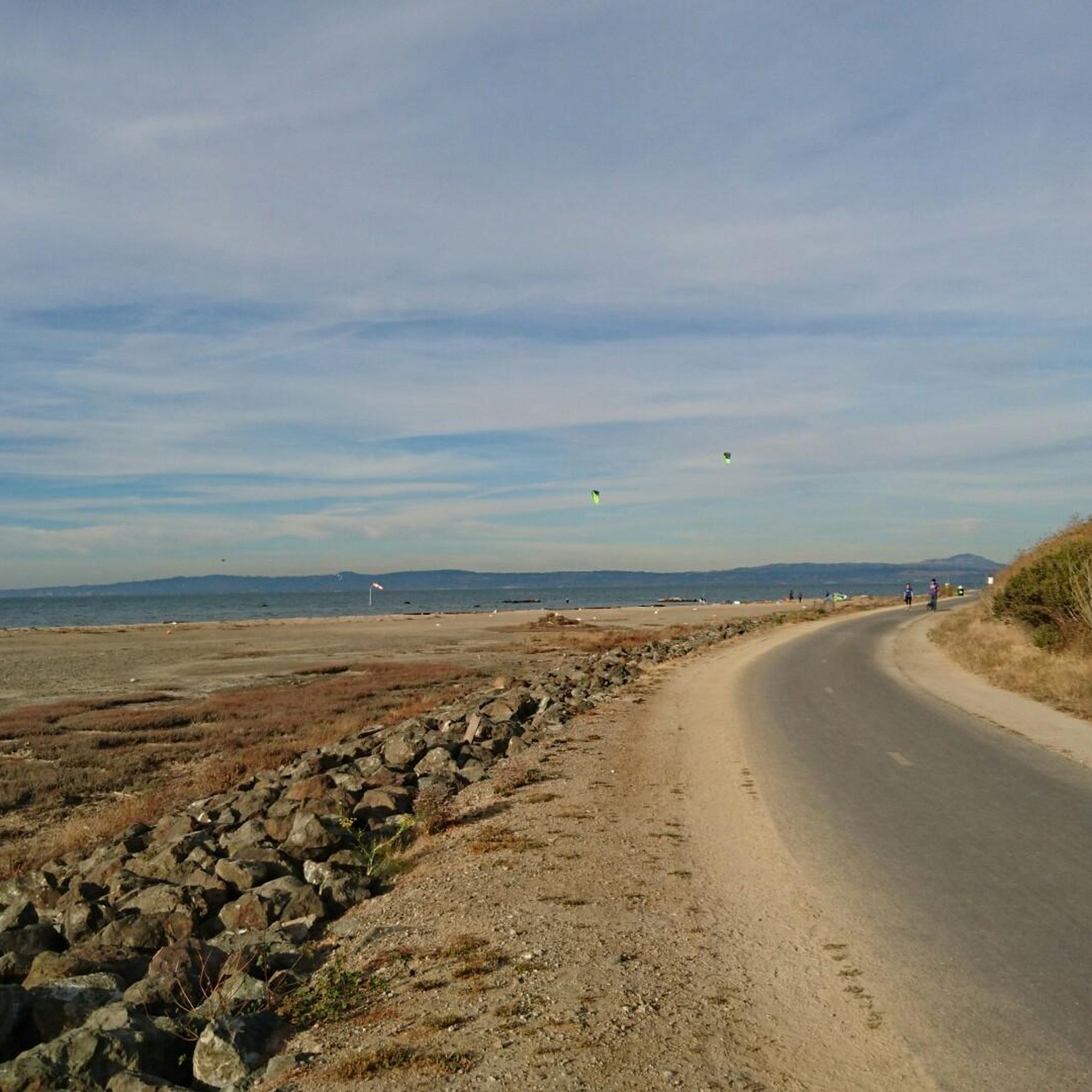
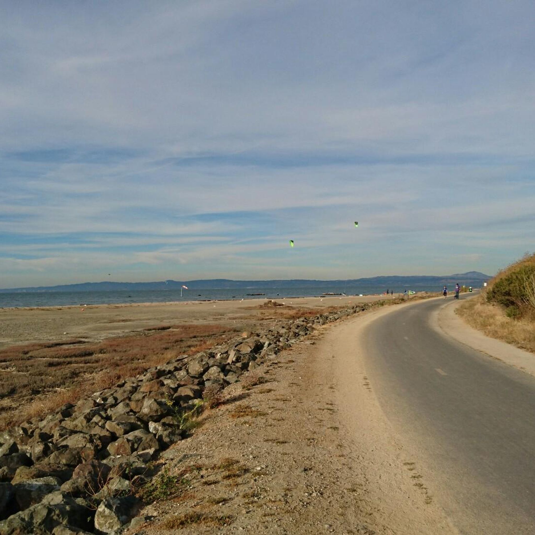
The Foster City Levee Trail: Belmont Slough offers a wonderfully flat and accessible hiking experience, perfect for a relaxed outing. You'll enjoy expansive views of the San Francisco Bay and the East Bay hills, with the San Mateo-Hayward Bridge often in sight. The trail winds past vibrant salt marshes, home to native cordgrass and pickleweed, making it an excellent spot for birdwatching, where you might spot ducks, herons, and other shorebirds. This easy 3.2-mile (5.2 km) route has only 30 feet (9 metres) of elevation gain and takes about 1 hour and 18 minutes, making it ideal for all ages and fitness levels.
Planning your trip is simple, as the trail is open year-round, though spring and fall are particularly good for birdwatching. It's a dog-friendly path, so feel free to bring your leashed companion along. As a well-maintained segment of the San Francisco Bay Trail, access is generally easy, and you'll find the wide asphalt and decomposed granite path comfortable for walking, running, or cycling.
Beyond its recreational appeal, the Foster City Levee Trail plays a crucial ecological role as part of the San Francisco Bay National Wildlife Refuge Complex. It acts as a natural boundary between Redwood Shores and Foster City, with the levee itself providing significant flood protection for the area. Recent improvements, including new bridges, have helped restore tidal action in the Belmont Slough, enhancing this diverse ecosystem.
1
hikers
3.53km
00:53
0m
0m
Enjoy an easy 2.2-mile hike on the Foster City Levee Trail, offering bay views, birdwatching, and accessible paths for all skill levels.

2.63km
00:40
10m
10m
Enjoy an easy 1.6-mile hike along the Leo J. Ryan Park and Lagoon Trail, offering scenic views of the Foster City Lagoon and wildlife.
9
hikers
9.14km
02:19
20m
20m
The Seal Slough Trail offers a refreshing escape along the San Francisco Bay, winding through marshlands and providing expansive views. You'll walk a boardwalk section through the Bay Marshes, a great spot for birdwatching, and enjoy panoramic 360-degree views of the Bay, including the San Mateo bridge, especially from the slight rise within Seal Point Park. It's a predominantly flat, multi-use path, making it incredibly accessible for a 5.7-mile (9.1 km) journey.
This moderate hike, taking about 2 hours and 19 minutes to complete, is an excellent choice for a relaxed day out. You'll find parking readily available near the trailhead in Foster City, making it easy to start your adventure. Its minimal 66 feet (20 metres) of elevation gain means it's suitable for nearly everyone, including families and those with strollers.
What sets the Seal Slough Trail apart is its versatility and the blend of natural beauty with urban convenience. It's part of a unique blend of shoreline parks, offering opportunities to spot wildlife like the endangered California Clapper Rail. Plus, with a 3-acre dog park nearby, it's a truly pet-friendly destination for your furry companions.
5
hikers
11.4km
02:53
20m
20m
The Redwood Shores Loop offers a delightful blend of natural beauty and urban vistas, making it a unique hiking experience along the San Francisco Bay Trail. You'll wander along groomed paths, boardwalks, and levees, with the serene Redwood Shores Lagoon and Belmont Slough often in view, alongside the striking Oracle campus. This moderate 7.1-mile (11.4 km) route, with a mere 61 feet (19 metres) of elevation gain, is a flat and easy walk that typically takes just under three hours, perfect for a leisurely outing.
Planning your visit is straightforward, as the trail is largely accessible year-round. While there's minimal shade, making sun protection a must, the well-maintained paths are suitable for a wide range of users, including those with dogs on leash. Look out for picnic spots and observation platforms along the way, enhancing your experience of this popular trail.
This segment of the San Francisco Bay Trail is particularly notable for its exceptional wildlife habitat, running alongside significant ecological reserves like the Redwood Shores Ecological Reserve. It's a fantastic spot for birdwatching, offering frequent sightings of egrets and herons, and provides a distinct perspective on the Bay Area by combining natural marshland environments with modern corporate and residential views.
Get access to more routes and recommendations from other explorers.
Already have an account?
Our route recommendations are based on thousands of hikes, rides, and runs completed by other people on komoot.
Start today with a free account
Your next adventure awaits.
Tips from the Community

This small lagoon offers an excellent photo opportunity for visitors and photographers alike. Its calm, crystal-clear waters create a stunning mirror-like reflection of the iconic Oracle Buildings that surround it. The tranquil setting, combined with the striking architecture, makes it an ideal spot to capture breathtaking images, especially during sunrise and sunset.
0
0
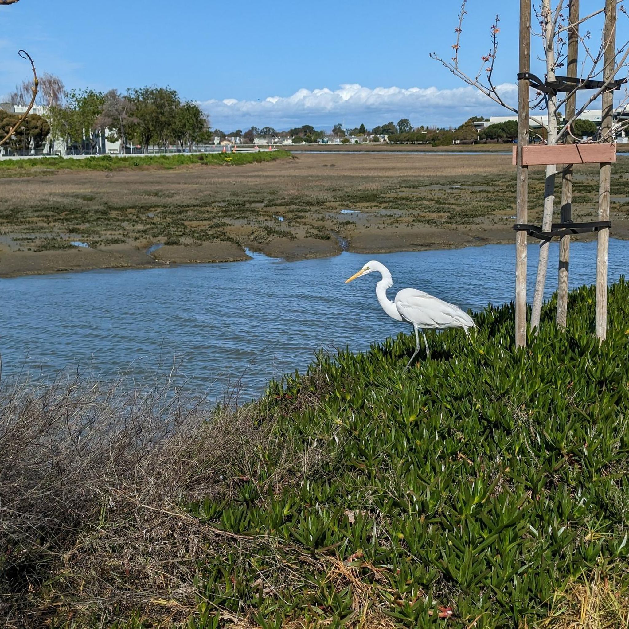
Belmont Slough is picturesque, with salt marshes filled with cordgrass and pickleweed. Along this lovely path, you can see plenty of herons and shorebirds, adding to the beauty of this part of the estuary.
0
0

The paved Foster City Levee Pedway follows the bank of Seal Slough on a scenic tour of the river's lakeshore developments. By definition, the slough is somewhere between a lake and a river; it looks like a river and feeds into San Francisco Bay, but has little to no current.
1
0
Belmont Slough is picturesque, with salt marshes filled with cordgrass and pickleweed. As you walk along this lovely path, you can see plenty of herons and shorebirds, adding to the beauty of this part of the estuary.
0
0
This small lagoon offers an excellent photo opportunity for visitors and photographers alike. Its calm, crystal-clear waters create a stunning mirror-like reflection of the iconic Oracle Buildings that surround it. The tranquil setting, combined with the striking architecture, makes it an ideal spot to capture breathtaking images, especially during sunrise and sunset.
0
0

From here on the Foster City Bay Trail, or the San Francisco Bay Trail, you can access Beach Park, a lovely waterfront park with beach access, trails, and views across the water to Hayward and of the San Mateo-Hayward Bridge. This is a great place to stop as you ride around the area.
0
0

Surrounded by levees due to the higher water level compared to the ground elevation, this area serves as a focal point for the surrounding housing area. It provides opportunities for various water activities, including boating, swimming, windsurfing, and offers stunning views of the waterfront. If you decide to fish, make sure you have the proper license to do so.
0
0

Frequently Asked Questions
Are there many easy, family-friendly hikes in Foster City?
Yes, the area is ideal for family outings. Most trails are flat, paved, and follow the shoreline, making them accessible for strollers and all ages. A great option is the Coyote Point Park loop, a short and easy walk through a waterfront park with plenty to see.
Can I bring my dog on the trails around Foster City?
Many trails in the area are dog-friendly, especially the paved shoreline paths. For a dedicated outing, Seal Point Park is a popular choice with a spacious dog park and an easy walking loop. Pulgas Ridge Open Space Preserve is another highly-regarded option, offering a 366-acre off-leash area for dogs.
What are the trail surfaces like in Foster City?
The vast majority of trails in Foster City are paved. Routes like the San Francisco Bay Trail and the Levee Pedway (Seal Slough Trail) are wide, multi-use paths perfect for walking, running, and cycling. You will find very few unpaved or rugged dirt tracks within the immediate city limits.
Are there any good circular walks?
Absolutely. Many routes are designed as loops. For an easy circular walk, consider the Seal Point Park loop from San Mateo. It's a short, flat trail that's perfect for a quick outing with great views of the bay.
What kind of scenery can I expect on a hike?
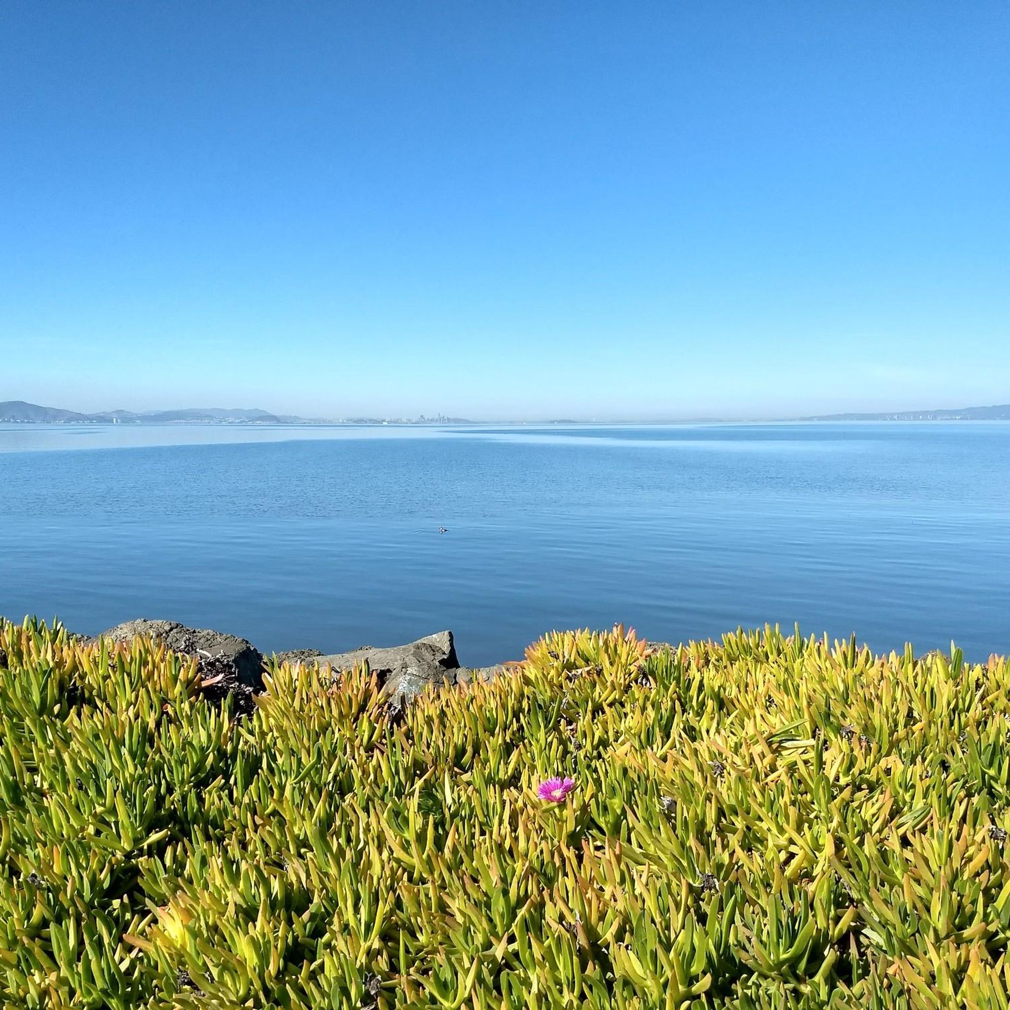
Hiking here is all about expansive water views. You'll be walking alongside the San Francisco Bay, tidal sloughs, and the city's unique lagoon system. Expect to see open skies, distant views of the East Bay hills and the San Mateo Bridge, and marshlands teeming with birdlife.
What wildlife might I see on the trails?
The marshlands and mudflats along the bay are a haven for birdwatchers. Keep an eye out for egrets, herons, and various shorebirds, especially along the sections of the Bay Trail near Belmont Slough. The area is a critical habitat for many species, including the endangered California clapper rail.
How many hiking trails are there around Foster City?
There are over 90 hiking routes to explore in and around Foster City. The majority of these are easy, paved paths suitable for all fitness levels, but there are also a good number of moderate options for those seeking a slightly longer walk.
What do other hikers think of the trails in Foster City?
The trails are highly rated by the komoot community. Hikers often praise the well-maintained paved paths and the beautiful, uninterrupted views across the San Francisco Bay. The flat terrain makes it a relaxing and accessible place for a walk.
Are there any trails with views of the San Mateo Bridge?
Yes, many of the trails along the eastern shoreline of Foster City offer excellent views of the San Mateo Bridge. A walk along the Foster City Levee section of the Bay Trail provides a fantastic vantage point for seeing the bridge span across the water.
What are the trails in Leo J. Ryan Park like?
Leo J. Ryan Park is the heart of Foster City's recreational space. It features a network of tranquil, paved walking paths that encircle the central lagoon. It's a perfect spot for a leisurely stroll, with manicured lawns, a gazebo, and opportunities for water activities on the lagoon.
What should I wear for a hike in Foster City?
Comfortable walking shoes are sufficient for the paved trails. The weather can change quickly by the bay, so it's wise to dress in layers. A windbreaker or light jacket is recommended, even on sunny days, as it can be breezy along the shoreline. Sunscreen and a hat are also essential due to the lack of shade on most routes.
Where can I find a map of the San Francisco Bay Trail?
The San Francisco Bay Trail is a major feature of the area. For detailed maps and segment information, including the sections through Foster City, you can consult the official trail maps. A helpful resource is the Bay Trail Map 4 which covers Burlingame to Redwood Shores.
Most popular routes around Foster City
Most popular attractions around Foster City

Get inspired with the komoot mobile app


Explore more
Browse the best Hikes in other regions.
